Botanizing at St. Joe State Park

Dry post oak woodland.

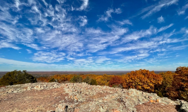
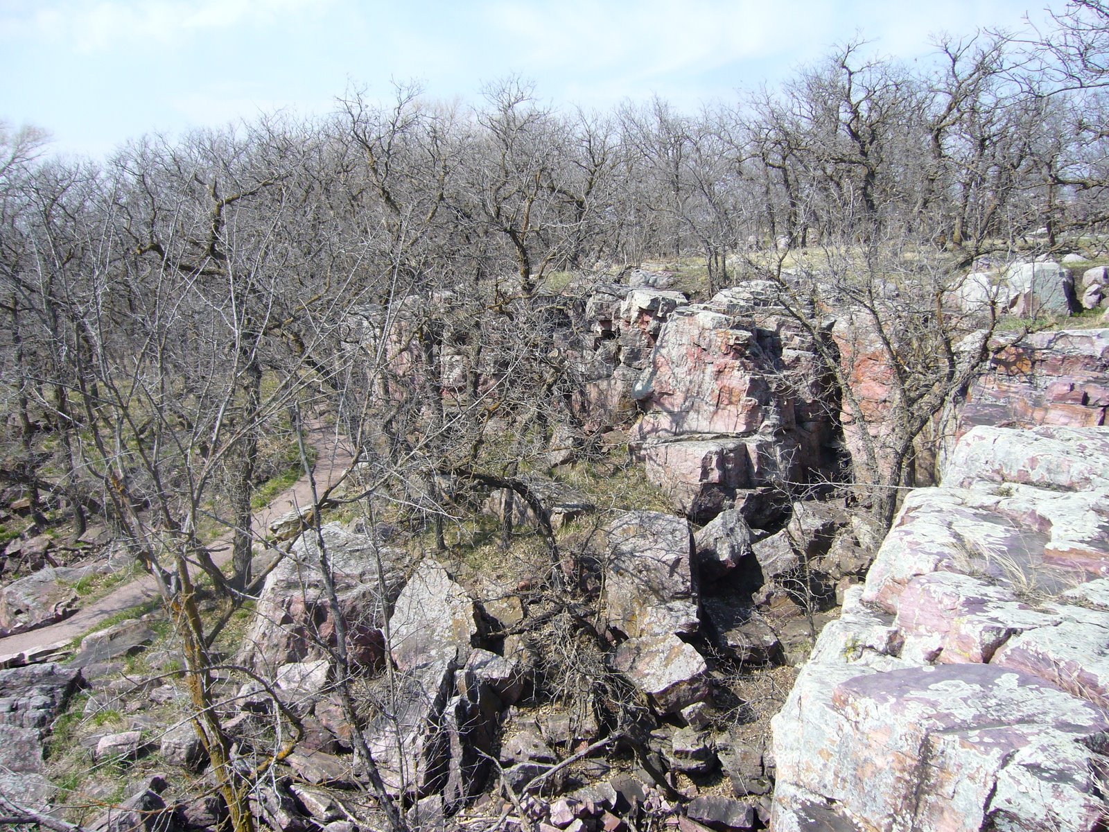
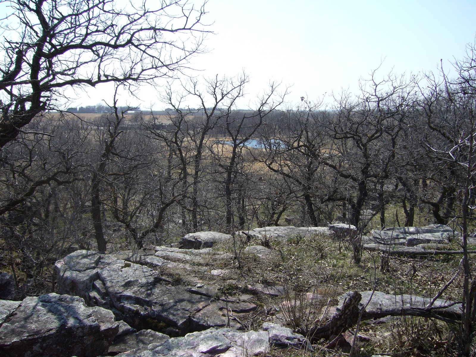
This week’s destination for the WGNSS Botany Group outing was St. Joe State Park, where the western portion of the Bicyle/Hiking Trail runs along a prime example of dry post oak woodland. Such woodlands were common in Missouri during pre-settlement times but have been largely eliminated from the present-day landscape due to incompatible land management practices, including fire suppression. Post oak woodlands depend upon periodic fires to maintain an open canopy, allowing a rich ground layer of native grasses and forbs to flourish in the abundant sunlight. In pre-settlement times, this happened naturally as a result of lightning strikes; however, remnant post oak woodlands exist today largely as a result of active landscape management including the use of prescribed burns and selective thinning. Evidence of these practices was easy to find in this remarkably restored example of an original post oak woodland.

Prescribed burns help to maintain an open canopy and a rich herbaceous ground layer.
Selective girdling optimizes species composition while minimizing ground layer disturbance.

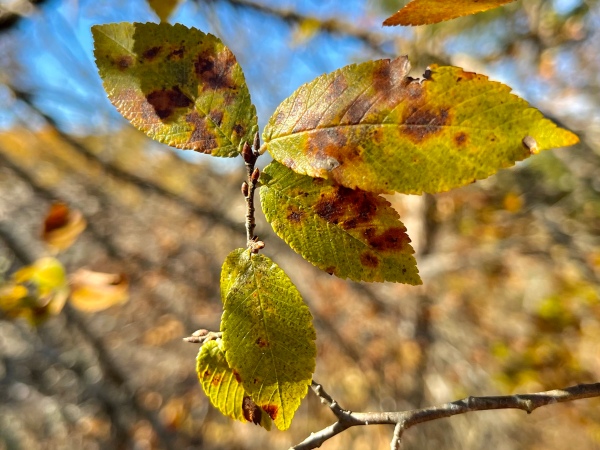
At the end of January, there is still a lot of winter left to endure—far too early to be thinking about the still-distant-spring even at our “middlin’ latitudes.” Nevertheless, even at this early date, the buds of Ulmus rubra (slippery elm) are noticeably swollen. (I’ve always felt “slippery” was a misnomer for this species. I know it refers to the slippery texture of the inner bark when chewed, but the leaves are rough, and the twigs are rough, and the buds are rough as well—and who even does that [chews the inner bark] anymore?!) It is this roughness to the leaves that most easily distinguishes U. rubra from the similar U. americana (American elm), but during winter it’s fuzzy, rusty-red buds provide the clue instead. If one has a pocketknife, a slice into the bark to look for alternating light/dark layers (the absence of which signifies U. rubra) can also be used.

Ulmus rubra (slippery elm).

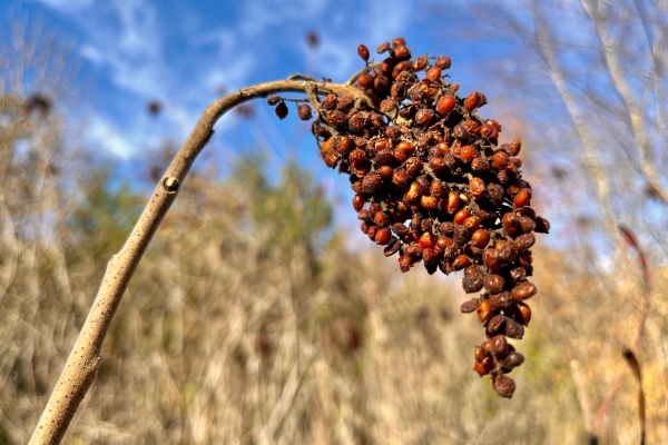
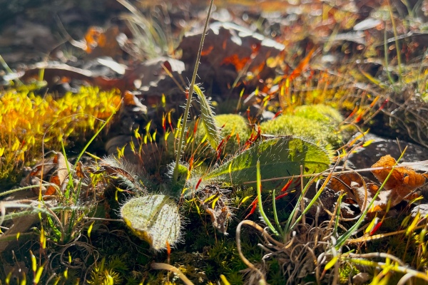
The rich ground layer of a post oak woodland dazzles during spring and summer, the temporal sequence of floral displays belying the diversity that produces it. This diversity does not disappear during the winter, nor does the evidence of it—it merely expresses itself in different form. To recognize the plants that are there, one must train their eyes to see these different versions of them. Bright yellow flowers are replaced by dry seed boxes… fleshy green leaves with purple ball inflorescences are replaced by naked stems with dehiscent pods… delicate white petals are replaced by prickly pods. The ability to recognize the elements of a landscape at any moment—not just at their most beautiful—makes it easier to enjoy the landscape itself at any moment. Following are some of the plants we saw, no doubt distinctive when in bloom, but also recognizable when not if one knows what to look for.

Dasistoma macrophylla (mullein foxglove).
Anemone virginiana (tall thimbleweed).
Manfreda virginica (formerly Aloe virginica—false aloe, rattlesnake master, Virginia agave).
Dioscorea villosa (wolf yam).
Asclepias purpurascens (purple milkweed).

During the previous week’s outing at Hawn State Park, the group spent a fair amount of time distinguishing Missouri’s five species of Betulaceae—all of which can be found growing together along the banks of Pickle Creek. One is not likely to see three of them along the margins of a dry post oak woodland, but the two remaining—Corylus americana (American hazelnut) and Ostrya virginiana (American hop hornbeam), both much more tolerant of drier situations—were seen in abundance. These two species also happen to be the two that are most often confused with each other—especially during winter, giving the group another opportunity to study their subtle differences. Both develop male catkins during the winter, but those of C. americana tend to be larger, lighter in color, and frequently occurring singly along the branch. The winter twigs are a bit more distinctive—with tiny hairs and rounded buds in the former, versus hairless with pointed buds in the latter. Of course, of the two, only O. virginiana produces the distinctive hops-like fruits that often persist into the winter, so their presence immediately identifies any plant possessing them.

Corylus americana (American hazelnut) (L) versus Ostrya virginiana (American hophornbeam) (R) – male catkins.
Corylus americana (American hazelnut) (L) versus Ostrya virginiana (American hophornbeam) (R) – winter buds.
Ostrya virginiana (American hophornbeam) (R) – last season’s fruit.

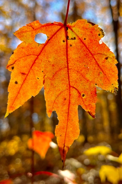
Direct comparisons of winter twigs proves to be a useful identification technique for other similar species pairs—even those in the same genus. Acer saccharum (sugar maple) and A. rubrum (red maple) often grow in close proximity and are similar enough to be frequently confused. When twigs of the two are placed next to each other, however, the differences are apparent. Color alone—A. rubrum usually exhibiting a reddish tinge to the twigs and buds—is not always diagnostic, and both species have what could be called pointed buds. Touch the tips, however—the buds of A. saccharum are sharp enough to prick the finger, while those of A. rubrum are blunted just enough to avoid feeling the prick.

Acer saccharinum (sugar maple) (L) versus Acer rubrum (red maple) (R) – winter buds.

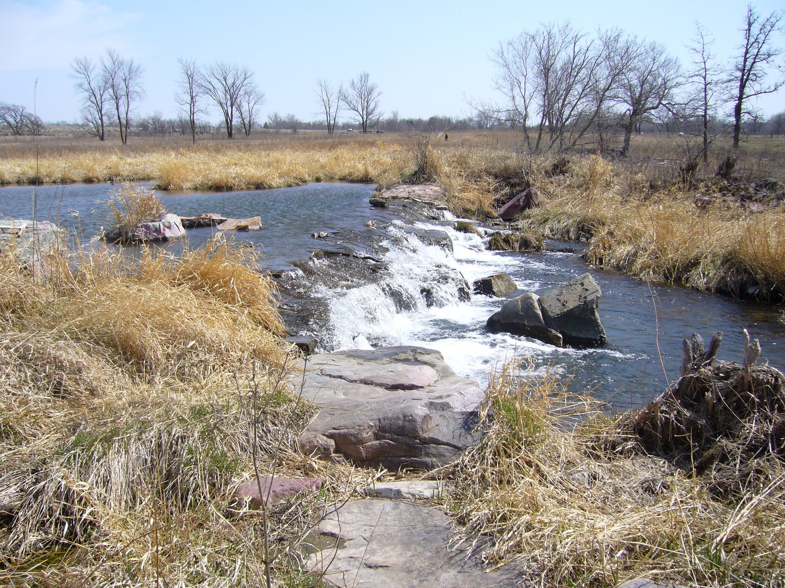
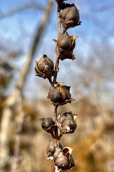
Along the length of the trail, I noted an abundance of dry, persistent flower stalks of Hydrangea arborescens (American hydrangea) colonizing the bordering rock ledges. Normally found in moist (and frequently inaccessible) situations, its presence in a dry post oak woodland suggests drainage through the layers of dolomite underneath the woodland reaches the surface in these exposed toe-slopes, keeping them persistently moist. While the promised floral display in June is reason enough to return, my interest in woodboring beetles provides additional motivation, as its flowers are a favorite of a diverse group of woodboring beetles call flower longhorns (subfamily Lepturinae)—some of which having been associated only with this plant. Time to mark the calendar!

Members of the WGNSS Botany Group (L–R): Keith Woodyard, Eileen & Tom Buescher, Alan Brandt (hidden), John Oliver, Kathy Thiele (hidden), Burt Noll, Michael Laschober, Pete Kozich.

©️ Ted C. MacRae 2022

Hughes Mountain redux

Despite the relatively long drive from St. Louis, a healthy group of 15 showed up for this past Monday’s WGNSS Botany Group outing at Hughes Mountain Natural Area; participation no doubt helped out by a spectacular forecast (sunny with highs in the 70s) and near-peak fall colors. Hughes Mountain is situated in the northern portion of the St. Francois Mountains. At its summit is Devil’s Honeycomb—a barren expanse of uniquely fractured Precambrian rhyolite formed by the gradual cooling of magma inside a volcano that was then exposed over 1.5 billion years of erosion. Devil’s Honeycomb is one of Missouri’s geologic wonders, and it’s rocks are among the oldest exposed rocks in all of North America.

Devil’s Honeycomb, summit of Hughes Mountain.

Rocks are not the only items of interest here; the igneous substrate results in acidic conditions that affect the flora in equally interesting ways. This is most pronounced in the igneous “glades” (more properly called xeric igneous prairies) where the soils are too thin and conditions too dry to support the growth of trees, offering refugia for grasses and other herbaceous plants more typical of the western grasslands to persist. Surrounding the glades are dry and dry-mesic upland deciduous forests of oak and hickory featuring a rich shrub layer and open woodland-adapted herbaceous plants.

Beginning on the trail from the parking lot, John Oliver pointed out a stand of tall, now leafless sumacs which nearly everybody (including this author) assumed to be Rhus glabra (smooth sumac) due to their size. In fact, despite their size, they proved to be R. copallinum (winged sumac), with the ID confirmed by a few persisting leaves and their distinctive axial “wings.” John pointed out that an easy winter ID tip for this species is the fruiting structures, which nod distinctively after first frost (those of R. glabra do not).

Post-frost “nodding” seed head of Rhus copallinum (winged sumac).

Ascending the trail through the dry-mesic forest towards the first set of glades, we noted the brilliant colors of small Acer rubrum (red maple) saplings in the understory. When their leaves finally drop, they will be more difficult to distinguish from A. saccharum; however, their rounded rather than elongated buds will still allow differentiation.

Acer rubrum (red maple).

Several of the oaks were examined, with most thinking they were largely Quercus shumardii (Shumard’s oak) and Q. velutina (black oak)—both similar to each other but the latter bearing larger, grayer, pubescent, quadrangular terminal buds. Approaching the glades, Q. marilandica (blackjack oak), Carya texana (black hickory), and Ulmus alata (winged elm) became more abundant, all three much preferring the drier conditions found around the glade margins. An interesting feature of the latter (in addition to the distinctive, corky ridges on the twigs), is the leaves, which are smaller than those of most other elms but tend to grow larger towards the terminus of the twig. They also tend to be much less asymmetrical at their base than other elms.

Ulmus alata (winged elm) showing gradually larger leaves towards the twig terminus.

Very little was left in bloom, but the remnants of recent bloomers were still evident. Solidago petiolaris (downy goldenrod) and Symphyotrichum anomalum (many-rayed aster) were common along the trail and still recognizable, their showy flowers gone and replaced by developing seeds. Hieracium sp. prob. gronovii (beaked hawkweed) was found nestled among mosses perched on a rhyolite shelf, the flowers gone but the leaves still green and distinctively hairy. Hypericum gentianoides (pineweed) was found on the glades proper, most with their stems and leaves turning red but the occasional plant still green enough to allow crushing its stems and enjoying its orange-like fragrance. Bucking the trend, however, was a small patch of Solidago nemoralis (old-field goldenrod), it’s yellow flowers fresh and bright in defiance of the calendar’s call to senescence. A small jumping spider in the genus Phidippus took advantage of the lingering greenery, hiding among the leaves in hopes of finding equally persistent prey.

Hieracium sp. prob. gronovii (beaked hawkweed).
Solidago nemoralis (old-field goldenrod).
Phidippus sp. on Solidago nemoralis (old-field goldenrod).

The benefits of management efforts by the Missouri Department of Conservation in the area’s forests were more evident than ever. Between the first set of glades and the main glades surrounding the summit, a rich shrub layer dominated by Rhus aromatica (fragrant sumac) stretched endlessly under an open woodland of oak and hickory, the latter turning the canopy bright yellow in vivid contrast to the orange and red shrub layer beneath. Such open woodlands were once common in pre-settlement Missouri but are now rare due to the elimination of fire in the landscape and its mediating impacts.

Rhus aromatica (fragrant sumac).

Entering the main glades, the group made their way up towards the summit and Devil’s Honeycomb, while Ted and Sharon stayed back to take a closer look at and photograph a robust colony of Cladonia cristellata (British soldiers) growing under Juniperus virginiana (eastern red-cedar). Lichens, of course, are unique in the world of vegetation in that they are a composite organism—a fusion between a fungus and another organism (usually a green alga or cyanobacterium) capable of producing food via photosynthesis. None of these groups of organisms are considered plants in the modern sense, and, in fact, fungi are more closely related to animals than they are to plants. Nevertheless, the convergence in appearance, habitat, and ecology of lichens with plants puts their study much more in the realm of botany than zoology.

Cladonia cristatella (British soldiers).

The group arrived at the summit just in time to enjoy spectacular vistas under crystal blue skies with wisps of clouds and the balmiest temperatures one could possibly hope for in early November.

The group enjoys the view from the summit of Hughes Mountain.
L–R: Ted MacRae, Rich Thoma, Kathie Bildner, Michael Laschober, Tina Cheung, Kathy Thiele, Nancy Mathis, Sharon Lu, Alan Brant, Mark Peters, John Oliver, Larry Lindenberger, Burt Noll, Gwyn Wahlman, Keith Woodyard.

©️ Ted C. MacRae 2021

Pipestone National Monument

Grandson, do not expect to accomplish much in this lifetime, for no one shares your vision… – The Oracle


Wednesday was my birthday, and it has been my custom for many years now to take the day off and go hiking/bugging somewhere. Coming as it does in early spring, it is usually the first real bug collecting trip of the year. This year, however, I was roped into a short business trip to visit a USDA lab in Brookings, South Dakota, so tradition would have to take a back seat. My visit at the lab ended early, though, and my flight back home from Sioux Falls didn’t leave until that evening, so I studied the map to look for any possible nearby points of interest in this landscape that has, for the most part, been unforgivingly converted to fields of corn, soybean, and wheat. I quickly noted a place called Pipestone National Monument just over the border into Minnesota. I love stopping at national monuments while traveling – they usually have some significant historical or geological interest, and their typically (though not always) small size means one can fully explore the area in a relatively short time. I did not know or had never heard of this place, but what I found was a charming little jewel tucked within a remnant of tallgrass prairie. At this far northern latitude, spring is still in its earliest of states. Few insects would be seen, but nevertheless I felt thankful for the chance to spend time outdoors and in a place of beauty where I could reflect on the years gone by and those (hopefully) still to come.

The area is named for a thin layer of catlinite – pipestone – exposed in this small area that has been quarried for centuries by Native Americans for carving into pipes (both war and peace). Quarrying within the monument continues to this day, with permission to do so reserved by law only to registered Native Americans. The area is identified as a sacred site associated with Native American spiritual beliefs and is preserved as a significant cultural and ethnographic landscape. Of particular interest to me was the site’s distinct hydrologic/geologic landscape and the native tallgrass prairie associated with it. A short ¾-mile trail loops through the area, providing a diverse glimpse of the area’s unique features. Pipestone may have provided the area’s namesake, but a narrow exposure of Sioux quartzite is the area’s most prominent geologic feature. Sioux quartzite is derived from billion and a half year-old layers of sand/silt sediments deposited thickly on the floors of ancient, Precambrian seas and compressed over the vastness of time into a hard, reddish metamorphic rock. Normally covered in this area by glacial till, the layers at this site are tilted upward 5–10 degrees towards the west and break through the surface to form a jagged, mile-long west-facing escarpment 23-30 feet high. Underneath the quartzite is the pipestone, a thin layer of metamorphosed shale. This fine-grained rock is derived from clay deposits, thus it is much softer and redder than the harder-than-steel quartzite. Pipestone Creek bisects the escarpment, giving rise to the lovely Winnewissa Falls, flowing over the escarpment and running down to a small, natural empoundment (Hiawatha Lake) before continuing its journey back into the glacial till and tallgrass prairie (for anybody surprised that there should be “falls” in this part of the country, it is interesting to note that nearby Sioux Falls is named after a grander example of of such flowing over quartzite exposures in its downtown).

Precious little remains of the expansive tallgrass prairie that once extended from horizon to horizon in this area. A few small parcels managed to escape the plow, but even in those tiny remnants dramatic alterations in plant communities have occurred due to fire suppression and the introduction of more than 70 non-native plant species. Prescribed burning programs are now being used at the Monument to restore the prairie’s native plant composition and appearance. Looking out over the tallgrass prairie remnants above and below the quartzite escarpment, it I was tempted to visualize circles of teepees on the higher ground away from the quarries (all Native American tribes worshipped this site and would never camp directly within it), with herds of American bison dotting the landscape in the distance. Contrasting with the openness of the prairie, the escarpment itself is densely studded with trees – American elm (Ulmus americana) along the top edge, and bur oak (Quercus macrocarpa) in the escarpment itself. Unlike the large, sometimes towering examples of their kind found further to the east, the trees here are dwarfed and spreading, almost gnarled. Below the escarpment, woodland quickly gives way to pure stands of smooth sumac (Rhus glabra) and choke cherry (Prunus sp.), which just as quickly yield to the surrounding sea of prairie. Along Pipestone Creek below the escarpment, lower layers of exposed quartzite provide nooks and crannys where enough moisture collects to support the growth of green ash (Fraxinus pennsylvanica) trees, until glacial till once again covers the quartzite, and riparian woodland yields to grasses and forbes. It’s not hard to imagine why this became a special place to the Native Americans, even before they discovered the pipestone that was to become so important to their culture.

The pipestone quarries are located a short distance to the west of the escarpment – where the hard quartzite layer is thin enough to break through – and, thus, have had little impact on altering the physical appearance of the escarpment itself. Winnewissa Falls (meaning “Jealous Maiden” in the Dakota language), lies at the center of the escarpment, providing a stunning centerpiece. Despite its beauty, it is but a shadow of what it was before early settlers in the area blasted away the top 18 feet of the ledge to create a reservoir for drinking water. A century of weathering and recolonization by lichens and mosses have softened the scars on the rocks, leaving little to indicate that such a dramatic alteration took place. However, standing in front of the falls, finding that “zone” where the temperature suddenly drops and cool wet mist blows on the face, and thinking about the significance of this place to the Native American tribes who held it so sacred, I was left feeling bewildered at how such drastic measures could have been contemplated for so beautiful a place.

In addition to the falls, nature has created some striking sculptures in the rock. “Old Stone Face” can hardly be mistaken for anything else – despite its human likeness, it was created entirely by natural forces. “The Oracle” is another naturally-formed human likeness found (though not as easily as Old Stone Face) in the outlines of the rocks. Tribal Shamans (Medicine Men) believed it served as a guardian of the valley and that voices issued from it’s cold stone lips. I stared for awhile and strained to listen, trying to imagine what words it might have spoken. At first, it seemed as if all was silent. Then I noticed the sound of the wind rolling over the prairie and twirling through the gnarled oaks. I heard the falls in the distance. I heard birds in the midst of frantic early-spring songs. I thought perhaps these might be the voices that guided the Shamans – spoken so loudly, yet so easily unheard.

The first U.S. government expedition to the quarry occurred in 1838 with Joseph Nicollet, a French scientist who was sent to map the upper Mississippi country. He and the members of his expedition carved their names in the rocks atop the escarpment, as did many of the early pioneers that first settled in the area. In studying the surface of these rocks, I couldn’t help but notice the incredible diversity of lichens to be found. Around 75 species are known from the area, and as shown in the photos I share below they come in a fantastic array of forms and colors. Lichens are primary colonizers of rock surfaces, able to do so as a result of their nutritional autonomy. Lichens are merely fungi that have evolved a specialised mode of nutrition: symbiosis with photosynthetic microalgae or cyanobacteria. Often, the algal component is capable of fixing nitrogen from the atmosphere, while the fungal organism attacks the rock with organic acids to release minerals. This is the basis of soil formation. Over time, enough soil accumulates in small depressions to allow mosses to colonize the rock surface. As successive generations of moss grow and die, more and more organic material accumulates on the rock surface, eventually supporting the growth of vascular plants (which extract nitrogen from the soil, rather than from atmospheric sources). These cycles of growth and death act in concert with the forces of erosion to ultimately convert barren rock to tallgrass prairie, hardwood forest, or other climax habitat. Mind you, this is an extraordinarily slow process – it can take a full century for a lichen to grow one inch! As I looked at the abundance and diversity of lichens on the rock surfaces, I tried to visualize the breadth of time encompassed by what was before me and quickly became lost in eternity.

While the trail that loops through the area is less than a mile in length, it took me an hour and a half to complete it. What started out as a few hours to kill ended as a hurried rush through the museum and interpretive center, trying to cram a few last morsels of knowledge into my head in those final moments before I would have to submit to the drive back to Sioux Falls. As I left the area, I noticed these oddly out-of-place boulders known as “The Three Maidens.”
Native Americans believe that these boulders shelter the spirits of maidens who demand offerings before permitting them to quarry the pipestone. Science tells us that the boulders are composed of granite and were likely carried here by glaciers during the past 1 million to 10,000 years ago. Originally a single boulder some 50 feet in diameter, repeated freezing and thawing over the millenia since it was dropped here have split the boulder into the several pieces seen here. Perhaps only The Oracle knows which is true.

For a more detailed, yet highly readable account of the geology of this area, please consult Minnesota Geology, Field Trip, Summer 2000 and Other MN DNR Workshops, by Arlyn DeBruyckere.