Welcome to the 13th “Collecting Trip iReport” covering a 20-day insect collecting trip to the southwestern U.S. from June 20 to July 9, 2023. Joining me for the entire trip was Mike Arduser, a hymenopterist specializing in native bees with whom I’ve collected on and off for nearly 40 years! (For those who don’t know, Mike discovered what became the holotype of Acmaeodera chuckbellamyi, a species I described to honor my friend and mentor, the late Chuck Bellamy. That holotype remains the only known representative of the species.) The trip started with three days in the Oklahoma panhandle, where I checked traps that I’d placed a month earlier. We then collected for a couple of days in southern Colorado as we made our way west and spent 10 days collecting across southern Utah and northern Arizona. On our way back east, we spent three days in northern New Mexico and a couple of days in the Texas panhandle before making the long drive back to St. Louis on Day 20.
This report assembles the field notes generated during the trip, which are presented in “semi-rough” form—i.e., they have been lightly condensed and “polished” but not further modified based on subsequent examination of collected specimens unless expressly indicated by [Edit…] in square brackets. As with all “iReports” in this series, this report is illustrated exclusively with iPhone photographs. Previous iReports include:
– 2013 Oklahoma
– 2013 Great Basin
– 2014 Great Plains
– 2015 Texas
– 2018 New Mexico/Texas
– 2018 Arizona
– 2019 Arkansas/Oklahoma
– 2019 Arizona/California
– 2021 West Texas
– 2021 Southwestern U.S.
– 2022 Oklahoma
– 2022 Southwestern U.S.
Day 1
Alabaster Caverns State Park
Woodward County, Oklahoma
After an 8-hour drive from St. Louis I was rarin’ to go. Unfortunately, it was blazing hot and humid—so much so that I really wasn’t prepared for it. Nevertheless, I had a job to do, and that job was to do the first check on the insect “jug” traps that I set out last month. I hiked down into the canyon and was glad to see the first trap still hanging (I always worry about people molesting my traps, and if the people don’t do it the raccoons will). My happiness quickly turned to dread when I saw how many beetles it had captured—it was literally overflowing with Euphoria flower scarabs (both E. fulgida and E. sepulchralis)! Oh well, I’m out for three weeks and don’t have to be anywhere by anytime, so it’s not a problem however long it takes to count the traps. In addition to Euphoria, traps baited with sweet red wine (SRW) or a 50:50 mixture of SRW and pure ethanol (EtOH) also had a nice variety of Cerambycidae. The trap baited with EtOH only had far fewer Euphoria and Cerambycidae—consistent with what I saw in my trapping study last year in Missouri; however, I was surprised to see the SRW-baited trap perform as well as it did (more Euphoria and only slightly fewer Cerambycidae compared to the mixture). If it continues to perform this well, I may opt to using SRW only for these traps. The most exciting find was Trigonarthris atrata (one of each in the SRW and SRW/EtOH traps)—I’ve never collected this species, and it seems to be relatively uncommon throughout the south-central U.S. where it occurs.
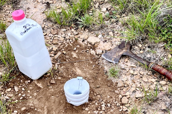
Hiking out of the canyon was difficult—the path I chose was almost vertical, especially at the top, and carrying equipment and a net as well made keeping my balance precarious. At least the gypsum rock is very “tacky” and made it easy to get a secure foothold. Lastly, I set a white “bottle” trap in the gypsum/clay shortgrass prairie along Raptorsroost Trail above the canyon—hoping it catches Acmaeodera during the next month.
Afterwards we went to the Canyon Campground and set up our camp, cooked some delicious burgers, and drank some beer (tasted so good considering how hot it was). I was, however, simply too exhausted to be motivated enough to setup the lights. Instead, we chilled for awhile before turning in and hoping for lower temperatures (which eventually did come down enough that we were able to get a good night’s sleep).

Day 2
We awoke to cloudy skies—a bit of a surprise, and as we we taking down camp it actually began to rain a bit. We hadn’t put the rain fly on the tent last night—hoping to maximize circulation because of the heat. I’m glad we didn’t get woken up at 3 am with rain coming down and have to quick put the rain fly over the tent in the middle of the night! After breaking down camp, I checked the Lindgren funnel trap that I placed in the juniper/bumelia/hackberry forest near the camp site the last time I was here and was happy to see it hadn’t been overrun by Euphoria (which I did not count or keep) but did have a few elaphidiines and Neoclytus. The find of the day, however, occurred while we were breaking down camp and I saw what I thought was a Dicerca sp. on the tent. I casually took a photo and then put it in a vial and took a closer look to decide if it was D. lurida or D. obscura. As I was looking at it, I noticed the impunctate pronotal midline and realized that it was not a Dicerca but a Poecilonota, and the shape and size suggested it was P. thureura, a species I had not collected since the first time I found it in 1980! What a fantastic find to start the day.

Gloss Mountain State Park
Major County, Oklahoma
We were not optimistic as we drove back towards the Gloss Mountains—a thick cloud layer blanketed the sky, and the rain while taking down our campsite had us thinking we might be spending much of the day dodging rain. As we approached the state park, however—its iconic profile looming in the distance as we approached, a patch of sun appeared over the park; a welcome sight along with the much more reasonable temps compared to the oven we dealt with yesterday. Blooms were diverse and plentiful—I’ve never seen this area so much and green, and Mike got to work looking at them in search of bees. I would have loved to have done the same thing (except beetles), but with the business of trap-checking at hand (and six traps the check, at that!) I put my nose down and headed up the slope to the first set of traps near and on the top of the mesa.

The SWR trap had suffered wind-throw—some of the beetles were on the ground below the trap; however, it must have happened very recently (not more than a couple days) because the beetles on the ground were still pliable and easily located/counted. Once again the traps were inundated with Euphoria flower scarabs, while Cerambycidae were almost non-existent but did consist of two more Trigonarthris atrata to double my series of this excellent find. The SRW/EtOH trap suffered negligible wind-throw and, like the previous, was inundated with Euphoria with only two Cerambycidae (Neoclytus acuminatus and N. mucronatum). The EtOH trap suffered the worst wind-throw, with a branch falling on it and dumping the entire contents. Again, this must have happened recently because all the beetles on the ground below the trap were still pliable and easily located/counted (again, mostly Euphoria). While I was atop the mesa, I set one white “bottle” trap in the gypsum/clay shortgrass prairie near the EtOH trap, and as I was doing this I collected an Onthophagus sp. on the ground in the mixed-grass prairie atop the mesa.

Back down on the slope, I encountered Mike, who had collected one Plinthocoelium suaveolens and seen a mating pair on the flowers of Sapindus drummondii; I checked for more periodically throughout the rest of the afternoon and didn’t see any, but I did collect a nice series of Trichodes bibalteatus off the flowers.
Back down in the plains below along the south edge of the park, I was disappointed to find that all three jug traps were wind-thrown and completely dumped with no possibility of data collection. Because the only trees in the area are short-statured mesquites, I clipped the traps directly to a branch, but the strong winds were able to “spin” the traps on their hooks. I reset all the traps, and to prevent a repeat of this I looped guide lines through the jug handle in several directions and tied them to the branches. Hopefully next time I’ll be able to collect data from this set of traps.

While I was there, I set a white bottle trap in gypsum/clay mixed-grass prairie near the SRW trap, then found several Chrysobothris octocola and Actenodes mendax (new state record?!) and on a wind-thrown branch of Prosopis glandulosa. Back in the parking lot, I checked the mesquite (where many years ago I first found C. octocola and Plionoma suturalis (as new state records) and found several more of each as well as a single Acmaeodera sp. prob. mixta, all on dead branches of Prosopis glandulosa. By this time, I was exhausted and needed to eat something before heading back up the slope to check the soapberry flowers one last time before heading off to our next destination.

Beaver Dunes Park
Beaver County, Oklahoma
It took about two hours to drive here from Gloss Mountain State Park, and given the amount of time it took to process the traps there it was too late to do the same here. Instead, we got a few supplies in town and enjoyed a spectacular sunset as we setup camp and cooked dinner (ballpark brats!).

Day 3
We spent a good part of the morning curating specimens and updating our field notes from yesterday, then broke camp and headed out to check the traps. We did notice that temps were cooling rapidly and skies looking more ominous, and as we arrived at the site we began to hear rumblings of thunder. I decided to forge ahead but try to stay close in case the skies opened up. Winds were picking up as I reached the first trap (SRW), but I got it checked quickly as there were few beetles to deal with (but tons of moths!). I was frankly glad to see it was not overwhelmed with Euphoria flower scarabs, which would have meant much more time counting beetles. It had dropped but not spilled, and the bait bottle was laying nearby, and since the reservoir was full I considered the data not compromised. The SRW/EtOH trap was also full of moths, but in this case I dumped the contents into the strainer, reset the trap (still hanging but the bait bottle blown out), and brought the contents back to the car to count in case the skies opened up. It threatened to do so as I was counting, but I used the hatch as a shield (and took advantage of the lights it offered). In this case there were a few more Euphoria, but not the overwhelming numbers seen at the two sites further east— makes me wonder if we are right at the edge of the range for E. fulgida. Cerambycidae included 21 elaphidiines (I’m sure there are 3 or more species involved). After conditions began improving, I retrieved the EtOH trap contents and brought the contents back to the car for sorting/counting. The number of cerambycids was surprising (73—the highest of any trap so far on the trip), given that EtOH traps have consistently shown poorer efficacy during the course of this study. I won’t know whether to be excited about any of the cerambycids until I can do IDs, but again there appear to be at least three or more species involved. Before leaving, I set out a bottle trap for Acmaeodera in open sand dune prairie near a lot of flowers and near the SRW trap. Traps all checked and reset, and the rain, thunder, and lightning continuing to roll, we decided to head west!
Black Mesa State Park & vicinity
Cimarron County, Oklahoma
We arrived at Black Mesa State Park mid-afternoon, and with the continued threat of rain we decided to setup camp while conditions were dry rather than waiting until later. Once done, we marveled at the amazing abundance and diversity of wildflowers in bloom—every time I’ve been here before the place has been bone dry! Given this, Mike decided to search for bees around the campground while I worked the traps I had placed in the area last month. There are two sets—one in the park in a canyon filled with hackberry and soapberry, and another north of the park at an interesting sandstone outcrop near Kenton with oaks and pines—unusual for the area! I decided to check the latter because I thought it had the better chance to produce something interesting. Boy, was that an understatement; as soon as I walked up to the SRW trap and looked inside, I saw it—a live Aethecerinus wilsonii walking over the hoards of Euphoria and other insects that had been attracted to the trap! I’ve been looking for this species since forever, and here was a big, beautiful male. I picked it out, dried it off a bit, and set it on a tree branch for a few photographs before getting down to counting the rest of the trap catch. This included 130 Euphoria fulgida (I thought they might be a different species at first, but then I determined that they are simply the western “fuscocyanea” form of the species—clearly I had not reached the western limit of the species at the previous spot!) and 30 elaphidiines. The SRW/EtOH trap was even more loaded with Euphoria and elaphidiines, but as expected the EtOH trap had lower numbers and diversity.


I was hoping I would have enough time to check the last set of traps before it got too late but decided doing so would be cutting things too close. I did decide, however, that I had time to set out the last Lindgren funnel trap in the North Canyon of the park and the last bottle trap at the Scenic Overlook. I placed the bottle trap first in an area with lots of wildflowers (where it will, hopefully, be visible to Acmaeodera visiting the flowers), then bushwhacked to a large cottonwood I’d spotted earlier in the North Canyon. When I reached the tree, I realized a hiking trail passed right by it, which would make the trap too vulnerable to vandals (amazing that, even out in nature, I have to worry about that), plus the understory around the tree was thick with poison ivy. I hiked instead up the canyon to the road and found a large hackberry off the trail where I could hang the trap discretely.
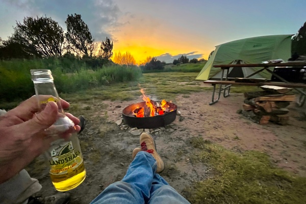
Traps placed, I went back to the campground where Mike and I enjoyed cool temps, a nice warm campfire, and grilled-to-perfection strip steaks while admiring incredible evening skies!
Day 4
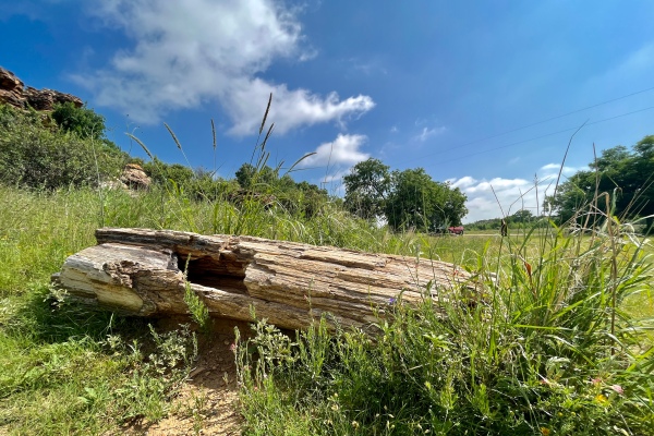
It rained overnight, but our tent worked to perfection and we slept well under cool nighttime temps. Mike had set out bowl traps at the campground for bees and while doing so encountered a Moneilema armatum mating pair in the flower of Opuntia phaeacantha. I’ve never seen an individual of this or any species of Moneilema in the flower of the host cactus! After breaking camp, we headed out to check the final set of traps, but on the way we stopped at the “Petrified Forest” to see what we might find on the spectacular blaze of wildflowers that the park is sporting right now. I imagine that such a spectacle is unusual for the area and that most years are not like this. Despite the abundance and diversity of bloom, there wasn’t a lot of corresponding insect activity. There are some iNaturalist records of two Tetraopes spp. from this area, but I found very little milkweed along the Bird Haven Trail leading off of the area and no beetles. I suspect it is still too early for them, as the plants that I did find were all very small.

Back at the “forest” I did find a single Acmaeodera in the mixta/immaculata complex on the flower of Engelmannia peristenia, a Trichiotinus texanus on the flower of Cirsium undulatum, and a rather darkly marked Batyle suturalis on the flower of Thelesperma magnicamporum.
I also got a chuckle when I was photographing one of the petrified logs and Mike just then realized it was not a regular log that I was photographing!
We then returned to the Canyon Overlook so I could check my traps. The floral diversity atop the overlook was just as amazing as down in the canyon, and as Mike set about searching for bees I got down to the business of checking the last set of traps. I expected results similar to the traps I’d checked last evening, and I was not surprised, with Euphoria fulgida “fuscocyanea” and elaphidiine Cerambycidae forming the bulk of the catch. I did, however, find not only some very interesting mantidflies (Climaciella brunnea) but a few individuals of the Polistes paper wasp species that must serve as the model for the mantidfly. I kept both, as this will be an interesting association to document.

Before leaving the area, we stopped again at the sandstone outcrop north of the park where I’d checked my traps the day before. I didn’t see much going on then, but it had been cool and cloudy and I hoped today’s sunshine and warmer temps would bring out more insect activity. Mike actually did pretty well with bees at the spot, but I found almost nothing—beating the oaks yielded nothing, beating the pines yielded nothing, and beating the junipers yielded nothing. Only when I beat the mesquites did I find a few blister beetles and mesquite bugs (none of which I kept). I did find a single Lycus arizonensis on Asclepias aspera (antelope horn), which I thought seemed way out of range for the species. In fact, it is way out of the normal range (central Texas through New Mexico and Arizona), but another person has already recorded this species on iNaturalist from a location very near to this one. Given the lack of beetle activity (and Mike now satisfied with the bees he had picked up over the past two days in the area), we decided to head north into Colorado on our eventual way to Utah.
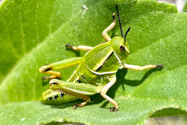
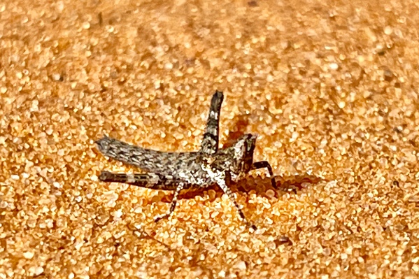
grasshopper—family Romaleidae).
Vogel Canyon Picnic Area
Otero County, Colorado
The drive north into Colorado and towards Vogel Canyon took us through some quite remote areas, the state line crossing actually occurring on a gravel road. I last came here about ten years ago with Jeff Huether, and I thought it might be a good stop before spending the night on our way to Utah. By now temps were in the 90s and the winds were whipping strongly from the south, so I opted not to use the beating sheet and instead just carried an aerial net. Not long after hiking down the Overlook Trail I saw what I thought was an Eleodes clown beetle crawling on the ground and then doing its characteristic “headstand” when it saw me. I figured I’d take a photo, but as I was doing so I realized it had long antennae—and that it was actually a Moneilema cactus beetle (M. armatum to be precise)! Cactus beetles look very much like clown beetles, which I believe are models that the cactus beetles mimic (the former are noxious, but the latter are not), but I’ve never seen cactus beetles actually mimicking the clown beetles behaviorally! Of course, no amount of coaxing could convince the cactus beetle to resume his headstand mimicry, so I had to be content photographing it clinging to the ground. I believe it came from a patch of Opuntia polyacantha very near where I first saw it, and from that point in I searched not only this plant but also patches of a second species of pricklypear cactus (O. phaeacantha) as well as tree cholla (Cylindropuntia imbricata)—without success! I did note that other iNaturalist records of cactus beetles in southeastern Colorado were later than this date, so it seems it may still be a bit early for them.

As at Black Mesa State Park, I also checked lots and lots of Asclepias latifolia (broadleaved milkweed) for Tetraopes milkweed beetles but saw none (again, it’s probably a bit too early for them). As I was doing this, I noticed Cacama valvata (cactus dodgers) bolting from the chollas whenever I got too close to them, but I did manage to sneak up on one for a photo.
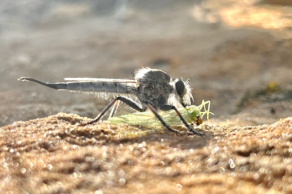
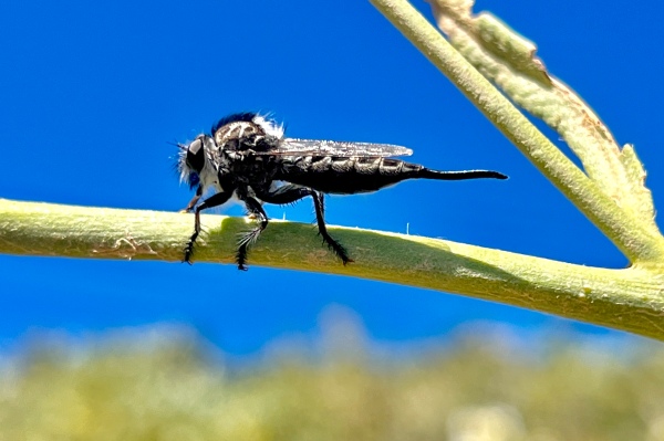
Frustratingly, the abundance and diversity of flowers here (the entire area around Oklahoma, Colorado, and Texas seems to have been inundated with rain this year) was void of insect activity—Mike did get some interesting bees at Escobaria cactus flowers, but for me beetle activity was almost zero. After reaching the end of the Overlook Trail and looking at the petroglyphs (disappointing, as vandalism has made it impossible to discern the original etchings), I hiked back along the Canyon Trail and—finally—doubled my beetle count for the spot when I found a Typocerus octonotatus (not at all uncommon) on the flower of Thelesperma megapotamicum! Not much else was seen during the remainder of the hike, save for an Efferia sp. robber fly holding as prey a green lacewing (family Chrysopidae).
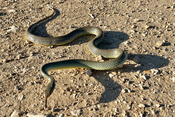
Back up at the trailhead, we decided Colorado is not where it’s happening right now and in the morning we’ll head towards Utah. On the way out, we saw a gorgeous Coluber constrictor flaviventris (yellow-bellied racer) crossing the road so stopped to take photographs. It was not very cooperative, but I managed to get a few good (enough) shots of it.

Rocky Ford, Colorado
There weren’t any public land campgrounds in or around Vogel Canyon as far as we could determine, so we hoteled it in Rocky Ford near La Junta a few miles north of the canyon. The High Chaparral Inn was comically small town, and finding something to eat for dinner turned into a major fiasco due to the lateness of the hour. After a fruitless drive north of town and back, we ended up having to sit for half an hour in the parking lot of the Sonic right across the street from the hotel just to get a burger—without a milkshake because the ice cream machine was broken!

Day 5
If last night’s dinner fiasco represented the worst of road tripping, the following morning coffee stop represented the very best. Actually, I’ve found some of the best coffee in the smallest of towns out west, and “The Coffea (not a typo) Shop” had it all—casual atmosphere, fun trinkets, delicious burritos, darling baristas, and most importantly incredible coffee, bold in flavor and brewed strong. It was so good I bought a pound of bulk to bring home with me.

The drive west along Hwy 50 later that afternoon was one of the most scenic I’ve ever encountered, and it all started in Cañón City at the foothills of the Rocky Mountains. A Tyrannosaurus rex clad in yellow tennis shoes welcomed us to the dinosaur theme that dominates the western U.S. Driving west, we oohed and aahed at every turn as the road followed the twists and turns of the Arkansas River amidst steep canyon walls until eventually we made it over Monarch Pass.

5 mi SE Montrose
Montrose County, Colorado
Last year Rick Westcott sent me label information for an undescribed species in the genus Nanularia—a very unusual location for a genus whose known members reside almost exclusively in California (the exception being the relatively widespread N. brunnea and the enigmatic N. pygmaea, the latter still known only from the unique holotype labeled simply “Texas”).

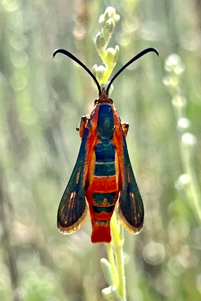
The specimen was collected in mid-July on Eriogonum pelinophilum (all species in the genus seem to feed exclusively on plants in this genus), but our path to Utah took us right through the city of Montrose so I decided to give it a shot. I’m pretty sure I found the locality (despite the somewhat imprecise label data—“8 km SE Montrose, 1875m”). The spot was small, but the elevation was spot on and—more importantly—there was lots of Eriogonum that seemed to be restricted to just that area. I searched the plants thoroughly, and while I did collect a few leaf beetles (a small series of Saxinus sp. and a single Neochlamisus sp.) and photographed a stunning clearwing moth (Synanthedon polygoni) associated with the plant, I did not see any Nanularia. For now, I’ll file this spot away and keep it in mind for the next time I happen to pass through this area—hopefully around mid-July!
27 mi ENE Gateway
Mesa County, Colorado
As we continued in our way west towards Utah, we passed through a spectacular canyon in Colorado’s “mesa country” with towering, jagged red bluffs lining either side of the highway. As we gained elevation and passed over the summit, conditions suddenly seemed greener and we started seeing lots of wildflowers in bloom along the roadsides. This is always a good sign for potential insect collecting, and if even greater interest to me were the stands of Quercus gambelii (Gambel’s oak) along the fencerows—a good host for buprestid beeltes (Brachys rileyi being the one I’d be most interested in finding). We found a turnout and pulled over to inspect the wildflowers and see what we might find. Mike found bees coming to Penstemon (foxglove), but I did not see beetles of any kind visiting the various flowers present. I then turned my attention to the Gambel’s oak and got out the long-handled net to works the high branches—collecting a nice series of Cyrtolobus treehoppers, Curculio weevils, and other miscellaneous beetles but no buprestids. I also collected a few Curculio weevils off the Cercocarpus (mountain mahogany) trees growing alongside the oaks. By now it was nearly 7 pm, so we continued west with the goal of making it to Gateway and finding lodging.
John Brown Canyon
Mesa County, Colorado
We had expected to find lodging in the town of Gateway, but it was nothing more than a closed convenience store and a few private residences. Fortunately, we found this spectacular canyon just outside of town with camping allowed.


Day 6
We broke camp early and continued west. Once we drove up to the top of the canyon and breached the rim, the morning light gave us a chance to look back and see exactly how spectacular the canyon was where we’d spent the night.
above Hideout Canyon
Manti-La Sal National Forest
Grand County, Utah
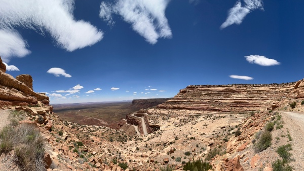
It was another morning of driving through spectacular canyonlands as we made out way to the next planned locality. Road conditions were tough—it took us an hour and a half to drive the 30 mile distance over incredibly rocky and steep terrain, and in fact we were stopped short just a mile from our destination by a rock ledge drop-off that was a bit too much for my loaded-to-max-capacity Bronco Sport to handle without risk of damage (a full-sized Bronco probably would have had no problem). The habitat, however, was surely what we were looking for—high elevation pinyon pine and juniper woodland, the former tree being the probable host of the recently described Buprestis pinyoni—so we parked the off the road and began to explore.

There was—again—a diversity and abundance of bloom for Mike to look for bees and me to look for Acmaeodera, but I first began by beating a dying pinyon (Pinus edulis) and promptly got a small series of Enoclerus sp. Beating other dying and dead pinyons throughout the course of the afternoon would produce more Enoclerus and also several acanthocine longhorned beetles and a Monochamus clamator. Besides the junipers, which produced nothing, the only other truly woody plants were Cercocarpus sp. (mountain mahogany) and what I would later determine to be Amelanchier utahensis (Utah serviceberry), the latter producing a single very tiny clerid. Opuntia fragilis (brittle pricklypear cactus) were blooming nicely, and after not seeing anything in the blooms at first I eventually started picking up Trichodes ornatus and Acmaeodera bowditchi.

Among the diversity of flowering plants present, the only other one that I saw attracting beetles was Tetraneuris acaulis (stemless four-nerved daisy), from which I picked a few A. bowditchi and also some smaller Acmaeodera (perhaps two species). I did do some beating of living Pinus edulis, not expecting much but alway hopeful, and got only a couple of Dichelonyx sp. scarabs. The collecting was not fast and furious, but I encountered different things with enough frequency to keep me motivated and ended up spending much of the afternoon there. Eventually we decided to leave, having sufficient series of what we’d found and not seeing anything new, and began the long, rocky, bouncy trek out of the wilderness.

On the way towards the last stop, I’d noticed a large Pinus edulis (Colorado pinyon pine) along the side of the road with several large, recently-dead branches on the roadside—apparently injured by heavy machinery (perhaps a road scraper). I’d passed it by on the way up, anxious to reach our destination, but I wasn’t about to pass it by on the way out (and it’s fortunate that I stopped). I saw little on the branches at first, but after careful inspection of the trunk (hoping to see Buprestis pinyoni) I noticed several small Enoclerus sp. running rapidly upon it—a sure sign that the tree was the right stage for attracting woodboring beetles. Then I saw it—sitting right on the trunk at a spot I must have looked at before, a nice big Dicerca tenebrosa; not a rare species but one I’ve never collected before. I searched the trunk and all branches again carefully and did not find another, but I did pick up a few of the Enoclerus. My curiosity quenched (and feeling a bit vindicated for wanting to stop), we continued on our way.
Day 7
Our destination last night was Sandthrax Campground. It was a beautiful primitive campground in a gorgeous sandstone canyon lined with large cottonwoods, but it was not what we expected since it lacked pinyon pines—the host of same beetle I was looking for at the previous spot and recorded from this locality in the type series. Perhaps the specimen is mislabeled, or perhaps it was able to fly a long distance and happened to be picked up by an entomologist camping at the campground—who knows! Nevertheless, we had a wonderful campfire after we arrived and enjoyed comfortable sleeping temperatures through the night.
After briefly looking around in the morning and not seeing enough (anything!) of interest to warrant spending time there, we packed up and started making our way to the area around Page, Arizona. It would take all day, as we left open the possibility of stopping anywhere that caught our fancy along the way.
Hog Springs Recreation Area
Garfield County, Utah
The first such place was Hog Springs Recreation Area, just a few miles down the road. It was a chance to explore up close the stunning red sandstone canyon leading down to the Colorado River as it flowed through Glen Canyon National Recreation Area.

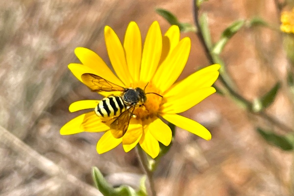
There was a lot of Sphaeralcea, mostly past bloom but with still enough individual blossoms to make them attractive. Diadasia sp. bees were utilizing the flowers, but did not see any of the Buprestidae or Cerambycidae that utilize Sphaeralcea and that I’d hoped to see.
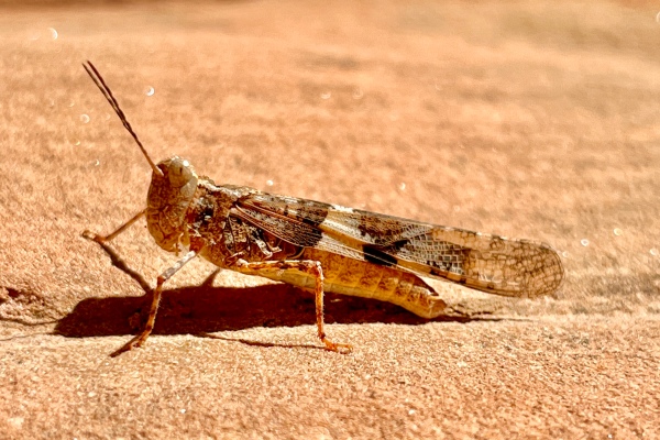
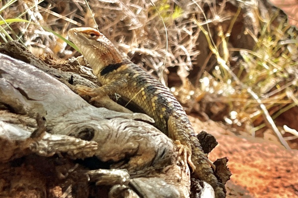
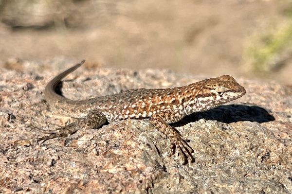
I walked up the canyon a ways and saw a Trimerotropis pallidipennis (pallid-winged grasshopper) and a largish and very skittish lizard that I take to be Sceloporus magister (desert spiny lizard) that let me take only two photos of it (and not very good ones at that) before it scampered up a large cottonwood tree out of view. The lack of insect activity was a bit concerning, especially considering that our previous location also had little to offer, so we continued our way with hopes of better collecting ahead.
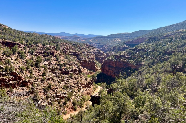
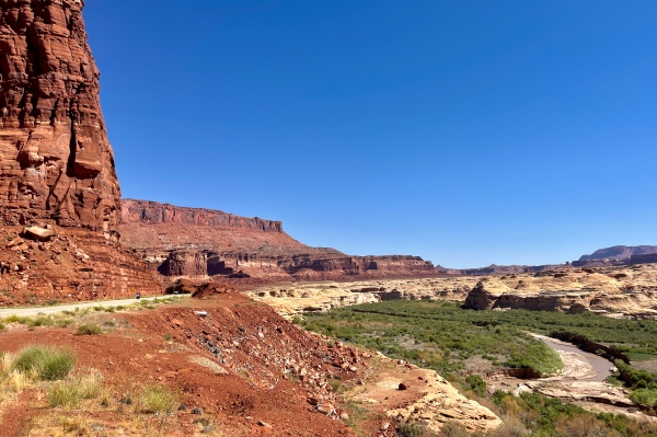
We passed through some of the most amazing canyon scenery that either one of us had ever seen on our way down through Glen Canyon National Recreation Area to a raging Colorado River. I’ve visited southern Utah briefly before and knew that the landscape was incredible, but what we saw today was otherworldly!
After climbing back up on the other side we reached pinyon/juniper woodland, and it became increasingly impossible for me to resist stopping every time I saw a pinyon pine with light green to brown needles—meaning the tree was dying or had recently died and was, thus, ripe for infestation by woodboring beetles!
Harmony Flat
San Juan County, Utah
We finally decided to stop in an area called Harmony Flat, where we saw not only scattered dead trees within the woodland but also low roadcuts boasting a bit of floral bloom. I looked at the blooms first, hoping that at this higher elevation I might see species of Acmaeodera on the flowers, but none were seen (nor were beetles of any kind for that matter—only bees, which Mike did find of interest!).

I turned my attention to checking out some of the dead/dying Pinus edulis (Colorado pinyon pibe) in the area. The first one I approached had a big, recently wind-thrown branch lying underneath an otherwise healthy tree, and when I started inspecting it I quickly found a Chrysobothris sp. on one of the branches. More careful inspection of the entire branch failed to turn up any additional individuals, so I turned my attention to an older dead branch lying underneath the more recently fallen one. I did not expect to see beetles in the branch, but I thought maybe there would be some still inside of it and used my knife to cut into the wood and hopefully follow galleries to their still-resident inhabitant. Very quickly I found a small Pogonocherus sp. in its pupal chamber—a fresh and perfectly formed adult but not yet emerged from the wood. Sadly, the only other beetle I found within the wood was a dead Chrysobothris sp. that had successfully pupated and neared adult emergence but then died before completing such. I searched for additional dead/dying pinyon pines but encountered fencing that prevented me from reaching those that I could see until spotting another one (living but with a few dying branches) near where I’d parked the car—along the way collecting a Cryptocephalus sp. that dropped off of an Artemisa sp. (sagebrush) as I approached. The dying branches produced only Enoclerus lecontei, a small series of which I collected. Finally, after checking in with Mike, who was having decent luck collecting bees off the blooms along the roadside, I spotted one fairly large dying pinyon line in the distance and went to sample it. The tree itself produced only more E. lecontei, which I did not feel the need to collect more of, but then I noticed a largish branch that had broken off earlier and seemed to be in perfect condition for attracting woodboring beetle adults. This was born out when I collected first one and then another Chrysobothris sp. (not the same species as the previous individual) on the main branch portion. Having spent a good hour at the site, and still needing to reach an area with cellular service to contact Paul Kaufman—another collector planning to meet up with us, we decided to continue on ahead.
The drive toward Page, Arizona took us off the plateau and down Moki Doug Way Grade—a terrifyingly steep but incredibly scenic drop into the lowlands below.
Approaching Mexican Hat, we finally got into cellular service and heard from Paul, who had just passed through town and was approaching the grade (we apparently crossed paths shortly after coming down the grade). We made arrangements to meet and then caravanned to our next planned stop to look for a tiny buprestid species called Acmaeodera navajo.
8 mi E Page
Coconino County, Arizona
Conditions were incredibly windy, and while Mike did find a few bees there were no beetles of interest (or even not of interest!). There was Sphaeralcea (globe mallow) in bloom (a known flower host for A. navajo), though it was a bit past its prime, and I hoped the lack of almost any insect activity was not a bad omen for the area. Fortunately I had other localities recorded for finding this species, so we packed up and moved onto the next one.
15 mi S Page
Coconino County, Arizona
The area east of Page not producing any of the Acmaeodera navajo I had hoped to find, we next came to this spot south of town. It was more of the same, however, with brutal winds and no beetles of interest despite the presence of Sphaeralcea sp. (globe mallow) in bloom. I did find Trirhabda nitidicollis on Ericameria nauseosa (rabbitbrush), a few of which I collected.

While I was photographing the beetle, a diminutive Brephidium exilis (western pygmy blue) flitted around and landed on the plant. I managed to photograph it (but missed the focus!).
Since it seemed not much was happening in the area, the three of us discussed our options for what to do next. We considered skipping the other localities I had recorded for the area and just driving on to the area north of Kanab where we planned to collect next. However, it would be approaching dark when we arrived (not fun setting up camp in the dark), so we opted to hotel it in Page instead. Since the other planned localities in the area were outside of town and on the way to Kanab, we could check them in the morning and move on if nothing was happening. Driving into town towards our hotel, we happened upon a restaurant called “Gone West” and were pleasantly surprised at the delicious amber ale on draft, excellent fish and chips, and live music covering some pretty cool songs—most with a bit of an electric guitar bent (much to my liking!).
Day 8
Hwy 89 at State Line
Coconino County, Arizona
We awoke to calm conditions with no trace of the battering winds we experienced yesterday, and after coffee, a bite to eat, and stocking up on provisions we navigated to another locality west of town where Acmaeodera navajo has been collected (right at the state line between Arizona and Utah).

Literature records indicate that adults are attracted to flowers of Sphaeralcea, Linum, and Opuntia, and we quickly began finding blooming plants of the first two. Almost immediately we began finding Acmaeodera pubiventris lanata—a species I’ve collected only sparingly before, on flowers of Sphaeralcea grossulariifolia, and after a bit of time I finally found my first A. navajo(!) on the same along with an occasional A. immaculata on. On the south part of the loop (up one side of the road and down the other), there were scattered plants of Helianthus ambigua, on the flowers of which we found a few individuals of the same three species. By the time I finished the loop, I wasn’t quite satisfied with the sparing numbers of specimens I had collected, especially of A. navajo, so I did another loop. During this time, insect activity had picked up considerably, and I collected more than enough of all three species for my needs.

I also took the chance to cross the state line so I could label some specimens from Utah (Kane Co.), collecting a few A. pubiventris lanata and a single A. navajo on flowers of S. grossulariifolia.
I think we probably arrived at the spot just as the insects were starting to become active (~10 am), and over the course of the next two hours their activity really picked up. At any rate, full collecting bottles has a way of replenishing enthusiasm for the hunt, and we headed towards the next spot full of optimism about our chances of success. POSTSCRIPT: Mike found a live male Prionus sp. in the door-well of our vehicle. I doubt that it is really from this locality, but rather that it flew into the car at a previous site a result of being attracted to residual prionic acid from lures that I have had previously. For now I will place it with this locality but reassess which of the previous localities it might have come from after identification of the species.
23 mi NW Page
Kane County, Utah
There exists a very old record of Nanularia brunnea in the University of California—Davis collection from this locality. It is a species I’ve never collected, despite living for five years in California—part of the range of this, the most widespread and commonly encountered species in the genus. I was heartened to see its host plant—Eriogonum inflatum—as soon as I got out of the vehicle, and the plant appeared to be common along a sandy 2-track paralleling the highway. Paul walked one way and I walked the other, and almost immediately Paul came back showing me something he’d collected on the stem of one of the plants—it was, indeed, N. brunnea! My motivation now sky high, we continued to look at the plants while working our way west along the highway. At one point, the stand thinned out and confined itself to just along the 2-track, so Paul continued west and I turned around to re-examine the more extensive stand of plants. As it turned out, I should have been more patient and continued along with Paul, as he eventually found three more individuals while I found none. He offered to let me have one, but I was determined to see and collect the species for myself, so I returned to the area where he had seen them and eventually found it for myself. I found three individuals—one crawling along the bottom of a low branch of the plant and two more sitting on the stem just below the lowest branch point (the latter also dropping as soon as I saw them but, fortunately, seen on and recovered from the ground). Paul was happy that I’d succeeded (not only was it my target for the site, but it also meant that he didn’t have to give me one of his specimens!). It may have taken well over two hours for me to find the first individual, but the time spent searching up to that point was not fruitless—also present and blooming at the site was Sphaeralcea ambigua, and on its flowers I found occasional individuals of the three species of Acmaeodera I’d collected at the previous spot (A. navajo, A. pubiventris lanata, and A. immaculata). Also present on the Sphaeralcea were a few individuals of Amannus sp. (pectoralis or vittiger), neither of which I’ve ever collected before. In this regard, I was able to repay Paul the favor, as he had not seen this species while we were there. I offered to give him one of mine for another specimen of Nanularia, a deal he readily accepted! A small series of my target for this spot now in the bottle, we set our sites on the next location and next target species.
Kitchen Corral Wash Rd
Grand Staircase-Escalante National Monument
Kane County, Utah
Another target species for the trip is Chrysobothris nelsoni, a species associated with Eriogonum and described from various localities in southern Utah but mostly near the Coral Pink Sand Dune system near Kanab. We plan to visit that area eventually, but part of the type series was collected at this spot, which was not too far out of the way as we continued west, and given the success we’ve already had today and that we still had a good amount of daylight left before reaching Kanab, I decided to give the area a look. It was a long drive over sometimes rough, sometimes sandy roads to reach the location, but the scenery of carved canyons was just spectacular!
The pinyon/juniper woodland had some small “dune-ish” areas of sand within it, but I didn’t encounter any Eriogonum plants or any of the more extensive sand areas that I expected would be needed to support stands of the plant. As I searched the area, I didn’t encounter many flowering plants, but I did see a couple of Opuntia aurea in bloom (yellow form) and collected Trichodes ornatus and a few of the hoards of nitidulids that congregate in the flowers of plants this genus, and I also found a single Acmaeodera diffusa on the flower of a lone blooming Sphaeralcea parvifolia plant. Beating was only somewhat more productive—just one Dichelonyx sp. and a curculionoid were found while beating the branches of living Pinus edulis; however, I did find a few Chrysobothris spp. on a dead P. edulis—two smaller ones that may be C. cuprascens beating one of the branches and a larger one of the “sculptured group” on the trunk itself. Ever on the lookout for Buprestis pinyoni, I spotted a largish P. edulis cadaver with Buprestis-sized emergence holes in one of the remaining large branches and began chopping into the branch in hopes of finding a Buprestis cadaver. I didn’t find an intact cadaver, but I did find a single Buprestis sp. elytron fragment in the branch and collected it hoping I will be able to determine the species. Mike found a variety of bees, but he was most excited about a pollen-collecting wasp in the genus Pseudomasaris that he had collected from the flowers of Lupinus sp. I remembered this as I later walked by the plant and saw a large wasp fly from it out of the corner of my eye, instinctively swinging my net and remarkably capturing another individual that Mike was happy to have.

While the small dune areas did not produce C. nelsoni or the Eriogonum plants they feed on, we did find a couple of nice large Eleodes beetles, one E. obscura sulcipennis and one E. caudifera, crawling across the sand.
The drive back out through the canyon was just as spectacular as the drive in, but this time we had an added obstacle to contend with—an angry bovine! We came upon the big, black bull standing in the middle road, and he very clearly took our approaching vehicle as a challenge! We tried slowly moving to the far side of the road, but he moved as well to block us—tail twitching as he continued to stare us down! All we could do was wait until he got bored enough and slowly strolled off the road and into the brush, at which time we gunned it a bit going through in case he changed his mind and wished to resume the stand off!
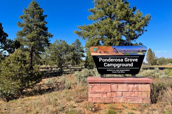
Ponderosa Grove Campground
Kane County, Utah
Mike and I had planned to camp in Coral Pink Sand Dunes State Park, but Paul mentioned a BLM (Burrau of Land Management) campground north of the state park that sounded like a much better option—not only was it less likely to be a crowded, RV parking lot, but we would be able to collect insects with no permit requirements. When we arrived at the campground, our expectations were not only met but greatly exceeded! It was a beautiful campground, with widely spaced sites located within a grove of large, stately ponderosa pines (hence the name).
After setting up camp and cooking dinner (steak!), I opted to gather firewood instead of setting up my lights as temperatures were already tumbling below the threshold for longhorned beetles. Paul, however, decided to set up his lights anyway (both ultraviolet and mercury vapor), and I’m glad he did—a nice number of Polyphylla uteana came to the lights, more than enough for both he and I to each collect a small series for our collections.


Day 9
Hancock Rd
Kane County, Utah
Sleeping temps were delicious last night, and the crisp air made made the morning coffee routine especially enjoyable. I had two targets for this general area—Chrysobothris nelsoni and Xylotrechus rameyi, both described recently from nearby localities by my friend and fellow coleopterophile Ron Alten. Ron had given me some locations and tips for finding the two species, and my plan for the day was to visit the various localities and hope that my combination of timing and experience would yield success. This was the first of the localities I had marked for C. nelsoni, but from the start it didn’t feel “right”—pinyon/juniper woodland with little of the open sand that seemed needed for stands of Eriogonum host plants. Nevertheless, one never knows what else they might find as they explore an area, so we gave the area a good look. There was Sphaeralcea present, but all of it was past bloom and yielded no beetles. I also found some recently windthrown branches of juniper that I hoped might yield woodboring beetles, but again none were found. The only beetle I did find was a small tenebrionid walking in the sand. Fortunately, I was able to get ahold of Ron by phone, who advised me to go closer to the dunes—not in the state park, but in the BLM lands north of the park. I should have guessed this would be the case and thanked Ron for his help, then headed back to the west a few miles where we had seen the dunes approaching the highway.
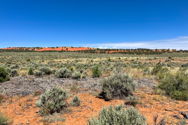
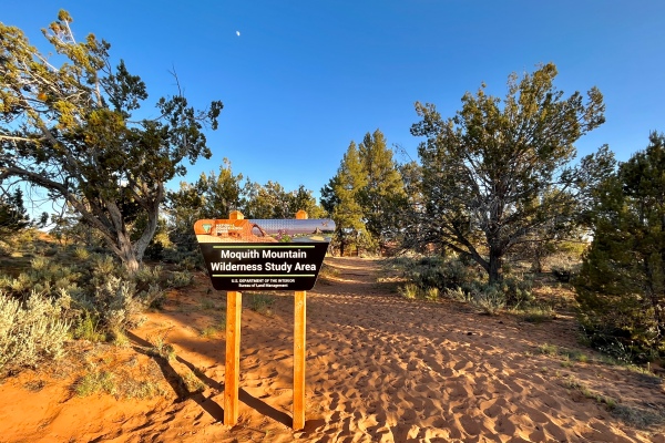
Moquith Mountain Wilderness Study Area
Kane County, Utah
The northernmost extent of the sand dunes cross the highway at this location, so we decided to stop here to see if we could find the Eriogonum host for Chrysobothris nelsoni—and find it we did (the host, not the beetle). In fact, not only was E. alatum, the recorded host for the species, abundant, but there were several other species of Eriogonum present as well. I spent quite a bit of time in the dunes searching the Eriogonum, focusing on E. alatum but also paying attention to the other species I was seeing (especially E. inflatum, a known host for other buprestids such as Nanularia brunnea), but no amount of searching turned up the beetle. I began to wonder if I was too late—most records of the species are from May and it was now the end of June. I also wondered if I had the proper search image—Ron had told me that the beetles would be on the basal leaves rather than up on the stems. Could they be underneath? I lifted the leaves on several plants as I looked, but this slowed things down considerably. After over an hour on the dunes without success I decided to check back in with the other guys and worked my way back to the roadside.

As I walked toward the car, I noticed Sphaeralcea parvifolia blooming abundantly along the roadside in a stretch of pinyon juniper woodland and collected a number of Acmaeodera diffusa on the flowers. Back at the vehicles, Mike was busy collecting bees from flowers in a small wet meadow surrounded by the dunes—I swept through the meadow thinking there may be sedges off which I might find Taphrocerus, but all I found was a single A. diffusa and a curculionoid. Mike had, however, found a single Anthaxia (Haplanthaxia) caseyi on the flower of Hymenopappus filifolius in the nearby sand dunes; so I spent a bit of time searching the same in hopes of finding more. None were found, however—a few miscellaneous beetles being the only things I collected off the flowers. When I returned to the vehicles, I encountered Paul taking shelter under the shade of a large ponderosa pine at the edge of the dune—he also had had no success finding C. nelsoni, and our hopes of finding the species dimmed further.

Before heading to potential localities for our next target, I wanted to stop at a roadside pull off along Hancock Rd that looked like it could be interesting—pinyon/juniper woodland at the edge of the dunes and bordering open sagebrush chaparral. I thought more insects might be out compared to this morning at the first stop. Unfortunately, the results were similar, with not much in bloom although I did find a few Acmaeodera diffusa and one Meloidae on the flower of Hymenopappus filifolius—one of the few flowering plants we found in the area.
5 mi S Mt. Carmel Junction
Kane County, Utah
Having failed in our attempt to find Chrysobothris nelsoni, we turned our attention to another target we had for the area, Xylotrechus rameyi—also described by Ron Alten with the type and paratypes taken at several nearby localities. This was one of them, and the grove of Quercus gambelii (Gambel oak) which the paratype series had been collected on amidst the pinyon/juniper stands dominating the area confirmed that we were at the right spot. I spent a fair bit of time beating the lower branches of the oaks—without success, and Paul also had no success beating the oaks on the other side of the small turn off from the highway. For awhile I turned my attention to the flowers of Hymenopappus filifolius (fineleaf woollywhite) that were abundant in the area, collecting a few Acmaeodera diffusa from them, but eventually I turned my attention back to the oaks to give X. rameyi another shot by using the tropics net to better sample the higher branches that I hadn’t reached with the beating sheet. This yielded a single Agrilus sp. and a few other miscellaneous insects but still no X. rameyi. As I was sweeping the oaks with the tropics net, I encountered a pretty little pricklypear cactus in bloom that proved to be Opuntia aurea, off which I collected more A. diffusa. By now we’d been in the field all day and were feeling a bit exhausted, and failing to find either of our desired targets further decreased motivation, so we decided to make an ice run into town and take another shot at X. rameyi at the nearby type locality just outside of town.
2 mi S Mt. Carmel Junction
Kane County, Utah
The type of Xylotrechus rameyi was reared from infested Acer negundo (boxelder maple) collected at this site, so we came here to look for boxelders that might be harboring adults of the species. Unfortunately, no boxelder trees were found anywhere in the area—in fact, the only trees of any kind that were seen was a few Populus fremontii (Fremont’s cottonwood). Failing to find any boxelder, I started looking for other flowering plants, but none were found except an isolated stand of Asclepias speciosa hosting a few large scoliid wasps, which I collected and gave to Mike. We decided to travel further down the river to try to see if boxelder occurred elsewhere but soon encountered a private property sign preventing further progress. By now it was getting late enough that we decided to head back to the campground to process the day’s catch and prepare dinner. It seemed the day would end without success on either of the day’s targets.
Moquith Mountain Wilderness Study Area
Kane County, Utah
When we got back to the campground, I looked at the dunes across the road and felt like I had to give Chrysobothris nelsoni one more shot. The season for it may have been late, but I reasoned that sooner or later I was bound to run into a straggler. If nothing else, I could cut into dead plants from the previous season in hopes of finding a reasonably intact cadaver from an adult that had failed to emerge this year.
As I was walking the dunes I collected a few bees on yellow form flowers of Opuntia aurea to give to Mike and continued looking (admittedly rather casually) at the Eriogonum alatum host plants dotting the dunes.
I’d been on the dunes for a while when suddenly the phone range—it was Ron Alten asking if I’d been successful in finding C. nelsoni after we’d talked in the morning. I confessed that I had not but took the moment to verify with him that I was looking at the correct host plant. He described it as a tall, single-stemmed, plant with a branching inflorescence and a basal rosette of elongated leaves. This increased my confidence that I was looking at the correct plants, and to confirm this I walked up to one of the plants to describe it to him. We had just begun discussing where on the plant the beetles occur when I looked at the basal rosette of leaves of the plant I’d walked up to, and there it was sitting right there—a bright metallic green beetle that clearly had to be C. nelsoni! I yelled out “I’ve got it!” and described it to Ron to assure him that I had, indeed, found the species, and then we marveled at the irony of finding my first individual at the very moment I was on the phone with the person who described it telling me how to find it!

Success now in hand, I thanked Ron for his help and for checking back with me (I may have given up without finding the species had he not called me back) and continued my now much more deliberate search of other plants in the area. It would take another hour to find the second adult—again, sitting down on the basal rosette of leaves, but in the meantime I pulled several dead plants and found evidence of the larval workings in the crown of the plant.
After finding the second individual, I reasoned that the setting sun made the prospect of finding additional individuals too low to warrant continuing the search and started heading back to the campground (anxious as heck to tell Paul and Mike the news!). Along the way, I found another Eleodes caudifera—apparently a male based on its highly elongated apical elytral projections—walking across sand.

Ponderosa Grove Campground
Kane County, Utah
Paul elected not to set up his lights at the campground, but rather bring them to the dunes across the road. The brightening moon and rapidly cooling evening temperatures, however, killed any desire I may have had to do the same. Instead, Mike and I chose to enjoy a few brews and dine on bratwurst cooked over an open flame while admiring the brightly moonlit western sky with its marvelous views of Venus and the Big Dipper. The next morning I found an Asemum sp. cerambycid dead on the floor inside my tent—apparently it had flown in the night before (perhaps following my flashlight) and then gotten stepped on.

Day 10
Moquith Mountain Wilderness Study Area
Kane County, Utah
Paul had planned to head back to Phoenix this morning while Mike and I headed further west. However, given my success late yesterday in finding Chrysobothris nelsoni still out we decided to spend a bit more time this morning to see if we could get some specimens for Paul and a few more for me. We broke down camp to give more time for temperatures to warm and the beetles to become active, then walked back over to the dunes across the road. After a quick tutorial session on what the plants look like and where the beetles could be found, we split up and checked plants in different areas of the dunes. It took an hour before I found the first adult of the day—sitting on the basal rosette of leaves just as both of the adults I encountered yesterday were doing. After another half-hour I saw an adult fly from a plant I was approaching, but I was able to chase it down and net it before it escaped. The last beetle I would see during the morning almost escaped as well, but I was able to secure it from its perch in the basal rosette of leaves. With three more specimens in hand, I decided that I had an acceptable series of adults and headed back to the campground, and when I got there Mike told me that Paul also had been successful (finding five individuals!) and had already left for Phoenix. Mission accomplished, we began what would be a mostly driving day to eventually reach Leeds Creek Canyon near St. George in far southwestern Utah.
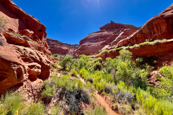
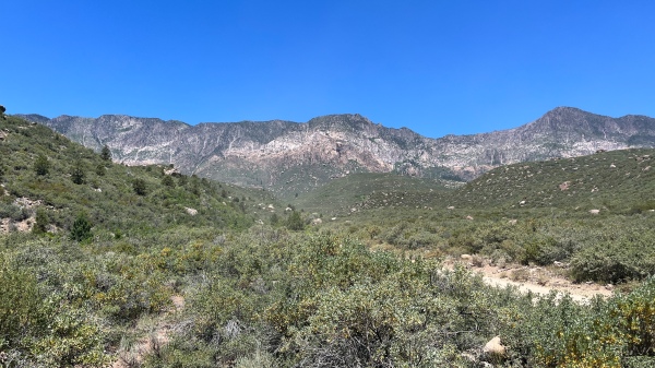
The day was one of the most spectacular “transfer” days I’ve ever had on a collecting trip—our route took us right through the heart of Zion National Park! I knew of Zion’s reputation as one of Utah’s most stunning of national parks, but I really wasn’t prepared for just how stunning it is—massively expansive canyons etched in multicolored sandstone with jagged peaks and ridges. Every turn of the bend revealed a more spectacular vista then the previous, culminating in a precipitous drop down through the western canyon. Part of me wanted to stop at every turn and take a photograph, but I knew this would radically increase our travel time as I was constantly seeing sights more beautiful than the previous. I decided instead to wait until I came here again—as my wife and I have talked about—and do proper photography on a proper visit.
Leeds Canyon
Washington County, Utah
If leaving Zion felt like an end to the stunning vistas for the day, arriving at Leeds and making our way up the rough, rocky road into the canyon above was an unexpected surprise. Dry chaparral at the bottom gradually transitioned to pinyon/juniper woodland, with Gambel oak appearing at even higher elevations and eventually ponderosa pine forest once we surpassed 6000’ elevation. It was a Thursday before a holiday weekend, so we were a bit apprehensive about whether the campground at the top of the canyon would have any available spots and then pleasantly surprised to find it virtually empty with our choice of any spot. We chose one at the very back of the campground— well isolated from other sites, should they eventually become occupied, and with a stunning view through towering pines framing the canyon peaks towering above at heights of 10,000’.

The cool, moist air with low-hanging clouds belied recent rain and the likelihood of more on the way, but having been in the vehicle much of the day we were anxious to begin collecting and opted to explore rather than first setting up camp. I began by beat-sampling the living branches of the different trees around the campground but found nothing other than a few Elateridae on Pinus ponderosa, Quercus gambelii, and Cercocarpus ledifolius and a crabronid wasp inspecting holes in the trunk of a large standing dead Pinus ponderosa (maybe looking for potential nesting sites, or perhaps hunting?).

We began hiking a trail off the west end of the campground, where we passed an enormous ponderosa pine—it’s crown damaged by lightning many years ago and a secondary leader taking its place, near which I encountered a pricklypear cactus with a couple of blooms of the brightest pink I’d ever seen. This proved to be the pink form Opuntia aurea (I’d seen the yellow form of this species yesterday near Coral Pink Sand Dunes), and nestled down in the flowers—apparently already a bedded down for the evening—was Acmaeodera diffusa.

It was then that we felt the first raindrops, so we decided we’d better go back to the site and set up camp—lest we found ourselves doing it later in the rain, but as we hustled back the raindrops became larger and began falling with great intensity. Whipping winds soon accompanied the rain, making setting up the tent a real challenge, but we were able to setup the tent and bring our things inside—including our chairs for a place to hang out—before the heavy rain began. Curiously, the heavy rain never materialized, and quickly enough the winds as well subsided. As a bonus, the previous occupants had left some uncut bolts of mountain mahogany—completely dry and ready to burn if one was willing to cut them up. I did exactly that (it was some of the hardest wood I’ve ever encountered!), allowing us to enjoy yet another campfire on a cool mountain evening.

Day 11
We came to the canyon above Leeds based on the recommendation of Denanthony Fernandez. Denanthony and I have never met, but we’ve corresponded some and I know him to be an indefatigable collector of Buprestidae and Cerambycidae in the southwestern U.S. Denanthony was also kind enough to send GPS coordinates for some of the spots where he has collected within the canyon, ranging from pinyon/juniper woodland at the lower elevations to ponderosa pine and Gambel oak forest at the top. We decided to try the lower elevations first and then, depending on how successful we were, work our way up to the higher elevations. The first spot coincided with a creek crossing (it was gushing with water!) where we found a place to park and then started exploring. Immediately I found Acmaeodera bowditchi on the flowers of Sphaeralcea grossulariifolia, but it was apparently an isolated plant and no other plants in bloom were found. I soon got distracted photographing a small lizard, while Mike started examining stands of a white-flowered shrub lining the roadway for bees. I began examining it as well, at first finding only several galerucine leaf beetles on its foliage.
Eventually, however, Mike saw an Acmaeodera fly to one of its flowers, and when we started watching the plants more could be seen. We quickly realized that the plant was Eriodictyon angustifolium—the precise plant that Denanthony had mentioned as hosting a variety of Acmaeodera in the area. The beetles were sporadic at first and never really became abundant, but after some amount of time I had collected a decent series of what turned out to be A. angelica as well as one or two specimens each of A. bowditchi, A. perlanosa, and A. pubiventris lanata on its flowers. While I was doing this, Mike wandered off and found a well-maintained little trail but reported only a single blooming pricklypear cactus off which he’d collected a few bees and a single A. diffusa. I decided to see if I could find it and bushwhacked in the direction he’d come from, encountering not one but several Opuntia woodsii with its salmon-colored flowers and collecting both A. diffusa and A. ligulata on them.

I decided to follow the trail to look for more pricklypear cactuses in bloom but had little luck. Beating was fruitless as I walked the trail, but eventually I saw a small creek from the trail (with the promise of plants in bloom) and found a spur in the trail that led me down to it. Creekside I found a few large patches of Psoralia tenuifolia actively visited by bees (collecting a few for Mike) but nothing else. However, in the other side of the creek (near an old historic kiln) I found several Heliomeris multiflora in bloom with A. bowditchi and bee on its flowers.

The spur ended at the kiln, but a foot trail continued through the woodland, which I followed hoping to find more plants in bloom. This resulted in limited success—I found single flowering individual of Cylindropuntia whipplei, off the flowers of which I collected a few A. quadrivittatoides, and Opuntia camanchica, off which I collected a single A. bowditchi (and a bee for Mike). At this point I decided we’d sampled this spot well enough and turned around to find Mike and head for the next spot up the road.
Just one-half mile further up the canyon from the previous stop, we could already see the activity on the flowers of pricklypear cactus along the roadside as we drove up and parked. The first of such we approached was Opuntia woodsii, with its sumptuously salmon-colored blooms, and on this plant alone I collected several species of Acmaeodera including A. bowditchi, A. diffusa, A. ligulata, and A. quadrivittatoides from its flowers. Several blooming Opuntia camanchica—its flowers brighter yellow with salmon-colored centers—were growing nearby and attracting Acmaeodera in droves, and over the next hour or so I collected good series of the same species I’d collected from O. woodsii.

Eventually I tired of finding more of the same on these two species of pricklypear cactus flowers and began looking for other flowers that may be harboring Acmaeodera. They were few and far between, but I did find a couple of Penstemon palmeri still in bloom (most seemed well past), one of which had a single A. ligulata on its flower, and a small area with a few Psoralea tenuiflora in bloom produced but a single Acmaeodera sp. (I could not decide at the time if it represented the common A. rubronotata or a small individual of the localized target A. knowltoni). As I searched, a male Okanagana utahensis singing in a nearby Quercus turbinella caught my attention, and I was able to sneak up on it and locate it. I noticed another individual nearby—a female attracted to the call in presumed—and after photographing it managed to capture the male (but not the female).

By now I’d had enough of pricklypear cactus Acmaeodera, and Mike and I decided we had enough time in the day to try one more lower elevation spot—this one another mile or so up the canyon road.
We noticed oaks had become more abundant amongst the pinyons and junipers as we found a place to pull off the road, and almost immediately after getting out of the vehicle I noticed Eriodictyon angustifolium blooming much more abundantly along the road than the more spent-looking plants at the first stop that morning. Even before I had gotten ready, I saw an Acmaeodera ligulata and an A. pubiventris lanata on flowers of the plant closest to me—I managed to capture the former, but the latter eluded me (and of course I never saw another at that stop!), and I eventually collected good series of A. bowditchi, A. diffusa, and A. rubronotata/knowltoni. I also collected a few non-buprestid beetles on the E. angustifolium flowers, including a red/black Saxinus sp. and a red/black Trichodes ornatus. Penstemon palmeri was in better bloom here, and I collected one Acmaeodera diffusa on its flowers and a single Elateridae on Artimisia sp. (sagebrush). A bit further up the road Mike had found an even more robust stand of E. angustifolium in peak flower, from which I collected additional specimens of Acmaeodera angelica, A. bowditchi, A. diffusa, and A. rubronotata/knowltoni. I also noticed more of the red/black Trichodes ornatus (red/black) and then realized that the several other beetle species on the flowers all seemed to be following a red/black coloration theme. These included Collops sp., Lycidae, and Coccinellidae (the latter which I did not collect).
Once we’d collected our fill, I got out the tropics net and spent some time sweeping the canopy of the Gambel oaks (common here but not further down the canyon), but I found no beetles and little else of interest. Beyond the trees, however, we found an east access to Leeds Creek, it’s course swollen with gushing water. We had been in the field all day and were quite hot, and I couldn’t resist the opportunity to clean off and refresh myself in the clear mountain water. The rocky creek-bed and rapid current made securing footing (with bare feet) difficult, so proper handholds became paramount, and the frigid temperatures limited the time I could keep any part of my body submerged, but the refreshment and invigoration made it well worth the effort. What a fantastic way to wind down the day of collecting!
When we returned to the campground, we saw that every other site had become occupied (it was now Friday before a holiday weekend), and we thanked our lucky stars that we’d gotten here when we did and were able to claim such a choice spot! There was a fair bit of daylight remaining, so before starting dinner and settling down for the evening I wanted to return to the flowering Opuntia aurea that we’d found yesterday and check it again for Acmaeodera. I found the plant, but the flowers were now spent and nearly closed—their vivid pink now dulled and browned. However, I pried apart the petals and found, nevertheless, a couple of A. diffusa bedded down within the flower. I searched a bit more but did not find other cactus in bloom, so I returned to the campsite where Mike and I processed our day’s catch while we still had daylight.
Later in the evening as we were sitting by the campfire (still utilizing the super-hard mountain mahogany I’d cut up the day before), I saw a cerambycid beetle crawling on the ground towards the campfire. This proved to be Arhopalus productus, and over the next half-hour or so I found three additional individuals apparently attracted to the fire. As a final collecting act for the day, I decided to “walk the road” before going to be to see what beetles I might find walking nocturnally. I photographed a few interesting non-beetles, and near the furthest point before turning around I found a species of Zopherus that I take to be Z. uteanus.On the way back to the campsite, I checked the trunk of a massive, standing, recently-dead Pinus ponderosa in a nearby campsite. I had checked the tree several times during the day expecting to but not seeing woodboring beetles on it; however, this time I found another A. productus plus a few individuals of two species of Trogossitidae.
Day 12
Yesterday we checked several lower elevation spots in the canyon, so today we wanted to try the higher elevations. I still wasn’t sure I’d collected Acmaeodera knowltoni, thinking that specimens I’d collected at the lower elevations that could be small individuals of this species might actually be A. rubronotata instead, and guidance from Denanthony indicated that the species was not only more abundant but also the individuals larger (and this easier to distinguish from A. rubronotata) higher up in the canyon. Before going down to the highest of the spots recommended by Denanthony, we stoppped at a spot even further up in the canyon where profuse blooms of Penstemon palmeri could be seen blooming abundantly along the roadside (good for bees). This contrasted markedly with the paltry, sparse blooms we’d seen in the pinyon/juniper woodland at lower elevations, and we reasoned other plant species may also be blooming in greater abundance. Almost immediately getting out of the vehicle I found a new-for-the-locality flowering plant—Acmispon wrightii (Wright’s deervetch)—with several Acmaeodera diffusa on its flowers.
Right next to it was a single Sphaeralcea grossulariifolia in bloom with more of the same, but I hit the jackpot when I walked up the road a ways and found a rather large patch of these plants blooming abundantly and upon the flowers of which I collected numbers of not only A. bowditchi and A. diffusa, but also both A. knowltoni and A. rubronotata—the latter two easily distinguishable from each other not only by the larger size of A. knowltoni but also its uniformly orange rather than yellow elytral flecks with red towards the apices.
Acmaeodera knowltoni was also found along with A. bowditchi, A. diffusa, and Trichodes ornatus (red/black) on the flowers of Penstemon palmeri along the roadside leading up the road, and at the start of a trail leading off a nearby parking area I found the pink form of Opuntia aurea with A. bowditchi, A. diffusa, and A. knowltoni on its flowers.

A second species of Penstemon (P. linarioides) was common along the trail, which I checked it thoroughly for the presence of Acmaeodera, but the only beetles I found associated with its dark purple flowers was Trichodes ornatus. A small clump of A. wrightii was also found in this area, and in this case so found not only A. diffusa on its flowers but also A. knowltoni. The impressive numbers of Acmaeodera collected during the morning hours at this spot had me wondering what we would find at the next spot!
A bit further down the canyon the Gambel oak woodland transitioned to scrub oak (Quercus turbinella) woodland with robust stands of Eriodictyon angustifolium blooming along the roadside.
Right beside the vehicle were some robust blooming Penstemon palmeri with Acmaeodera angelica and A. knowltoni on its flowers, and in the nearest stand of E. angustifolium I collected several more A. angelica, A. diffusa, and A. knowltoni. I’d noticed even better stands of E. angustifolium a bit further down the road and walked to them—finding a bee for Mike on the flower of Diateria sp. (tansyaster) along the way, and then proceeded to collect nice series of the same plus not only A. bowditchi on the flowers but also a few specimens of A. ligulata and A. quadrivittatoides (these latter two the first I’d seen today).
After thoroughly examining the patches I’d seen, I walked back up to the vehicle to see how Mike had done, and he gave me a small Anthaxia (Melanthaxia) sp. that he’d collected on the flower of Eremogone macradenia. He had seen the plant in only one spot a bit further up the road, so I walked up to the spot to see if I could find any more. I did not, but I did collect a couple of A. bowditchi on the flowers. By now I was famished and thirsty and felt I’d given the spot a good enough look, so I ate a bite of lunch and downed a bottle of Powerade (ask me why I prefer this brand over Gatorade) before heading to the next spot further down the canyon.

This was another of the spots that Mike and I had noticed as a possible stop in addition to those recommended by Denanthony. It was below the third stop up the canyon that we’d visited the day before but above the second, mostly pinyon/juniper spot and, thus, still contained a lot of scrub oak (Quercus turbinellum) with robust stands of Eriodictyon angustifolium along the road. We had to park down the canyon a bit to fully get off the road and then hiked back up to where we’d seen the stands. Along the way I found a single Opuntia camanchica in good bloom with several Acmaeodera visiting the flowers. These included A. bowditchi (of which I only took a few for the record given the number I collected on this cactus species the day before) but also A. ligulata and A. quadrivittatoides which were more interesting records for the cactus. Despite their robustness and profuse blooms, the E. angustifolium stands that prompted us to stop here produced very few Acmaeodera (or even bees, for that matter), but when I hiked further up the canyon I encountered some smaller stands in sparser bloom that produced at least a few individuals of nearly every other species of Acmaeodera that we had found in the canyon (A. angelica, A. bowditchi, A. diffusa, A. knowltoni, A. perlanosa, and A. pubiventris lanata). As we’d approached the spot from above, I’d also noticed several stands of Heliomeris multiflora along the roadside as well, so I hiked up to them and was rewarded with A. ligulata on the flowers along with A. bowditchi and A. diffusa.
Having visited all of the spots up and down the canyon that Denanthony had recommended (except the area right around the campground, which we would explore the next day) and then some, we decided to go back to the first stop we made the day before—the lowest elevation spot in the canyon where we had collected—to see how it compared in the (now) late afternoon compared to mid- to late morning. It was hot, and I needed to eat and rehydrate, so I found a shaded spot to do that while Mike forged ahead. As I was getting ready to walk to the spot myself, Mike came back with a specimen of Acmaeodera quadrivittatoides that he had taken in flight near the stand of Eriodictyon angustifolium from which we’d had such good luck collecting the previous day. I had not seen this species during that first visit but found a few additional individuals this time, and the same went for A. knowltoni and A. ligulata (in fact, a single individual of A. pubiventris lanata was the only repeat species this time).
Coming back up the canyon, we stopped again at the first spot where we collected so Mike could pick up “bowl traps” that he had set out. (Bowl traps are commonly used by apiologists to sample bees in an area. Small plastic bowls, generally white, yellow, or blue in color, are filled with soapy water and placed on the ground. Bees mistake the colored bowls for flowers and drop into the soapy water when trying to land on it. Incidentally, these have proven effective also for flower-visiting species of Acmaeodera—Mike has given me many that he has collected over the years in his bowl traps, and I have begun using the technique myself.) While backing into the pullout, the tire pressure warning light suddenly came on, and I got out to see the left front tire hissing air and going flat. What ensued was a comedy of errors of epic proportions! We unloaded the back of the vehicle and got out the spare tire and jack, but we could not find a tire wrench anywhere in the vehicle. Mind you, the vehicle was purchased new last year, so it was unthinkable to me that it could have come without a tire iron! No problem, I thought—I’ll just call AAA. I had just enough cell service to make the call and endure the endless automated questions and call transfers before reaching a live person and submitting a service request. While I was waiting for service, I decided to walk back up to the spot where I’d had such good luck collecting A. knowltoni and other species in the genus on Sphaeralcea grossulariifolia to see how late afternoon collecting would compare (hang in there—the comedy of errors will ensue shortly). The S. grossulariifolia flowers were not open to the same degree as they were in the morning, but still the Acmaeodera were numerous on them and I added to my series of A. knowltoni (along with a few more A. bowditchi and A. diffusa for the record). As I walked back to the vehicle, a missed call notification came through on my phone. Apparently AAA had tried to contact me (unsuccessfully due to poor reception in the area I had walked to) and left a voicemail. When I called them back, they told me they couldn’t send a tow truck up an unpaved road. My explanation that I needed only a tire iron and not a tow truck fell on deaf ears, so when I hung up I told Mike there was nothing left to do but to walk up to the campground (thankfully less than a mile up the road) and see if I could bum a tire iron. As it turned out, I didn’t even have to walk all the way to the campground, as I encountered a family parked at the creek crossing below the campground. Dad rummaged through the back of his truck and produced a tire iron after I explained our predicament, and I was quickly on my way back to the vehicle. There was once positive from the walk—during the return leg, I was finally presented an opportunity to photograph a splendid individual of Papilio rutulus (western tiger swallowtail)—a species that had eluded all my previous attempts to photograph it by refusing to even land anywhere, much less pose long enough to attempt a photograph!
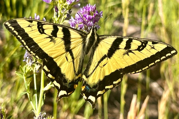
Returning to the vehicle, we were ready to change the tire and get the day back on track, but when I attempted to loosen the first lug the iron spun freely—it was too big! Who knew tire lugs came in different sizes? (Okay, maybe others know this, but it was news to me!) Just then a truck came by, so we waved him down and explained our predicament to the man driving and the several young men that he was clearly the boss of. It took them much more time to find it, but they finally produced a tire iron after some extensive rummaging through the truck’s tool chest. It looked to me exactly the first one I’d bummed, but I tried it anyway. Of course, the result was the same—it was too big! As Mike, the man, and his crew debated the next step, I got to thinking about how weird-looking the jack was that I’d pulled from my vehicle—it just didn’t make sense that a tire iron could have been mistakenly omitted from the spare tire compartment. I picked up the jack, looked it over carefully, and saw one part of it that had a lug socket-looking piece on it. I started fumbling with that part of the jack, and it suddenly detached from the jack proper—proving itself to be a custom-designed foldable tire iron! I felt like such an idiot, but I was so elated to have finally found the iron that I didn’t care. I showed the others what I’d found, and after a good laugh (either with me or at me, perhaps both) the man and his crew continued on their way and Mike and I proceeded to change the tire and get back on the road.

As a final collecting act (perhaps a momento for the flat tire fiasco), I found a tenebrionid beetle crawling on the road next to the vehicle while we changed the flat.
Safely back at the campground after our flat tire fiasco, we settled down to process the day’s (prodigious) catch. We again relished our choice site in the campground, with its stunning view and maximum privacy, and eventually prepared what had become our favorite dinner—“dirty burgers” (burgers cooked in a frying pan in which grease and drippings from previous days’ meals are allowed to accumulate).
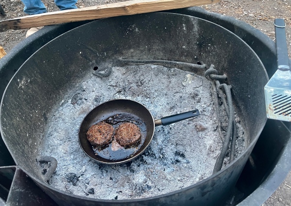
Conditions still were not favorable for blacklighting (moon nearing full and coolish temps at such high elevation), so instead of setting up lights I waited for a bit after darkness fell and then wandered over to the giant recently-dead ponderosa pine in the neighboring campsite and checked it for beetles attracted to its trunk. Unlike the previous night, when only one longhorned beetle was found, this time I encountered multiple specimens of Arhopalus sp., Tetropium? sp., Trogosittidae, and Elateridae after repeated circuits around the giant tree trunk. Once no more beetles were found, I began walking the road up through and out of the campground. I was especially interested in seeing if I could find more of the Z. uteanus that I found the previous night and succeeded in finding three more (in almost the exact same place as the previous specimen) along with several tenebrionid beetles.
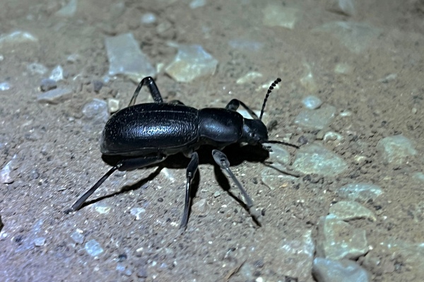
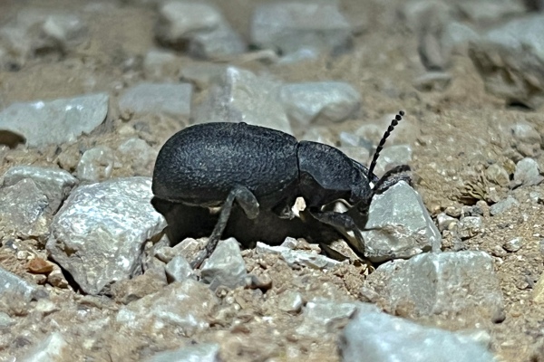
At the furthest point that I walked before turning back, towering ponderosa pines framed a stunning view of the moonlit canyon wall with the Big Dipper hanging perfectly over it—a perfect scene to capture using the iPhone’s night photography mode.
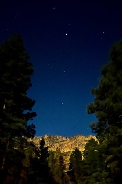
Day 13
Our plan for the day was to leave the canyon and travel further west to a couple of localities (one near the border with Arizona, another just over it) where Ampheremus cylindricollis has been recorded to occur before at last starting back to the east and traveling to Jacobs Lake, Arizona. First, however, we couldn’t leave the canyon without giving a good look at the highest elevations in the canyon. We had seen wild rose (Rosa woodsii) in bloom just below the campground each of the past two mornings but no beetles upon them; however, the time needed to break down camp had us leaving the campground a bit later in the day with correspondingly higher temps.

When we reached the creek crossing where the roses were growing, we could see gobs of beetles in them even before we parked and got out of the vehicle! With the first tap of a flower over the net I got a couple of Acmaeodera knowltoni and nearly two dozen Anthaxia sp.! The latter were clearly members of the subgenus Haplanthaxia, meaning the species was A. caseyi—the only western U.S. species of the subgenus (as opposed to the subgenus Melanthaxia, of which there are many western U.S. species). However, several A. caseyi subspecies have been described, and it will require closer examination to determine which (if any) of the described subspecies this population pertains to. The buprestids were so abundant on the rose flowers that I quickly collected sufficient series of each and turned my attention to examining the beetles in the flowers carefully to look for any that represented other species. In the end, I found just one Acm. bowditchi, two Acm. diffusa, and a few Anthaxia (Melanthaxia) sp. in addition to the dozens of A. knowltoni and hundreds (literally!) of A. caseyi seen (also a couple of Curculionidae).
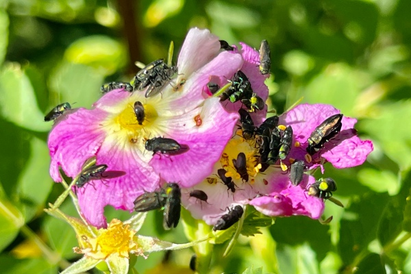

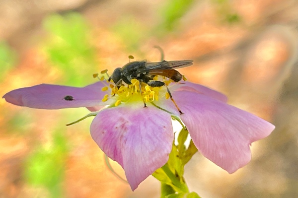
After getting my fill of rose visitors, I set about to see what other beetles I might find in the area, which had experienced a burn in the past year or two (though not stand-killing). Nothing was found beating any of the dead branches, whether pine or oak, and the only beetles I found beating living trees was Curculio sp. on Quercus gambelii. Near a small tributary of the main creek I found Aquilegia formosa (western columbine) and Erythranthe guttata (seep monkeyflower) in bloom, the latter with a few A. knowlton and A. caseyi on its flowers. The only other plant I could find in flower in the area was Erigeron flagellaris, and while I looked at many plants I found only a single A. knowltoni on one of its flowers. I’d hoped to find more on the dead wood (especially non-Acmaeodera, which were the preponderance of buprestids I collected in the canyon over the past few days), but I was happy to have added at least a couple of Anthaxia spp. and increased my series of (and recorded flower hosts for) A. knowltoni.

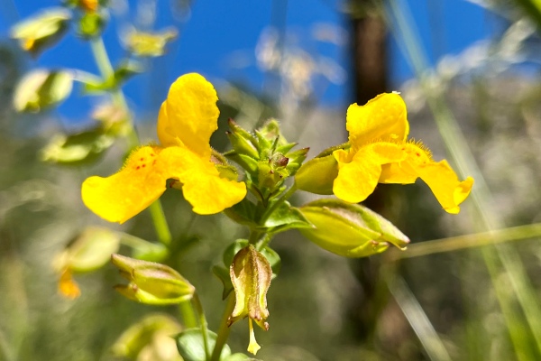
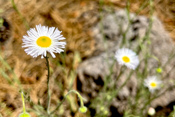
It was now near midday, so we decided we should find our way back to civilization and get the flat tire fixed so we could check the two westernmost localities and make it to the Jacobs Lake area by evening.
Santa Clara River Reserve
Washington County, Utah
After spending a couple hours of our afternoon in Hurricane, Utah (what a name!) getting yesterday’s flat tire fixed at a Walmart (what a cultural experience that was—imagine Appalachia meets Mexico with a touch of Salt Lake City!!), we drove a half-hour to a site in the extreme southwestern corner of the state to look for Ampheremus cylindricollis—a species I have not yet collected myself and which should be associated with Eriogonum inflatum. We had gradually dropped in elevation during the day (we were nearing the western edge of the Colorado Plateau), and by the time we reached the site we were under 3000’ — the lowest we have been at any time in this trip (including northwestern Oklahoma!). The drop in elevation meant an increase in temperature, and when we arrived the thermostat read 109°F (the second-highest temperature I’ve ever experienced while collecting [my PR is a blistering 115°F in the Glamis Dunes of southern California]). Despite the heat, I was anxious to start collecting because I could see stands of Eriogonum as we drove down the road towards the parking lot—except it was not E. inflatum but rather a smaller species that I determined to be E. deflexum (flatcrown buckwheat). Nevertheless, I began sweeping it and quickly found a tiny buprestid that I did not immediately recognize. Buoyed by this unexpected surprise, I swept more of the plants and quickly came up with two more specimens. With three now in hand, I couldn’t wait any longer to know what species it represented, so I checked my sources and determined it must be Anambodera nebulosa—perhaps an even better catch than A. cylindricollis because not only have I never collected it, but neither is it even represented in my collection by a specimen I’ve gotten from someone else. (I am also unsure whether the host plant has been recorded or if it has ever been collected in Utah.) At that point, I started sweeping every Eriogonum plant I could find (including a few E. inflatum, which I did find up the hill a ways) but persistently came up empty. It was not until I’d worked my way to the first parking area and swept the last stand of E. deflexum on that side of the road that I eventually found a fourth individual. Considering how much work it took to find them (and the extreme heat in which I was doing it), I gave only a half-hearted attempt to plants on the other side of the road as I walked back to the car (with predictably unsuccessful results). I also failed to find A. cylindricollis, but I had one more locality that I wanted to check so I remained optimistic.
Virgin River Canyon Recreation Area
Mojave County, Arizona
It took us another half hour to make it to Virgin River Canyon — a Bureau of Land Management Recreation Area just inside the northwestern-most corner of Arizona as one drops down from the Colorado Plateau into the Great Basin.
This was the other spot I had where I might be able to collect Ampheremus cylindricollis, and if we thought the last stop was hot, this one was extreme — a sweltering 112°F! Unfortunately, we drove throughout the area and did not see any stands of Eriogonum inflatum (the host plant for A. cylindricollis) — or any species of Eriogonum for that matter. Nevertheless, we got out our nets and began looking around, as there were other flowering plants present (Baileya and Hymenopappus). Nothing was seen in them at first (although Mike eventually found a true desert bee species on the lone still-flowering individual of the latter), so I took the short Canyon Scenic Overlook Trail to its terminus. I was glad I did, as there were some very informative interpretive signs about the geology of the area, but the overwhelming heat had me wilting quickly and I worked my way back to the car.

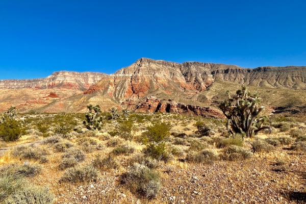
I’m not sure where in the area the host plant occurs, but it is not at this spot. With no other potential collecting localities identified in the area — and having reached the westernmost extent of the trip, we turned back towards the east and started heading for Jacobs Lake in the Kaibab Mountains of northern Arizona.
The beginning of our eastward return towards the Kaibab Plateau was uneventful, although we became increasingly concerned when a smoke plume appeared on the horizon and the closer we got to reaching our destination (Jacobs Lake Campground) the more it seemed that that was also the location of the fire. When we got up on top of the plateau, we discovered a vast swath of its northern portion had already been devastated in an obviously very hot (i.e., stand replacing) wildfire within the past couple of years, only increasing our fears about what we might find. Fortunately, the devastation ended some miles before we reach Jacobs Lake (and the smoke plum—a controlled burn, was still some miles beyond), but when we reached the campground we were sorely disappointed to find not a single spot available even on a Sunday night (though admittedly still a holiday weekend leading into July 4th). Our only choice was to turn around and head down off the plateau into the tiny town of Fredonia, where we found a room at an odd little complex of duplex units.

Day 14
Our hopes of good coffee in the morning were dashed when the ‘Closed’ sign in the small bakery across the street remained in place, so we were forced to visit one of the two local gas stations where I unintentionally eavesdropped on a group of local Arizona Republicans that had claimed the available breakfast seating area (hiding the rips in my jeans as a result—it’s a weird story!) before driving back up onto the plateau and through the devastation to LeFevre Overlook.
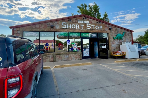
Le Fevre Overlook
Kaibab National Forest
Coconino County, Arizona
The pinyon/juniper woodland at this spot was not completely without impacts from the recent wildfires but did not exhibit the wholesale devastation seen further back. Immediately after starting out—not even 10 meters from the vehicle—I encountered a dead Pinus edulis with tantalizingly loose bark that said “peel me!” Peeling back the first slab gave an immediate payoff—an Arhopalus montanus that had taken shelter under the loose bark. I peeled back another piece and found another individual, and by the time I had peeled the entire trunk I had a nice series of a half-dozen specimens.
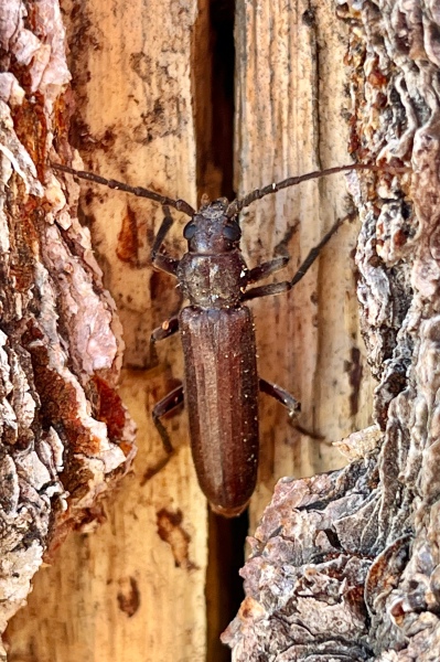
Peeling the bark revealed not only longhorned beetles but also Buprestis-sized emergence holes in the sapwood, one of which still contained a dead individual that had failed to emerge from the wood. I carefully chipped away at the surrounding wood until I was able to extract the cadaver—a nearly intact B. prospera—another target for the trip and now a new addition to my cabinet!

As I worked I was approached by several tourists curious about what I was doing. I cheerfully fielded their questions and even showed the specimens to those interested, having long ago stopped seeing these as annoying interruptions but rather opportunities to present the science of entomology in a favorable light. I did not extend the same courtesy to a particular Arizona Republican, who pulled up in his large pickup (white, with giant tires of course) and got out packing an intentionally visible sidearm. I’m thinking “Who in the hell does this man think he’ll meet that he needs to be able to shoot them?” That’s some compensation if I ever saw it! I hoped he wouldn’t want to engage, but no such luck—when he asked me what I was doing, I just said “kinda busy” in an attempt to abort any further interaction. This worked, and I was relieved to not have to tell him more directly not to approach me. I worked several other dead pinyon pines in the area the same way but was not able to replicate the success I’d had at that first tree, so I began beating the living trees in the area to see if adults of other woodboring species were out and about. Indeed they were, producing several individuals of one of a sculptured Chrysobothris sp., a small species of Acanthocinini, and a giant male Monochamus clamator.
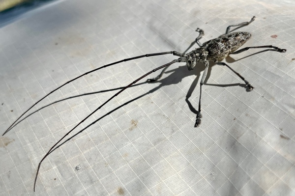
Across the road I spotted a recently wind-thrown branch of P. edulis, and crossing the road to reach it was worth the effort—I was able to collect a nice series of what I believe is Chrysobothris cuprascens (another species I’ve not collected previously) as well as a few specimens of the sculptured Chrysobothris sp. I’d collected earlier (I presume).

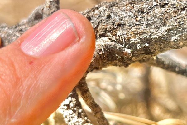
Working my way to a large standing recently dead P. edulis nearby, I encountered and netted a small histerid beetle in flight, but on the trunk of the tree itself I found only a few Enoclerus sp. (perhaps E. lecontei) and no Buprestidae or Cerambycidae. I went back to the fallen branch to see if I could collect a few more C. cuprascens, which I did but also found one being preyed upon by an Enoclerus sp. and collected predator and prey together. Mike was having only moderate luck with bees (due to a dearth of plants in bloom), and since I’d gotten a good enough look at the area we decided to move further up the plateau.
We drove further south onto the higher elevations of the plateau, the scrubby pinyon/juniper woodlands being gradually replaced by forests of tall, stately ponderosa pine. Gone also were the devastating effects of recent wildfires, replaced by evidence of active fire management practices intended to minimize accumulation of wood fuel and controlled burns that leave their telltale black signatures at the base of the trees but do not kill them. The result of these efforts was a rich ground layer of ceanothus, lupine, and other shrubs and forbs in full bloom.
4 mi NW Jacob Lake
Kaibab National Forest
Coconino County, Arizona
I spotted a large, recently wind-thrown ponderosa pine as we drove, it’s faded gray-green suggesting it might be the right age to look for woodboring beetles running along its trunk and branches, and stopped the vehicle at the nearest pull-off. There was so much blooming ceanothus around that Mike barely had to walk before he started finding bees visiting the flowers. I searched them also for Buprestidae and Cerambycidae but found none, but my immediate objective was to hike back to the fallen tree I’d seen from the highway. Along the way I continued—for a while—to check the ceanothus flowers but eventually quit doing this when it was clear no beetles were utilizing them at this time, and the occasional small dead tree and fallen branch also failed to produce any beetles running along them. At one point before reaching the fallen giant I encountered a huge, standing dead ponderosa pine with mostly intact but tantalizingly loose bark and promptly began peeling it. The bark was still semi-attached but easily peeled off in large chunks, occasionally revealing galleries packed with moist, fibrous frass that usually surrounded a large entrance hole into the sapwood. Eventually in one of these galleries I found a huge cerambycid larva that, based on size alone but also the presence of distinct legs I take to be Trichocnemis spiculatus—common in ponderosa pine in Arizona and one of only very few species with larvae of this size. I collected it in an attempt to rear to adulthood and did the same with another found under the bark of a nearby tree—others were later found boring into the slightly punky sapwood of the first tree.
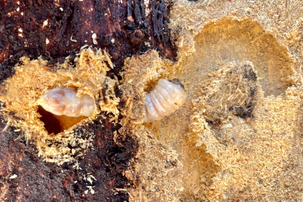
Eventually I reached the large, recently-fallen Pinus ponderosa that was the reason for the stop. The lower half of the massive trunk was propped up at eye level by the branches that snapped and impaled into the ground when it fell, making it easy to scan both its upper sunlit and lower shaded surfaces for any sign of movement. None was seen at first, but eventually tiny Enoclerus sp. (prob. lecontei) were seen running along the trunk. Continued searching scared up a Chalcophora angulicollis, which flew to and landed clumsily on the tree’s exposed root-wad, and several Chrysobothris sp. prob. dentipes were seen on the sunny surface but only one captured. The upper branches of the tree were no more productive—only a single Chrysobothris sp. (not C. dentipes) was found after thoroughly searching them.
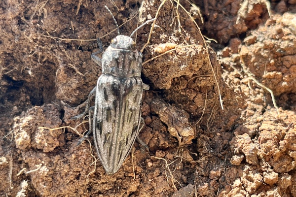
I continue to peel bark on the way back to the car, finding only a dead Trogosittidae under loose bark on the lower trunk of a large dead Pinus ponderosa, and by the time I’d returned to the vehicle I was not overly impressed with the spot. Mike, however, was having tremendous success collecting bees, not only from the ceanothus but other flowers as well, so I decided to cross the highway and check out some standing dead pines that I could see from afar. As I started out, I noticed movement on a small, newly-fallen branch of P. ponderosa right next to me and saw that it was a Chrysobothris sp.—colllecting not only that one but another that flew to the branch while I was putting the first one in the bottle. As I crossed the road and walked towards the trees, I noticed another fallen giant ponderosa pine looking very much like the first one I’d seen from the highway and veered towards it. Immediately upon approach I saw the zippy movement and escape flight of a Chrysobothris, its identity belied by the green flash of its abdominal tergites as it took flight. Continued searching along its trunk produced not only C. dentipes but also several Phaenops gentilis.
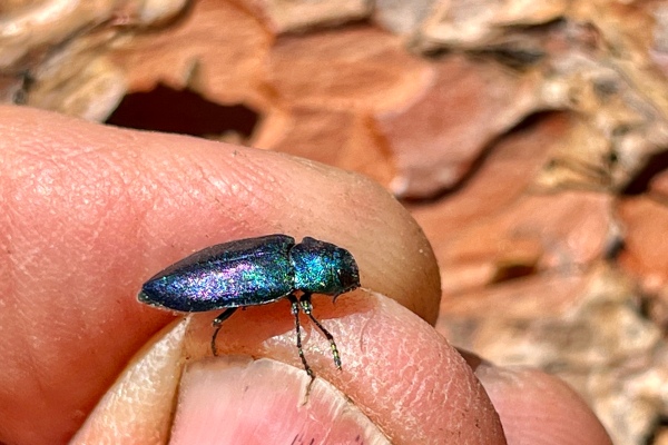
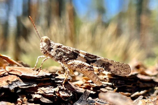
Nothing was seen on the lower portions of the branches, but beating the upper needled portions produced many Enoclerus sp. (prob. E. lecontei) and what I at first took to be a very small species of Oedemeridae. Something about them, however, gave me pause, and I got out the lens to take a closer look at them. I’m glad I did, because they turned out not to be ordemerids, but rather tiny cerambycids of the genus Phymatodes! I continued beating the branches to find more and eventually collected a nice series of them. Ironically, the standing dead trees that first caught my attention had nothing on them. By now, we were anxious to get to Jacob Lake Campground to see if, on a Monday, we could now claim a site. Only a few sites were available, most of them in undesirably exposed settings, but luck was with us when we found a large, nicely shaded site that was well-distanced from those surrounding it. We claimed the spot and then went back out to take advantage of what remained of the afternoon.
Driving south of Jacob Lake on Hwy 67 took us directly into the area subject to the controlled burn that had caused the smoke plume that concerned us the day before. Smoldering embers dotted the blackened understory, but the tall pines above, their foliage bright and green, belied the controlled nature of the burn. I wanted to get out and look for Melanophila spp., which are famously attracted to smoldering remnants of forest fires, but access to the public was closed for obvious safety reasons.
7 mi S Jacob Lake
Kaibab National Forest
Coconino County, Arizona
Clearing the burn area we encountered a more open forest that had clearly been ravaged by an uncontrolled fire within the last couple of years—perhaps the same one that had devastated so much of the northern edge of the plateau, but along the margins where the damage was less severe we saw stands of flowering trees that proved to be Robinia neomexicana. I expected to find Agrilus egenus on the living foliage, and that is what I found in numbers. There were a few large, standing, dead Pinus ponderosa—under the loose bark on the lower trunk of one I found a Trogosittidae and on the lower trunk of another I captured several Xylotes sp. flies that were clearly attracted to the tree.

Not much else was found of interest, so we decided to drive further south into even higher elevations. This eventually led out of the area of devastation into an area of high alpine meadows with interesting, ground-hugging species of flowering plants but little of interest in the way of insects.
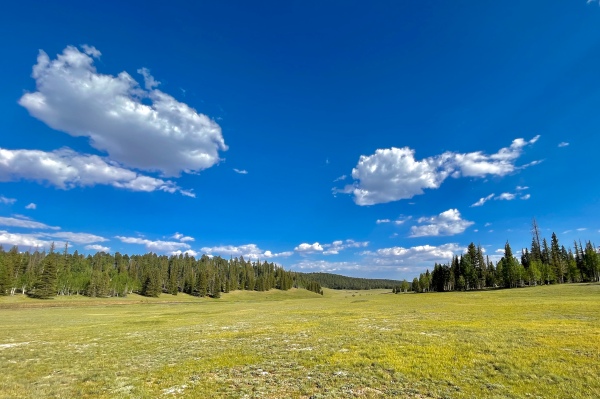
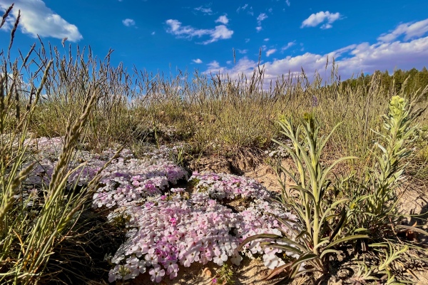
The afternoon by then passing into evening, we returned to the campground and spent a very comfortable night sleeping at altitude.
Day 15
A couple weeks ago I noticed Facebook posts by Joel Dubois, who had collected some nice species near Farmington. I thought the area might be a nice stopping point for collecting as we began to work our way back to St. Louis in earnest, and Joel was kind enough to send me location information for where he had collected. It would be a 5½-hour drive from our campsite at Jacob Lake, so instead of a leisurely morning enjoying our coffee, we broke camp early and were on the road by 8 am.
The drive down off the Kaibab Plateau and across northern Arizona was as spectacular as any we’ve seen during the trip, and we marveled at the myriad bizarre rock formations, multicolored canyon walls, and desolate volcanic ash landscapes. It was tempting to stop and explore along the way, but we kept our noses to the grindstone and reached the site by mid-afternoon.
Brown Springs Campground
Glade Run Recreation Area
San Juan County, New Mexico
The place looked extremely dry and dusty, but we reserved judgment until we actually got out and sampled for a while (the lessons of experience). Sadly, our initial impression was confirmed, and almost nothing was seen on any plant other than a few tiny Dasytinae and bees on flowers of Stanleya pinnata (“Bees are everywhere.”—Mike Arduser). Not wanting to waste any more time than necessary, we quickly ended our explorations and headed for the next spot.

Above Pump Canyon
San Juan County, New Mexico
I visited this canyon once many years ago with fellow beetle-enthusiast Paul Kaufman while he lived in Farmington. Paul collected some nice beetle species from the canyon while he lived here, so I scheduled it as one of our collecting localities for later in the trip as we worked our way back to St. Louis. It was only an hour drive from the previous spot, so we were a little concerned if it would prove to be as dry and lifeless as the previous spot. The presence, however, of pinyon pine and juniper as we worked our way up the canyon created some optimism, with the sighting of ponderosa pines near the top of the canyon being especially welcome.
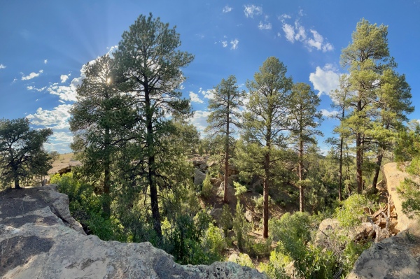
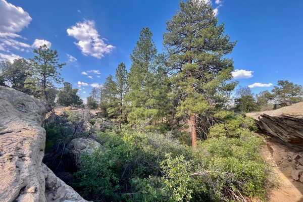
The first thing I noticed starting out was a small stand of Eriogonum alatum—the same plant that serves as the host for Chrysobothris nelsoni in southwestern Utah! I thought it unlikely that I would find the species here as well, but of course I had to look at the plants anyway. As I did, I noticed two species of clytrine leaf beetles feeding on the inflorescences; one a large, chunky species and the other a much smaller one. I collected a few of each, but buprestids were what I was after and thus turned my attention to the two species of pine in the area—Pinus edulis on top of the mesa and P. ponderosa at its edge and down in the canyon. I’d beaten the branches of several dead P. edulis and chopped around the base of a large, standing dead P. ponderosa—both with no success, when I spotted another large, standing dead P. ponderosa across the road. As I approached it I noticed the metallic green of a Buprestis (Cypriacis) sp. partial carcass on the ground beneath it. It is probably B. aurulenta, but I can’t discount the possibility of it being B. prospera since pinyon pine also occurs in the area—a more specific identification will have to await close examination when I get home. The tree itself produced nothing, so I turned and saw a cut stump of Pinus edulis that was apparently half-live, half-dead when it died or was cut and that exhibited emergence holes of Buprestis on the barkless dead half. I began chipping away at the stump with my hatchet hoping to find an intact carcass of whatever species had made the emergence holes and quickly encountered one in an emergence hole that had not quite reached the exterior when it died. It looks to me like the image I’ve seen of Buprestis pinyoni and the host is right; if it is that species, it would be a really nice find as it was one of my (admittedly long-shot) targets for the trip!
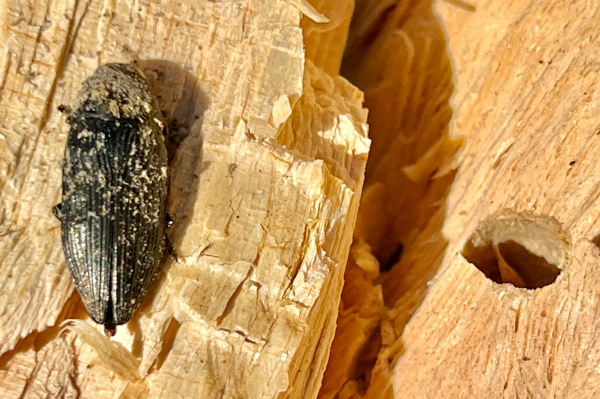
Finding the last two carcasses motivated me to continue looking for other evidence of the species, and I beat/chopped/peeled bark from a number of dead pines of both species but did not find any more individuals—either live or dead. I did, however, enjoy the spectacular views of the head of the canyon (essentially a sandstone box canyon). I found more Eriogonum on the other side of the canyon, on one of which was another of the smaller clytrine leaf beetle species, and I also collected two tiny bees in the flower of Penstemon sp. (blue) for Mike. Finally, when I returned to the car I noticed the characteristically “flagged” branch of a small Quercus gambelii that had been pruned by a cerambycid larva. I peered inside the hole at the cut end of the branch and saw the culprite inside, so I collected the branch and trimmed it to bring it back for rearing. By now it was getting into the evening hours and there seemed to be little other insect activity going on, so we made the one-hour drive to Navajo Lake State Park—keeping our fingers crossed that the holiday crush had subsided and that we would be able to find a nice campsite (preferably with shade!).
Cottonwood Campground
Navajo Lake State Park
San Juan County, New Mexico
The campground as a whole was less than impressive—typical of state park campgrounds that look more like a suburban neighborhood than remote wilderness. It was nearly full, but a few spots remained at the back of the area. Remarkably, these were some of the most delightful spots in the entire campground—ensconced within a grove of large cottonwood trees and well isolated from the cluster of RVs and giant pickup trucks (mostly white, with giant wheels of course) populating the bulk of the campground. After setting up camp and cooking “dirty burgers” for dinner, I walked the campground loop to look for beetles crawling on the road and attracted to the lights at the restrooms. There was not much at the lights, only one sculptured tenebrionid and one nondescript elaterid (along with numbers of a small melolinthine, which I did not collect); and I found two Tenebrionidae walking the road near the restroom and our campsite. [Edit: the “sculptured tenebrionid” turned out to be a great find—Trogloderus verpus, described recently by Andrew Johnston.] Tomorrow will be another driving day, with about six hours to go before reaching our next destination—Mills Canyon in northeastern New Mexico.
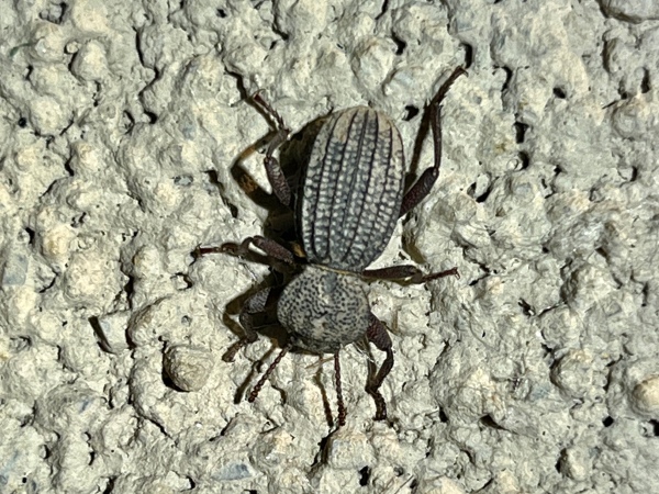

Day 16
The drive from Navajo Lake to Mills Canyon was by any definition the most memorable of the trip. It was a study of contrasts, from remote mountain forests and barren high plains to dramatic canyon descents that dumped us out rather abruptly onto the western reaches of the vast Great Plains. There was also drama—some of it self-made and some of it thrust upon us. Leaving Navajo Lake State Park, we were a bit concerned to find no open gas stations in nearby Navajo City, and with no cell service anywhere in the area we had to rely on an old road atlas to plan our route. A wrong turn before we figured this out didn’t help, but the gauge still indicated we had sufficient fuel to make it to a “town” about halfway to Dulce with plenty to spare. Getting onto Hwy 64, we quickly came upon a trio of vehicles led by an old pickup truck driving far below the speed limit and veering worrisomely from side to side on the winding, mountain road. Passing was impossible with the continuous double yellow lines, so we settled into fourth position and watched with increasing concern as the truck shortcut every leftward curve, blind or not and sometimes completely crossing the double yellow, and ran partially or completely off the right bank with every rightward curve of the road. Calling 911 was an impossibility with the complete lack of cell service, so we helplessly followed for mile after mile hoping and praying that we wouldn’t be forced to witness a most horrific head-on collision or tumbling rollover off the right bank. At various times the truck would speed up, seemingly without reason and often well exceeding the posted speed limit to disappear off in the distance, only to slow back down to well under the speed limit and reform the caravan of worried witnesses. To make matters worse, the “town” halfway to Dulce did not exist—we reached it to find only an arroyo and leaving us biting our lips whether we would reach Dulce—about 15 miles beyond the “zero” mark on my fuel gauge! The truck sped on ahead for much of the latter half of the drive to Dulce, allowing us to worry only about our fuel situation and devise action plans should we run out of fuel short of town and with no cell service, and when we hit the zero mark 15 miles from town the real sweating began. With about five miles to go, we quickly came upon the truck, once again driving at a snail’s pace and veering just as badly as ever from side to side. It did give us something else to worry about, but I was happy to drive slowly to maximize fuel efficiency, and the long final descent into town further helped in that regard. I was elated to make it into town but then horrified to see the truck make the same turns we were making and then slowly crawl into the first available service station—would I really run out of gas just short of the pump because of this guy?! Fortunately that did not happen, and I could only let out a sigh of relief as I was finally able to get out from behind the slowly crawling truck and zip up next to a pump. The truck ambled into the bay next to us, and we were anxious to see if the driver was somehow impaired or merely drunk! Much was explained as we watched the most elderly of men slowly exit the vehicle, oblivious to everything around him, and pop the hood of his truck. As we gassed up, a police vehicle pulled up in front of the truck, and the officer driving asked the elderly gentleman if everything was okay. I didn’t eavesdrop further, but when the officers appeared satisfied with their conversation and about to drive off, I discretely motioned for them to come over. I explained what we had seen for the past hour plus following the old man all the way from Navajo Lake, generating enough concern on the police officers’ part that they not only again made contact with the man but also called a backup unit. We did not get to see how things turned out—the officers told us we were free to leave, but hopefully they were able to reach a family member or friend that could come to the old man’s aid and get him off the road. I felt sorry for the old man, but at the same time we very probably prevented an accident that could have injured or even killed somebody, whether it be the old man himself or another motorist through no fault of their own. Freshly gassed up and all drama now over, we continued east. The village of Taos offered some entertainment—“green” housing developments west of town were a marked contrast to the ramshackle used bus/camper neighborhoods that preceded them, a gathering of artists’ kiosks at a rest stop just outside town offered a chance to view local talent (I couldn’t pass up the aspen burl carved to a sheep skull!), and the city of Taos itself merged adobe-themed architecture with artsy-fartsy flair.

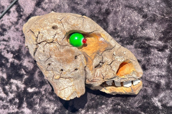
The transition back into the Great Plains marked a dramatic change in scenery, and we watched entire thundercloud systems bloom at various points in the distance—one seemingly in the area of our destination. It passed over us just as we stopped to replenish groceries in nearby Springer, and I hoped against hope that we would not arrive late in the afternoon to a drenched landscape with insect activity already having ceased for the day. The rain held off as we got closer and closer, although a bull snake (Pituophis catenifer sayi) did defiantly hinder our path as we neared our destination.
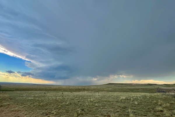
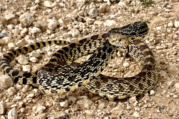
When we arrived at the canyon we checked out the Rim Campground above the canyon and then the Canyon Campground down below. The road down the canyon was narrow and rocky but afforded some spectacular views of what essentially is the edge of a large break from the plateau above and the plains below. After looking around the canyon bottom (and seeing another bull snake that was even more cantankerous than the one we’d seen atop the plateau), we decided that the floral diversity above was more interesting and, thus, would give better odds for insect collecting.
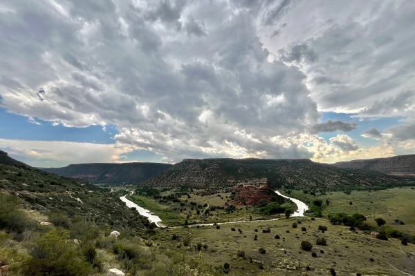

Mill Rim Campground
Kiowa National Grassland
Harding County, New Mexico
By the time we reached the campground back on top of the canyon, thunderclouds had moved ominously close and repeated flashes of lightning followed closely by cracks of thunder forced us to sit in the car until the feeling of danger had passed. Once it did, we started exploring the immediate vicinity of the campsite, although the fresh rain—in my experience usually a killer of insect activity if it happens late in the afternoon, gave me little reason to be optimistic. I noticed an enticingly freshly dead Pinus edulis at the edge of our campsite, walked up to it, and whacked to one of its branches over my beating sheet. Off fell a fine Alaus lusciosus—a species I have not collected before, and closer inspection of the tree revealed not only several cicadas (Hadoa duryi) on its branches, but also a couple of Zopherus concolor on its trunk. (I would come back to this tree repeatedly over the rest of the evening and the next day!)

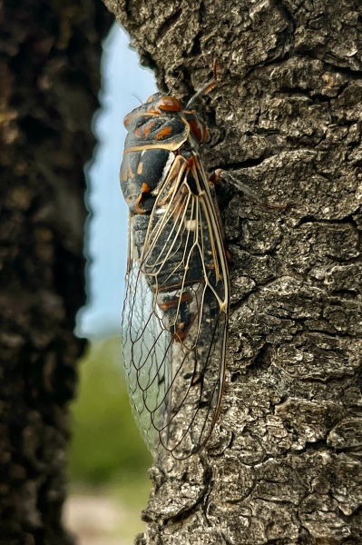
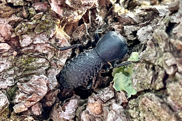
As I was searching the tree, I saw a Buprestis sp. land on and run up the trunk of the tree before quickly taking flight to a nearby living tree. With this, I decided to start beating the various living trees around the campsite, trying the one I’d seen the Buprestis fly to (which yielding nothing) before moving to another nearby tree and seeing a fine B. consularis land on my sheet! This is another species I’ve not collected before [Edit: I now think it possible or even likely that the species is actually B. laeviventris], but despite continued beating I never got another one after that. (I suspect it may have been the same individual that I saw on the dead tree and that species was near the end of its activity period due to the lateness of the hour.)
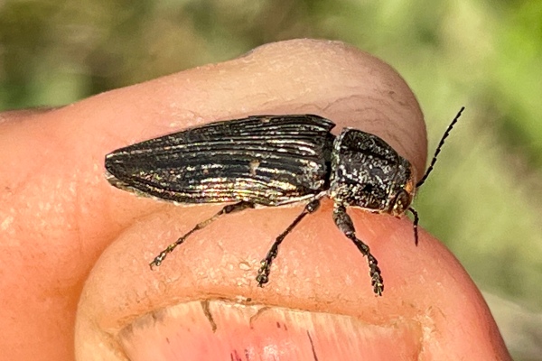
Beating other trees also was fruitless, the only thing of interest being a single clerid beetle beaten from a living branch of Quercus × undulata. Flowers seemed abundant around the campsite, but the only beetle I found on them was the quite pedestrian Batyle ignicollis on Ratibida tagetes. It seemed clear that the combination of rain and a sinking sun had put an end to much of the insect activity in the area. With that, we set up camp and then kicked back for a bit before cooking dinner.
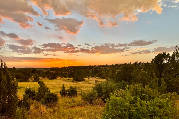

Despite the prior rain, I was strongly considering setting up the lights—the temperatures seemed like they were not cooling off too much, and the continued threat of storms from surrounding cloud systems combined with a finally-past-full moon created a situation that I’ve often found is conducive to bringing insects to the lights.

In addition to setting up the lights (both mercury-vapor and ultraviolet), I also got out the prionic acid lure (that Paul had given me) and placed it on the table at dusk. Almost immediately, a large male Prionus californicus came flying into the campsite, landed near the lure, and crawled about frantically while erratically waving its antennae trying to locate what it thought was a calling female. Several more males flew into the campsite over the next half-hour before darkness fell completely and I put the lure away.
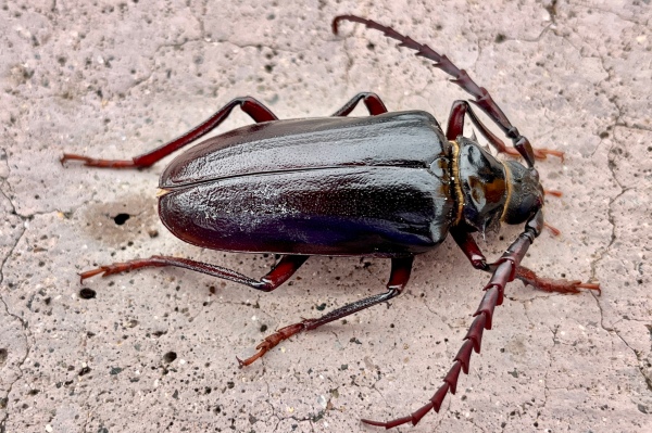
By now the lights had caused a fair gathering of insects to amass on the sheet, but other than a rather abundant small melolonthine scarab they were almost all moths—temps were not quite high enough to “bring the beetles.” There were two exceptions—one minor (another male P. californicus), and one major (a male P. emarginatus, first time collecting the species for me!).
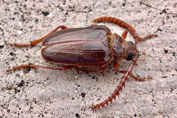
Oh, and remember that dead P. edulis in the campsite? I not only collected several more Z. concolor from its trunks and branches after dark but also a nice series of Eutrichillus neomexicanus. Considering how un-optimistic I was regarding our collecting prospects for the spot after arriving so late in the day—and after rain at that, it was an incredible stretch of good collecting for the spot!
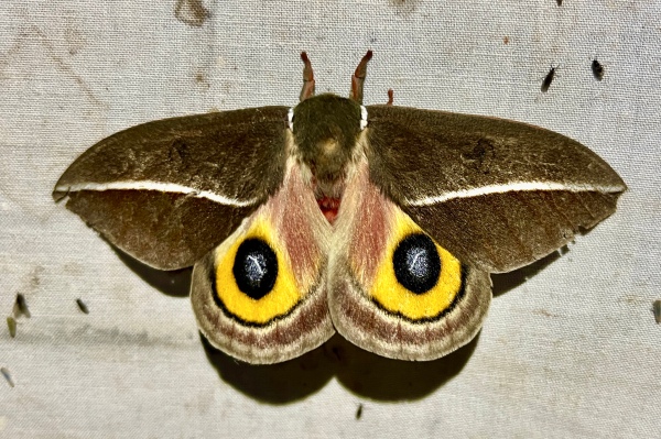
Day 17
Our original plan after arriving yesterday had been to see how collecting was in the area and then make a decision whether to remain (if the collecting was good) or travel further east into the Texas panhandle) to one of several state parks that had caught my interest. The collecting we experienced yesterday—obviously—warranted continued collecting for at least another day, so rather than tearing down camp to get back on the road we were able to leisurely enjoy our morning coffee before striking out. My first target was the dead P. edulis right in our campsite that had produced so many interesting insects yesterday. Inspection of its trunk and branches revealed more of the cicadas (Hadoa duryi) that were abundant in the area, a few of which I collected, and beating its branches produced yet another series of E. neomexicanus.
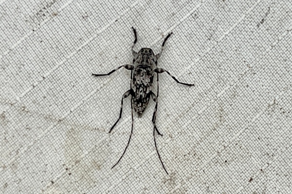
I would return to this tree repeatedly during the day hoping to see more Buprestis consularis/laeviventris, and in the late afternoon I finally got my wish as several individuals visited the tree and searched along its trunk.
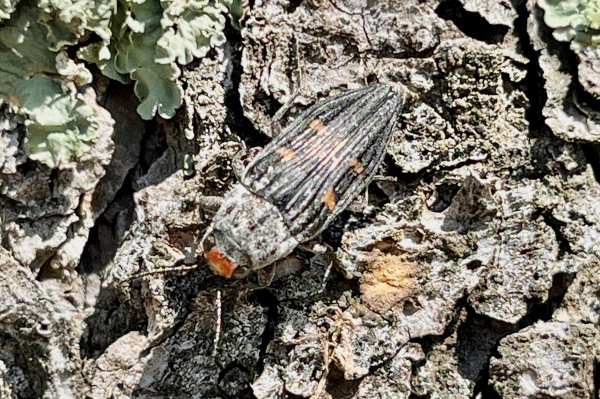
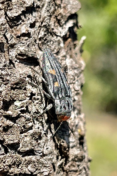
In the meantime, I began searching other campsites in the campground to see if I could find other P. edulis at the right stage of “deadness.” None were found, but I did find an old dead P. edulis stump that exhibited Buprestis-sized emergence holes and from which I chopped the remnants (prothorax and elytra) of an adult B. consularis that had failed to emerge. The first flower-visiting insects of the day were found when I wandered over to a small water tank with lush vegetation around its margins. Acmaeodera sp. nr. mixta/immaculata, and a chrysomelid beetle were taken on a flower of Engelmannia peristenia, and Paranapiacaba tricincta (in outbreak numbers) and several melyrid beetles were swept from vegetation near Cucurbita foetidissima in full bloom.
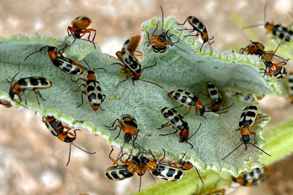

Even more beetles were collected on the other side of the pond, where flowers of Ratibida columnifera produced more of the same Acmaeodera along with Batyle ignicollis, B. suturalis, a single Typocerus confluens, and several melyrid beetles, bees, and wasps. Another B. ignicollis was also collected on the flower of Hymenopappus tenuifolius.


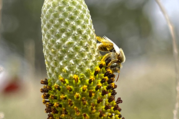
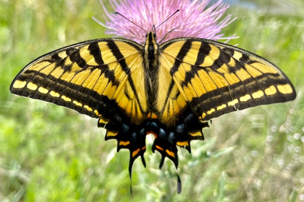
After looking at most the flowers in the area, I notice tiger beetles running in a barren wet ditch running from the pond towards the road. Catching several of them revealed two species present: Cicindelidia punctulata (most exhibiting the green coloration of subspecies C. p. chihuahuae) and C. sedecimpunctata.


Just as I was finishing up with the tiger beetles, a huge beetle flew into the area. It was so large it sounded like a diesel engine in flight, and after getting a good glimpse at it I realized it was Prionus heroicus! I collected this species during my previous visit to this spot (some 10 years ago) using prionic acid lures to attract them, and I suspect in this case the beetle was attracted to residual prionic acid on my hands after handling the lure last night.
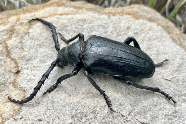
The area outside the fence surrounding the campground (and subject to grazing) didn’t look too interesting, so I walked through the campground back to our campsite to try my luck in a large grassland area south of the campground but still inside the fence line. Along the way I saw a “flagged” dying branch that had been broken (perhaps by a camper) and was hanging off a living P. edulis—beating it produced a fine Monochamus clamator and several Enoclerus sp. (prob. E. lecontei), and right at the edge of our campsite I noticed a few small blooming Sphaeralcea coccinea and collected Acmaeodera sp. mixta/immaculata, Agrilus sp., Enoclerus sp., and clytrine leaf beetles off their flowers. In the grassland area itself, I found several patches of Engelmannia peristenia in flower and collected several more of the Acmaeodera off their flowers along with occasional curculionoid weevils, meloids, and mordellids (the former for Bob Anderson, the second for Jeff Huether, and the latter for Enrique Ruzzier). As I searched the grassland, P. heroicus males continued to approach me in flight, and I captured also an Ospriocerus sp. robber fly. Other flowers were also encountered in different areas: the flowers of Thelesperma megapotamicum produced more Acmaeodera, and those of Ratibida columnifera produced the same along with a few mordellids and bees for Enrique and Mike. Mike had spent much of the past few hours in a sandstone barren on the west side of the campground, so I wandered over reasoning that he must be having good success. He was, and alerted me to a few interesting plants that might be good beetle hosts. I saw one of these right away—Melampodium leucanthum, flowers of which produced an interesting (and still unidentified) Acmaeodera earlier this spring in nearby Black Mesa, Oklahoma. Checking them produced not only the same Acmaeodera that I was collecting off the other other flowers, but also A. ligulata(?) (if it is that species, it must be a northeastern extension to its known range in southern New Mexico and Arizona). More A. ligulata(?) were collected on the flower of Tetraneuris acaulis as well as Opuntia polyacantha along with Euphoria kernii and Enoclerus sp. I normally never see Acmaeodera in flowers of cholla (Cylindropuntia), but in this case I did find one A. sp. mixta/immaculata on the flower of C. imbricata. Having thoroughly searched the sandstone barren and seeing all that it had to offer, I walked over to the canyon top to enjoy the scenery and see what insects I might find in the area.
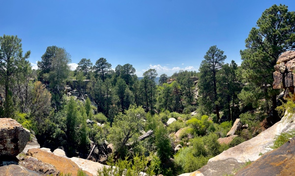
There was not much going on florally; however, I encountered a half-dead P. edulis and beat a Phaenops piniedulis from on of its dead branches. This is another species that seems far northeast of its normal range, but I have previously collected this species even further northeast at Gloss Mountain State Park in northwestern Oklahoma (publication pending)! We had seen some flowers along the roadside leading down the canyon, so I walked the upper canyon road to see if if there was anything on them. There was not, but when I turned back I encountered another P. heroicus—this one was perched on the branch of a small Quercus × undulatus. I suppose it is possible that it was attracted to the prionic acid residue on my hands and landed there unnoticed, but I’m now beginning to think all this diurnal activity is normal and has nothing to do with the prionic acid lures I handled the night before. At one point along the road, I encountered a few oak trees that must be Q. grisea (gray oak), a species I am familiar with from west Texas and from which I have collected many buprestids. Beating the living branches did produce one buprestid—Agrilaxia sp. (perhaps A. texana), but dang it I missed it! Continued beating failed to produce more but did produce a very nice series of Alaus lusciosus and a Lichenophanes sp., and nearing the top of the canyon I was again buzzed by a couple of P. heroicus males. The last insect I encountered before calling it for the afternoon was a single Moneilema armatum that I found on Opuntia phaeacantha—I had been checking Opuntia all day looking for Moneilema, and finally I found one!
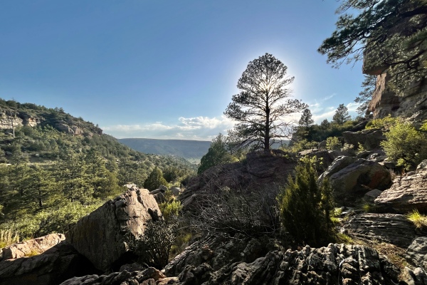
Later in the evening, after processing the day’s catch and cooking dinner, I elected not to set up the lights due to the now quite windy conditions. This was a bit disappointing, as I was hopeful I could catch more Prionus emarginatus to go along with the single individual I had collected the night before. Instead, I decided to check the dead P. edulis in our campsite as well as the half-dead one over by the canyon top to see what might be on them at night. Only E. neomexicanus was found on the branches of the tree in our campsite, but no more Zopherus concolor (several of which I’d found on the tree the night before) were found. On the half-dead tree, however, I did find a couple of Z. concolor along with E. neomexicanus on its branches.

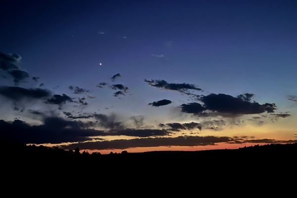
Day 18
The next morning, Mike gave me a few beetles that he’d collected the day before—these included one A. ligulata(?) and one A. sp. mixta/immaculata that he’d collected on the flower of Xanthisma spinulosum and a couple of clytrine leaf beetles that he’d on the stem of Eriogonum tenellum. After we broke camp, I cut up a portion of the standing dead P. edulis in our campsite on which I had found Buprestis consularis and so many other beetles, taking home three bolts of the trunk (2–4” diameter) and five bolts of the main branches (1–2”) for rearing. (As I bundled up the wood, I could actually hear Monochamus larvae munching on the wood inside the trunk.) There was much more wood left from the tree that I could’ve taken home, but there simply wasn’t enough room so I had to leave it. I hated the thought of the next campers coming to this campground, occupying this site, and finding the leftover wood… then burning it! I also hated the idea of leaving this place, since the insect collecting had been so fantastic. We were, however, nearing the final days of the trip, and if nothing else I wanted to see Copper Breaks State Park in Texas as a potential locality for Cylindera celeripes (swift tiger beetle).
It was another 6-hour driving day as we continued on our way back east towards what would prove to be the final collecting locality of the trip. Driving south through northeastern New Mexico was just as interesting (in a desolate sort of way) as the areas we’d already gone through, but as soon as we reached I-10 East and entered Texas, the landscape became a monotonous expanse of unbroken plains, with little other than seemingly endless windmill farms to provide fodder for conversation until we reached the city of Amarillo—apparently nothing more than a long strip along the highway populated by chain business in strip malls. Past Amarillo, our route (mercifully!) took us off the interstate onto equally monotonous roads until we neared our destination and began seeing “breaks” in the landscape. As we neared our the park we were greeted by juniper woodlands on a broken, undulating landscape that contrasted dramatically with the featureless scenery that led us there. It was almost as if we were at the edge of another plateau, like at Mill Canyon—albeit on a much smaller scale, giving me some optimism about our prospects for finding interesting insects.
Copper Breaks State Park
Hardeman County, Texas
We arrived at the park just after the headquarters had closed and followed the road down into a riparian corridor to Kiowa Campground, where we found the perfect spot in a completely deserted campground. Getting out of the vehicle was like entering a sauna—gone was the cool, dry mountain air to which we had become accustomed over the past two weeks, replaced by thick, humid, warm air that saturated everything. At the same time, I was greeted by the sound of one of my favorite insects—Neocicada superbus (superb dog-day cicada) males singing on trunks/branches of a grove of Sapindus drummondii near our campsite! I first encountered this Texas/Oklahoma specialty in the White River Hills of extreme southwestern Missouri back in the early 1980s, its sumptuous lime-green coloration and male song sounding like a chainsaw quickly elevating it to iconic status. Despite visiting the White River Hills frequently, I’ve only been there a few times during the right season to hear their distinctive song filling the air, so hearing and seeing them so abundantly in this location was, for me, a nice start.
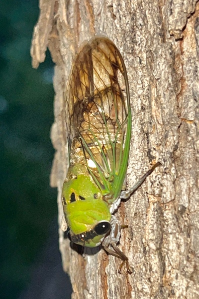
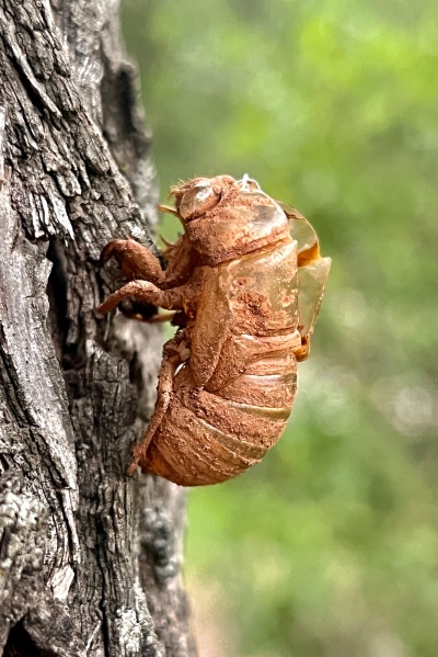
As dusk settled, I started setting up the lights hoping the warm, humid air and now moonless sky would result in some awesome insect collecting. A pesky storm system to the west, however, was drawing ever closer, and when winds started whipping I knew it was a lost cause and rushed to disassemble everything before the rain hit. It only rained a little bit, but it was enough to kill the blacklighting(!), and once the worst had passed I went over to the nearby restrooms to see if their incandescent building lights had attracted anything of interest. I picked up a few Canthon sp., elaterids, and carabids from under the lights and photographed a very large and impressive Ummidia audouini (Audouin’s trapdoor spider) on the cement-block wall, then turned my attention to checking tree trunks and finding only a few tenebrionid and clerid beetles on them before turning in for the night.


Day 19
Our plan for today was simple—see if the insect collecting was good enough to warrant spending the day here, or if it was not make an early call to abort and head towards the Wichita Mountains in Oklahoma to complete the last day of insect collecting for the trip. It mattered not much to me in terms of driving back to St. Louis the next day—the 10-hour drive it would be from here was reasonable, so it really depended upon how the morning collecting went. I went with Mike to a breaks area just across the road from the campground where he wanted to set out bowl traps and explored the area. I was on the lookout for Cylindera celeripes (swift tiger beetle), which has not been seen in Texas since the 1930s near Wichita Falls—Dan Duran and I regarded this area to be the best possible refuge for them in the state, at least based on Google Earth photos. I was also in the lookout for any flowers that might attract beetles. In regards to the former, I became less optimistic about finding the tiger beetle here after seeing the habitat in person—it had the same gypsum-capped clay substrate where I’ve seen the tiger beetle further north in Oklahoma, but the gypsum was much more “broken” and eroded and lacked the large expanses of level ground that the beetles seem to need. In regards to the latter, the only blooming plants that I saw, at least with potential for beetles on them, was Helianthus annuus, from which I collected a few Batyle suturalis (and a few bees for Mike). I also found on the foliage of the plant an adult female Neobarrettia spinosa (red-eyed devil)—one of the most terrifyingly impressive (and appropriately named) katydids you’ll ever see! Not much else seemed to be going on in the area, and I had noticed many of the hackberries (Celtis reticulata) in the campground area were half-dead and bearing visible damage to their trunks and branches caused by longhorned beetles. I approached several of them, at first finding nothing on their trunks but eventually scaring up a couple of Chrysobothris sp. (prob. C. caddo) on thr lower trunk of one of the dying ones [2023-69b]. I continued around the outer campground area checking other dead/dying hackberries along the way and eventually happened along a few patches of Grindelia ciliata hosting small treehoppers (Vanduzea segmentata) in the upper stem leaf axils of the plants and being tended by even tinier ants. I was not aware there were other species in the genus besides V. arquata (which I’ve seen commonly on their exclusive host, Robinia pseudoacacia [black locust]), so I collected a series of the treehoppers along with a few of their protector ants.
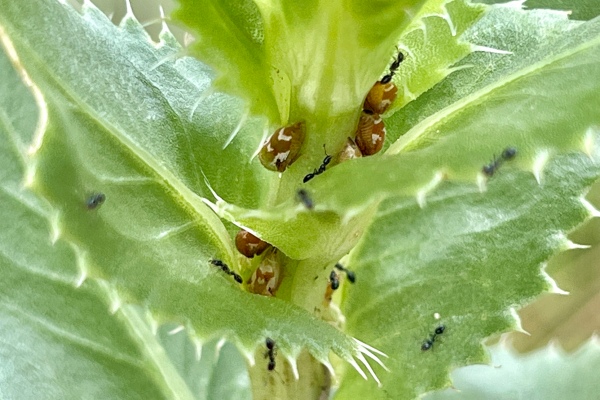
After searching a few more hackberry trees (unsuccessfully), I came upon one that was half-dead with a dead major branch coming out of its trunk. Something about it said “chop me” (I think it was the interface between living and dead wood—often a good place for woodboring beetle larvae to develop), and I began chipping away at the dead wood hoping to encounter larval galleries. Shortly enough, I did encounter a decent-sized cerambycid larva in the wood—it seemed large enough to be mature, so I put it in a vial with some pieces of wood with a thought to try to rear it to adulthood. That became less important when I encountered a pupa of presumably the same species—I put that in a vial with wood dust as well, opining that I would have a better possibility of rearing an adult from a pupa than a larva. Continued chipping away at the wood finally revealed a teneral adult cerambycid in its pupal cell—easily identifiable as Eburia haldemani (another species I have never collected before). I would eventually chop a second adult from the wood as well and then collect the remaining piece of wood for in-host rearing.
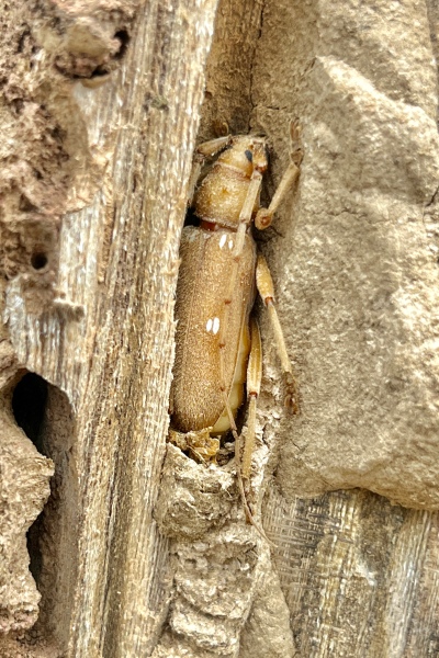
By this time it was heating up and I needed some water, so I went back to the campsite before heading down to the Juniper Ridge Nature Trail, which I reasoned may have the best potential habitat for finding C. celeripes (if the species did, indeed, occur here). Along the way, I passed a large stump of C. reticulata that looked about the right age for developing woodboring beetle larvae, so I began chipping at the wood hoping to encounter Texania fulleri, a handsome buprestid that I’ve encountered only once before (in the trunk of a large, dead hackberry outside of San Antonio). I did not encounter that species, but I did encounter two more teneral adult E. haldemani as well as a second pupa, which I placed into individual vials for hardening (the adults) and emergence (the pupa).
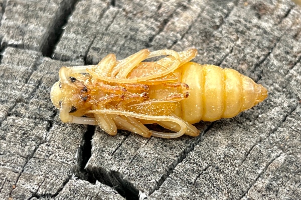
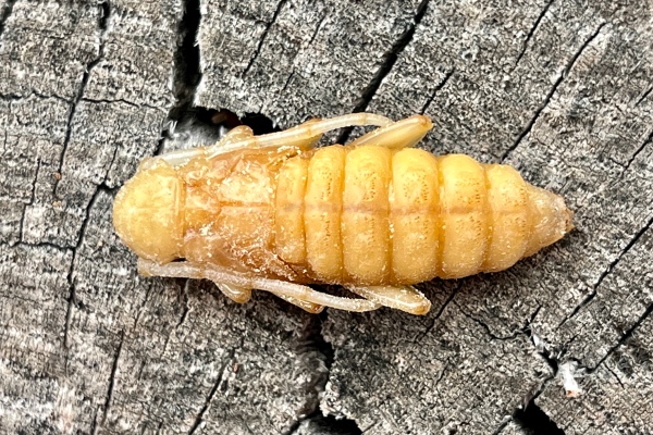
Reaching the nature trail, I started exploring the rugged, up-and-down “breaks” terrain looking for any sign of C. celeripes. Again, the more I looked, the less I believed that this was a good locality for the species due to the highly eroded nature of the substrate with no unbroken, level expanses.
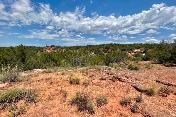
I was, however, finding flowers in bloom, and on them beetles. The most abundantly blooming plants were Melampodium leucanthum (blackfoot daisy)—previously seen to be a good Acmaeodera flower, and over the next couple of hours traversing the trail and exploring it’s off-trail nooks and crannies I collected a very nice series of A. obtusa along with a few Trichodes bibalteatus and mordellid beetles (the latter for Enrique) off its flowers.
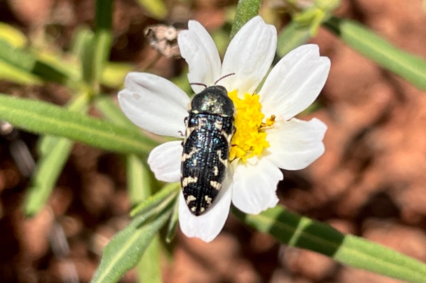
Tetraneuris acaulis (stemless four-nerve daisy), another good Acmaeodera host, was also blooming, though much less abundantly than M. leucanthum, and I collected a few A. obtusa on its flowers as well. As I traversed the circuitous route through juniper woodland, male cicadas sang in the juniper trees, but consistently went silent on my approach before screeching noisily as they bolted and flew to another, usually very far away tree! I tried three times to catch one before finally succeeding. The species turned out to be Diceroprocta texana, a species I have collected before in the Monahans Sandhills of west Texas.
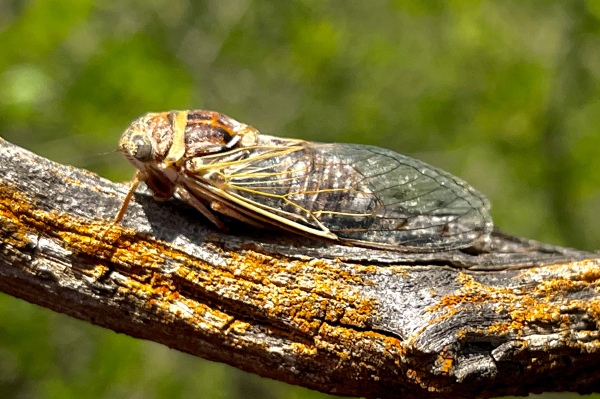
I also became fixated on collecting two of the robber flies that I was seeing—the mydas fly-mimicking Ospriocerus abdominalis, and the giant Microstylum galacticum, eventually succeeding in catching a couple in flight. Near the end of the trail I found a dead Chrysobothris sp. dead on ground, presumably it is C. caddo. There were no host trees anywhere near—perhaps it was dropped by a Cerceris fumipennis wasp that had captured and paralyzed it? At the southmost part of the trail there was a large patch of Gaillardia pulchella, which I had not seen on other parts of the trail. There weren’t many insects visiting its flowers, but I did collect another A. obtusa off of it.

By this point, I was really hot and dehydrated—any further collecting would have to wait until after I went back to the campsite and rejuvenated myself! Even that would have to wait, as I found several interesting insects right as I entered the campsite, the first being a dead Megatibicen dealbatus (plains cicada) on the ground at base of a large Populus deltoides (cottonwood) beside our tent. At first I thought it was M. dorsatus (prairie cicada—with which I am familiar from my boyhood collecting days outside of Kansas City), but I quickly determined its true identity after consulting online sources as yet another species I have never collected before now.
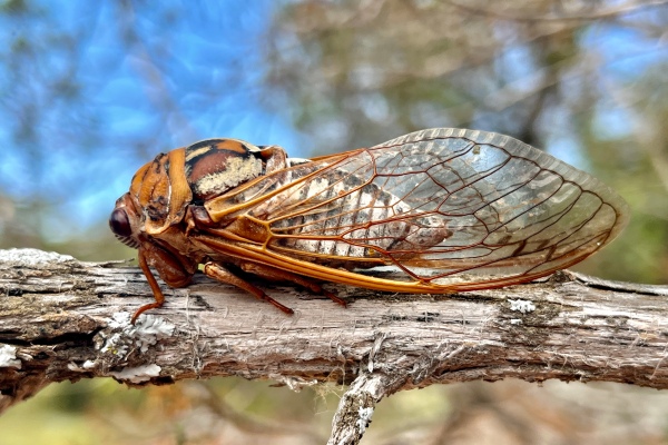
As I was putting the cicada in a vial, I noticed the distinctive black/white of a female Plectrodera scalator (cottonwood borer) chewing on the exposed root of the same cottonwood tree—this was also photographed and then put in a vial.

Finally, I noticed the a flash of metallic green at the base of the trunk of a Sideroxylon lanuginosum (gum bumelia) in our campsite, immediately recognizable as indicating the presence of the über-charismatic Plinthocoelium suaveolens suaveolens (bumelia borer) [2023-69o]. Even though I have seen this species many times (and trapped literally hundreds of them over the years from dolomite glades across southern Missouri), they were for many years before that my “white whale,” and I still never tire of seeing them.

By now it was apparent that there was more than enough of interest here to justify further exploration, making the decision whether to stay or to go an easy one. After resting, rehydrating, and refueling, I went back over to the adjacent group picnic area where I had seen additional gum bumelia trees this morning. I found not only another individual but also a mating pair of P. suaveolens (one of the pair got away). Movement around a nearby grove of C. reticulata caught my attention, and I realized it was a large Stenelytrana gigas (gigas longhorned beetle) flying around one of the standing dead trunks in the grove. I made a beeline for the grove (at least as much a beeline that these old legs can make now), and somehow managed to net it, then monitored the trunk for a while and picked off a couple more C. caddo and a Chariessa pilosa (pilose checkered beetle) that landed on it.
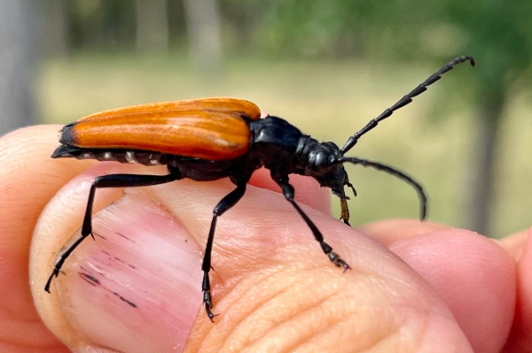
When I reached the dying C. reticulata that I’d collected two C. caddo on this morning, there were many more on it as well as on a nearby tree—allowing me to collect quite a nice series, as well as C. pilosa and Neoclytus mucronatus.
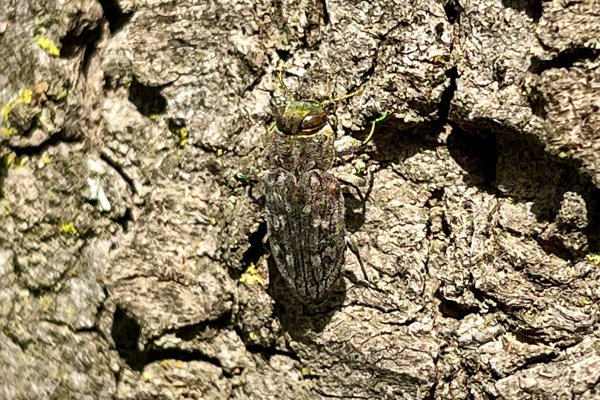

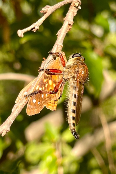
On the way back to the campground, Mike called my attention to another P. scalator that was in the act of ovipositing at the base of another large cottonwood in the campground and said that he’d found two more while I was gone. We watched the female complete oviposition, then I looked for more at the bases of other cottonwoods throughout the general campground area, finding three more for a total series of seven individuals—by far the most individuals of this species that I have seen at one time!
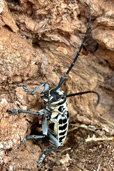
After another break for an ice run into town and a delicious “last supper” of some of the thickest brats I’ve ever had (jalapeño and cheddar, grilled of course, with lots of mustard!), I turned on the lights and hoped for a successful final collecting act for the trip. This was only the second night (out of 19!) that I was able to run the lights for nighttime insects—every other night it was either too cold, too windy (usually both), and it was especially frustrating last night after getting stormed out just as I began to set things up. The night did not disappoint! Insects starting coming in right away, the most notable early catches being another M. dealbatus and several individuals of a tiny cicada (perhaps Pacarina puella?), a specimen of which I had tried to salvage from a spider web earlier in the day but which fell apart as I was doing so. In addition to the overwhelmingly abundant N. superbus, this gave me four species of cicadas from the park. Tiger beetles featured prominently also—in addition to several Cicindelidia punctulata (expected), I also collected several Ellipsoptera cuprascens/macra, a couple of Tetracha carolina, and one Eunota circumpicta (I was disappointed, however, in my repeated failure to collect a Eunota togata that kept appearing at the light and then eluding my bottle!). Around 11:00 I turned off the MV light (to allow the UVs to pull in the shyer species) and walked over to the picnic area where I had collected so many C. caddo off of half-dead C. reticulata. This also did not disappoint, as I collected not only a diversity of longhorned beetles such as Amniscus sexguttata and Elytrimitatrix undatus but three individuals of Eburia haldemani—now I had more than just the teneral adults that I’d chopped out of the trees earlier in the day. Walking back to the UV light, there was not only another E. haldemani at the light but also another P. scalator along with several other longhorned beetle species. I probably could have continued going for another couple of hours, but it was approaching midnight and I was exhausted. I turned in knowing that I got to experience a fantastic final insect collecting act for the trip!
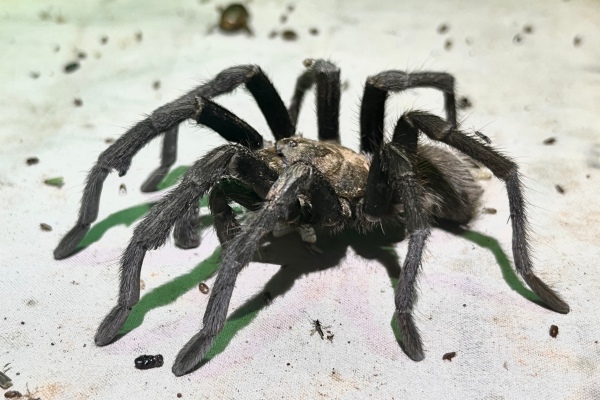
Day 20
The drive back to St. Louis (Day 20) was typically boring—long stretches of travel on interstate highways with no prospect of a cool native habitat to look forward to. However, it provided time to reflect on the successes and frustrations of the trip, muse over some of the humorous experiences we’d had, and contemplate where we might want to go in future excursions. At 8:00 p.m. (after 4,519 miles and 92½ hours in the vehicle), I pulled into my driveway, unloaded the vehicle, and bade adieu to Mike—for the time being!

©️ Ted C. MacRae 2023