🌿 Botanizing w/ the Webster Groves Nature Study Society (WGNSS) Botany Group at Rockwoods Reservation – 3 Nov 2025

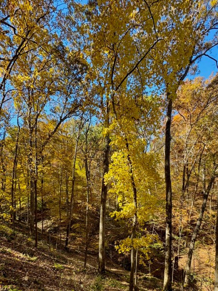
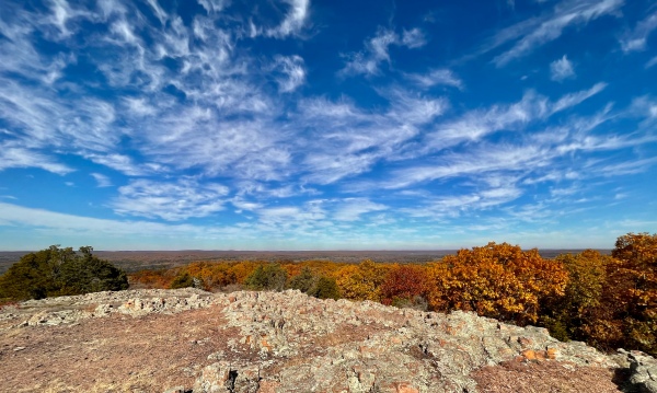
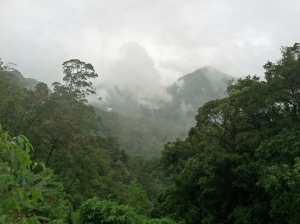
After several weeks of traveling to the outer reaches of the St. Louis area, the WGNSS Botany Group pinned their hopes on seeing good fall colors closer to home at Rockwoods Reservation in Wildwood. Despite its proximity to St. Louis, Rockwoods offers visitors a taste of the Ozarks with its mix of dry, rocky ridges, cool, moist ravines, and forested slopes featuring a variety of woodland types depending on substrate and exposure. Several trails are on offer, but the group chose the Rock Quarry Trail as the most likely to provide a diversity of plants and color.

Hard maples ablaze!

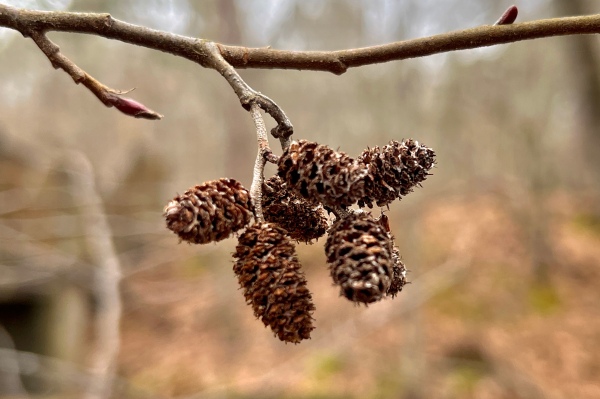
A large (seemingly misplaced) Taxodium distichum (bald cypress) tree right at the trail entrance captured our attention, and numerous globular cones, still green at this point in the season could be seen within its crown. Bald cypress trees are often attacked by a small fly called the cypress twig gall midge (Taxodiomyia cupressiananassa—family Cecidomyiidae) which produces globular galls on the twigs that can be mistaken for immature cones, but despite thorough searching none were found.

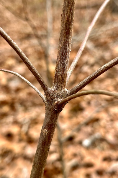
As we started up the rocky trail, John noticed several freshly fallen leaves on the ground under a large(ish) tree and picked one up for the day’s first “pop quiz.” Morus (mulberry) or Tilia (linden or basswood), two unrelated trees that bear similar-looking leaves, were the early guesses, but which? The shape of the leaf base—usually symmetrical in the former and asymmetrical in the latter—can be useful but is not consistent. A better way is to break the leaf petiole to check the color of the sap that exudes—milky in the former and clear in the latter. In this case, it was milky, identifying the tree as Morus rubra (red mulberry).

Our late summer and early fall this year was unusually dry with almost no rain from the beginning of August until near the end of October. This year’s fall floral display has suffered as a result, with many of the plants we are seeing in flower now looking rather pitiful compared to if they had grown under more favorable conditions. The recent rains may not have been enough to “save” the season, but the landscape has “perked up” a bit in their wake. By early November, Solidago (goldenrods) and Symphyotrichum (true asters) make up the bulk of the anticipated plants in flower, and we were fortunate to see blooms of several species in these two genera. These included not only some species that we have seen in the past weeks, such as Solidago ulmifolia (elm-leaved goldenrod), Symphyotrichum anomalum (many-rayed aster), Symphyotrichum patens (spreading aster), and Symphyotrichum lateriflorum (calico aster), but also a few that we have not.

Symphyotrichum lateriflorum (calico aster—family Asteraceae).

The bulk of these were located in or near a small “glade” on a southwest-facing not far from the trail entrance. The patch of xeric habitat is not a true glade, but rather a scar of past quarrying activity on the southwest-facing limestone slope that has resulted in a glade-like habitat. It was here that a few patches of Solidago rugosa (rough-leaved or wrinkle-leaved goldenrod) were found. This species is similar to S. ulmifolia but usually has multiple stems and sessile leaves with the margins not as coarsely toothed and the veins more deeply impressed, giving the leaf a rugose appearance (on which the species name is based).

Solidago rugosa (wrinkleleaf or rough-stemmed goldenrod—family Asteraceae) inflorescence.
Solidago rugosa (wrinkleleaf or rough-stemmed goldenrod—family Asteraceae) leaves.

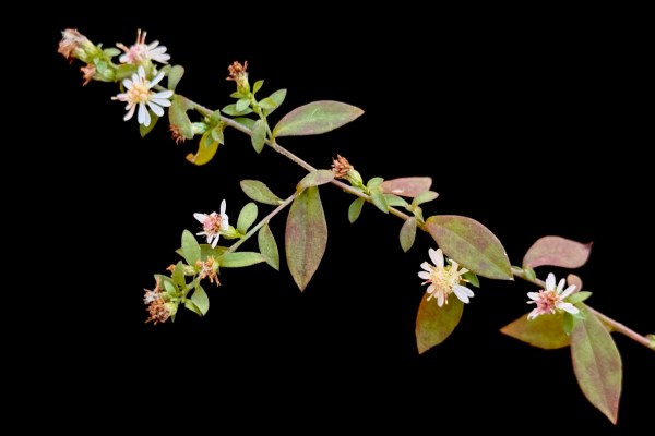
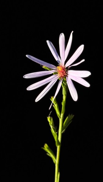
We have seen Symphyotrichum oblongifolium (aromatic aster) in true glades the past few weeks (at Victoria Glades and Fults Hill Prairie), and we saw it blooming in this “pseudo glade” as well. Amongst the several plants of this species, however, was a single blue-flowered aster that did not exhibit the same profusely branched and many-leaved growth. This turned out to be the slightly more conservative (CC = 7) Symphyotrichum laeve (smooth blue aster), identifiable by its smooth, completely hairless, narrowly elongate leaves that clasp the stem at the base.

Symphyotrichum laeve (smooth blue aster—family Asteraceae) flower.
Symphyotrichum laeve (smooth blue aster—family Asteraceae) stem and leaves.

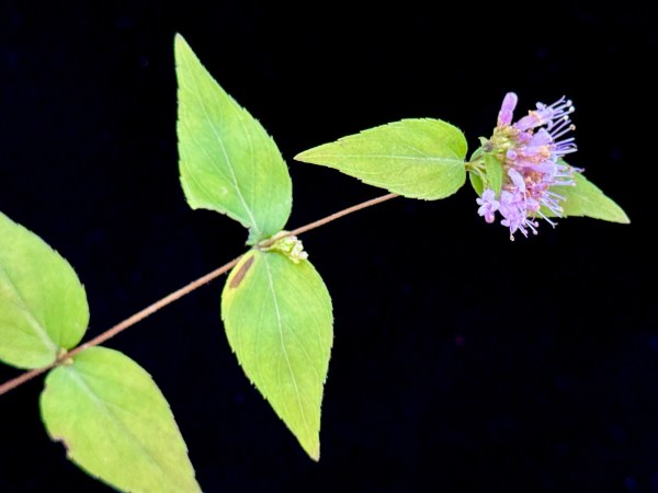
Just beyond the glade and reentering the dry woodland, a single white-flowered aster was seen and determined to represent Symphyotrichum urophyllum (arrowleaf aster) based on its leaves—heart-shaped at the base and gradually becoming more arrowhead-shaped and sessile to nearly sessile further up the stem—and dense, cylindrical cluster of white flowers at the top of the plant.

Symphyotrichum urophyllum (arrowleaf aster—family Asteraceae) inflorescence.
Symphyotrichum urophyllum (arrowleaf aster—family Asteraceae) stem and leaf.

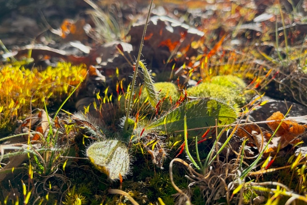
Moving further along the trail, the substrate transitioned from limestone to chert, which was accompanied by the appearance of more acid-loving lichens, mosses, and plants such as Vaccineum pallidum (lowbush blueberry) and Cunila origanoides (American dittany), a few plants of the latter still exhibiting blooms in good shape. The finely divided leaves of Viola pedata (bird’s foot violet), a characteristic occupant of upland forest openings having dry, cherty soils, were common along the steep trailside bank in this area.

Cunila origanoides (American dittany—family Lamiaceae).

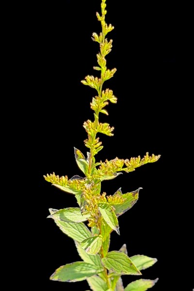
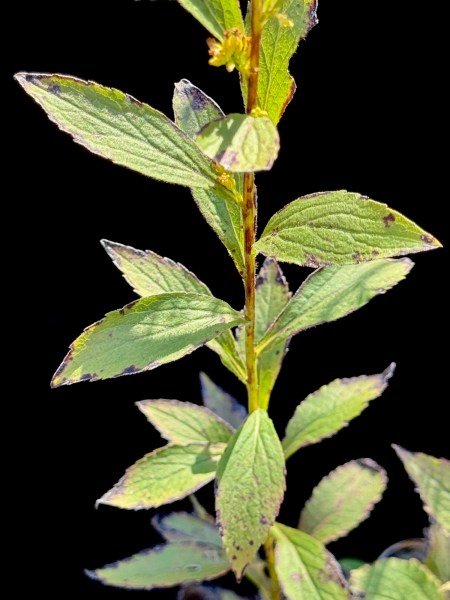
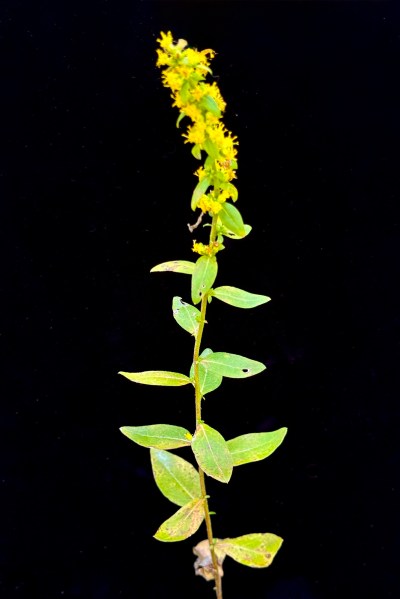
Further up the trail along the ridgetop, we saw a single plant representing yet another acidophile and first sighting for the season—Solidago hispida (hairy goldenrod). This species can be recognized by its single stem, erect, narrow cluster of yellow flowers at the top of the plant, distinctly hairy leaves and stems (especially at the base), and larger basal leaves. It typically inhabits dry, open, and rocky woodlands, especially those with acidic substrates.

Solidago hispida (hairy goldenrod—family Asteraceae) upper stem leaves and inflorescence.
Solidago hispida (hairy goldenrod—family Asteraceae) lower stem.

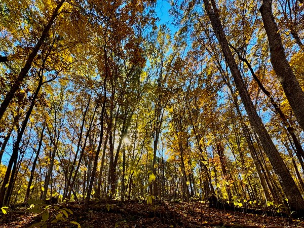
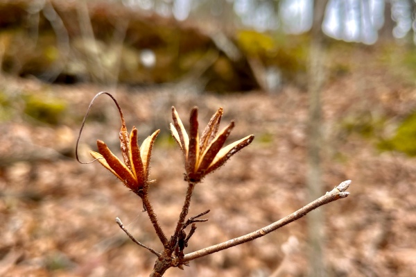
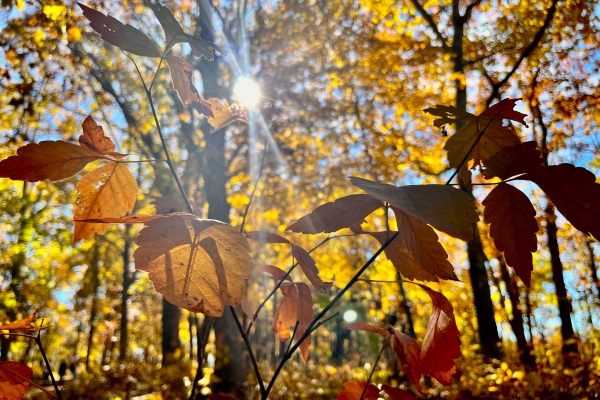
A long gentle descent off the ridge top took the group gradually down into a deep ravine with a tall, dense canopy that contrasted distinctly with the dry, rocky, more open forests seen to that point. Muted browns and yellows of oaks and hickories gave way to vibrant golds, oranges, and reds of hard maples. Polystichum acrostichoides (Christmas fern) was abundant on the north-facing slopes, the darkened tips of their fertile fronds conspicuous against the much more green rest of the plant, and two other fern species were noticed as well: Adiantum pedatum (northern maidenhair fern), a deciduous species with its fronds just starting to senesce, and Asplenium rhizophyllum (walking fern), an evergreen species that spreads vegetatively (“walks”) by rooting to form new plantlets whenever the tips of its long, undivided leaves touch moist substrate. Lindera benzoin (spicebush) was also abundant in the more mesic habitat now being traversed, their just-formed flower buds now sufficiently developed to distinguish male (larger buds) from female (smaller flower buds) plants at a glance.

Backlit leaves of Asimina triloba (pawpaw) under a canopy of blazing yellow Acer saccharum (sugar maple).

The trail ends up the road a ways from its start, requiring a short roadside walk to return to the parking lot. Despite the presence of asphalt, the group remained on the lookout for plants of interest in the now riparian forest corridor paralleling the road. A fourth goldenrod—Solidago altissima (tall goldenrod)—was seen (its identity confirmed by rubbing its leaves with the fingers to feel its roughness), but the biggest attention getter was a spectacularly large Ilex decidua (deciduous holly or possumhaw) bearing a profusion of bright orange-red berries.

Ilex decidua (deciduous holly, possumhaw—family Aquifoliaceae).

For lunch afterwards, the group chose the ever-popular Clancy’s Irish Pub in nearby Ellisville.

©️ Ted C. MacRae 2025

Botanizing at Hawn State Park

Pinus echinata (shortleaf pine) woodland at Hawn State Park.

Nestled in the northern foothills of the St. Francois Mountains lies one of Missouri’s most remarkable of places—Hawn State Park. I have written about this place on several occasions and visited even more often, yet I never tire of exploring its sandstone canyons, rhyolite shut-ins, and stately pine forests. As such, I was happy to see it as the selected destination for the WGNSS Botany Group Monday Walk.

A partially frozen Pickle Creek meanders through Hawn State Park.

It was a chilly winter morning when the group met at the picnic area parking lot, and after a bit of discussion to orient ourselves on the plants we might see, we crossed the foot bridge over Pickle Creek to explore the habitats off the Whispering Pines Trail. Almost immediately (in fact, even before completely crossing the bridge), we noticed Alnus serrulata (smooth alder) lining the edges of the creek banks. Unlike many trees, A. serrulata is easy to recognize during winter by virtue of its persistent female cones and newly-formed male catkins. Alnus serrulata is one of five species in Missouri belonging to the family Betulaceae—all five of which occur together here in Hawn State Park (and, in fact, can be found within feet of each other). In the case of this species, the female cones are unique, the male catkins are green and red and occur during winter in clumps, and the winter buds are red with two scales.

Alnus serrulata (smooth alder) – persistent female cones.
Alnus serrulata (smooth alder) – newly-emerged male catkins.
Alnus serrulata (smooth alder) – winter buds.

Immediately after crossing the bridge, we saw the second betulaceous species on slightly higher ground—Corylus americana (American hazelnut). Like A. serrulata, this species is usually a small tree, but it lacks the persistent cones during winter, has more brownish male catkins that may be clumped, especially at the branch tips, but also tend to occur singly along the length of the branch, and has brownish, rounded winter buds and noticeably fuzzy twigs.

Corylus americana (American hazelnut) – male catkins.
Corylus americana (American hazelnut) – winter bud.
Corylus americana (American hazelnut) – male catkins.

Entering the mixed pine-oak forest (and pondering Fr. Sullivan’s oak ID quiz—which turned out to be Quercus coccinea, or scarlet oak), Kathy noticed the persistent fruiting stalks of one of our native terrestrial orchids—Goodyera pubescens (downy rattlesnake plantain). Normally, this orchid is noticed during winter by virtue of its striking white-veined green leaves, but in this case they were completely hidden under leaf litter. Had it not been for the fruiting stalk, we would never have noticed its presence. Hawn State Park has a healthy population of these orchids, and hopefully the fruits of this individual will bear an abundance of its tiny (spore-sized) seeds.

Goodyera pubescens (downy rattlesnake plantain) – last season’s fruiting stalk.

Continuing our off-trail bushwhacking, we eventually reached a series of sandstone canyons that promised not only spectacular ice formations from their constant moisture drip, but the potential for seeing plants that rely on the cool, shaded, moist, acidic nooks and crannies they offer.

Sandstone ledges.

Two fern species were seen. The first was Asplenium platyneuron (ebony spleenwort)—not uncommon and distinguished by the dark, reddish-brown, glossy stipe and rachis (on fertile fronds) with simple pinnate leaves and alternately-arranged leaflets with a basal auricle (ear-lobe). Two columns of elongated sori (spore-bearing structures) oriented diagonally to the central veins can be found on their lower surface of the leaflets. Dryopteris marginalis (marginal wood fern) was also found on the sandstone ledges. This fern is most easily identified by the location of its sori on fertile fronds, which occur along the margins of its subleaflets (some other less common species will have the sori placed more interiorly).

Asplenium platyneuron (ebony spleenwort) – lower leaf surface of fertile frond.
Dryopteris marginalis (marginal wood fern) – lower leaves of fertile frond.
Dryopteris marginalis (marginal wood fern) – lower surface of lower leaves of fertile frond.

The most exciting find on the sandstone ledges was Mitchella repens (partridge berry). This member of the Rubiaceae (same family as coffee) is characteristic of sandstone canyons and ledges and occurs in Missouri only in a few counties in the southeastern part of the state where this habitat exists. The plant is unmistakable and easily identified, especially when in fruit. Interestingly, each of its bright red berries is actually a fusion of two fruits, as evidenced by the pair of minute, persistent calyces at the tip.

Mitchella repens (partridge berry).
Mitchella repens (partridge berry) – fruit showing paired calyces.

Back on-trail, the group focused on identifying the many different tree species along the trail (Quercus coccinea was dominant). One small “tree” had us stumped, however, it’s giant terminal bud with small lateral buds clustered nearby seemingly suggesting oak—until we noted the curious whorl at the branch node and, on a subsequently-seen individual, persistent fruit capsules that immediately identified it as Rhododendron prinophyllum (early azalea). Another lover of acidic pine woodlands, this species is restricted in Missouri to high-quality habitats in the Ozark Plateau, and Hawn State Park has some of the finest populations to be found.

Rhododendron prinophyllum (early azalea) – winter bud.
Rhododendron prinophyllum (early azalea) – branch node.
Rhododendron prinophyllum (early azalea) – last season’s fruiting capsules.

As the group ascended the trail and began pondering whether to turn around, the characteristic leaves of a small saxifrage were seen at the base of an oak tree. Micranthes virginiensis (early saxifrage, Virginia saxifrage) shows a preference for rocky acid soils and reaches the western limit of its distribution in Missouri, where it is limited to a few counties in the Ozarks. A similar but much smaller species, Micranthes texana (Texas saxifrage) can be found in sandstone glades in western Missouri.

Micranthes virginiensis (early saxifrage, Virginia saxifrage).
Micranthes virginiensis (early saxifrage, Virginia saxifrage) – last season’s fruiting stalk.

Returning to Pickle Creek, the group focused on the remaining three species of Betulaceae found in Missouri—and Hawn State Park, all growing in the immediate vicinity of the foot bridge. The three species—Betula nigra (river birch), Carpinus caroliniana (American hornbeam, musclewood, blue beech), and Ostrya virginiana (American hophornbeam), all have numerous subtle characters that distinguish them from the other two members of the family (Alnus and Corylus), but in winter they are most easily recognized by their bark. The flaky, peeling, cinnamon-brown bark of B. nigra is the most distinctive and cannot be mistaken for anything else. This contrasts completely with the smooth, gray, sinuous look of C. caroliniana (which I can’t help but stroke whenever I see it—should I be admitting that!?). In between is the rough, shredded, brownish appearance of O. virginiana (which is further distinguished from C. americana by its pointed rather than rounded buds).

Betula nigra (river birch) – bark.
Carpinus caroliniana (American hornbeam, musclewood, blue beech) – bark.
Ostrya virginiana (American hophornbeam) – bark.

©️ Ted C. MacRae 2022

Hughes Mountain redux

Despite the relatively long drive from St. Louis, a healthy group of 15 showed up for this past Monday’s WGNSS Botany Group outing at Hughes Mountain Natural Area; participation no doubt helped out by a spectacular forecast (sunny with highs in the 70s) and near-peak fall colors. Hughes Mountain is situated in the northern portion of the St. Francois Mountains. At its summit is Devil’s Honeycomb—a barren expanse of uniquely fractured Precambrian rhyolite formed by the gradual cooling of magma inside a volcano that was then exposed over 1.5 billion years of erosion. Devil’s Honeycomb is one of Missouri’s geologic wonders, and it’s rocks are among the oldest exposed rocks in all of North America.

Devil’s Honeycomb, summit of Hughes Mountain.

Rocks are not the only items of interest here; the igneous substrate results in acidic conditions that affect the flora in equally interesting ways. This is most pronounced in the igneous “glades” (more properly called xeric igneous prairies) where the soils are too thin and conditions too dry to support the growth of trees, offering refugia for grasses and other herbaceous plants more typical of the western grasslands to persist. Surrounding the glades are dry and dry-mesic upland deciduous forests of oak and hickory featuring a rich shrub layer and open woodland-adapted herbaceous plants.

Beginning on the trail from the parking lot, John Oliver pointed out a stand of tall, now leafless sumacs which nearly everybody (including this author) assumed to be Rhus glabra (smooth sumac) due to their size. In fact, despite their size, they proved to be R. copallinum (winged sumac), with the ID confirmed by a few persisting leaves and their distinctive axial “wings.” John pointed out that an easy winter ID tip for this species is the fruiting structures, which nod distinctively after first frost (those of R. glabra do not).

Post-frost “nodding” seed head of Rhus copallinum (winged sumac).

Ascending the trail through the dry-mesic forest towards the first set of glades, we noted the brilliant colors of small Acer rubrum (red maple) saplings in the understory. When their leaves finally drop, they will be more difficult to distinguish from A. saccharum; however, their rounded rather than elongated buds will still allow differentiation.

Acer rubrum (red maple).

Several of the oaks were examined, with most thinking they were largely Quercus shumardii (Shumard’s oak) and Q. velutina (black oak)—both similar to each other but the latter bearing larger, grayer, pubescent, quadrangular terminal buds. Approaching the glades, Q. marilandica (blackjack oak), Carya texana (black hickory), and Ulmus alata (winged elm) became more abundant, all three much preferring the drier conditions found around the glade margins. An interesting feature of the latter (in addition to the distinctive, corky ridges on the twigs), is the leaves, which are smaller than those of most other elms but tend to grow larger towards the terminus of the twig. They also tend to be much less asymmetrical at their base than other elms.

Ulmus alata (winged elm) showing gradually larger leaves towards the twig terminus.

Very little was left in bloom, but the remnants of recent bloomers were still evident. Solidago petiolaris (downy goldenrod) and Symphyotrichum anomalum (many-rayed aster) were common along the trail and still recognizable, their showy flowers gone and replaced by developing seeds. Hieracium sp. prob. gronovii (beaked hawkweed) was found nestled among mosses perched on a rhyolite shelf, the flowers gone but the leaves still green and distinctively hairy. Hypericum gentianoides (pineweed) was found on the glades proper, most with their stems and leaves turning red but the occasional plant still green enough to allow crushing its stems and enjoying its orange-like fragrance. Bucking the trend, however, was a small patch of Solidago nemoralis (old-field goldenrod), it’s yellow flowers fresh and bright in defiance of the calendar’s call to senescence. A small jumping spider in the genus Phidippus took advantage of the lingering greenery, hiding among the leaves in hopes of finding equally persistent prey.

Hieracium sp. prob. gronovii (beaked hawkweed).
Solidago nemoralis (old-field goldenrod).
Phidippus sp. on Solidago nemoralis (old-field goldenrod).

The benefits of management efforts by the Missouri Department of Conservation in the area’s forests were more evident than ever. Between the first set of glades and the main glades surrounding the summit, a rich shrub layer dominated by Rhus aromatica (fragrant sumac) stretched endlessly under an open woodland of oak and hickory, the latter turning the canopy bright yellow in vivid contrast to the orange and red shrub layer beneath. Such open woodlands were once common in pre-settlement Missouri but are now rare due to the elimination of fire in the landscape and its mediating impacts.

Rhus aromatica (fragrant sumac).

Entering the main glades, the group made their way up towards the summit and Devil’s Honeycomb, while Ted and Sharon stayed back to take a closer look at and photograph a robust colony of Cladonia cristellata (British soldiers) growing under Juniperus virginiana (eastern red-cedar). Lichens, of course, are unique in the world of vegetation in that they are a composite organism—a fusion between a fungus and another organism (usually a green alga or cyanobacterium) capable of producing food via photosynthesis. None of these groups of organisms are considered plants in the modern sense, and, in fact, fungi are more closely related to animals than they are to plants. Nevertheless, the convergence in appearance, habitat, and ecology of lichens with plants puts their study much more in the realm of botany than zoology.

Cladonia cristatella (British soldiers).

The group arrived at the summit just in time to enjoy spectacular vistas under crystal blue skies with wisps of clouds and the balmiest temperatures one could possibly hope for in early November.

The group enjoys the view from the summit of Hughes Mountain.
L–R: Ted MacRae, Rich Thoma, Kathie Bildner, Michael Laschober, Tina Cheung, Kathy Thiele, Nancy Mathis, Sharon Lu, Alan Brant, Mark Peters, John Oliver, Larry Lindenberger, Burt Noll, Gwyn Wahlman, Keith Woodyard.

©️ Ted C. MacRae 2021

Brazilian Bike Adventure

Atlantic Forest

Atlantic Forest in Serra do Mar.

Yesterday I joined my Brazilian colleagues on a bicycling tour from the outskirts of São Paulo to the beaches of the Atlantic Coast. To say that the tour was an ‘adventure’ is an understatement—it was epic! For those not familiar with São Paulo, its 20 million inhabitants make it not only the largest city in Brazil, but also one of the five largest cities in the world. Yet, despite the explosive growth it has seen during the past century, it remains isolated from the Atlantic Coast of southeastern Brazil by the Serra do Mar, a 40-kilometer wide swath of rugged, mountainous terrain and part of the Great Escarpment that runs along much of the eastern coast of Brazil. It is here where some of the last tracts of Atlantic Forest, the second largest forest ecotype in South America after the Amazon, remain. Atlantic Forest once stretched along much of Brazil’s Atlantic coast, turning inland in its southern reaches to Paraguay and the northern tip of Argentina. However, much of the forest, especially in populous southeastern Brazil, has fallen victim to the axe. Only the ruggedness of the Serra do Mar has allowed the Atlantic Forest to survive in such close proximity to one of the world’s most populous cities. Understandably, travel between São Paulo and the coast has been difficult. In former years, vehicles had to snake their way through the mountains along a treacherous 2-lane highway with steep grades and hairpin turns. That highway has since been circumvented by an elevated, double, 4-lane highway of alternating spans and tunnels, and the old highway, now closed to vehicles, is instead used by maintenance crews for the new highway and cyclists who yearn to experience the Atlantic Forest up close and personal.

Our van dropped us off in the outskirts of São Paulo, from where we rode along the main highway a short bit before accessing the old highway. Dropping into the Atlantic Forest was like being magically transported into virgin wilderness. The pavement was so encroached by the forest, steep and slippery in places, that it was hard to imagine it ever served as a link between Brazil’s largest city and its largest port. Heavy rains the previous night made the forest moist and gave it an earthy aroma, and moisture-laden air hung heavy with fog and intermittent drizzle. For a time it seemed we would have an uninterrupted, 40-km downhill freeride; however, just a few kilometers into the ride we encountered the first of what would be many landslides blocking the route. I can honestly say that I’ve never portaged a bike through as rough and tumble a pile of trees, rocks, and mud as I did on this day. Still, perhaps encouraged by the fresh bike tracks that lay before us, we soldiered on. After picking our way through a half-dozen such landslides we came upon a work crew who said there were another 30–40 landslides further down along the route. We were at a tunnel that connected with the main highway, so we decided to play it safe and take the main highway the rest of the way down. That, too, was an adventure, made feasible only by the fact that traffic was crawling at a snail’s pace due to the popularity of the Atlantic beaches with the citizenry of São Paulo. It was enjoyable to swish past the cars as they idled their engines, but we had to navigate about seven kilometers worth of shoulderless tunnels. That would have been impossible in normal traffic, but the congestion made finding room to squeeze by large trucks and buses the biggest problem (and I guess breathing exhaust!). Eventually we made it down into Santos, the largest port city in Brazil, and after picking our way through the center of the city, took a ferry to the beach city of Guarujá. Rain, landslides and traffic had thrown everything they had at us, but we persevered the 53-km trek and watched the sun break through while enjoying our just rewards in a beachside restaurant.

Following are a few more of my favorite photos from the day, and you can see all of them in my Facebook album Brazilian Bike Adventure.

Descending into the forest.

Descending into the forest.

Magical vistas such as this were around every turn of the road.

Magical vistas such as this awaited us around every turn of the road.

Manacá da Serra (Tibouchina mutabilis) was abundant in the forest.

Manacá da Serra (Tibouchina mutabilis) flowered in abundance in the forest.

Elevated roadways bypass the beauty of the forest below them.

Why did the ‘hellgramite’ (order Megaloptera, family Corydalidae) cross the road? (Thanks to dragonflywoman for the ID.)

The first of many landslides that blocked our path.

The first of many landslides that blocked our path.

The new elevated highway snakes through the Serra do Mar. This portion was closed due to landslides.

The new elevated highway snakes through the Serra do Mar. This portion was closed due to landslides.

Outside of the cicada killer, this digger wasp (family Crabronidae) on the  beach at Guarujá is the largest that I have ever seen.

A large digger wasp (family Crabronidae) greets us on the beach at Guarujá.

My Brazilian colleagues and I enjoy some well-deserved refreshments after our 53-km trek!

My Brazilian colleagues and I enjoy some well-deserved refreshments after our 53-km trek!

I may have looked like a nerd still in my cycling clothes, but the wave experience was unforgettable.

I may have looked like a nerd still in my cycling clothes, but the wave experience was unforgettable.

Copyright © Ted C. MacRae 2013

Backyard gems

I’ve been fortunate to have the chance to travel far and wide in my searches for insects—from the Gypsum Hills of the Great Plains and Sky Islands of the desert southwest to the subtropical riparian woodlands of the Lower Rio Grande Valley, tropical thorn forests of southern Mexico and veld of southern Africa. No matter how far I travel, however, I’m always happy to return to the Missouri Ozarks. It is here where I cut my entomological teeth so many years ago, and though I’ve now scrabbled around these ancient hills for more than three decades it continues to satisfy my thirst for natural history. Though not nearly as expansive as the Great Plains, there are nevertheless innumerable nooks and crannies nestled in the Ozarks, and I find myself constantly torn between looking for new spots (it would take several lifetimes to find them all) and going back to old favorites. Living in the northeastern “foothills” in the outskirts of St. Louis provides an ideal vantage for exploration; however, sometimes I am truly amazed at the natural history gems that can be found within a stone’s throw from my house. Some examples I’ve featured previously include Shaw Nature Reserve, home to a hotspot of the one-spotted tiger beetle, Castlewood State Park, where I found a gorgeously reddish population of the eastern big sand tiger beetle, and Victoria Glades Natural Area, site of the very first new species (and perhaps also the most beautiful) that I ever collected.

Englemann Woods Natural Area | Franklin Co., Missouri

Today I found another such area—Englemann Woods Natural Area, and at only 5 miles from my doorstep it is the closest natural gem that I have yet encountered. One of the last old-growth forests in the state, its deep loess deposits on dolomite bedrock overlooking the Missouri River valley support rich, mesic forests on the moister north and east facing slopes and dry-mesic forests on the drier west-facing slopes dissected by rich, wet-mesic forests with their hundreds-of-years-old trees. A remarkable forest of white oak, ash, basswood and maple in an area dominated by monotonous second-growth oak/hickory forests.

Englemann Woods Natural Area

Steep north-facing slopes border the Missouri River valley.

It is not, however, the 200-year-old trees that will bring me back to this spot, but rather the understory on the north and east-facing slopes. Here occur some of the richest stands of eastern hornbean (Ostrya virginiana) that I have ever seen. This diminutive forest understory inhabitant is not particularly rare in Missouri, but as it prefers rather moist upland situations it is not commonly encountered in the dry-mesic forests that dominate much of the Ozarks. Stands of this tree, a member of the birch family (Betulaceae) are easy to spot in winter due to their habit of holding onto their dried canopy of tawny-brown leaves (see photo below).

Englemann Woods Natural Area

Rich stands of eastern hornbeam (Ostrya virginiana) dominate the north- and east-slope understory.

Why am I so interested in this plant? It is the primary host of the jewel beetle species Agrilus champlaini. Unlike most other members of the genus, this species breeds in living trees rather than dead wood, their larvae creating characteristic swellings (galls, if you will) on the twigs and stems as they spiral around under the bark feeding on the cambium tissues before entering the wood to pupate and emerge as adults in spring. This species is known in Missouri from just two specimens, both collected by me way back in the 1980s as they emerged from galls that I had collected during the winter at two locations much further away from St. Louis. The presence of this rich stand of hornbeam just 5 miles from my home gives me the opportunity to not only search the area more thoroughly to look for the presence of galls from which I might rear additional specimens, but also to look for adults on their hosts during spring and (possibly, hopefully) succeed in photographing them alive.

Englemann Woods Natural Area

Inside the “hornbeam forest.”

Another “draw” for me is the restoration work that has begun on some of the west-facing slopes in the areas. Pre-settlement Missouri was a far less wooded place than it is today, as evidenced by the richly descriptive writings penned by Henry Schoolcraft during his horseback journey through the Ozarks in the early 1800’s. At the interface between the great deciduous forests to the east and the expansive grasslands to the west, the forests of Missouri were historically a shifting mosaic of savanna and woodland mediated by fire. Relatively drier west-facing slopes were more prone to the occurrence of these fires, resulting in open woodlands with more diverse herbaceous and shrub layers. At the far extreme these habitats are most properly called “xeric dolomite/limestone prairie” but nearly universally referred to by Missourians as “glades”—islands of prairie in a sea of forest! I have sampled glades extensively in Missouri over the years, and they are perhaps my favorite of all Missouri habitats. However, it is not future glades or savannas that have me excited about Englemann Woods but rather the availability of freshly dead wood for jewel beetles and longhorned beetles resulting from the selective logging that has taken place as a first step towards restoration of such habitats on these west-slopes. The downed trees on these slopes and subsequent mortality of some still standing trees that is likely to result from the sudden exposure of their shade adapted trunks to full sun are likely to serve as a sink for these beetles for several years to come. I will want to use all the tools at my disposal for sampling them while I have this opportunity—beating, attraction to ultraviolet lights, and fermenting bait traps being the primary ones. It looks like I’d better stock up on molasses and cheap beer!

Englemann Woods Natural Area

Restoration efforts on the west-facing slopes begins with selective logging.

Eastern red-cedar (Juniperus virginiana) is native to Missouri, but in our time it has become a major, invasive pest tree. The suppression of fire that came with settlement also freed this tree from a major constraining influence on its establishment in various habitats around the state, primarily dolomite/limestone glades. Nowadays most former glade habitats, unless actively managed to prevent it, have become choked with stands of this tree, resulting in shading out of the sun-loving plants that historically occurred much more commonly in the state. Untold dollars are spent each year by landscape managers on mechanical removal and controlled burns to remove red-cedar and prevent its reestablishment in these habitats. There is one habitat in Missouri, however, in which eastern red-cedar has reigned supreme for centuries or possibly millenia—dolomite/limestone bluff faces.

Juniperus virginiana

Craggly, old Eastern red-cedars (Juniperus virginiana) cling tenaciously to the towering dolomite bluffs.

With little more than a crack in the rock to serve as a toehold, red-cedars thrive where no other tree can, growing slowly, their gnarled trunks contorted and branches twisted by exposure to sun and wind and chronic lack of moisture. Some of the oldest trees in Missouri are red-cedars living on bluffs, with the oldest example reported coming from Missouri at an incredible 750–800 years old. There is something awe-inspiring about seeing a living organism that existed in my home state before there were roads and cars and guns. These ancient trees are now an easy drive from my house (though a rather strenuous 300-ft bushwhacking ascent to reach the bluff tops)—they seem ironically vulnerable now after having endured for so long against the forces of nature. For me, they will serve as a spiritual draw—a reason to return to this place again regardless of what success I might have at finding insects in the coming months.

Juniperus virginiana

This tree may pre-date Eurpoean settlement.

Aplectrum hyemale

Adam-and-Eve orchid (Aplectrum hyemale).

Copyright © Ted C. MacRae 2013

Friday Flower: Red Buckeye

Beetles, spiders, and snakes were not the only delights that Rich and I saw as we hiked the lower stretch of the Ozark Trail’s Wappapello Section in early April.  Entering the rich, moist, east-facing slopes overlooking the Black River valley, the oaks and hickories were still in the early stages of bud break. A lush, green understory, however, spread out before us, punctuated by the striking inflorescences of red buckeye, Aesculus pavia (family Hippocastanaceae). Among the first trees to bloom in spring, red buckeye is unmistakable in the field due to its red flowers and palmately divided leaves.

Red buckeye is native to the southeastern U.S., just reaching Missouri in the southeastern Ozarks (though cultivated further north). This makes it less well-known than the more widely distributed Ohio buckeye, Aesculus glabra (absent only from the southeastern lowlands and northwestern corner of the state, and easily distinguished by its white inflorescences, larger size, and spreading growth habit).  Like that species, the seeds and young foliage especially are poisonous if eaten due to glycosidic alkaloids and saponins.  Native Americans roasted, peeled and mashed the nuts into a meal called “Hetuck.”

I first encountered this species in 2001 along Fox Creek in the White River Hills of extreme southwestern Missouri.  It was one of several species that I had selectively “cut” and left in situ for a season to allow infestation by wood boring beetles.  I retrieved the wood the following spring and reared five species of longhorned beetles (family Cerambycidae) from the dead branches, including Astyleiopus variegatus, Hyperplatys maculata, Leptostylus transversus, Lepturges angulatus, and the prize – the very uncommonly encountered Lepturges regularis. All of these represented new larval host records; however, it was not until after I published those records (MacRae and Rice 2007) that I realized the plant itself was not known by Steyermark (1963) to occur naturally outside of the southeastern Ozark Highlands.

Speaking of early spring flowers, many such delights can be found at Berry Go Round #27 which is now up at Mary Farmer’s A Neotropical Savanna. It’s not just spring ephemerals, however, as another Missouri blogger and I show that winter has it’s own botanical charms. Stop by and enjoy the feast!

REFERENCES:

MacRae, T. C. and M. E. Rice. 2007. Distributional and biological observations on North American Cerambycidae (Coleoptera). The Coleopterists Bulletin 61(2):227–263.

Steyermark, J. A. 1963. Flora of Missouri.  The Iowa State University Press, Ames, 1728 pp.

Copyright © Ted C. MacRae 2010

Add to FacebookAdd to DiggAdd to Del.icio.usAdd to StumbleuponAdd to RedditAdd to BlinklistAdd to TwitterAdd to TechnoratiAdd to Yahoo BuzzAdd to Newsvine

Email to a friend

Lake Tahoe – 2010 Preview

How does an entomologist/wannabe botanist-ecologist-geologist-cyclist-nature photographer spend his time on a family vacation?

  • Thursday evening to Saturday late afternoon:
    – Drive from St. Louis to Lake Tahoe.  In between driving shifts:
    – Complete manuscript on Cylindera cursitans surveys
    – Complete manuscript on Dromochorus pruinina surveys.
    – Arrive late afternoon, quick 1-hr bike ride before dark.
  • Sunday:
    – Cross-country skiing with the family: Spooner Lake (~6 miles).
    – Sight-seeing: Sand Harbor Overlook on the east shore.
    – Hang out at the hot tub with the family and a glass of wine.
  • Monday:
    – Drive to Sacramento with the family.
    – Visit buprestid-colleagues Chuck Bellamy (CDFA) and Mark Volkovitsh (Russian Academy of Science).
    – Private lesson from Mark on how to dissect buprestid larvae for taxonomic description.
    – Dinner with my favorite brothers-in-law.
    – Drive back to Lake Tahoe.
  • Tuesday:
    – Snowshoe hike with the family: Emerald Bay to Eagle Lake and back (2 miles, 1,900′ of climbing).
    – Bike ride: South Lake Tahoe to Bliss State Park and back (33 miles, 1,100′ of climbing).
  • Wednesday:
    – Bike ride: all the way around Lake Tahoe (72 miles, 3,500′ of climbing).
    – Hang out at the hot tub with the family and a glass of wine.
  • Thursday:
    – Botanizing and hiking with daughter Madison at Mt. Rose (4 miles, 1,300′ feet of climbing).
    – Hang out at the hot tub with the family and a glass of wine.
  • Friday:
    – Alpine skiing with the family at Heavenly Ski Resort.
    – Join a 2-hour ski tour with US Forest Service rangers discussing natural and cultural history of Lake Tahoe.
    – Hang out at the hot tub with the family and a glass of wine.
  • Saturday morning to Sunday night:
    – Drive from Lake Tahoe back to St. Louis.  In between driving shifts:
    – Process/file photographs from trip (~250).
    – Complete reports for 2009 collecting permits.
    – Complete new applications for 2010 permits.
    – Begin manuscript on Cylindera celeripes conservation status.
  • Monday:
    – Return to work mentally refreshed!

I’ve already shared a bit of the trip with a view of Mt. Rose from 7,000′ and ensuing pismire quagmire.  Today I share some views of one of the most scenic of lakeside spots on the east shore – Sand Harbor Overlook.  I featured this spot in this post from last year’s trip due to its stunning beauty, and this year I was no less impressed.  I still had that same, annoying, afternoon sun to deal with (next year I’ve resolved to get here during the morning) but managed to get some passable photographs.  The one above is my favorite, and I hope you enjoy the following as well. (p.s. if someone knows how to fix a sun-blown sky in Photoshop Elements, please let me know).

Copyright © Ted C. MacRae 2010

Add to FacebookAdd to DiggAdd to Del.icio.usAdd to StumbleuponAdd to RedditAdd to BlinklistAdd to TwitterAdd to TechnoratiAdd to Yahoo BuzzAdd to Newsvine

Email to a friend

Hawn State Park – Winter Hiking at its Finest

Two weekends ago we received another wave in what has been an unusually frequent series of snow events. I’m sure my northern (and Patagonian) friends are not impressed, but at our middlin’ latitudes snow falls rather infrequently and rarely sticks around for long when it does. This winter has been different, with snowfall almost every week, it seems like, and temperatures that have remained cold enough to keep it around for awhile. While this latest snowfall measured only a modest 1-2 inches here in the St. Louis area, a 7-inch blanket (as measured by my hiking stick) fell in the Ozark Highlands just south of here. Coming as it did at the start of the weekend, I welcomed the opportunity to go for a hike — among my favorite wintertime activities — in a landscape that is rarely seen covered in deep, newly-fallen snow. My daughter Madison loves hiking as much as I do (even in deep snow), so the two of us headed off to perhaps my favorite of Missouri’s public areas, Hawn State Park.  I have long adored Hawn for its premier hiking, facinating geology, and unusual flora, and everytime I visit Hawn I find something new to love about it.  

Lamotte sandstone outcrops on the White Oaks Trail


Such was the case on this visit, when Madison and I decided to explore the White Oaks Trail, a newer trail that I had not yet hiked.  I was a little concered whether we would even be able to get to the park, as the road leading into it had only been partially plowed (and we had already seen one car off the road, causing me to reach down and switch on the 4-wheel drive).  Most of the park was snowed in, but we were able to reach the uppermost parking area, leaving our snow-covered trail-finding abilities as the last obstacle to overcome.  After studying the trail map and looking at different route options, I asked Madison if she wanted to hike 2 miles, 4 miles, or 6 miles.  She immediately blurted out “6 miles!”, so off we went.  I was disappointed to see that we were not the first persons to have the idea, as we entered the trail only to find two sets of footprints (one human, one canid) leading off in front of us.  It did, however, make following the trail easier, and in fact I’ve had enough experience finding trails through the Ozark Highlands that I never felt like I needed the footprints in front of us to point the direction.  

Madison next to the root wad of an 83-yr old wind-thrown oak tree.


The White Oaks Trail followed nicely up-and-down terrain through mature white oak (Querucs alba) (appropriately) upland forest dissected by small riparian valleys before settling into relatively mild terrain through monotonous black oak forest.  Just when I thought the trail wouldn’t match the splendor of Hawn’s Whispering Pines and Pickle Creek Trails, it wrapped around to the south at the far end and passed by a beautiful hoo-doo complex of Lamotte sandstone outcroppingss supporting majestic, widely-spaced, mature shortleaf pines (Pinus echinata).  The rock outcrops provided a perfect spot to break for lunch while looking out on the deep, snow-covered valley in front of us.  

More Lamotte sandstone exposures along Pickle Creek, Whispering Pines Trail.


After counting a cut, wind-thrown black oak (Quercus velutinus) and determining a lifespan of 83 years, we took a connector trail down to the Whispering Pines Trail where it ran alonside the incomparably beautiful Pickle Creek.  Our hope was to hike down to the igneous shut-ins, where hard, pink rhyolites channeled the creek’s clear, spring-fed waters through narrow chutes and miniature gorges.  Upstream from the shut-ins, Pickle Creek runs lazily through the softer Lamotte sandstones that overlay those ancient rhyolites, combining with the snow cover to create a scene as peaceful and serene as any I’ve ever witnessed.

Pickle Creek meanders lazily through Whispering Pines Wild Area.

  
Just above the shut-ins, Pickle Creek bends to the west, carving deeply into the soft sandstone.  The porous nature of the rock allows moisture to trickle through and between the strata from the hillside above, creating seep zones that weaken underlying layers and lead to their collapse.  The abundant moisture this winter and continuous cycles of daytime thawing and nighttime freezes have resulted in extraordinary ice formations along the bluff face and underneath the overhanging layers, the likes of which are rarely seen in our normally more open winters.  Compare the scene in the first photo below with that in the second, taken at almost exactly the same spot one year ago in February 2009.  

Icicle formations along Pickle Creek, Whispering Pines Trail.


Same place as above in February 2009.


Ice rarely forms over the small ponds and lakes that dot the Ozark Highlands, much less its creeks and other moving waters.   The scene below of Pickle Creek as it exits the sandstone gorge is a testament to the slowness of its movements and the unusually consistent cold temperatures experienced during the past several weeks.  Only a short distance downstream, however, these lazy waters reach the bottommost layers of the erodable sandstones and encounter the hard rhyolites below.  These half-a-billion year old layers of igneous rock are much more resistant to the wearing action of water, which rushes noisily through narrowly-carved chutes before fanning out in broad sheets over smooth, steep slopes below.  

Pickle Creek along Whispering Pines Trail.


Sadly, there would not be time to visit the shut-ins.  The short February day conspired with our snow-slowed pace to leave us with a too-low-sun by the time we reached the fork in the trail that led to the shut-ins, a mile in one direction, and our car, a mile in the other.  Although we (both) had thought to carry flashlights (just in case), the last thing I really wanted to do was find myself stumbling over snow-covered trails through the dark with my 10-yr old daughter. Even had we survived the nighttime winter woods, I might not have survived the inevitable maternal reaction to such an escapade.

Arriving back at White Oaks Trailhead with a few minutes to spare.


Copyright © Ted C. MacRae 2010  

Add to FacebookAdd to DiggAdd to Del.icio.usAdd to StumbleuponAdd to RedditAdd to BlinklistAdd to TwitterAdd to TechnoratiAdd to Yahoo BuzzAdd to Newsvine  

Email to a friend