Botanizing at Meramec State Park, Natural Wonders Trail

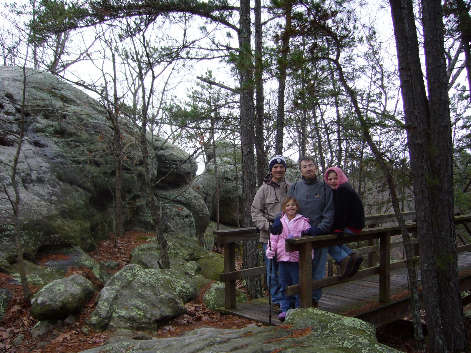
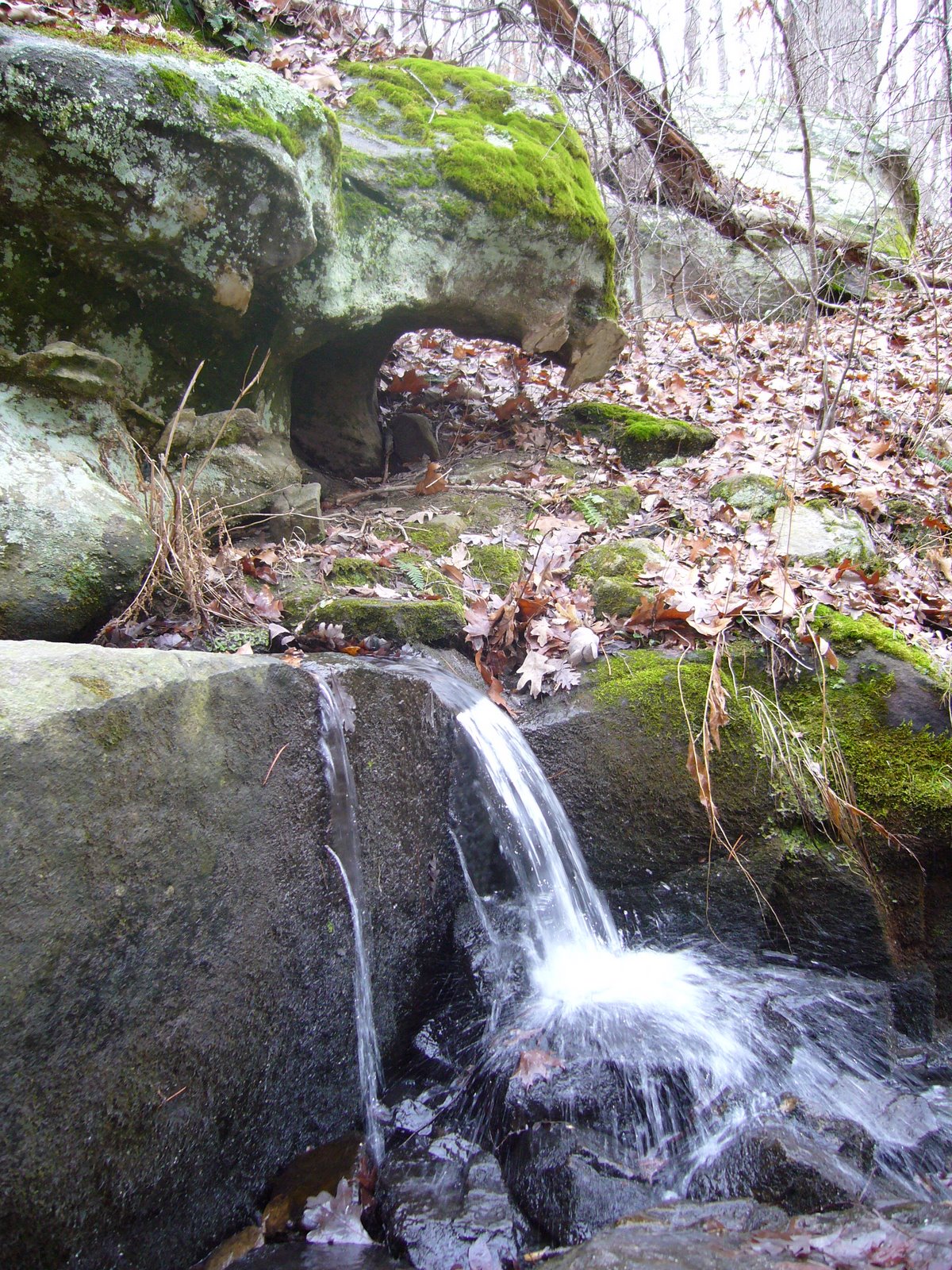
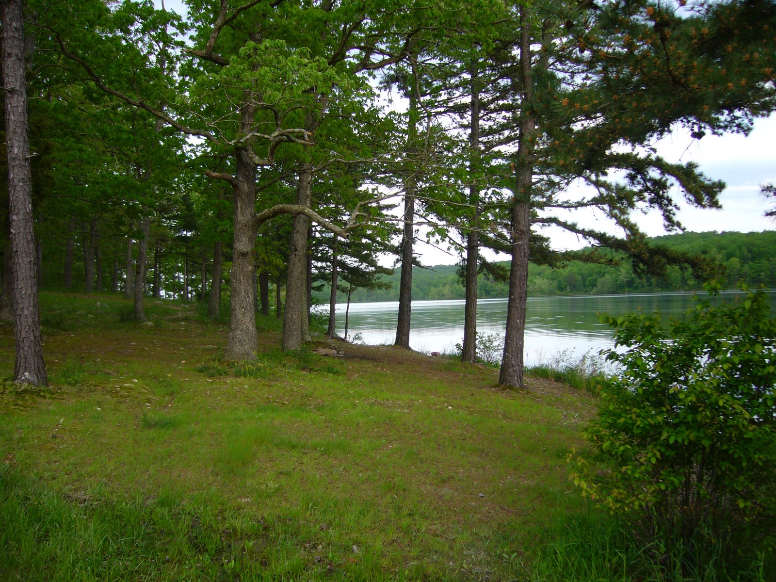
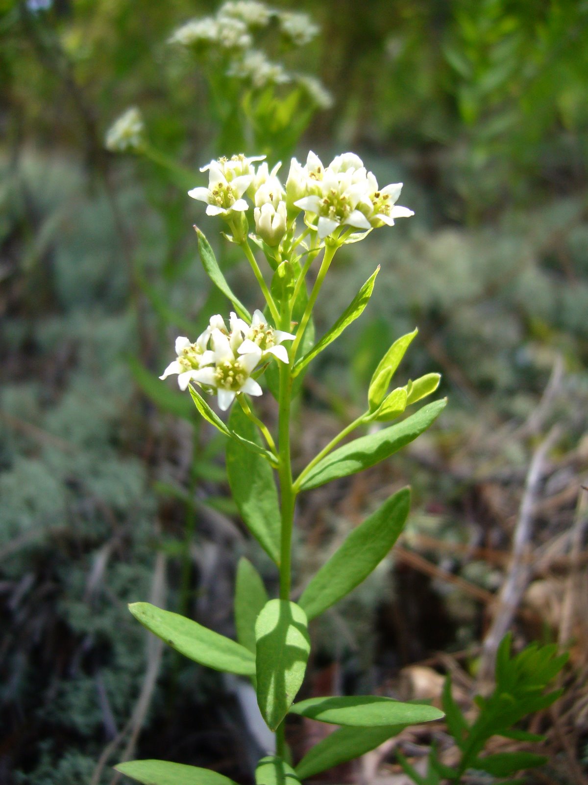
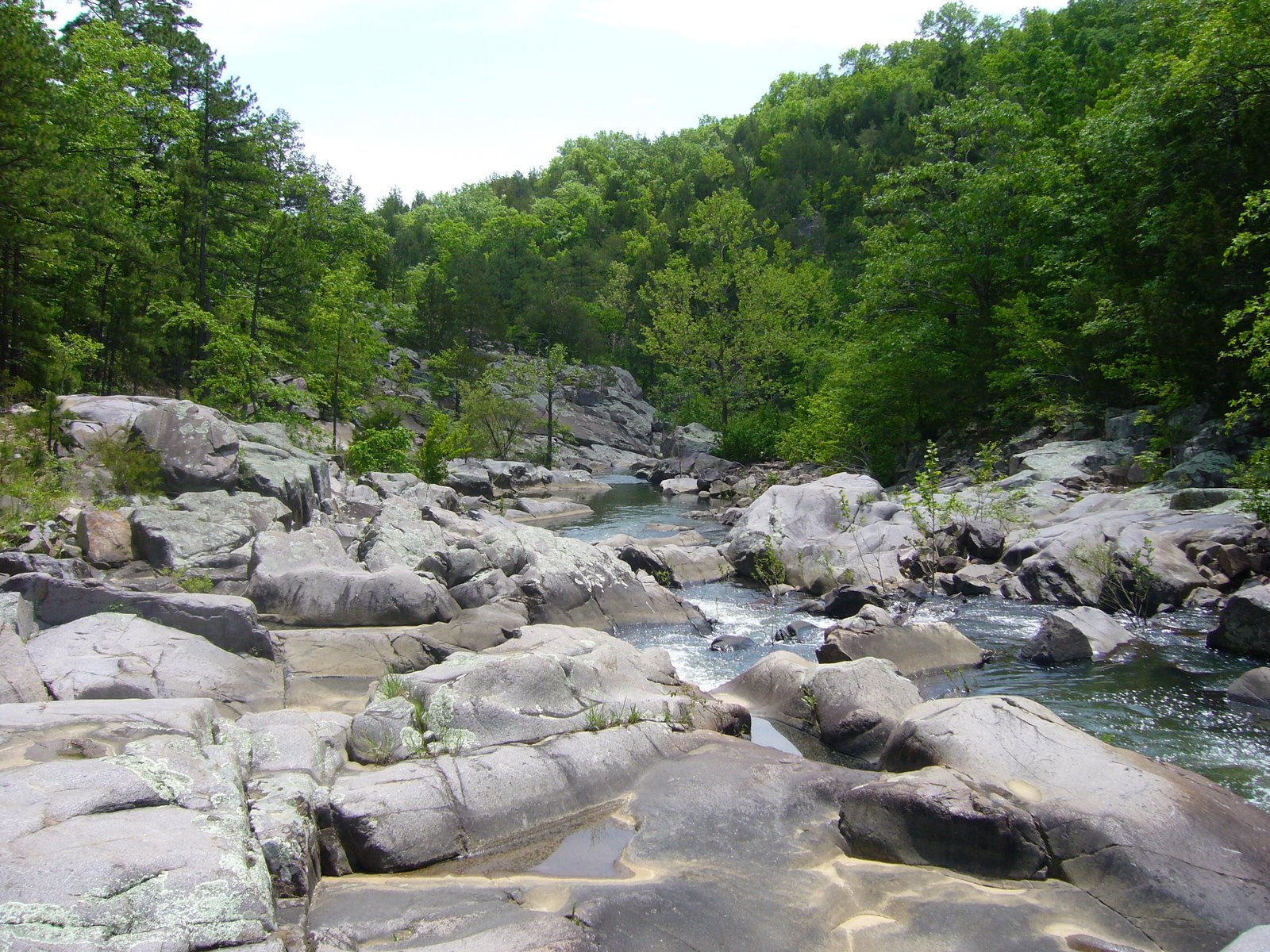
Two days ago, the WGNSS Botany Group met in the Visitor Center parking lot on a not-as-cold and not-as-cloudy day compared to previous days with the plan to walk the Natural Wonders Trail—a relatively easy 1.3-mile loop that features mesic forest on north-facing slopes, dry forest and glades on the south-facing slopes, and a spring-fed creek that meanders through the riparian corridor below. The upland portions of the trail pass through Meramec Mosaic Natural Area, boasting an amazing diversity of natural communities and associated flora all in relatively close proximity.

North-facing dolomite bluff in dry-mesic deciduous upland forest supporting at least six species of ferns.

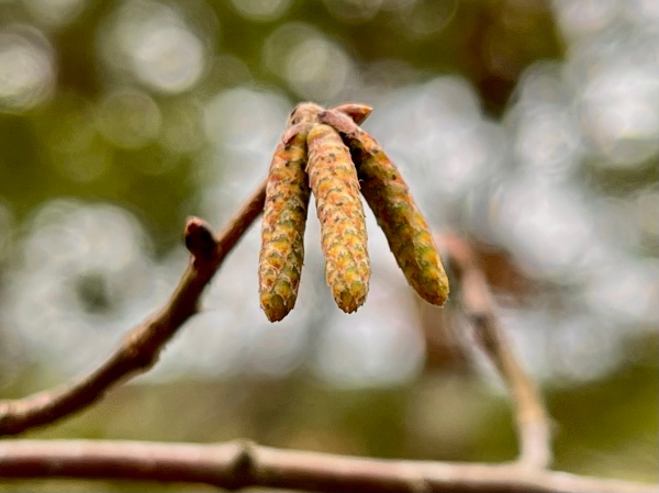
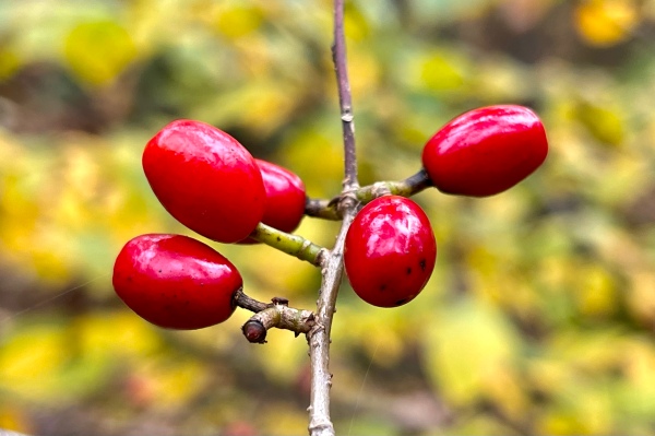
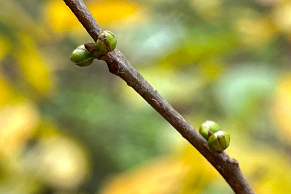
We walked clockwise around the loop, which took us up and out of the riparian forest onto the north-facing slopes. Lindera benzoin (spicebush) was abundant in the understory at the lower elevations, with male and female plants both being immediately recognizable—the former sporting noticeably swollen buds that will produce the male flowers in spring, and the latter still bearing many of their now-faded berries, their earlier bright red color lost to a dull purple-black. Two members of the Betulaceae were also seen commonly in the understory—Ostrya virginiana (hop hornbeam), with its hop-like fruit clusters and almost always adorned with rich-brown marcescent leaves, and Corylus americana (hazelnut) sporting distinctive hanging male catkins.

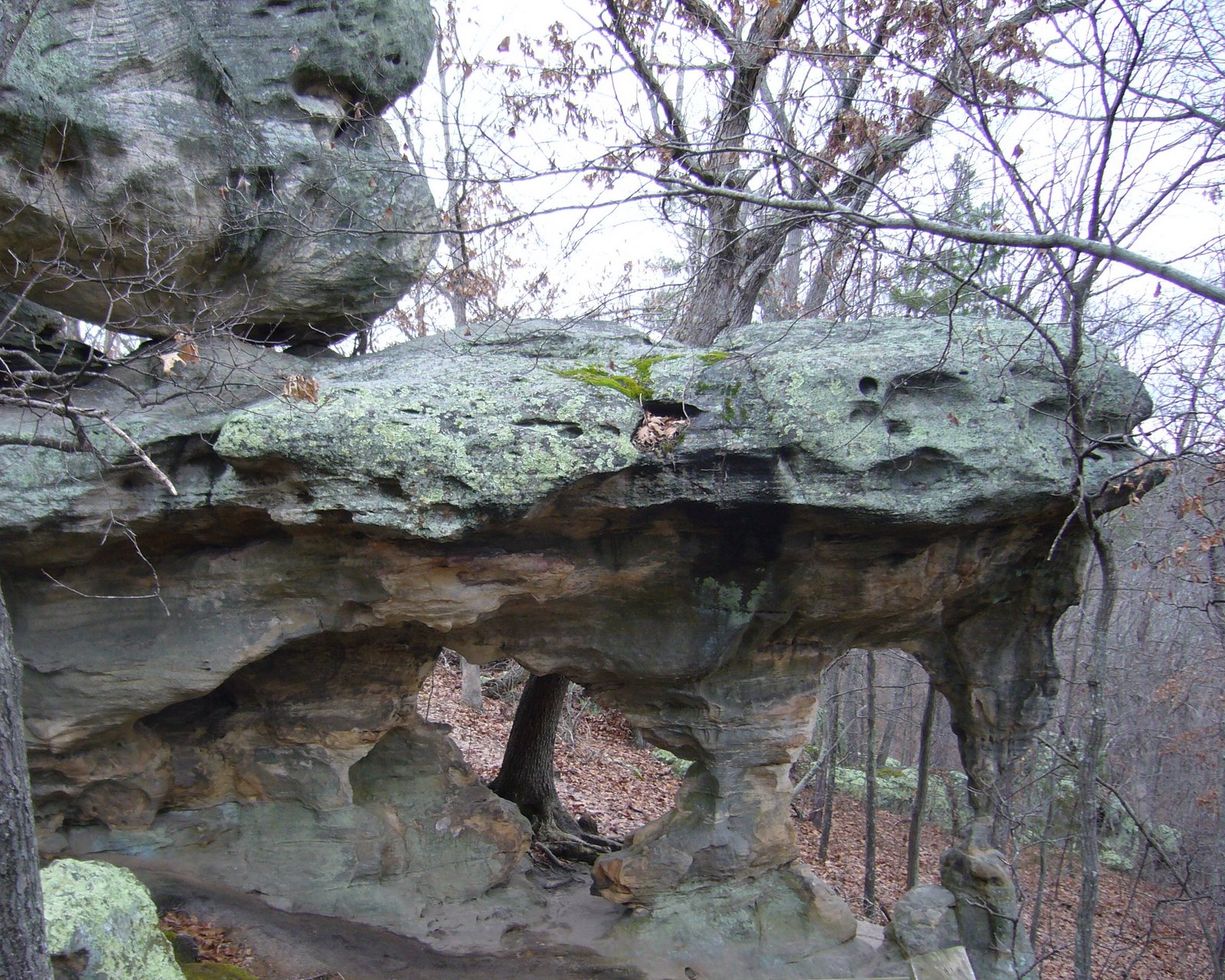
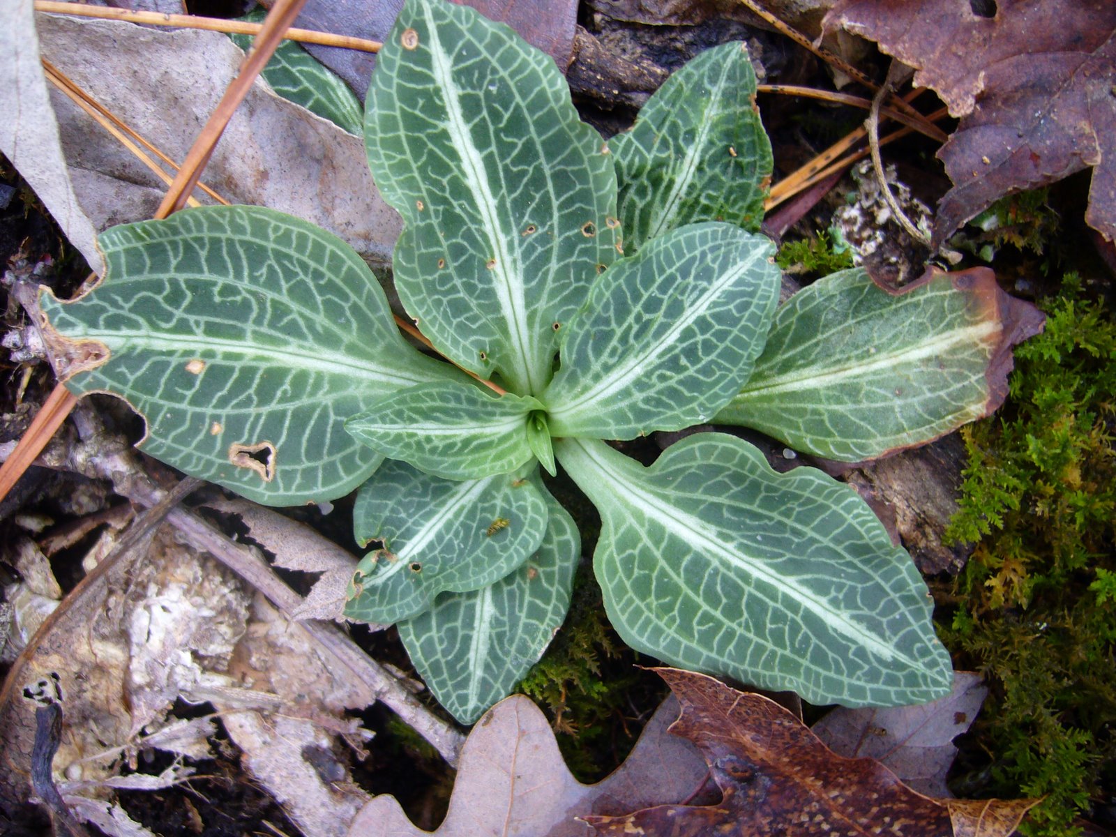
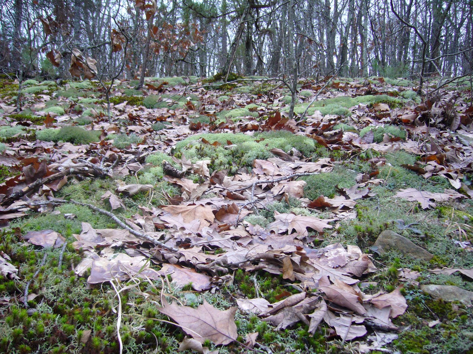
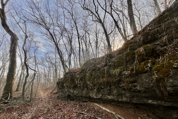
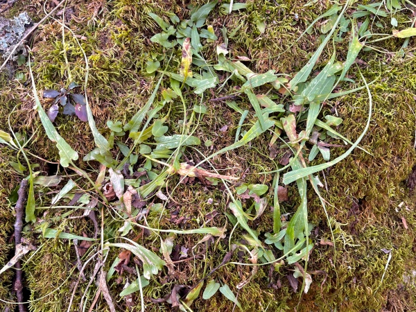
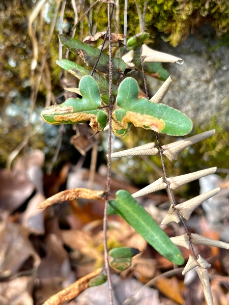
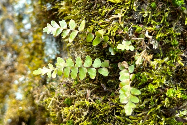
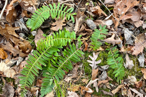
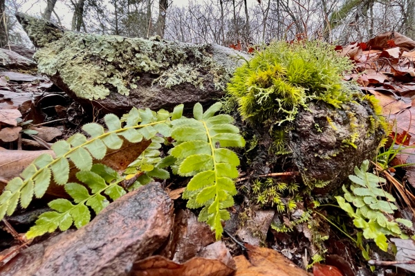
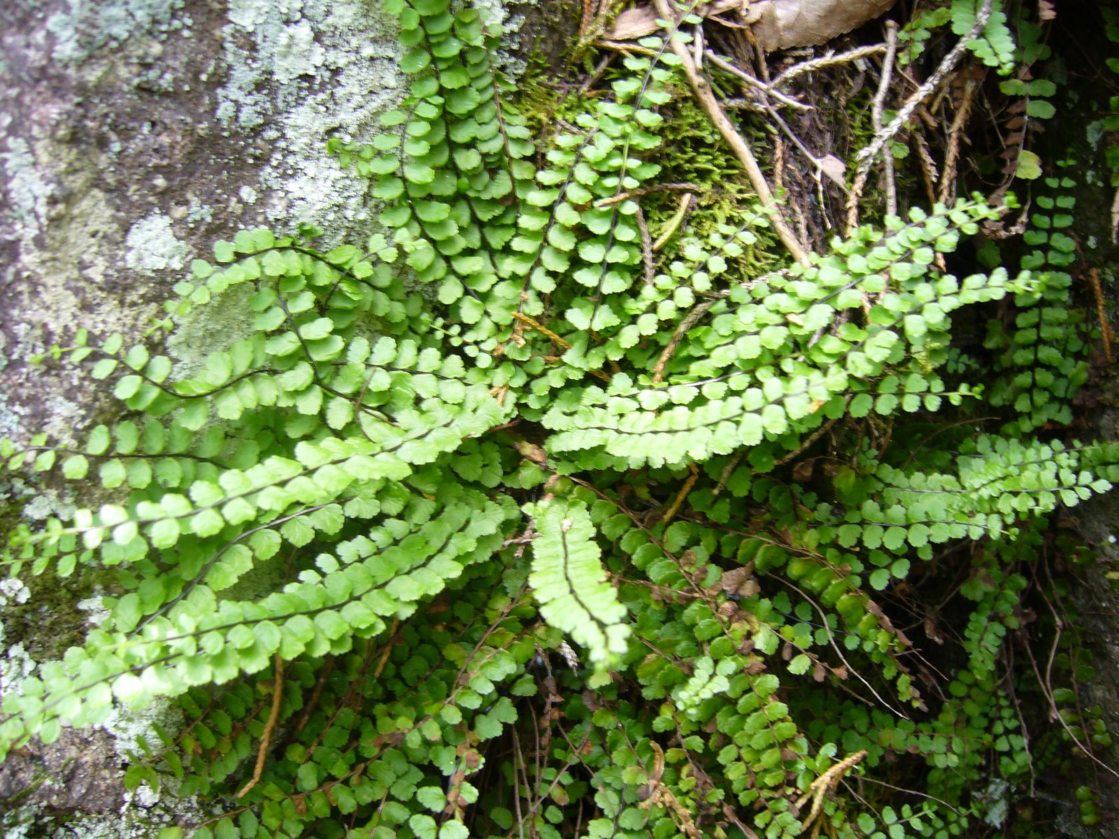
We had scarcely reached the upper slopes when we began noticing a diversity of green foliage—not from the numerous trees and shrubs, but rather from a variety of ferns, hangers-on from earlier times that continue to find niches within the woody-dominate community that now dominate the landscape. The first example seen was a single Sceptridium dissectum (cutleaf grape-fern), its leaf now in reddish-bronze winter dress. Shortly afterwards we began to see prominent outcrops of dolomite as we neared the north-facing bluffs, their surfaces thickly covered with mosses and providing a perfect situation for Asplenium rhizophyllum (American walking fern). The long, tapering leaves of this species root at their tips and give rise to new plantlets—an asexual method of reproduction that allows a single plant to quickly colonize an entire rock surface.

Sceptridium dissectum (cutleaf grape-fern) in dry-mesic deciduous upland forest.
Asplenium rhizophyllum (American walking fern) on north-facing dolomite bluff in dry-mesic deciduous upland forest.

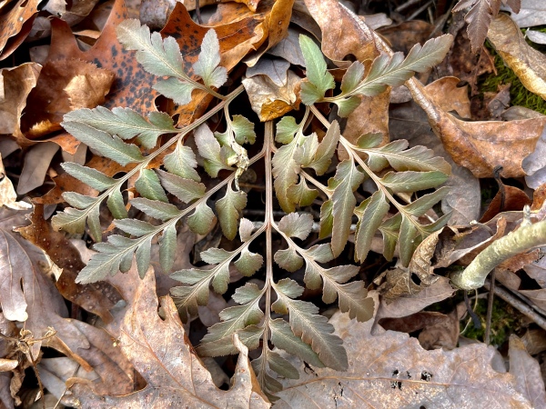
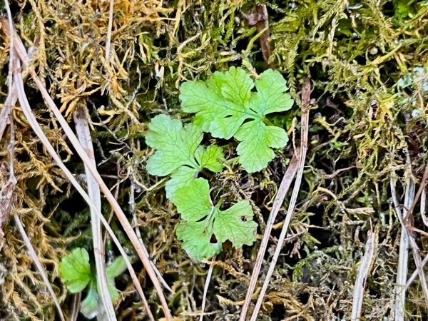
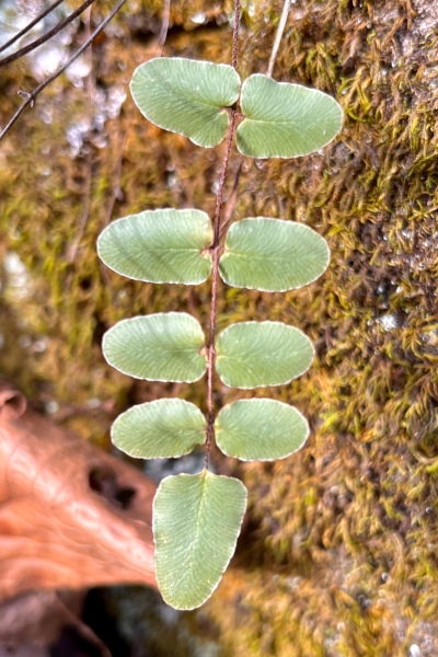
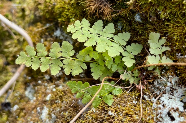
The bluff faces themselves provided the greatest diversity of ferns. An unusual species observed in abundance was Cystopteris bulbifera (bulblet fern, bulblet bladderfern, or bulblet fragile fern). Unlike many ferns, the fronds of this species turn completely brown during the winter (although a few small green plantlets of what may be this species were observed growing among them). It’s most notable feature, however, is the small “bulblets” that form on the underside of its leaves, providing the plant a most unusual method of asexual reproduction.

Winter foliage of Cystopteris bulbifera (bulblet fern, bulblet bladderfern, or bulblet fragile fern) on north-facing dolomite bluff in dry-mesic deciduous upland forest.
Possible plantlet of Cystopteris bulbifera (bulblet fern, bulblet bladderfern, or bulblet fragile fern) on north-facing dolomite bluff in dry-mesic deciduous upland forest.
Vegetative bulblet on winter foliage of Cystopteris bulbifera (bulblet fern, bulblet bladderfern, or bulblet fragile fern) on north-facing dolomite bluff in dry-mesic deciduous upland forest.

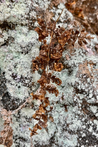
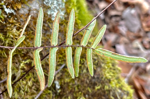
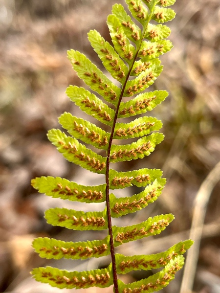
Two Pellaea spp. (cliffbrake) we’re found as well growing from crevices on the bluff face: P. atropurpurea (purple-stem cliffbrake or purple cliffbrake) and the more uncommonly encountered P. glabella (smooth cliffbrake). In some cases the plants were growing very near each other, allowing the group an opportunity to compare and contrast. Pellaea atropurpurea is distinctive in both habit and appearance, with fertile leaflets narrowly elongate—sporangia arranged along the curled under margin and the sterile leaflets broader and “T-shaped” at the base. In addition to its dimorphic leaves, the distinctly pubescent, purplish-brown rachis separates it from P. glabella. The latter species can be found scattered throughout the Ozarks and a few northern counties and is less likely to be seen growing in soil as opposed to exposed rock.

Pellaea atropurpurea (purple-stem cliffbrake or purple cliffbrake) on north-facing dolomite bluff in dry-mesic deciduous upland forest.
Underside of fertile frond of Pellaea atropurpurea (purple-stem cliffbrake or purple cliffbrake) on north-facing dolomite bluff in dry-mesic deciduous upland forest.
Pellaea glabella (smooth cliffbrake) on north-facing dolomite bluff in dry-mesic deciduous upland forest.

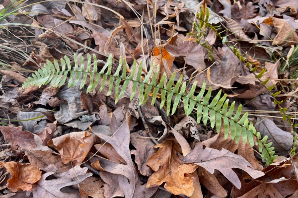
Two more species of Asplenium were found as we continued to examine the moss-covered rock exposures, one being the commonly encountered A. platyneuron (ebony spleenwort or brownstem spleenwort)—distinctive by its purple-brown rachis and “offset” pinnae with asymmetrical basal lobes, and an as-yet-undetermined species provisionally assigned to this genus. We would see additional examples of A. platyneuron away from the rock faces growing in the soil—their fertile fronds tending to grow more erect than the sterile fronds. This same habit was seen in the eighth and final fern of the day, the very common Polystichum acrostichoides (Christmas fern) which we encountered regularly in more mesic areas of the forest floor.

Asplenium platyneuron (ebony spleenwort or brownstem spleenwort) on north-facing dolomite bluff in dry-mesic deciduous upland forest.
Fertile frond of Asplenium platyneuron (ebony spleenwort or brownstem spleenwort) on north-facing dolomite bluff in dry-mesic deciduous upland forest.
Fertile frond underside of Asplenium platyneuron (ebony spleenwort or brownstem spleenwort) on north-facing dolomite bluff in dry-mesic deciduous upland forest.
Asplenium sp. (spleenwort) on north-facing dolomite bluff in dry-mesic deciduous upland forest.
Sterile fronds of Polystichum acrostichoides (Christmas fern) on north-facing dolomite bluff in dry-mesic deciduous upland forest.

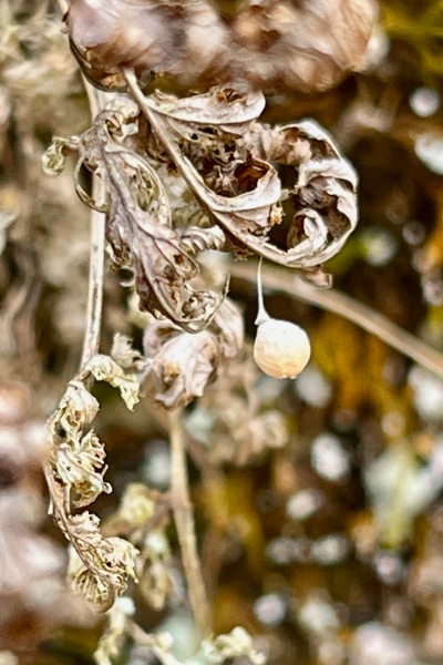
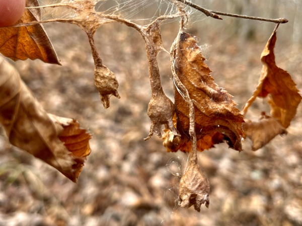
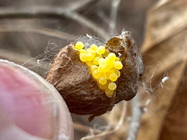
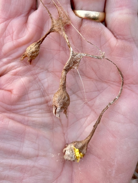
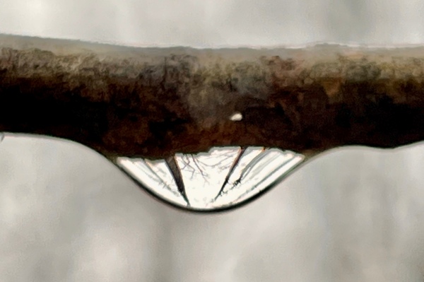
Despite the botanical focus of the walk, we are all naturalists at heart and quick to notice anything that piques our natural history curiosity, regardless of what kingdom of life it pertains to, and when John called out, “Okay Ted, here’s a quiz for you,” I suspected my entomological skills would be put to the test. What he’d found were three strange-looking structures hanging from a small Ostrya sapling that would have, to anybody less-observant, been passed off as some plant fruiting structure. Of course, we knew that Ostrya fruits bore no resemblance to these structures, and when we noticed they were connected to each other and had apparently been “tied” to the twig by some sort of insect, we then guessed they may have been the fruiting structures of an as yet unidentified herbaceous plant or vine. That idea was quickly dispelled, however, when cutting into one of the structures revealed it was filled with bright yellow spheres that I can only surmise to be lepidopteran eggs, with the structures themselves and their attachments to the twig consisting of the silk that many caterpillars use to construct cocoons in which to pupate. Could these be the eggs of an usual type of bagworm moth, the females of which are typically wingless and larvicida and remain in their cocoon after emergence, where they mate, lay eggs, and die? The structures and their egg-like contents, at this point, remain a mystery, but I did collect them and am attempting to hatch the “eggs” (if that is what they are) in an effort to gain further clues about their identity.

Unknown structures tied to a sapling Ostrya virginiana (hop hornbeam) in dry-mesic deciduous upland forest.
Cutting into the structure revealed what must be eggs, possibly lepidopteran.
The structures were tied together along but independent the tree branch.

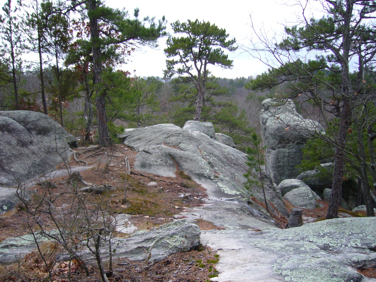
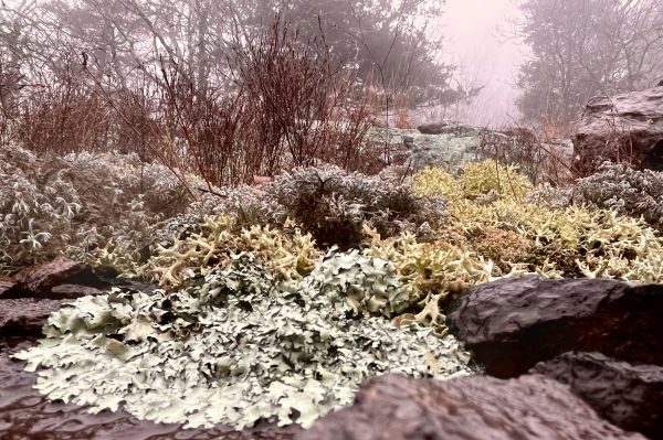
Turning back to the east the forest changed dramatically. The tall canopy of mesic-loving hardwoods such as Quercus alba (white oak) and Acer saccharum (sugar maple) gave way to a shorter, more open canopy of trees preferring dry to xeric conditions such as Q. muhlenbergii (chinquapin oak), Rhamnus caroliniana (Carolina buckthorn), and Sideroxylon lanuginosum (wooly buckthorn or gum bumelia). Entomologist that I am, I couldn’t resist the chance to check the ground around the bases of the trunks of each of the latter, hoping to see evidence of larval activity by the spectacular and highly host-specific Plinthocoelium suaveolens (bumelia borer), but no such evidence was seen. At one point, the dry oak woodland yielded to a bona fide dolomite glade (more properly called “xeric dolomite prairie”), with evidence of mechanical removal of woody plants and prescribed burns serving as testament to dedicated management practices intended to restore and preserve the original character of the glade by park management.

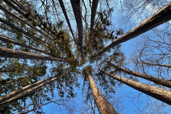
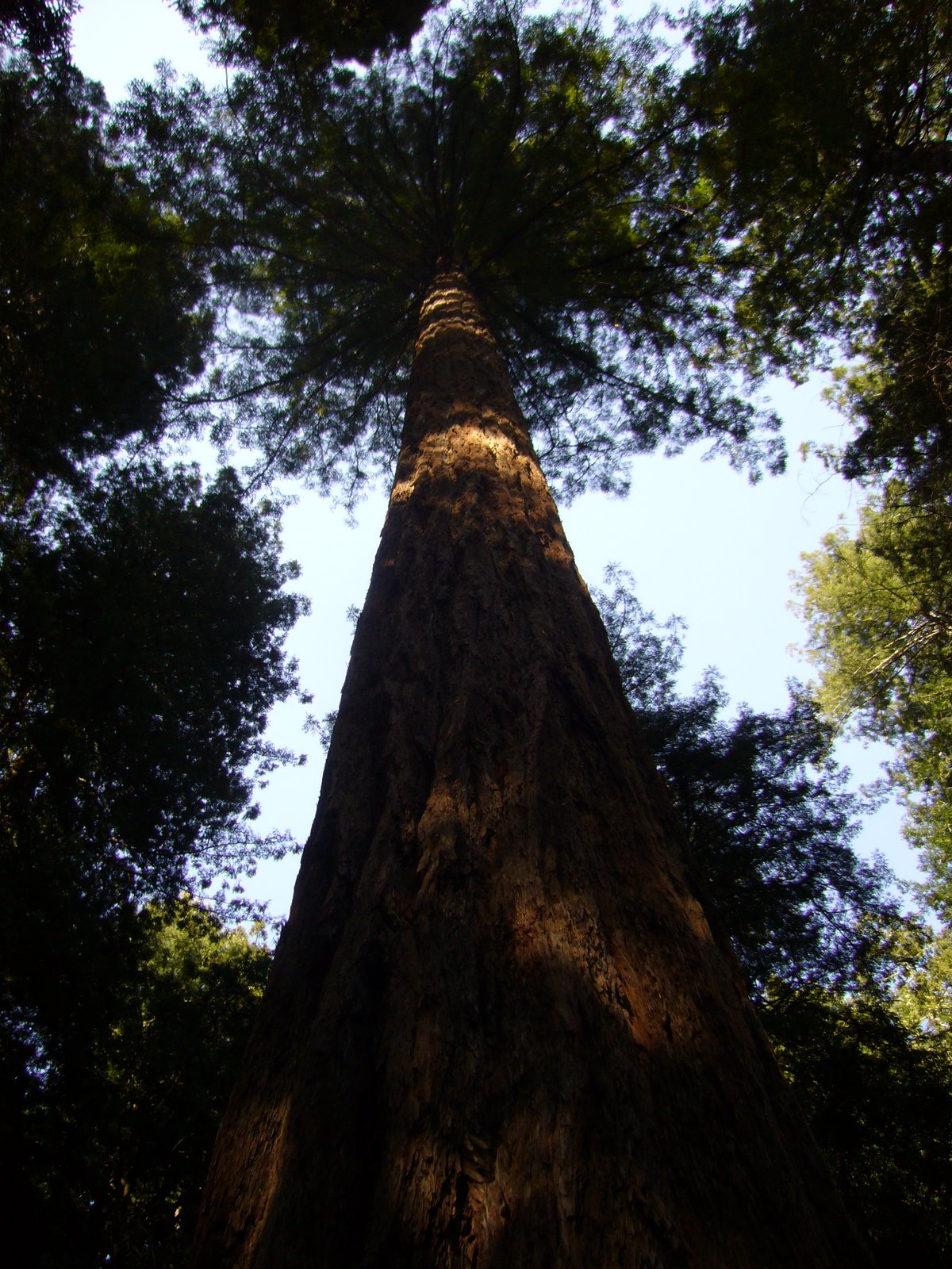
The final stretch led back down into the valley, where a disturbing amount of Lonicera japonica (Japanese honeysuckle) was observed on the forest floor and growing up the smaller trees. A grove of Pinus echinata (shortleaf pine), apparently planted some time ago, looked oddly out of place given the dolomitic substrate in the area but did provide an opportunity for dramatic up views. After regrouping in the parking lot (and remarking on what a “fern-tastic” walk it had been), a number of participants caravanned to Clark Street Cade and Bakery in nearby Sullivan for a welcome resumption of the traditional post-walk lunch.

Grove of planted Pinus echinata (shortleaf pine) in dry-mesic deciduous upland forest.

©️ Ted C. MacRae 2022

Rain on Russell Mountain

Hiking buddy Rich and I have already hiked the entirety of the Ozark Trail, doing so in 5–15 mile segments from 1996 through 2015. Since then, we have been redoing some other the segments in the reverse direction from the first time, the eventual goal thus being to hike the entirety of the Ozark Trail in both directions. Today was a small contribution to that goal, in which we did the short section between the fire tower at Taum Sauk State Park (containing Missouri’s highest point at 1,772’ asl) and Russell Mountain.

Raindrop prism.

The forecast was not promising, with steady rain predicted and temperatures remaining in the 30s. Still, Rich and I are not prone to cancelling a hike due to less than ideal conditions, so we arrived at Taum Sauk Mountain mid-morning despite the periodic rain and decided to give it a go. It was a good decision—our rain jackets and warm underlayers kept us confortable, and we were rewarded for our tenacity with an serenely beautiful look at the craggy, water-soaked landscape.

Young Polystichum acrostichoides (Christmas fern), Flavoparmelia baltimorensis (rock greenshield lichen), a fruticose lichen, and Polytrichum commune (common haircap moss) in dry-mesic upland deciduous igneous forest.

It was slow going as we both forgot our hiking sticks, forcing us to more deliberately choose our footing on the rugged, rocky, boulder-strewn trail. Normally on a winter hike, it is the buds, bark, and remnant leaves that I pay attention to as I strive to identify the component trees comprising the forest around me. Today, however, with intermittent light rain, heavy moisture-laden air, and our eyes mostly looking downward to choose our next footstep, it was the ferns, mosses, and lichens—bright green and water-swollen—that captured our attention.

Closeup of Polytrichum commune (common haircap moss) and a fruticose lichen from previous photo.

Polystichum acrostichoides (Christmas fern) dotted the forest floor and along the trail. Most of the plants we saw were older, their fronds and pinnae ragged and tattered. A young individual, however, captured our eye, partly because of its fresh, bright green foliage and partly because of the close association with Polytrichum commune (common haircap moss), Flavoparmelia baltimorensis (rock greenshield lichen), and an unidentified fruticose lichen—a natural mini-terrarium.

Closeup of young Polystichum acrostichoides (Christmas fern) from previous photo.

Further along the trail, a patch of Thuidium delicatulum (delicate fern moss) was found thriving in the cold, wet conditions. As the name suggests, the leaves of this moss resemble the fronds of a small fern but form colonial mats rather than arising from a basal rosette as in true ferns. Wet conditions such as existed today are ideal for seeing this moss in its most attractive state—under dry conditions, the leaves are more appressed and contracted against the central stems.

Thuidium delicatulum (delicate fern moss) growing trailside in dry-mesic upland deciduous igneous forest.

As we descended the hillside, running water could be heard in the distance, suggesting we would be treated to the sight of a waterfall. At the bottom, the normally dry creek ran full, water crashing over the rhyolite boulders strewn further up the ravine and gushing down below us. Some careful footwork was required to scale the hillside off-trail to reach the water’s edge and get a closeup and personal view, but experience made the careful footwork down the hillside and back up well worth the effort.

Rain-swollen creek.

Approaching the glades on Russell Mountain, the diversity of conspicuously green lichens and mosses immediately caught our attention. The normally xeric landscape was lush and moist—water pooling in depressions of the exposed rhyolite bedrock and stream over its slopes in sheets. Beds of Polytrichum commune (common haircap moss) colonized the edges of exposed bedrock, forming extensive mats of turgid, bright green, bristly vertical stems that looked like miniature primordial forests. Like Thuidium delicatulum (delicate fern moss), this moss also is more attractive when moist, its leaves widely spreading and straight, while in dry conditions they are erect with their tips often recurved.

Polytrichum commune (common haircap moss) on exposed rhyolite in the glade.

The final leg of the hike took us through the scenic rhyolite glades (more properly called xeric rhyolite prairie) between the Ozark Trail and the Russell Mountain Trailhead. Normally, the glades are a harsh habitat—dry grasses crackling underfoot amid the searing heat and the surrounding forest of Quercus shumardii (Shumard’s oak) and Carya ovata (shagbark hickory) stunted and open. Today, however, dense fog, heavy air, and water running over every surface made the glade seem mysteriously soft and gentle.

Fog settles over the glade.

The exposed rhyolite bedrock here represents remnants of volcanic rock formed 1.5 billion years ago. Representing one of the oldest continuously exposed landforms in North America, these craggy hills are but mere nubs of mountains that soared 15,000 feet above the salty Cambrian waters that lapped at their feet. It is only reasonable that these ancient rocks should be so heavily colonized by lichens—ancient life forms themselves resulting from a symbiotic association between fungi and a photosynthetic partner, usually algae or cyanobacteria (blue-green algae).

Exposed rhyolite heavily colonized by foliose and fruticose lichens and mosses.

Like the previously seen mosses, rain brings out the best in lichen attractiveness—their hydrated tissues at their brightest and most colorful. A number of fruticose and foliose lichens can be found intermingling in the exposed rhyolite surfaces, with Flavoparmelia baltimorensis (rock greenshield lichen) being one of the most conspicuous examples of the latter.

Foliose and fruticose lichens, including Flavoparmelia baltimorensis (rock greenshield lichen) in the foreground, co-mingle on the exposed rhyolite.

©️ Ted C. MacRae 2021

Botanizing at Castlewood State Park

Fall color was the goal of today’s Webster Groves Nature Study Society (WGNSS) Botany Group field trip, and Castlewood State Park—with its breathtaking bluff-top views over the Meramec River Valley—is as good a place to see the autumn spectacle as any. It was a well-attended group despite the cool temps, blustery winds, and hint of moisture in the air, likely helped by the park’s closer-than-usual proximity to St. Louis.

Meramec River viewed from Lone Wolf Trail Overlook.

The group decided to hike the Lone Wolf Trail, which traverses both dry forest along the bluffs and riparian forest along Kiefer Creek. We got the climbing out of the way quickly by making the long, steep ascent up to the bluffs from the parking lot—giving ample opportunity for all to make it up before exploring the bluffs. John pointed out a small tree with developing male catkins that identified it as Ostrya virginiana (hop hornbeam). The catkins will remain closed through the winter and flower next spring. Ostrya (pronounced “oh-STRY-uh”) bark is usually vertically striate (pronounced “STRY-ate”), but the bark on this tree was still relatively smooth—a “non-striate Ostrya”!

Male catkins of Ostrya virginiana (hop hornbeam).

Reaching the wooden deck overlooking the Meramec River Valley, the size of our group apparently intimidated three youngsters that were on the deck, and they quickly yielded way. The expected fall colors had not yet materialized, leading some to engage in what seems to be an annual tradition of debating whether this year’s colors are abnormally late. While at the deck and walking further along the trail from it, debates centered mostly around distinguishing the various oaks and hickories. Fallen (squirrel-clipped?) twigs from one of the large oaks exhibited large, fuzzy, quadrangular buds typical of Quercus velutina (black oak), but the leaves had usually deep sinuses. After consulting a Missouri oaks field guide, we decided they must represent Q. velutina despite the atypical leaves. Close examination of the hickories with magnification revealed distinct pubescence on the buds and petioles, suggesting Carya texana (black hickory).

The WGNSS Botany Group takes in the view from the Lone Wolf Trail Overlook.

There was little still remaining in bloom along the bluffs, and what was still in bloom was in pretty rough shape. We found two blue fall asters near each other, but a closer look revealed that they were actually two different species—Symphyotrichum turbinellum (prairie aster), distinguished by its vase-shaped involucre and branchy growth with simple leaves, and Symphyotrichum patens (creeping aster), recognizable at once by its basally clasping leaves. Another fall aster without blooms caused some debate—the recurved phyllaries of the involucre and chordate lower leaves suggested Symphyotrichum anomalum (manyray aster), but the toothed leaf edges suggested something else. Without a flower to see the color, it was suggested it could be an “anomalous anomalum.” Otherwise, only the occasional, scraggly Solidago ulmifolia (elm-leaf goldenrod) completed the list of still-barely-blooming plants along the bluffs.

Acalypha virginca (Virginia copperleaf) provides the forest floor with subtle fall color.

Descending from the bluffs along a north-facing slope and more mesic conditions provided much more color than along the bluff. Patches of Asimina triloba (pawpaw)—their large, simple leaves now vivid yellow, brightened the understory, while the ubiquitous Acer saccharum (sugar maple) lifted the yellows higher into the canopy. Only the giant oaks, mostly Q. alba (white oak) and the aforementioned Q. velutina soared above the maples, their great height no doubt a result of rich, deep soils on the north-facing slope. On the ground below, a multitude of ferns colonized the moister areas, with three species found growing side-by-side: Adiantum pedatum (northern maidenhair fern), Phegopteris hexagonoptera (broad beech fern), and Polystichum acrostichoides (Christmas fern).

Apioperdon pyriforme (pear-shaped puffball, stump puffball) on dead oak trunk base.

Fall color was not restricted to the leaves of the trees—fruits also provided dazzling points of color. Cornus florida (flowering dogwood) and Lindera benzoin (spicebush) both sported bright red berries similar enough in appearance to each other that close examination was required to distinguish those that had fallen to the ground. The former is synecious (i.e., all flowers bisexual), thus, all individuals can bear fruit. The latter, however, is dioecious (i.e., some individuals bear only male flowers, while others bear only female flowers); thus, only female trees produce the red berries. Comparing male versus female trees provided a chance to compare also the now-developing flower buds that will be among the first to open of any plant next spring. Since male plants tend to flower earlier than females, their flower buds were observed to be ever so slightly larger and further developed than those on female plants.

Lindera benzoin (spicebush) female fruits.
Lindera benzoin (spicebush) female flower buds.
Lindera benzoin (spicebush) male flower buds.

Along Kiefer Creek, flowers were limited to the occasional Campanula americana (tall bellflower) until we came upon a small area where a few late-blooming and very short-stemmed Rudbeckia hirta (black-eyed Susan) were found (regrowth?), but the remnants of green garden netting found around them indicated that they might have been planted. Definitely native in the same area, however, were a few still-flowering Eupatorium serotinum (late boneset) plants, a couple of which were found to be hosting a small, dark blue and yellow striped caterpillar. Neither of the two entomologists present knew what it was, although both had suggestions, but a little bit of sleuthing revealed them to be the larval stage of Haploa clymene (clymene moth), one of the tiger moths (subfamily Arctiinae) and known to feed on Eupatorium.

An unusually short-stemmed Rudbeckia hirta (black-eyed Susan).
Haploa clymene (clymene moth) caterpillar on Eupatorium serotinum (late boneset). Species ID based on host.

After returning to the parking lot and chatting with the group, I went back to the Eupatorium plants to take additional photographs of the Haploa clymene caterpillars with the big camera (look for those in a future post). On the way back to the car, I found a small snail actively crawling over the trail surface—its body fully stretched and antennae fully extended. I couldn’t resist putting the iPhone to the test to see if it could capture good photos of this small snail, and both the lateral and head-on shots were more than adequate. iNaturalist identifies it as a species in the genus Ventridens (dome snail), a member of the family Zonitidae (true glass snails).

Ventridens sp. (dome snail) on trail through mesic riparian deciduous forest.

©️ Ted C MacRae 2021

Ozark Trail – Marble Creek Section

If you know wilderness in the way that you know love, you would be unwilling to let it go…. This is the story of our past and it will be the story of our future. – Terry Tempest Williams


During the past several years that Rich and I have been hiking the Ozark Trail, most of our hikes have taken place in the fall and winter months. From a hiker’s perspective, I really enjoy these off-season hikes – the foliage-free canopy affords unobstructed views of the terrain and vistas, the cool (even cold) temperatures are more comfortable under exertion (provided one has properly layered), and there are no mosquitos to swat, ticks to pick, or gnats to incessantly annoy. I also enjoy them as a naturalist, for the world is quiet and still, allowing me to focus on things I may not notice amidst the cacophany of life during the warmer months. By the end of winter, however, the biologist in me yearns to once again see bugs and flowers and the great interplay of life. Unfortunately, this makes something as simple as hiking from point A to point B rather difficult – too many distractions! Nevertheless, each spring Rich and I try to hike a small leg of the Ozark Trail before the crush of summer activities fills our calenders. Last week, we chose the Marble Creek Section, an orphan stretch (for the time being) in the rugged St. Francois Mountains that eventually will connect to the famed Taum Sauk Section. It would be our first return visit to the St. Francois Mountains since we first embarked on our goal to hike the entirety of the Ozark Trail.

The St. Francois Mountains are the geologic heart of the Ozark Highlands. Since their primordial birth 1.5 billion years ago, recurring cycles of erosion and deposition have worn them down and covered them up, only to see them reemerge once again as the younger rocks covering them were themselves stripped away. The Ozarks are an ancient landscape with ancient hills, and none are older than those of the St. Francois Mountains. It’s as if the Earth itself began in these mountains. We began our hike at Crane Lake, a clear, blue 100-acre lake built in the 1970s by the Youth Conservation Corps. The trail surrounding the lake was built in 1975 and is, in its own right, a National Recreation Trail. It meanders along the lakeshore and through hillside igneous glades and descends into a deep ravine below the dam where Crane Pond Creek cascades through spectacular rhyolite shut-ins. East of the lake the trail connects to the Ozark Trail proper and continues to Marble Creek campground. All told, we would be hiking a 9-mile stretch.

I knew we were in a special place almost from the beginning when I noticed a small flowering plant growing next to the trail under the mixed pine/oak canopy. I’m not a very good botanist, but I instantly recognized the plant as dwarf spiderwort (Tradescantia longipes), an Ozark endemic known from only a handful of counties in Missouri and Arkansas. I knew this only because I had just the night before read about this wonderful plant on Ozark Highlands of Missouri, a superb natural history blog focused on my beloved Ozarks. Reading about this lovely, diminutive member of the genus, I wondered if I might encounter it on my own hike the next day. As we searched off the trail and near the lakeshore we encountered dozens of the plants, each with one or two exquisite blue flowers. Our excitement at seeing a true Ozark endemic increased with each plant we encountered, giving us confidence that its future, at least in this area, appears secure. Of the numerous photographs I took, I share two that show its short, squat habit and filament-covered stamens. Eventually we decided we needed to move on – we had spent 20 minutes and only hiked 100 ft!

Looping around the south side of the lake, the trail traversed mesic to dry-mesic upland forest and afforded spectacular views of the lake and rugged north shore. The spring ephemerals had already come and gone, replaced by such classic woodland denizens as birdfoot violet (Viola pedata, pictured), fire pink (Silene virginica), cream wild indigo (Baptisia leucophaea), four-leaved milkweed (Asclepias quadrifolia), Pursh’s phacelia (Phacelia purshii), and shooting star (Dodecatheon meadia). Insect life was abundant, however, the only species seen in one of my chosen specialties, metallic wood boring beetles (family Buprestidae), were early spring species of Acmaeodera – pictured here is A. ornata on a dewberry (Rubus sp.) flower. This pretty little beetle occurs throughout eastern North America in early spring on a variety of flowers, where adults feed on pollen and mate. Eggs are laid on dead branches of certain hardwood trees, through which the larvae tunnel as they develop. Dry, dead wood contains little nutritional value, and the larvae cannot digest the cellulose. As a result, they eat considerable volumes of wood, extracting whatever nutrients they can for growth and ejecting the bulk as sawdust, which they pack tightly in their tunnels behind them. A year or more might be required before they have grown sufficiently to transform into the adult and emerge from the wood. A smaller relative, Acmaeodera tubulus, was also seen on flowers of native dwarf dandelion (Krigia biflora).

We stopped for lunch on a little point extending out towards the lake. The forest overstory was dominated by an open mixture of white oak (Quercus alba) and shortleaf pine (Pinus echinata). Thickets of highbush huckleberry (Vaccinium stramineum) and carpets of reindeer moss in the open areas belied the acidic nature of the igneous substrate. Stands of bastard toad flax (Comandra richardsiana) in full bloom were found at the tip’s dry, rocky tip. These interesting plants feed parasitically on neighboring plants, attaching to the roots of their hosts by means of their long, thin rhizomes. Resuming our hike, we descended down into a shaded, moist draw feeding the lake and saw a huge royal fern (Osmunda regalis var. spectabilis) bush. I had never seen this aptly named fern before, but it was immediately recognizeable by its large size (~5 ft in height) and presence of distinctive, fertile leaflets on some of its upper branches – a very striking and handsome fern, indeed. Nearby was a smaller, but no less attractive species of fern that I take to be marginal sheild fern (Dryopteris marginalis) – another species I have not seen before (or at least made the effort to notice).

Soon, we reached the dam and for the first time saw the spectacular rhyolite shut-ins. While perhaps not quite as impressive as the nearby and much more famous Johnson’s Shut-Ins, Rich and I nonetheless watched entranced as the water roared over the smooth igneous rock exposure, forming elegant cascades, rushing through narrow chutes, and swirling into small pools. Steep canyon walls rose sharply on each side of the shut-ins, as if standing guard. Clambering amidst the pines and cedars that cloaked them, we found this maidenhair spleenwort (Asplenium trichomanes) nestled within a crack on a vertical rock face under continuous deep shade. Reaching the top of the bluffs, we were greated by one of my favorite of all Ozark habitats – the igneous glade. Glades are natural island communities surrounded by a sea of forest. Their shallow, dry, rocky soil conditions support plants and animals more adapted to prairie or desert habitats. Specific communities are influenced by the type of rock below – igneous and sandstone substrates support lichens, mosses, and other acid soil-loving plants, while limestone and dolomite substrates support a more calcareous flora. The photo here shows the massive boulder outcroppings typical of igneous glades and their weather-resistant bedrock. We hoped to see a collared lizard (Crotaphytus collaris), perhaps Missouri’s finest saurian reptile, but today was not the day. We did, however, see adults of the beautiful and aptly named splendid tiger beetle (Cicindela splendida) sunning themselves on the bare rock surfaces – flashing brilliant green and clay-red. The adults we saw had spent the winter deep inside tunnels dug into the rocky soil the previous fall and were now looking for mates. Male tiger beetles grab females by the neck, their jagged, toothy jaws fitting precisely in grooves on the female neck designed specifically for such. As I looked upon this prairie island within the forest, I thought about how the St. Francois Mountains were once themselves islands. I realized the landscape we were exploring today was itself a fossil – with rhyolitic ‘islands’ amidst a ‘sea’ of cherty dolomite laid down a half billion years ago in the warm, tropical, Cambrian waters that surrounded the St. Francois Islands, by then already a billion years old themselves. Yes, the Earth itself seems to have begun here.

Leaving the glade and once again entering the acid pine forest, we came upon one of the most striking floral displays that either of us have ever witnessed – wild azalea (Rhododendron prinophyllum) in the midst of full bloom! I have known about several colonies of this plant for many years now but had only seen them at the very end of the bloom period, with just a few, pitiful, limply hanging flowers still attached. Today, the plants were absolutely dazzling. The blossoms were not only visually attractive, a deep pink color, but also unexpectedly fragrant. We stood amongst several specimen plants as tall as ourselves, taking picture after picture amidst the clovelike aroma wafting around us.

We checked our watches – we were now 3 hours into our hike and had traversed just 2 miles. Clearly, this was not a sustainable pace, so we put our heads down and focused on covering ground. Once leaving the vicinity of Crane Lake, the trail became rather difficult to follow – it obviously receives little use, and in one stretch some logging activities had obliterated the trail completely. Were it not for the sporadic pieces of orange flagging tape tied just within sight of the previous, we would not have know where to go. At one point, we got completely off-track and had to backtrack a full half mile before we found the proper trail. The day put our contour map reading skills to their greatest test yet. It was difficult and strenuous terrain, with steep up and down grades and few long ridgetop stretches until (thankfully) the final 2 miles, which terminated in a long descent (more thankfully) to Marble Creek Campground. Despite the difficulties in following the trail and our not bringing enough water, I would have to rank this section a close second to the Taum Sauk stretch for its ruggedness, spectacular vistas, and unique plant communities. Yes, the St. Francois Mountains are truly the heart of the Ozarks.

Muir Woods National Monument

This is the best tree-lovers monument that could possibly be found in all the forests of the world. – John Muir

Coastal redwood (Sequoia sempervirens) is the tallest type of tree in the world, with maximum recorded heights approaching 380 feet. This majestic conifer grows only along the Pacific Coast in a narrow strip from Monterey to Oregon. Most of the estimated 2 million acres of original redwood forest are now gone — victims of the saw! One of the small groves that managed to escape this fate due to its relative inaccessibility grows along Redwood Creek and adjacent slopes in what is now Muir Woods National Monument. At heights approaching 260 feet, the redwoods growing here are not the tallest to be found; however, their proximity to San Francisco (just 15 miles from the Golden Gate Bridge) makes them the most heavily viewed examples of this ancient tree. Lynne and I visited Muir Woods a few times in the 90’s after moving to Sacramento — today (3/20) was our first visit since then, and the first ever for Mollie and Madison. In addition to getting to see these marvelous trees once again, we were also treated to a spectacular display of spring wildflowers.

We began our hike on the main paved trail. This is where most visitors confine themselves during a visit to this place, so the picture here documents a rare sight — no people! I apologize for its lack of focus, a consequence of the limitations of my little point-and-shoot camera in the limited amount of light that makes it through these towering trees during late afternoon.

Standing beneath one of these trees and looking up is a lesson in insignificance — the feeling one gets looking straight up the trunk of one of these giants cannot be adequately captured on film (er… microchip).

We quickly tired of the crowds and decided to hike up the Ocean View Trail, which climbs quite steeply up the east side of the valley. This marvelous trail was nearly devoid of people, and we found ourselves winding through thick, dark, cool forest with numerous side ravines. The lower elevations of the trail were dominated by redwood trees and a spectacular array of spring wildflowers. Among the most common was California toothwort (Cardamine  californica [=Dentaria californica]), a member of the mustard family (Brassicaceae). I noticed that the leaves at the base of the plant were broad and oval, while those arising from the flower stalk were slender and lanceolate, often divided into 3 leaflets.

Wake robins (genus Trillium), belonging to the lily family (Liliaceae, sometimes separated into the lily-of-the-valley family, Convallariaceae), are among my favorite wildflowers. We soon noticed Western wake robin (Trillium ovatum) growing commonly in shaded areas along the trail. We were also seeing some purple-flowered wake robins — at first I thought they were a different species, but it soon became apparent that these were older Western wake robin flowers, which change color from white to purple as they age.

A little further up the trail we began encountering small patches of Mountain iris (Iris douglasiana, family Iridaceae). Flower color for this native species ranges from cream-white to lavender, but all of the flowers we saw were of the white variety.

We saw this fat Solomon’s seal (Maianthemum racemosum ssp. amplexicaule [=Smilacina racemosa var. amplexicaulis]) growing in one of the cool, moist, side ravines. This is another member of the Liliaceae (sometimes separated into the Convallariaceae). The large, oval leaves clasping around the distinct, unbranched stem were almost as attractive as the flowers, which apparently give rise to bright scarlet berries in the summer.

In the middle elevations the redwood forest transitioned to drier oak woodland containing a mixture of Douglas-fir (Pseudotsuga menziesii), Pacific madrone (Arbutus menziesii), bigleaf maple (Acer macrophyllum), and tan oak (Lithocarpus densiflorus). Some of the Douglas-firs were enormous.


Indian warrior (Pedicularis densiflora) is a member of the figwort family (Scrophulariaceae, sometimes separated into the Orobanchaceae). This plant, with its striking bright red flowers and finely divided, fern-like leaves, is a facultative parasite on the roots of other plants. Apparently, the genus name refers to an old superstition that sheep could become infested with lice if they ate this plant.


The juncture of the Ocean View Trail with the Lost Trail was closed, so we backtracked down the 1+ miles back to the main paved trail. By now it was fairly late in the afternoon, and the crowds had thinned considerably. Having gotten lots of good views of the giant trees, we began turning our attention downwards to the smaller understory flora. Ferns, of course, are a dominant component of this understory, especially along Redwood Creek. This large specimen may represent Western sword fern (Polystichum munitum) (family Dryopteridaceae), which can apparently be distinguished by small hilt-like projections from the base of the pinnae (leaflets), but I couldn’t get close enough to see for sure.


Abundant on the ground in the valley was redwood sorrell (Oxalis oregana), a member of the family Oxalidaceae. In places this plant covered the ground in thick carpets.


Among the more interesting plants we saw in the valley was California fetid adder’s tongue (Scoliopus bigelovii), yet another member of the Liliaceae or Convallariaceae. I wasn’t sure what this plant was at first, despite its highly distinctive, glossy, mottled foliage. We were too late to see the blooms, which apparently have a fetid odor to attract flies for pollination, but did find the maturing pods on their slender, drooping stems.


Close to the creek’s edge we saw this colony of horsetails (Equisetum sp.), primitive plants in the family Equisetaceae. Members of this group belong to one of the most ancient lineages of vascular plants, dating back to the Devonian period (416-359 million years ago). Their Paleozoic ancestors (Calamitaceae and Archaeocalamitaceae) were giants, reaching heights of 50 ft or more, and were major components of the Carboniferous swamplands. Along with lycopod trees (Lepidodendrales), they were important contributors to coal formation and, like the lycopods, became extinct by the mid-Permian (~270 million years ago). The genus Equisetum represents the only surviving descendants of this lineage. Unlike their extinct progenitors, these small, herbaceous plants rarely exceed 4 ft in height; however, they share many of the same characters such as articulate stems with microphylls arranged in whorls. Recent phylogenetic studies, using both molecular and morphological characters, suggest that horsetails, together with ferns, form a clade representing one of the three major lineages of vascular plants (Pryer et al. 2001).


Nearby we saw a patch of Giant wake robin (Trillium chloropetalum) in flower. These were taller than the California wake robins we saw on the slopes of the Ocean View Trail but similarly characterized by a whorl of 3 leaves and flowers composed of 3 erect petals. Mature flowers darken to a deep red purple, so it seems these plants had just begun flowering. Muir Woods appears to be a good place for observing a diversity of Convallariaceae!


Also along Redwood Creek we found this bigleaf maple (Acer macrophyllum) in full bloom. As its specific epithet suggests, this maple has the largest leaves of any member of the genus — in this example the newly-expanded leaves were distinctly purplish. The picture below shows the greenish-yellow flowers (petals inconspicuous) produced on long, pendulous racemes.


Interpretive signs along the paved main trail pointed out a redwood “family group,” formed by sprouts growing from the base of a larger tree. Eventually, the central “mother” tree died and decayed away, leaving a ring of offspring that mature into an enormous, characteristic circle of trees. This apparently also happens with other types of trees, though on a smaller scale, as demonstrated in this picture of an oak (Quercus sp.) family group.


As the day drew to a close we found ourselves back in the parking lot, where this California icon, a clump of Coast live oak (Quercus agrifolia), was spreading its wide, majestic crown from multiple, twisted trunks and gnarled branches.


Much too soon, it was time to leave this beautiful valley, but before heading back to Sacramento we stopped to take one last look down towards the valley and out to the Pacific Ocean from the Panoramic Highway.

Pickle Springs Natural Area

Pickle Springs Natural Area lies in Ste. Genevieve County, about an hour south of St. Louis. Like Hawn State Park, the geology of this area and its effect on the flora have resulted in a unique collection of geologic features and plants found in few other places. The Lamotte sandstone outcrops that dot the landscape were formed nearly half a billion years ago when sand deposited in an extensive maze of braided river channels was cemented and buried under younger layers of limestone and dolomite formed from deposits on the floors of ancient seas that covered the interior of the continent. Later, the periods of uplift that created the St. Francois Mountains and resulting erosion of overlying strata once again exposed the sandstones at the surface. Millions of years of water, ice, rain, wind, and plants have further shaped the exposed sandstones, creating fanstastic shapes and formations and cool, deep canyons. The weathered sandstone created acid soils which support many unique plants. During the ice ages, northern plants and animals moved into the area ahead of the advancing glaciers. Mammoths roamed the landscape grazing on the northern vegetation supported by the area’s acid soils. Eventually the ice retreated, and so did the mammoths. But many of the plants remained – able to hang on in the cool, moist canyons long after the mammoths that once roamed these canyons disappeared. Because of this unique concentration of rare plants and geologic features, the area has been designated a Missouri Natural Area and a National Natural Landmark.

Yesterday I hiked the aptly-named ‘Trail Through Time’ with my family. This 2-mile trail is one of the most “feature-packed” trails in the state, with something to look at around almost every bend. Almost immediately the trail leads to the Slot, the result of a vertical fracture in the Lamotte sandstone that was loosened by leaching and then widened by erosion. The unique partridge berry (Mitchella repens) was seen on the moist, vertical walls of the rock, growing among strange holes, pockets, and ridges that formed as a result of the sand grains being variably cemented.


A short distance from The Slot lie Cauliflower Rocks – large moundlike formations (also called hoodoos or rock pillars) formed from jointed or fractured sandstone that undergoes deep solutional weathering followed by erosion and weather-mediated shaping. Hoodoos occur primarily in this type of rock due to its granular, variably cemented and cross-bedded matrix.


On the south side of Cauliflower Rocks lies a special type of buttress arch called Double Arch. It occurs at almost a right angle to the adjacent rock outrcrops, suggesting formation along a set of fractures running perpendicular to the main fracture trend of the area, but the precise details of its formation remain a mystery.


After leaving Cauliflower Rocks the trail descends steeply into a deep valley, at the bottom of which lies Pickle Creek just below its origin in a box canyon south of the Natural Area. Lush vegetation in this cool, moist valley contrasts with the stark rocks seen earlier.


The creek is fed by a series of seeps, allowing the valley to remain moist even during the dry summer months, and along with the acid soils support a unique plant community. Lush colonies of ferns (I believe this is Polypodium virginianum L.) covered the rocks adjacent to the creek…


…while this rattlesnake plantain orchid (Goodyera pubescens) was seen in a colony growing at the base of a black oak tree (Quercus velutina) just above the creek.


Mosses and lichens were also abundant in the valley. This little hair cap moss (Polytrichum sp.) with its distinctive fruiting structures was growing in a colony at the base of another black oak tree. The members of this genus prefer acidic environments.


Further ahead, along Bone Creek, several colonies of wooly aphids (family Aphididae) were seen on the branches of a small hop hornbeam tree (Ostrya virginiana).


The highlight of the hike had to be in Spirit Canyon at Owl’s Den Bluff. The horizontal layers of sandstone, each deposited on the steep downstream slopes of sandbars, are clearly visible in the towering bluff face. At the bottom lie bluff shelters – formed where lower sandstone layers collapse due to weathering or leaching, and where native Americans almost surely camped out. The sun never reaches parts of these shelters, providing ideal conditions for a variety of mosses and liverworts – many of which are known only from this area. Fallen boulders and collapsed portions of the bluff face provided photo opps for the daring…


…and good exploring for the nimble.


By now, the trail has passed the halfway point and is looping back to the west, where it ascends to Dome Rock Overlook. Along the way, a fascinating variety of lichens, including reindeer lichen, covers the forest floor where they are supported by the acid soils.


Dome Rock Overlook is a the largest hoodoo complex in the Natural Area. The thin soils and exposed conditions create a harsh, dry, windswept environment that only the hardiest of plants can withstand. Only a few small blackjack oaks (Quercus marilandica), shortleaf pines (Pinus echinata), and farkleberry (Vaccinium arboreum) survive here. Despite their small size, some of the trees growing here are at least 150 years old.


The trail descends from Dome Rock Overlook and passes underneath, providing spectacular views of the sheer rock face below the overlook. The trail completes its descent back into Pickle Creek Valley, where Pickle Spring can be seen. This small, permanent spring – an unusual feature in sandstone where seeps are more common – was an important source of water for early settlers.


Further along the trail lies one of the areas most unusual features – Rockpile Canyon – formed some 50 years ago (a fraction of a second in geologic time) when part of a sandstone bluff collapsed in a rumble, leaving behind a sheer bluff face and a jumbled pile of large boulders. A short spur in the trail leads to the head of a small box canyon, where some of the 20+ ice age relict plant species can be seen growing in the acid soils and cool, moist canyon walls.

Near the end of the loop lies Piney Glade, an area where the exposed sandstone bedrock once again creates a dry, harsh environment. Poverty grass and little bluestem grow in small, shallow pockets of soil scattered amongst stunted shortleaf pines and blackjack oaks – creating a small prairie surrounded by a sea of forest. All three forms of lichens can be found on the rocks and soils of the glade – the aptly named crustose lichens cling tightly to rock surfaces amongst foliose (leafy) and fruticose (branched) lichens.