March has been incredibly warm in the St. Louis area, particularly during the second half in which temperatures exceeded 80°F on seven of 12 days and 90°F twice! As one would expect, such unusually warm conditions played havoc with the first wave of early spring bloomers, particularly the conspicuously flowering understory trees that normally follow a predictable sequence of bloom beginning with Lindera benzoin (spicebush—family Lauraceae) in early to mid-March, Prunus mexicana/americana (Mexican/American plum—family Rosaceae) and Amelanchier arborea (common serviceberry—family Rosaceae) in mid- to late March, Sassafras albidum (sassafras —family Lauraceae) and Cercis canadensis (eastern redbud—family Fabaceae) in late March to early April, and — the zenith of native blooming understory trees — Cornus florida (flowering dogwood—family Cornaceae) in early to mid-April. Instead of a tightly choreographed sequence of mass blooms, we instead witnessed haphazard displays beginning earlier than normal and progressing sporadically throughout late March, with many trees knocked out of bloom by quite cold temperatures during several nights.
Nevertheless, it was not the disappointing displays of any of the above species that the group came to Little Lost Creek to see, but instead a much less commonly encountered understory tree with even less conspicuous blossoms—Dirca palustris (eastern leatherwood). One of only two Missouri representatives of the Family Thymelaeaceae, commonly called “stringbarks,” this species is found in scattered locations across the Missouri Ozarks and has been found reliably blooming in early April along Little Lost Creek.
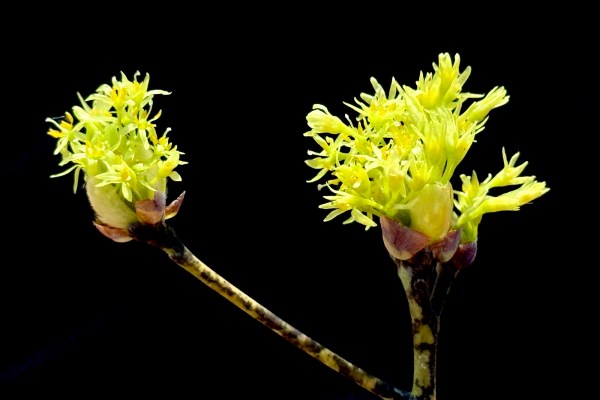
To get to the low, moist areas where D. palustris grows, however, we needed to hike the two-track across the old fields and rather disturbed adjacent forests where some of the more typical spring-flowering trees were seen. Sassafras was perhaps the least impacted by the crazy spring temperature, with most trees reliably in bloom.
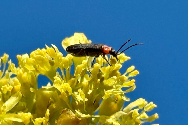
Ever the entomologist, I couldn’t help examining some of the flowers more closely in search of insects, eventually finding the aptly-named Ischnomera ruficollis (red-necked false blister beetle—family Oedemeridae), a frequent visitor to a variety of flowers.
Photo 3. Ischnomera ruficollis (red-necked false blister beetle) on flowers of Sassafras albidum (sassafras). Photo by Ted MacRae.
The patch of American plum along the two-track that I have seen blooming profusely in years past and had hope to photograph was, disappointingly, well past bloom. However, a fine specimen that I take to be Mexican plum was found blooming profusely along a fence line nearer to the beginning of the two-track. Mexican and American plums can be difficult to distinguish, but the former usually grows as anindividual tree while the latter tends to form clonal thickets with multiple stems arising from a single parental plant.
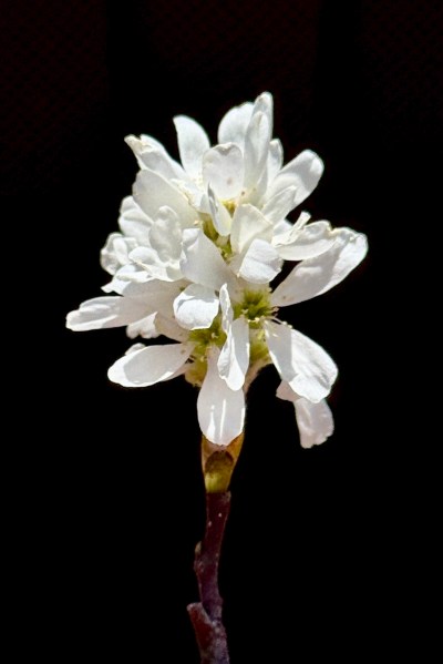
Serviceberry also should have been in bloom across the upland understory but was limited instead to just a few scattered trees still bearing flowers. One fine specimen, however, was found near the patch of American plum that was covered in near-perfect blossoms that simply begged to be photographed.
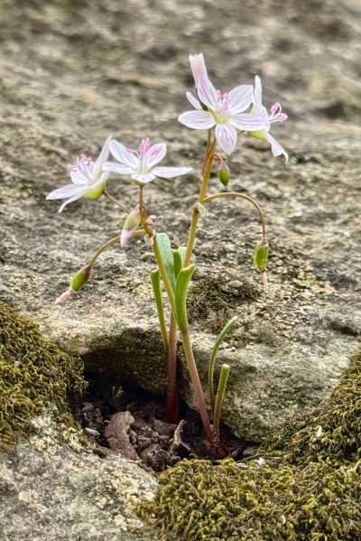
Veering into upland forests to approach the descent down into the valley, we saw some of the usual spring ephemerals and other plants that, despite not generally considered ephemerals, were nonetheless blooming quite early. Like the early-flowering trees, the spring ephemerals were impacted by the unusually warm March temperatures, with many of the species blooming far earlier than normal and now already fading despite the still-within-March date. Claytonia virginica (spring beauty—family Montiaceae, formerly Portulacaceae) is perhaps the best known ephemeral and, despite its commonness, is always a treat to see popping up in the woodlands after a long winter. The corolla color of this species is quite variable, with some being nearly white with barely perceptible venation, ranging to specimens with highly pronounced, vivid, pink venation.
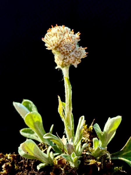
Antennaria parlinii (Parlin’s pussytoes—family Asteraceae), normally an April/May bloomer, also was in flower in the relatively dry, rocky forests before the descent into the valley. Missouri populations of this species were previously known as A. plantaginifolia, means “leaves of Plantain” and indeed the basal leaves do look like those of the genus Plantago—a character that distinguishes them from the single-veined leaves of Missouri’s only other species in the genus, A. neglecta (field pussytoes).
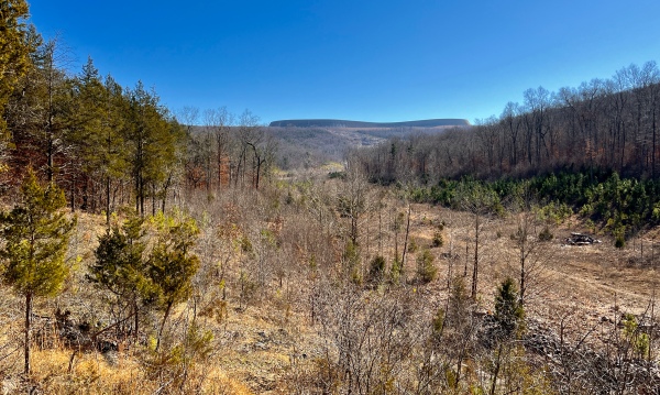
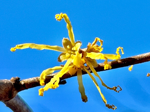
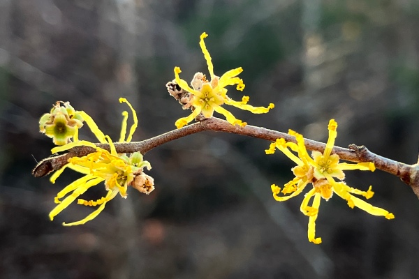
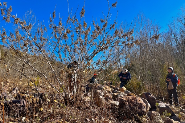
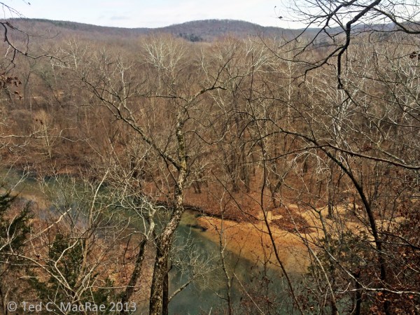
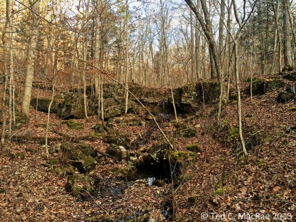
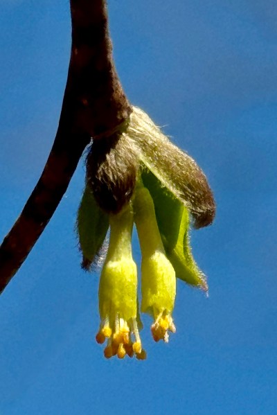
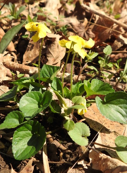
The descent into the valley is rather steep and precarious, especially for those of us who are “getting long in tooth” and needed to pick our way slowly down the rocky trail. The effort, however, was worth it as even before reaching the valley we began seeing leatherwood trees in bloom in the increasingly moist woodlands approaching the valley. The plants were, if anything, slightly past peak bloom, but not to the point that it made it difficult to find fresh examples of the instantly-recognizable flowers in clusters of 2–4 accompanying newly emerging leaves. More unusual than conspicuous with its small pendulous flowers surrounded by rusty woolly bracts, the species is distinguished from its even rarer congener, D. decipiens (upland leatherwood) by the small but discernible stalks and moist rather than upland habitat.
Several other botanical treasures awaited the group in the moist forests along Little Lost Creek besides leatherwood. One of these was very early blooming examples of Viola eriocarpa (smooth yellow violet—family Violaceae). This denizen of moist forests is often considered a smooth-leaved variety of V. pubescens (yellow violet) or even a synonym, and indeed the degree of “pubescentness” can be variable, making it sometimes difficult to distinguish a given plant.
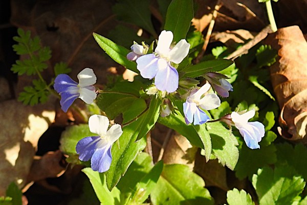
Another deep, moist, rich woods resident the group saw was the always-charming-to-see Collinsia verna (spring blue-eyed Mary—family Plantaginaceae). Unusually, this bona fide spring ephemeral is one of the few Missouri wildflowers that is truly “blue.” Equally unusual, its distribution is mainly in the Upper Midwest but in Missouri is apparently concentrated across the middle latitudes of the state.
[Warning: entomological geekery ahead!]
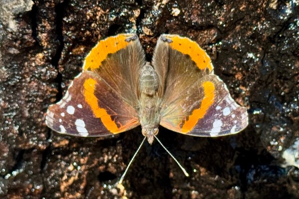
I, myself, missed these botanical finds due to my discovery immediately upon reaching the valley of a large oak tree with a dark, wet stain of flowing sap on its trunk that was hosting a variety of insects (remember; it is still March here—not normally a time to observe insects). Numerous muscoid flies, expectedly, congregated at the flow and lapped up the sap, as did a couple of brightly colored Vanessa atalanta (red admiral butterfly—family Nymphalidae). These fast-flying butterflies overwinter as adults and, thus, were ready to take advantage of the sudden warming spell. They also could have been difficult to photograph had their sweet tooth not enticed them to pose nicely on the dark, sap-saturated bark.
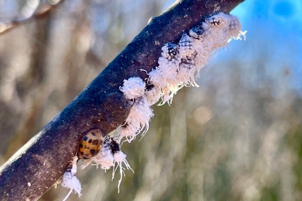
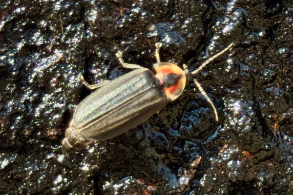
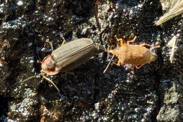
A closer look at the many insects congregating on the flow revealed the presence of two fireflies that proved to be Ellychnia corrusca (known as Photinus corruscus in some sources, e.g. iNaturalist) (winter firefly—family Lampyridae). Honestly, I didn’t recall ever having seen fireflies feeding on a sap flow, or for that matter any that were active in March—muggy summer nights are what I picture when I think of fireflies! The common name of this species, however, alludes to the fact that it can often be seen during warm days in winter, especially on tree trunks. Moreover, not only do adults become active in late winter, they mate at that time as well. The fact that these individuals were seen feeding on a sap flow is also unsurprising given that the species has been reported as a pest of sap buckets in the spring. There was one more surprise, however—as I was photographing the beetles, I noticed their all-dark abdomens, suggested they lack light-producing organs. This is surprisingly common among several groups of fireflies which have given up a crepuscular (i.e. active during dusk and/or dawn), luminescent lifestyle in favor of a diurnal (i.e., day active), non-luminescent existence. (We know that non- luminescent firefly species evolved from luminescent species—i.e., they used to be able to produce light and then lost the ability—rather than representing a lineage that evolved before other fireflies gained luminescent capabilities because their larvae do still posses light-producing organs.) Why did they do this? One possibility is the appearance of “femme fatale fireflies”—i.e., females of the genus Photuris that can that mimic the flash patterns of females in the genus Photinus to attract and eat Photinus males!
Non-luminescence as an antipredation strategy may be a good solution for femme fatales, but leading a diurnal existence still does not eliminate the risk of predation by other insects! One of the fireflies we saw on the sap flow had been attacked by a stink bug (family Pentatomidae) that came to the sap flow not for the sugary substance, but to prey on the other insects that it had attracted. For those of you who are asking “Aren’t stink bugs plant feeders?”, the answer is… mostly! While the majority of species use their piercing/sucking mouthparts to feed on developing seeds and fruits, there is one group of stinkbugs (the subfamily Asopinae) that has adapted its style of feeding to sucking the juices out of other insects rather than plants. This particular stinkbug was identified as Podisus maculiventris (spined soldier bug), and no amount of struggling by the firefly could release it from the stink bug, whose mouthparts had firmly impaled the firefly. Despite being predators, asopine stink bugs still lack chewing mouthparts and can only ingest liquid substances. This might be fine for sucking a juicy seed, but it falls short when trying to ingest another insect… unless it can digest the insect before it consumes it! This is called pre- or extra-oral digestion, whereby the stink bug injects its digestive enzyme-laden saliva into the prey and allows the enzymes to slowly liquify its innards. Once digested, the stink bug can then suck up thenutritious slurry, leaving only the shriveled external carcass of its hapless prey. Another such stink bug was seen elsewhere in the forest, this one preying on a fat, juicy caterpillar.
For lunch, a smaller than usual crowd enjoyed authentic comida mexicana at Casa Tequila Cantina in nearby Warrenton.
For a complete listing of plants observed, notes, and short observations, see Little Lost Creek by Michael Laschober in the Monday Morning Botany Walks section at St. Louis Nature Students.
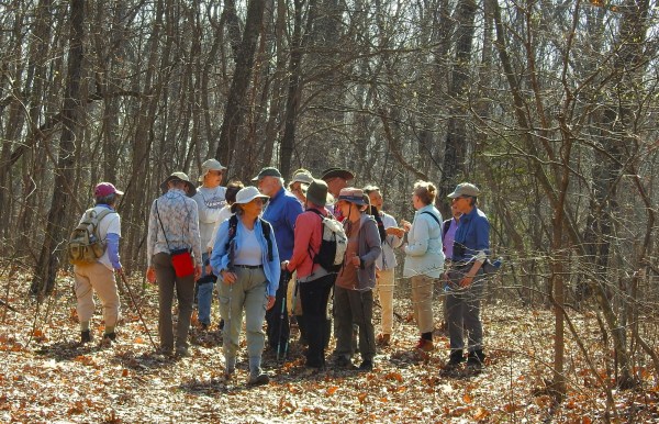
Participants: Brenda Adams, Gisela Baner, Prem Barton, Renee Benage, Kathy Bildner, Tina Cheung, Wayne Clark, Sally Fabbri, June Jeffries, Shari Langer, Michael Laschober, Ted MacRae, Len Meier, Burt Noll, John Oliver, David Steinmeyer, Kathy Thiele, Elaine Wolshock, Matthew Wolshock, Richard Wolshock, and Laura Yates.
©️ Ted C. MacRae 2026