Saving Missouri’s tigers

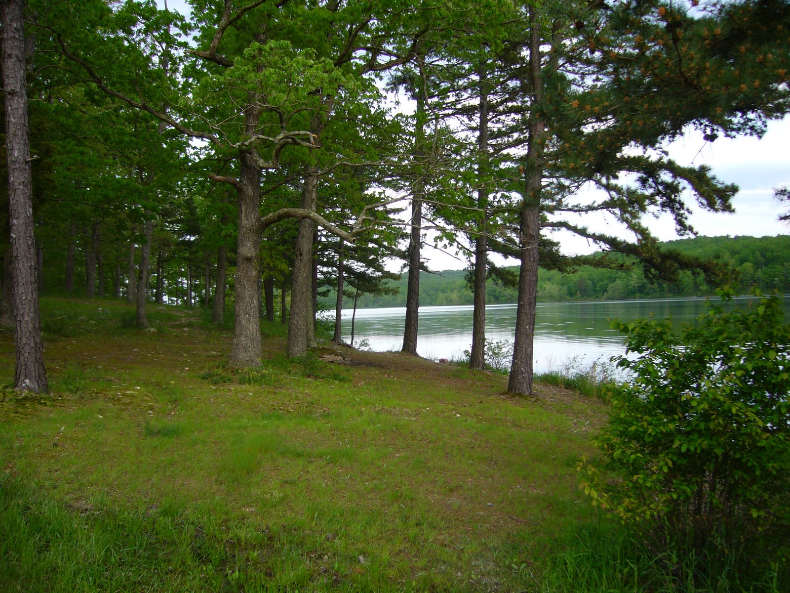
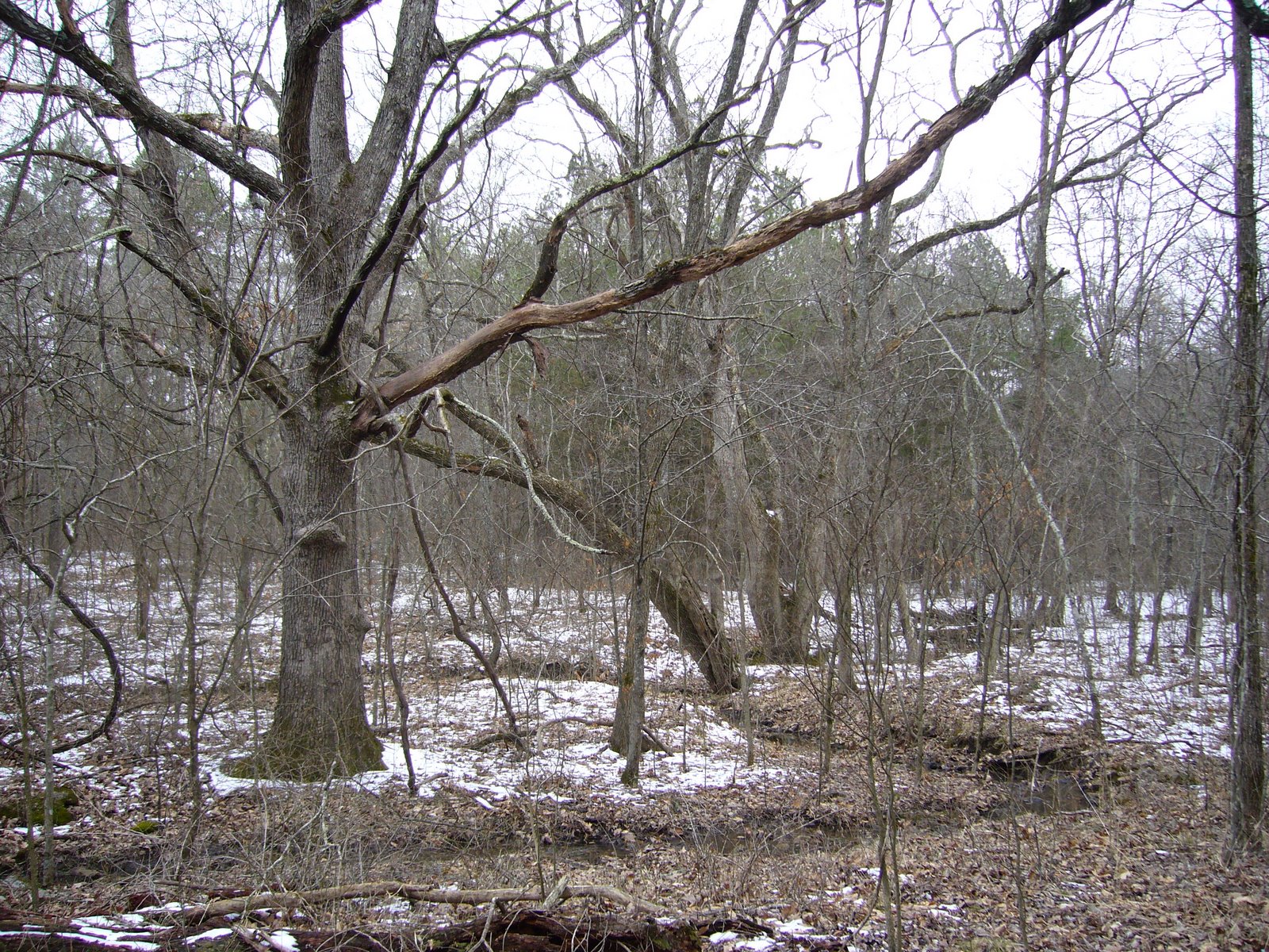
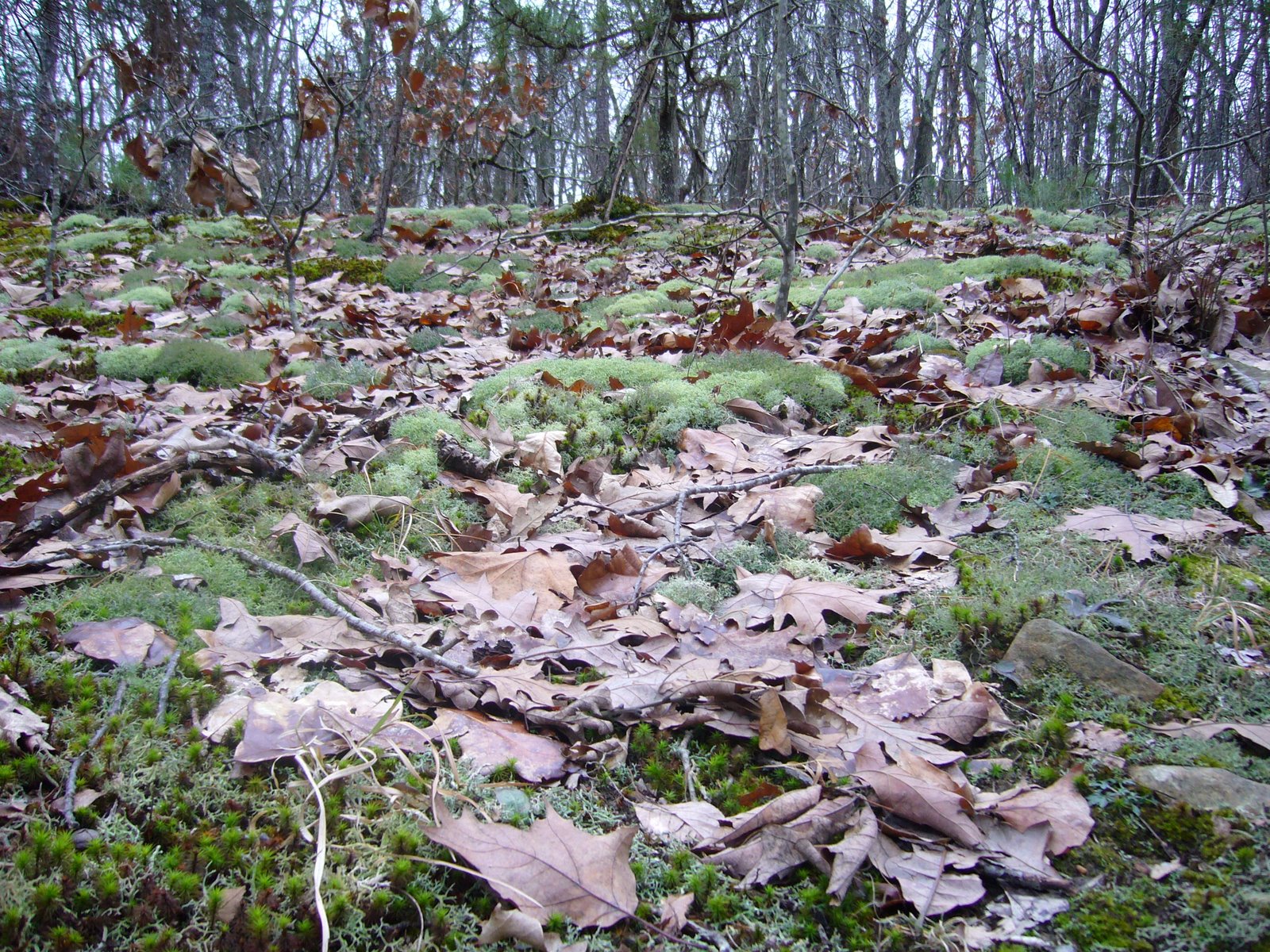
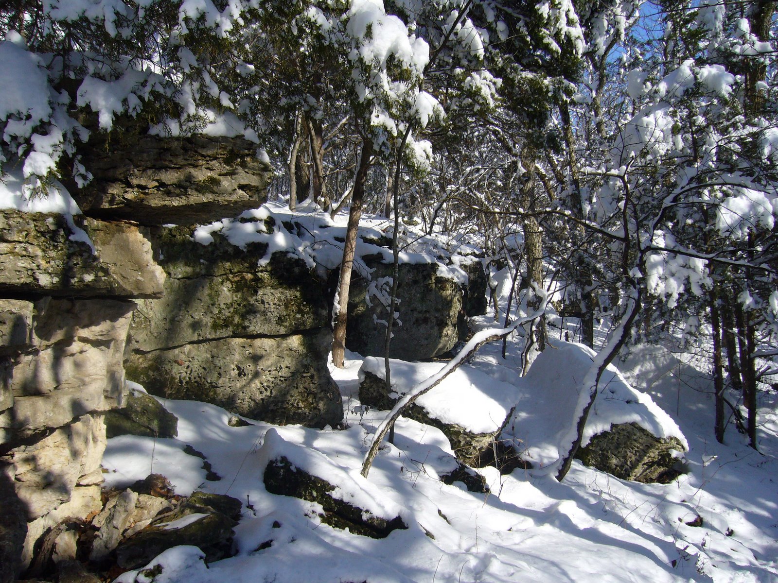
For several years now, my friend and colleague, Chris Brown, and I have been studying the tiger beetles (family Cicindelidae) of Missouri in an attempt to characterize the faunal composition and in-state distributions of the included species. Our studies have relied on examination of specimens in museum collections along with several seasons of field work across the state. The data we’ve gathered so far have revealed a fauna that reflects the ecotonal position of Missouri, comprised of elements from the eastern deciduous forest, the southeastern mixed hardwood forests and pinelands, and the western grasslands. These beetles are most frequently associated with disturbed habitats containing sparse vegetation, such as sandbars and erosion cuts, but they also live in other habitats such as along muddy banks, on glades and in forest litter. Since European settlement of Missouri, drastic alterations have occurred in the abundance and distribution of these habitats across the state, and tiger beetle populations have been affected as a result. Dredging and straightening of natural water courses have impacted species that prefer the water’s edge, while fire suppression has impacted those that need dry, open habitats. Grazing has had a profound impact on species associated with sensitive, saline habitats. Conversely, some anthropogenic changes have benefited certain species – road, borrow sand pit and pond construction have increased habitat for species able to utilize such habitats. To date, our surveys have confirmed the presence of 23 species in Missouri (16% of the North American fauna). Some species are common and widespread, such as Cicindela sexguttata (six-spotted tiger beetle) (above, photo taken in a mature white oak forest in Warren Co.). Others have more specific habitat requirements, but their status within the state remains secure. A few are rare and highly localized, primarily representing species at or near the northern or western edge of their distributions that exist in the state as small, disjunct populations. Special conservation efforts may be warrented for these to ensure their continued survival within the state.

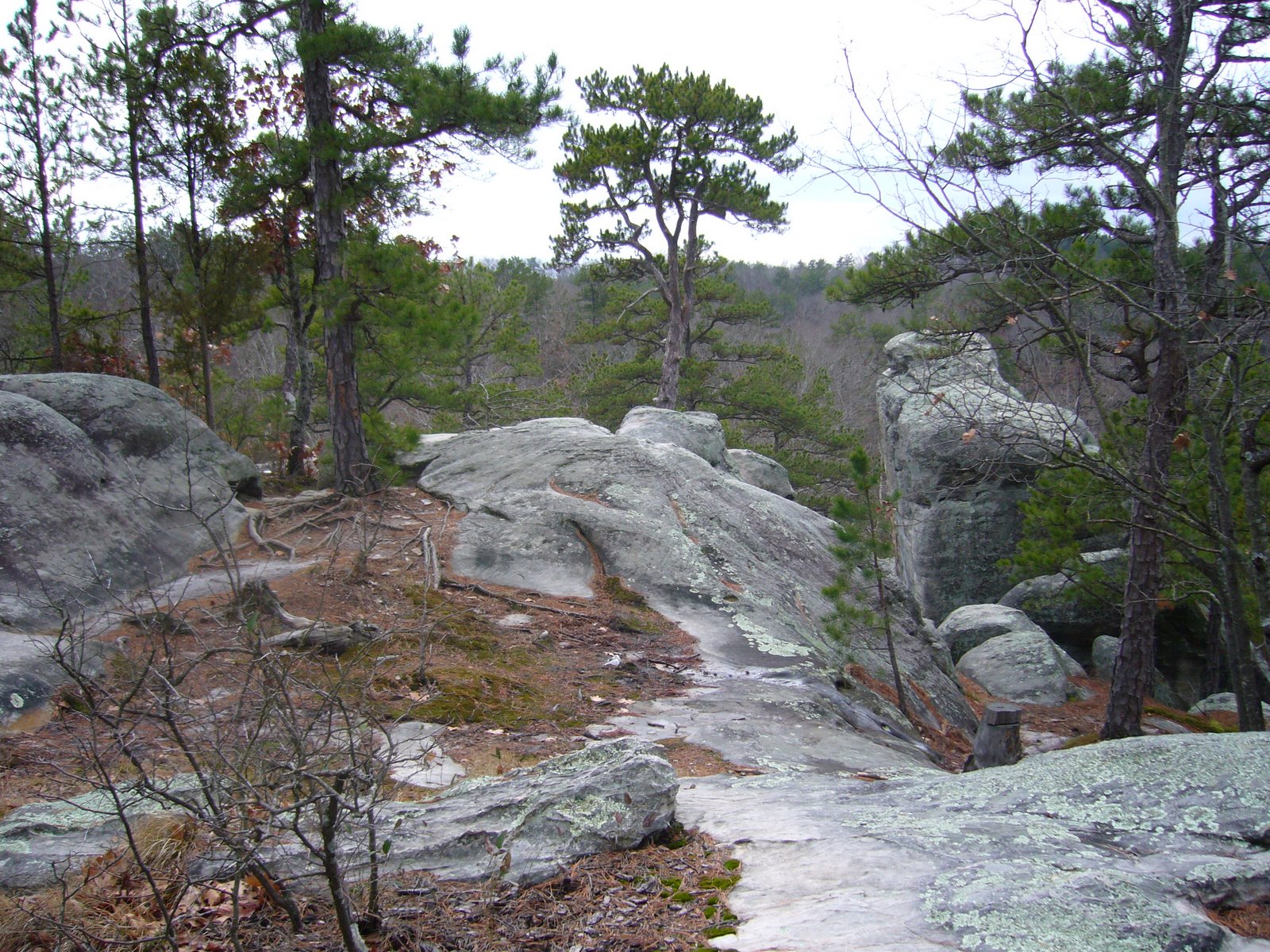
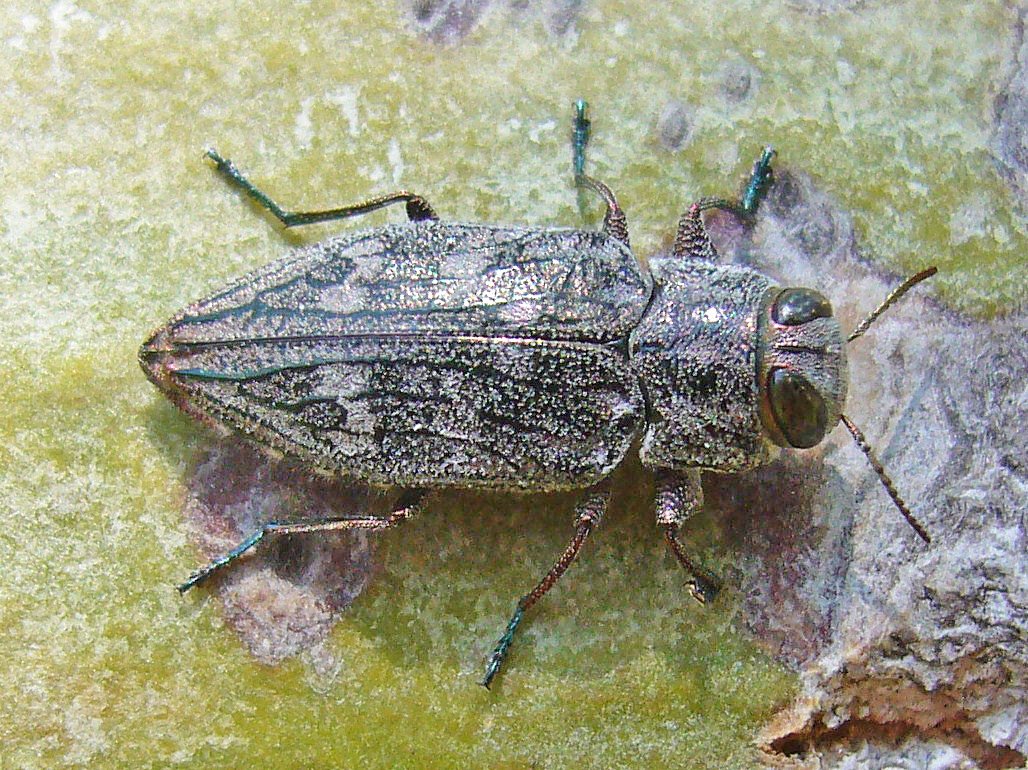
One species of potential conservation concern is C. pruinina (loamy-ground tiger beetle), a grassland species normally found in Kansas, Oklahoma, and Texas (left, photo by Chris Brown). This beetle is sometimes treated as a synonym or subspecies of C. belfragei but was most recently considered a valid species by Spomer et al. (2008). When we began our studies, the species was known from Missouri only by a small series of specimens collected in one of the western counties and deposited in the collection of Ron Huber. An additional specimen in the Huber collection labeled “Columbia, Mo.” is considered to likely represent student mislabeling. Several attempts at relocating the western Missouri population were required before we found it, and intensive surveys to determine the extent of its distribution in Missouri were conducted during 2006 using a combination of pitfall traps and direct observation. Those surveys succeeded in detecting the beetle only along one 2.5-mile stretch of county road in Johnson Co. The beetle seems to be restricted to red clay embankments occurring in a small localized area of the county. This season we plan to refine our survey by focusing tightly on promising habitats in this area near the sites identified in 2006 to more precisely define the distributional limits of this population. Regardless of what we find, the flightless nature of the species, its highly localized Missouri occurrence, and the disjunct nature of such suggest that special conservation status is warranted for the species to ensure its continued presence in the state. Despite the relatively low numbers of individuals we have seen, the protected status of the land on which this beetle lives leaves us optimistic about its future.

A Missouri species about which we are far less optimistic is C. circumpicta johnsonii (saline springs tiger beetle) (right, photo by Chris Brown), long known from saline spring habitats in the central part of the state. The Missouri population is highly disjunct from the main population further west and exhibits a uniform blue-green coloration rather than the mix of blue, green, and red colors exhibited by the main population. These features suggest that separate subspecies status might be warranted for the Missouri population. Numerous historical collection records exist from a handful of sites in Howard and Cooper Counties; however, surveys conducted by us during recent years revealed that the populations had suffered severe declines. This appears to be largely due to cattle disturbance and vegetational encroachment of the sensitive saline spring habitats upon which the beetle depends, especially at sites located on private land. Ron Huber, in a letter to me listing the collecting records he had for this species, reported seeing “hundreds of the wary little buggers” at one locality on private land, but in our visit to the site not a single individual was seen around the spring – badly trampled and overgrown with the exotic pasture grass tall fescue (Festuca arundinacea). In all, we were successful in finding the beetle at only one of the historical localities and at one new site located nearby. While both of these sites are located on state protected land, we concluded that the longterm viability of the C. circumpicta johnsonii population in Missouri was in serious jeopardy. Based on our recommendation, the species was placed on the Missouri Species of Conservation Concern Checklist with a ranking of S1 (critically emperiled). While this affords the species legal protection under the Wildlife Code of Missouri, the benefit may be minimal since the Wildlife Code does not address the main threat to this beetle’s survival – habitat degradation. We have not surveyed for this beetle since but plan to make field observations this summer (no trapping!) to check on its status. I sincerely hope we will not have to hang our heads with the realization that we have succeeded in extirpating yet another beautiful and irreplaceable gem.

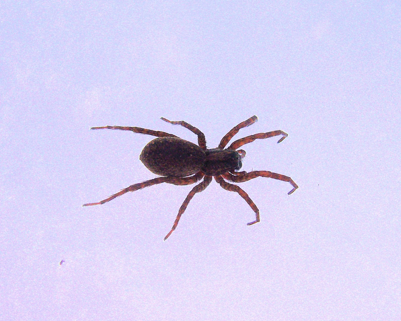
Last year we finally succeeded in locating C. cursitans (ant-like tiger beetle) in Missouri (left, photo by Chris Brown). Adults are flightless, and at less than 1 cm in length, are among the smallest of North American tiger beetles. The species has been recorded broadly but sporadically between the Appalachians and Great Plains – a distribution that is probably underestimated due to its small size and general resemblance to ants. A significant distributional gap exists between the eastern and Great Plains records, which Ron Huber believes may be indicative of two disjunct forms and potentially two species. Missouri falls within this gap, and although the species has not yet been formally recorded from the state, a single specimen collected in 1991 “nr. Portageville” is deposited in the Enns Entomology Museum, University of Missouri, Columbia. We had made several attempts over the past few years to locate this species by searching what we thought were promising habitats along the Mississippi River near Portageville, but the species was not located until last year, when I relayed this information to Portageville biologist and tiger beetle enthusiast Kent Fothergill. Kent not only located the beetle at the location I suggested, but quickly found another population on a nearby parcel of land managed by the Missouri Department of Conservation. Hurriedly, we visited the first site and observed a few additional individuals at a nearby location just to the south. The bottomland forest habitat within which all of these individuals were observed is fairly extensive along the Mississippi River in the southeastern lowlands of Missouri, but at this point we can only speculate whether C. cursitans occurs throughout this habitat. Other habitats have been reported for this species, including mesic and wet prairies and meadows (Brust et al. 2005). Such habitats are also found in the southeastern lowlands, and while C. cursitans has not been seen through cursory examinations in such areas, it is possible that the small size, cryptic habits, and narrow temporal occurrence of C. cursitans have allowed it to escape detection. Kent will be helping us this season with additional trapping and direct observation at several selected sites along the Mississippi and St. Francois Rivers to determine whether the beetle occurs more broadly in the southeastern lowlands and whether it utilizes these other habitats in addition to bottomland forests.

I would be most interested in any additional reports of these rare tiger beetles in Missouri (contact me at the email address shown in the left sidebar copyright statement). Remember, C. circumpicta johnsonii is critically emperiled in Missouri – please do not collect it.

The Chrysobothris femorata “problem”

I found a young cottonwood tree (Populus deltoides) the other day that had recently fallen over in one of the many storms we’ve had this spring. Anytime I see one of these “windthrows” I immediately think – woodboring beetles! Windthrows are attractive to numerous species of Buprestidae and Cerambycidae, and when I find one I try to revisit it often as the season progresses and different beetle species – active at different times and attracted to wood at different stages of dying or death – are encountered. This particular tree was only partially uprooted and so still had fresh foliage in the crown. While death is inevitable, it will be a slow, lingering death as the remaining soil-bound roots try in vain to sustain the fallen tree. This is an ideal situation for attracting species of the genus Chrysobothris, which seem to respond to plant volatiles emitted from trees under duress or recently killed. In the deciduous forests of eastern North America, C. femorata and related species are the most commonly encountered Chrysobothris attracted to these situations. Nursery growers and landscapers know this insect as the “flatheaded apple tree borer” – in reference to the appearance of the larvae as they tunnel under the bark of one of its favored hosts. The species has in fact, however, been recorded breeding in some two dozen genera of deciduous woody plants throughout the continental states and Canada, an unusual level of polyphagy for a genus of beetles in which most species typically exhibit a fair degree of host fidelity.

The problem is, “C. femorata” is not really a species, but a complex of closely related species. Entomologists have recognized this for some time, and while diagnostic characters have been identified for some of the more distinctive members of the group, such characters have remained elusive for C. femorata and its closest relatives. As a result, the species has become sort of a “trash can” for specimens that could be not be assigned to one of these more distinctive species, and in many museum collections large series of specimens can be found labeled simply “C. femorata species complex”. Fortunately, some much needed clarity was provided earlier this year by Stanley Wellso and Gary Manley, who after years of careful, systematic study at last published a revision of the Chrysobothris femorata species complex. In their work, six new species were described and one species resurrected from synonymy under C. femorata. Three of the new species occur in the western U.S., another is restricted to Georgia and Florida, and the remaining two new species and one resurrected species occur broadly across the eastern or southeastern U.S. This brings to 12 the total number of femorata-complex species in North America, with nine occurring in the eastern U.S. and seven in Missouri. The characters used to distinguish the species are subtle but consistent, and available biological data seem to support the species as now defined.

Of the dozen or so Chrysobothris individuals I collected on the fallen cottonwood during this past week, all but one represent C. femorata (as now defined). The photos I share here show some of the characters that distinguish this species from its closest relatives – primarily the straight rather than curved lateral margin on the last third of the elytra and the generally distinctly reddish elytral apices (most easily seen in the full-sized versions of the photos – click to view). Females (first and second photos) tend to show distinct reddish tinges behind the eyes and on top of the head as well. Males (third photo) can be distinguished from females by their bright green face (I tried valiantly but could not get one of these guys to pose in a position showing such). The photos also illustrate some of the typical behaviors displayed by these beetles, with males rapidly searching up and down the trunk looking for mates (third photo), and females probing cracks and crevices in the bark with their ovipositor looking for suitable sites to deposit their eggs (second photo). Of the two dozen host genera recorded for this species, many likely refer to some of the newly described species. In particular, records of this species from oak (Quercus spp.) and hackberry (Celtis spp.) may refer to the new species C. shawnee and C. caddo, respectively. As now defined, this species is still quite polyphagous and occurs throughout the continental U.S., but it is more common east of the continental divide and appears to prefer maple (Acer spp.), birch (Betula spp.), sycamore (Platanus occidentalis), poplar (Populus spp.), and especially rosaceous hosts such as hawthorn (Crataegus spp.), apple (Pyrus malus), pear (Pyrus communis), and cherry (Prunus spp.). Also, of all the species in this complex, C. femorata appears to be the most partial to stressed or dying trees (as with these individuals collected on live, windthrown cottonwood) rather than completely dead hosts. Wellso and Manley note that considerable variation still exists among individuals assignable to their more restricted definition of C. femorata. Thus, it is possible that more than one species is still involved, particularly among those utilizing hardwood hosts (e.g. apple, maple, etc.) versus softwoods (e.g., poplar, birch, etc.). Detailed biological studies will likely be required to identify any additional species that might be hiding amongst these populations.

Ozark Trail – Marble Creek Section

If you know wilderness in the way that you know love, you would be unwilling to let it go…. This is the story of our past and it will be the story of our future. – Terry Tempest Williams


During the past several years that Rich and I have been hiking the Ozark Trail, most of our hikes have taken place in the fall and winter months. From a hiker’s perspective, I really enjoy these off-season hikes – the foliage-free canopy affords unobstructed views of the terrain and vistas, the cool (even cold) temperatures are more comfortable under exertion (provided one has properly layered), and there are no mosquitos to swat, ticks to pick, or gnats to incessantly annoy. I also enjoy them as a naturalist, for the world is quiet and still, allowing me to focus on things I may not notice amidst the cacophany of life during the warmer months. By the end of winter, however, the biologist in me yearns to once again see bugs and flowers and the great interplay of life. Unfortunately, this makes something as simple as hiking from point A to point B rather difficult – too many distractions! Nevertheless, each spring Rich and I try to hike a small leg of the Ozark Trail before the crush of summer activities fills our calenders. Last week, we chose the Marble Creek Section, an orphan stretch (for the time being) in the rugged St. Francois Mountains that eventually will connect to the famed Taum Sauk Section. It would be our first return visit to the St. Francois Mountains since we first embarked on our goal to hike the entirety of the Ozark Trail.

The St. Francois Mountains are the geologic heart of the Ozark Highlands. Since their primordial birth 1.5 billion years ago, recurring cycles of erosion and deposition have worn them down and covered them up, only to see them reemerge once again as the younger rocks covering them were themselves stripped away. The Ozarks are an ancient landscape with ancient hills, and none are older than those of the St. Francois Mountains. It’s as if the Earth itself began in these mountains. We began our hike at Crane Lake, a clear, blue 100-acre lake built in the 1970s by the Youth Conservation Corps. The trail surrounding the lake was built in 1975 and is, in its own right, a National Recreation Trail. It meanders along the lakeshore and through hillside igneous glades and descends into a deep ravine below the dam where Crane Pond Creek cascades through spectacular rhyolite shut-ins. East of the lake the trail connects to the Ozark Trail proper and continues to Marble Creek campground. All told, we would be hiking a 9-mile stretch.

I knew we were in a special place almost from the beginning when I noticed a small flowering plant growing next to the trail under the mixed pine/oak canopy. I’m not a very good botanist, but I instantly recognized the plant as dwarf spiderwort (Tradescantia longipes), an Ozark endemic known from only a handful of counties in Missouri and Arkansas. I knew this only because I had just the night before read about this wonderful plant on Ozark Highlands of Missouri, a superb natural history blog focused on my beloved Ozarks. Reading about this lovely, diminutive member of the genus, I wondered if I might encounter it on my own hike the next day. As we searched off the trail and near the lakeshore we encountered dozens of the plants, each with one or two exquisite blue flowers. Our excitement at seeing a true Ozark endemic increased with each plant we encountered, giving us confidence that its future, at least in this area, appears secure. Of the numerous photographs I took, I share two that show its short, squat habit and filament-covered stamens. Eventually we decided we needed to move on – we had spent 20 minutes and only hiked 100 ft!

Looping around the south side of the lake, the trail traversed mesic to dry-mesic upland forest and afforded spectacular views of the lake and rugged north shore. The spring ephemerals had already come and gone, replaced by such classic woodland denizens as birdfoot violet (Viola pedata, pictured), fire pink (Silene virginica), cream wild indigo (Baptisia leucophaea), four-leaved milkweed (Asclepias quadrifolia), Pursh’s phacelia (Phacelia purshii), and shooting star (Dodecatheon meadia). Insect life was abundant, however, the only species seen in one of my chosen specialties, metallic wood boring beetles (family Buprestidae), were early spring species of Acmaeodera – pictured here is A. ornata on a dewberry (Rubus sp.) flower. This pretty little beetle occurs throughout eastern North America in early spring on a variety of flowers, where adults feed on pollen and mate. Eggs are laid on dead branches of certain hardwood trees, through which the larvae tunnel as they develop. Dry, dead wood contains little nutritional value, and the larvae cannot digest the cellulose. As a result, they eat considerable volumes of wood, extracting whatever nutrients they can for growth and ejecting the bulk as sawdust, which they pack tightly in their tunnels behind them. A year or more might be required before they have grown sufficiently to transform into the adult and emerge from the wood. A smaller relative, Acmaeodera tubulus, was also seen on flowers of native dwarf dandelion (Krigia biflora).

We stopped for lunch on a little point extending out towards the lake. The forest overstory was dominated by an open mixture of white oak (Quercus alba) and shortleaf pine (Pinus echinata). Thickets of highbush huckleberry (Vaccinium stramineum) and carpets of reindeer moss in the open areas belied the acidic nature of the igneous substrate. Stands of bastard toad flax (Comandra richardsiana) in full bloom were found at the tip’s dry, rocky tip. These interesting plants feed parasitically on neighboring plants, attaching to the roots of their hosts by means of their long, thin rhizomes. Resuming our hike, we descended down into a shaded, moist draw feeding the lake and saw a huge royal fern (Osmunda regalis var. spectabilis) bush. I had never seen this aptly named fern before, but it was immediately recognizeable by its large size (~5 ft in height) and presence of distinctive, fertile leaflets on some of its upper branches – a very striking and handsome fern, indeed. Nearby was a smaller, but no less attractive species of fern that I take to be marginal sheild fern (Dryopteris marginalis) – another species I have not seen before (or at least made the effort to notice).

Soon, we reached the dam and for the first time saw the spectacular rhyolite shut-ins. While perhaps not quite as impressive as the nearby and much more famous Johnson’s Shut-Ins, Rich and I nonetheless watched entranced as the water roared over the smooth igneous rock exposure, forming elegant cascades, rushing through narrow chutes, and swirling into small pools. Steep canyon walls rose sharply on each side of the shut-ins, as if standing guard. Clambering amidst the pines and cedars that cloaked them, we found this maidenhair spleenwort (Asplenium trichomanes) nestled within a crack on a vertical rock face under continuous deep shade. Reaching the top of the bluffs, we were greated by one of my favorite of all Ozark habitats – the igneous glade. Glades are natural island communities surrounded by a sea of forest. Their shallow, dry, rocky soil conditions support plants and animals more adapted to prairie or desert habitats. Specific communities are influenced by the type of rock below – igneous and sandstone substrates support lichens, mosses, and other acid soil-loving plants, while limestone and dolomite substrates support a more calcareous flora. The photo here shows the massive boulder outcroppings typical of igneous glades and their weather-resistant bedrock. We hoped to see a collared lizard (Crotaphytus collaris), perhaps Missouri’s finest saurian reptile, but today was not the day. We did, however, see adults of the beautiful and aptly named splendid tiger beetle (Cicindela splendida) sunning themselves on the bare rock surfaces – flashing brilliant green and clay-red. The adults we saw had spent the winter deep inside tunnels dug into the rocky soil the previous fall and were now looking for mates. Male tiger beetles grab females by the neck, their jagged, toothy jaws fitting precisely in grooves on the female neck designed specifically for such. As I looked upon this prairie island within the forest, I thought about how the St. Francois Mountains were once themselves islands. I realized the landscape we were exploring today was itself a fossil – with rhyolitic ‘islands’ amidst a ‘sea’ of cherty dolomite laid down a half billion years ago in the warm, tropical, Cambrian waters that surrounded the St. Francois Islands, by then already a billion years old themselves. Yes, the Earth itself seems to have begun here.

Leaving the glade and once again entering the acid pine forest, we came upon one of the most striking floral displays that either of us have ever witnessed – wild azalea (Rhododendron prinophyllum) in the midst of full bloom! I have known about several colonies of this plant for many years now but had only seen them at the very end of the bloom period, with just a few, pitiful, limply hanging flowers still attached. Today, the plants were absolutely dazzling. The blossoms were not only visually attractive, a deep pink color, but also unexpectedly fragrant. We stood amongst several specimen plants as tall as ourselves, taking picture after picture amidst the clovelike aroma wafting around us.

We checked our watches – we were now 3 hours into our hike and had traversed just 2 miles. Clearly, this was not a sustainable pace, so we put our heads down and focused on covering ground. Once leaving the vicinity of Crane Lake, the trail became rather difficult to follow – it obviously receives little use, and in one stretch some logging activities had obliterated the trail completely. Were it not for the sporadic pieces of orange flagging tape tied just within sight of the previous, we would not have know where to go. At one point, we got completely off-track and had to backtrack a full half mile before we found the proper trail. The day put our contour map reading skills to their greatest test yet. It was difficult and strenuous terrain, with steep up and down grades and few long ridgetop stretches until (thankfully) the final 2 miles, which terminated in a long descent (more thankfully) to Marble Creek Campground. Despite the difficulties in following the trail and our not bringing enough water, I would have to rank this section a close second to the Taum Sauk stretch for its ruggedness, spectacular vistas, and unique plant communities. Yes, the St. Francois Mountains are truly the heart of the Ozarks.

Saving turtles, one by one…

“You should be able to push him from behind,” said the other motorist, who had also seen the young snapping turtle sitting in the middle of the exressway right after I did and pulled up as I was taking some “pre-rescue” pictures. “Nyeah, I think I’ll go ahead and get something to push him with anyway,” I said, hoping that the tone of my voice did not betray my true thoughts, “What, are you crazy? I’m not putting my bare fingers or sandal-clad feet anywhere near that thing!” I’ve rescued plenty of snappers over the years, and I know first hand just how surprisingly quick they can be. Truth be told, snapping turtles can be safely moved by hand – apparently they cannot reach the back of or underneath their shell. However, it takes considerably more temerity than I possess to actually try this. I grabbed a bicycle pump from the back of the truck and hooked the base of it under its shell. Immediately, the young turtle snapped at the pump – startling the man as well as two other cyclists who had stopped to watch the goings on. I admit to feeling more than a little vindicated as they all stepped back a few steps. I was hoping the turtle would maintain his grip on the pump so I could just carry him over to the roadbank, but every time I tried to lift he let go. So I had to just keep hooking the pump under his shell and pulling him towards the side of the road – the turtle fought every bit of the way, hissing and snapping and clawing against the road. At last he was in the grass – it was then an easy matter to roll him over a few times down the bank and safely (for now) away from the road.

Road mortality is suspected to have contributed to widespread population declines in turtles across the United States. This seems especially true for freshwater aquatic species, which often make land migrations for breeding. Vehicles often do not stop for turtles in the road, and I have seen some (usually a pickup truck with very large tires) swerve deliberately in an attempt to hit them (or even more sadistically, “shoot” them across the roadway). Conincident with these declines has been a demographic change towards male-biased populations in many freshwater species. Adult female freshwater turtles make nesting migrations that males do not and are often attracted to road shoulders and embankments as nesting habitat, making them disproportionately more vulnerable to road mortality. The resulting male-biasing surely represents an additional risk factor to their populations, especially in areas where high traffic occurs in proximity to wetlands. In such places, mitigation measures such as barriers and wildlife underpasses are clearly warranted (Steen et al. 2006).

I’ve always been a little awed by snappers – so grizzled and ancient, almost dinosaurian, and while I doubt that my sporadic rescues have near as much impact as barriers or underpasses, I do know that they cannot possibly hurt. As for this turtle, whether it continued on its way or turned around and crawled back onto the road (due to my unwittingly placing it on the side from which it just came) will remain unknown. I was heartened to see that I wasn’t the only person who stopped, intent on saving this grotesquely beautiful creature. But as I scanned this miles-long stretch of very recently constructed roadway, which now enables St. Louis countians to rapidly zip along next to newly created wetlands in the Missouri River bottoms while avoiding the stop-and-go on I-270, I couldn’t help but wonder why barriers and underpasses, seemingly simple protective measures, weren’t also included on the final blueprints of the roadway before they were sent to the printers. If such had been done, then I would not have had this encounter. But I could’ve lived with that.

Ozark Trail – lower Courtois Section

The Courtois Section is the northern terminus of the Ozark Trail (OT). Despite its proximity to the St. Louis metro area, it feels just as remote and wild as the more southern sections. Rich and I played hooky from work on Friday and made our first visit to this stretch of the Ozark Trail. At 40 miles in length, we’ll need to break it up into at least three parts, so for our first attempt we hiked the lower portion from Hazel Creek (where the Trace Creek section begins) north to the Hwy 8 trailhead. Apparently this portion of the OT is very popular with mountain bikers and equestrians; however, we didn’t encounter a single person all day.

I expected the terrain to be rather mild at this northern end of the OT, but the first few miles were quite up and down. There was still some snow on the ground from a big storm a few days earlier – mild temps and sunny skies since then had caused a lot of melt. As a result, south facing slopes were completely devoid of snow cover, while north facing slopes still had and inch or two of snow, creating “split” scenes such as this:


Right away we noticed a lot of fresh woodpecker damage on oak trees. This is likely the result of infestations by the red oak borer (Enaphalodes rufulus), a cerambycid beetle that preferentially attacks red and black oaks suffering from drought or other environmentally-induced stress. The larvae of these beetles mine beneath the bark on the trunks of these trees before tunneling into the sapwood to pass the winter. Overwintering larvae are tasty morsels for woodpeckers, who hammer into the trunks with their beaks and extract the larvae with their barbed tongues. Interestingly, conventional wisdom has it that the tongue “stabs” the larva, and the barbs aid in pulling the larva out of its gallery. However, recent experiments with a West Indian species suggest this is not the case. Rather, the larva “sticks” to saliva on the tongue, and the barbs help to grab the larva as the tongue is wrapped around it. This picture shows a small black oak (Quercus velutinus) tree with fresh damage, probably from a pileated woodpecker (Dryocopus pileatus) judging by the size, going after one of these larvae.


A few miles into the trail, we came upon some curious “pits” covering one hillside. We speculated what they might be – sinks was an early thought, but I didn’t think that was so because the ground was mounded around the edge like they had been intentionally dug. Rich then remembered reading something about miners digging such pits in past years looking for minerals – we decided that must be what they were, and this was later confirmed in our Ozark Trail guidebook. Certain hillsides were literally covered with these pits, spaced ~10-15 feet apart.

After passing through Snapps Branch (where we noticed a small calcareous wet meadow, or fen – thankfully fenced), the trail leveled out for awhile before descending down to Boiling Springs Hollow where we stopped for lunch. Many of the larger valleys along the OT show some evidence of prior habitation – either by remains of old structures or by the stage of succession exhibited by the bottomland forest. Right at Boiling Springs, I noticed this large, old oak tree along with several large sugar maples (Acer saccharum) surrounded by younger forest – I suspect these “founder trees” were planted at some point when people lived near the spring (or at least spared from “the saw”) and remain as the only evidence of the people who lived here in the past.


I love bones and pick them up whenever I get the chance. After leaving Boiling Springs I noticed this half mandible of a white tailed deer (Odocoileus virginianus) laying on the trail, still partially embedded in the snow. It was remarkably clean and complete, containing all of its dentition and with no remaining tissue except for a small piece attached to the nerve fossa. It’s completeness begged the question – where was the other half? We looked around and couldn’t find it. We then wondered if it had been dragged there by a scavenger, although we thought that if that was the case it should show signs of gnawing or at least have lost some of its dentition. At any rate, I have a white tailed deer cranium in my collection but not a mandible, so this will be a welcome addition.


Eventually we entered Machell Hollow, where we followed a beautiful stretch through the upper reaches of the valley. In this area we noticed a large number of dead white oaks (Quercus alba) that were all about the same size (~4-8″ dbh) and in about the same stage of decay, as if they had all died about the same time (maybe 4-5 years ago). There were still plenty of larger living trees, and I began to suspect that a fire had moved through this area and began looking for the evidence. Soon we found several larger trees showing some blackening around the base of the trunk that seemed to confirm this thought. We had a lot of fun “pushing over” some of these trees, with one in particular probably representing our champion pushover to this point. I didn’t think it was gonna go, but Rich chipped in, and against our formidable combined weight the tree gave way and came down with a crash. I noticed evidence of tunneling by wood boring beetles (probably a species of Buprestidae) inside the trunk of this tree where it cracked upon falling and lamented that I could not take a piece with me for rearing. All of the dead white oaks had this one type of shelf fungus growing from their trunks, which were particularly numerous on this already fallen tree:


Climbing up (briefly) out of Machell Hollow, we saw this cut shortleaf pine (Pinus echinata) laying by the side of the trail. Interestingly, the accumulated ice on the cut end of the trunk was not the result of water running off the trunk, but through the trunk, apparently through insect galleries and perhaps even the vascular bundles of the wood itself. The slow melt and freeze resulted in these interesting little ice columns joining the trunk to the moss-covered ground below.


Back down into the lower reaches of Machell Hollow, evidence of prior settlement was obvious, as the bottomland forest in this area was replaced by young successional forest comprised primarily of chokecherry (Prunus virginiana), honey locust (Gleditsia triacanthos), and brambles (Rubus sp.). We saw this lone little fruticose lichen growing on a small honey locust. Apparently, of the three main groups of lichens, fruticose lichens are the most sensitive to environmental disturbance. Perhaps the existence of this one colony suggests that the health of this bottomland forest is returning as succession proceeds along the path to maturity.


Here’s a picture of Rich taking his own picture of the lichen. I don’t know why he didn’t just wait and steal mine once it got posted 😉


Much more abundant on the honey locust trees were these foliose lichens. Lichens in this group are probably the most commonly noticed lichens in the Missouri Ozarks (although the less conspicuous crustose lichens may actually be more diverse). If you click on the photo to see the full-sized version, you can see long, black “hairs” around the margin of each “leaf” – if anyone knows the identity of this or any of the other lichens pictured on this site please let me know.


While ascending out of Machell Hollow, we noticed this small canyon about a hundred yards off to the left and decided to go investigate. Along the way we noticed the small creek coming from it was actually a ‘losing creek’ – which means that the water flows into the ground at certain points and is ‘lost.’ This is another feature of the limestone/dolomite-based Karst geology so common here in southern Missouri that results in its abundance of caves and springs. When we got to the canyon we saw it was comprised of a layer of sandstone. This must be a rare western exposure of the LaMotte sandstones that are more common just to the east in Ste. Genevieve County (see earlier posts on Hawn State Park and Pickle Springs Natural Area). This sandstone layer overlying dolomite has created an interesting geological feature, where a losing creek originates from a box canyon. Ice stalactites were dripping from the north facing slope of the canyon walls.


Back down into another hollow leading to Lost Creek we saw more dead white oaks with shelf fungi growing from the trunks. This one was interesting in that the shelf fungi were themselves supporting the growth of algae on their surface – an exquisite example of the interconnectedness of life.


We had seen a flock of wild turkeys (Meleagris gallopavo) moving through the forest earlier in our hike. We were too clumsily noisy to get close enough for more than a cursory look at them as they trotted off on high alert, but evidence of their activity was obvious as we saw their fresh “scratchings” over a wide swath through the forest as they searched for acorns to eat. Tracks were abundant in the snow around the area also, but I couldn’t get a good picture of them. Later, as we neared Lost Creek, I saw more tracks in the mud, so I was able to get a good picture of one. It looked fairly fresh (well defined, with nail holes evident):

Lost Creek represented the end of our hike, but it proved to be a more than insigificant final hurdle, as the water level was quite high due to all the recent snow melt. There was no choice, we would have to get wet. Rich is smarter than I and had thought to bring along some flip flops, so he took off his boots and socks, rolled up his pants, and forded the creek. I let him go first to see how deep the water was – it reached above his knees and got is rolled up pants wet. I decided to get my boots wet – I didn’t want to walk on those rocks barefoot, which would slow me down far more than I wanted in that cold water. I could handle wet boots for the final quarter mile in exchange for the comfort and speed they would provide on the rocks. Rich may be smarter, but I took a better line and didn’t even get my pants wet, so for me it was only a matter of changing into my comfy shoes back at the car, with no need for a change of clothes (which I also wasn’t smart enough to bring, either). We completed the hike in 7 hours – yes, we’re lollygaggers, constantly distracted by little things that most people either don’t see or don’t care about. It was a wonderful hike on another beautiful day, and we ended it with another traditional post-hike visit to the nearest pizza parlor before the short drive back to St. Louis.

Ozark Trail – upper Trace Creek Section

Last Saturday Rich and I finished the Trace Creek Section of the Ozark Trail by hiking the upper 12.5 miles of the section – from Hazel Creek to the Hwy DD crossing. Today was a special day for us – we would be completing our 200th mile of the Ozark Trail! Unfortunately, I came down with a cold the day before, making it somewhat difficult to fully enjoy that milestone. Nevertheless, it was a milestone that we’re quite proud of. Since we started hiking the Ozark Trail some 7 years ago, we’ve completed the Taum Sauk, Middle Fork, Blair Creek, Current River, Between The Rivers, Eleven Point, and – now – Trace Creek Sections. Of these, the Taum Sauk Section is unquestionably the finest, crossing the rugged granite outcroppings of the St. Francois Mountains, and the Eleven Point Section with its towering bluff top views is a close second. We still have much to see, however. Completed sections still awaiting us are the Karkaghne, Marble Creek, Wappapello, and Victory Sections, and the Coutois and North Fork Sections are nearing completion. By the time we complete these sections, I expect additional parts of the planned route will be constructed and ready for our enjoyment.

But back to Saturday’s hike. We started at Hazel Creek with mild temps and cloudy skies but no precip in the forecast. We talked briefly to a mountain biker with a 29er who took this photo of us:


These cabin remains lie in the campground at the trailhead – those are sandstone blocks which I suppose must have been transported from the Lamotte formations some 30 miles to the east near Ste. Genevieve.


There was much to see in the vicinity of Hazel Creek. As an orchid enthusiast, I was pleased to find these Adam and Eve orchids (Aplectrum hymenale), also known as puttyroot, growing in healthy numbers on the hillside above the valley. The single leaf of this unusual plant is dusky grey-green in color, deeply creased and looking like crepe paper. They appear in late summer and persist until the plant flowers the following spring.


Another of the shelf fungi was found growing on the trunk of a large, dead deciduous tree.


My preoccupation with lichens continues. This colony of British Soldiers (Cladonia cristatella) was found growing in trailside rocks. This lichen is named for its resemblance to the uniforms worn by English soldiers during the Revolutionary War, although the spore-producing reproductive structures are not the brilliant red color as seen during the summer. Lichens are not plants, or even a single organism, but instead a symbiotic association between an alga (in this case, Trebouxia erici) and a fungus (in this case, Cladonia cristatella). Lichen scientific names are derived from the fungus part of the relationship.


Puffball mushrooms have been a favorite of mine since I found my first colony during childhood and delighted in watching the ‘smoke’ fly as I slapped them with my hands. These days I’m satisfied to just look at them (and maybe poke one or two).


The term “puffball” actually refers to a polyphyletic assemblage of fungi distributed within several orders in the division Basidiomycota. I’m no expert (or even a novice), but I wonder if these apparently mature individuals might represent the pear-shaped Morganella pyriforme, a saprobic species that is considered a choice edible while still young. Please leave a comment if you know its identity.


The trail was not particularly rugged but traversed across a number of ridges between the Hazel Creek and Trace Creek valleys. The bedrock was mainly chert, and along the trail we saw this quartz formation with its intricately formed interior exposed.


Approaching Trace Creek, this fireplace and chimney were all that remained of what was probably once a cozy little homestead. Obviously this house had not been constructed of sandstone blocks like the one at Hazel Creek. On each side of where the house once must have been stood two grand, old sugar maple trees (Acer saccharum) – we speculated they had been planted by the former residents and wondered what life was like in this isolated little part of the Ozarks back in the day.


We reached the trails namesake, Trace Creek, about halfway through our hike, and by this time we were the Ozark Trail’s newest 200-mile veterans. It was a pretty little valley, and we stopped here for a bit to eat and rest. Adam and Eve orchids were plentiful here, and in looking for them I became surprised to notice how large a variety of green, herbaceous plants one can find in these deciduous forests during the winter, especially in the lower elevations (moister?).


On these hikes, it has become customary to ‘push over’ trees – dead trees, that is. The larger the better, but of course the larger they are the ‘deader’ they must be for us to be able to push them. I did not push over a single tree on my previous hike of the lower Trace Creek Section, so I made up for it this time and found three trees to push over. Here, Rich finds out what all the fun is about:

The final miles of the hike became more difficult, as my sore throat and congestion combined with the miles started taking their toll on me. We finished our hike at the Hwy DD crossing after 7 hrs of hiking, portaged back to the other car, and met up in Sullivan for our traditional post-Ozark Trail hike pizza dinner.

Pickle Springs Natural Area

Pickle Springs Natural Area lies in Ste. Genevieve County, about an hour south of St. Louis. Like Hawn State Park, the geology of this area and its effect on the flora have resulted in a unique collection of geologic features and plants found in few other places. The Lamotte sandstone outcrops that dot the landscape were formed nearly half a billion years ago when sand deposited in an extensive maze of braided river channels was cemented and buried under younger layers of limestone and dolomite formed from deposits on the floors of ancient seas that covered the interior of the continent. Later, the periods of uplift that created the St. Francois Mountains and resulting erosion of overlying strata once again exposed the sandstones at the surface. Millions of years of water, ice, rain, wind, and plants have further shaped the exposed sandstones, creating fanstastic shapes and formations and cool, deep canyons. The weathered sandstone created acid soils which support many unique plants. During the ice ages, northern plants and animals moved into the area ahead of the advancing glaciers. Mammoths roamed the landscape grazing on the northern vegetation supported by the area’s acid soils. Eventually the ice retreated, and so did the mammoths. But many of the plants remained – able to hang on in the cool, moist canyons long after the mammoths that once roamed these canyons disappeared. Because of this unique concentration of rare plants and geologic features, the area has been designated a Missouri Natural Area and a National Natural Landmark.

Yesterday I hiked the aptly-named ‘Trail Through Time’ with my family. This 2-mile trail is one of the most “feature-packed” trails in the state, with something to look at around almost every bend. Almost immediately the trail leads to the Slot, the result of a vertical fracture in the Lamotte sandstone that was loosened by leaching and then widened by erosion. The unique partridge berry (Mitchella repens) was seen on the moist, vertical walls of the rock, growing among strange holes, pockets, and ridges that formed as a result of the sand grains being variably cemented.


A short distance from The Slot lie Cauliflower Rocks – large moundlike formations (also called hoodoos or rock pillars) formed from jointed or fractured sandstone that undergoes deep solutional weathering followed by erosion and weather-mediated shaping. Hoodoos occur primarily in this type of rock due to its granular, variably cemented and cross-bedded matrix.


On the south side of Cauliflower Rocks lies a special type of buttress arch called Double Arch. It occurs at almost a right angle to the adjacent rock outrcrops, suggesting formation along a set of fractures running perpendicular to the main fracture trend of the area, but the precise details of its formation remain a mystery.


After leaving Cauliflower Rocks the trail descends steeply into a deep valley, at the bottom of which lies Pickle Creek just below its origin in a box canyon south of the Natural Area. Lush vegetation in this cool, moist valley contrasts with the stark rocks seen earlier.


The creek is fed by a series of seeps, allowing the valley to remain moist even during the dry summer months, and along with the acid soils support a unique plant community. Lush colonies of ferns (I believe this is Polypodium virginianum L.) covered the rocks adjacent to the creek…


…while this rattlesnake plantain orchid (Goodyera pubescens) was seen in a colony growing at the base of a black oak tree (Quercus velutina) just above the creek.


Mosses and lichens were also abundant in the valley. This little hair cap moss (Polytrichum sp.) with its distinctive fruiting structures was growing in a colony at the base of another black oak tree. The members of this genus prefer acidic environments.


Further ahead, along Bone Creek, several colonies of wooly aphids (family Aphididae) were seen on the branches of a small hop hornbeam tree (Ostrya virginiana).


The highlight of the hike had to be in Spirit Canyon at Owl’s Den Bluff. The horizontal layers of sandstone, each deposited on the steep downstream slopes of sandbars, are clearly visible in the towering bluff face. At the bottom lie bluff shelters – formed where lower sandstone layers collapse due to weathering or leaching, and where native Americans almost surely camped out. The sun never reaches parts of these shelters, providing ideal conditions for a variety of mosses and liverworts – many of which are known only from this area. Fallen boulders and collapsed portions of the bluff face provided photo opps for the daring…


…and good exploring for the nimble.


By now, the trail has passed the halfway point and is looping back to the west, where it ascends to Dome Rock Overlook. Along the way, a fascinating variety of lichens, including reindeer lichen, covers the forest floor where they are supported by the acid soils.


Dome Rock Overlook is a the largest hoodoo complex in the Natural Area. The thin soils and exposed conditions create a harsh, dry, windswept environment that only the hardiest of plants can withstand. Only a few small blackjack oaks (Quercus marilandica), shortleaf pines (Pinus echinata), and farkleberry (Vaccinium arboreum) survive here. Despite their small size, some of the trees growing here are at least 150 years old.


The trail descends from Dome Rock Overlook and passes underneath, providing spectacular views of the sheer rock face below the overlook. The trail completes its descent back into Pickle Creek Valley, where Pickle Spring can be seen. This small, permanent spring – an unusual feature in sandstone where seeps are more common – was an important source of water for early settlers.


Further along the trail lies one of the areas most unusual features – Rockpile Canyon – formed some 50 years ago (a fraction of a second in geologic time) when part of a sandstone bluff collapsed in a rumble, leaving behind a sheer bluff face and a jumbled pile of large boulders. A short spur in the trail leads to the head of a small box canyon, where some of the 20+ ice age relict plant species can be seen growing in the acid soils and cool, moist canyon walls.

Near the end of the loop lies Piney Glade, an area where the exposed sandstone bedrock once again creates a dry, harsh environment. Poverty grass and little bluestem grow in small, shallow pockets of soil scattered amongst stunted shortleaf pines and blackjack oaks – creating a small prairie surrounded by a sea of forest. All three forms of lichens can be found on the rocks and soils of the glade – the aptly named crustose lichens cling tightly to rock surfaces amongst foliose (leafy) and fruticose (branched) lichens.

Rockwoods Reservation, Lime Kiln Loop Trail

Rockwoods Reservation, in western St. Louis Co. is one of the oldest Conservation Areas in Missouri (est. 1938). It contains nearly 2,000 acres of high quality upland forest and a small prairie restoration plot. Despite its proximity to St. Louis and the numerous hiking trails it offers, I haven’t explored this area very much. We had a winter storm move through the area yesterday, dumping about 7 inches of snow over the area. Deep snows are not common in St. Louis, which typically has more open winters, so today offered the perfect opportunity to start exploring this area in a rare wintery setting. My daughters came with me to explore the 3.25-mile Lime Kiln Loop Trail.


The first half mile of the trail follows alongside a spring-fed creek. As we enjoyed the serenity of the snowy landscape, a belted kingfisher flew into a nearby tree, where it paused briefly before zipping off in a chatter. The spring itself offered a beautiful contrast between the green aquatic plants that populate the spring’s exit and the surrounding white blanket.


After the spring, the trail started traversing up the hillside into a mesic upland forest dominated by oaks and hickories. The high canopy of this mature forest resulted in a sparse understory, affording spectacular views back down through the draws from which we came.


The girls were full of energy at this point, so they kept running ahead on the trail and then waiting for me to plod my way back up to them. Eventually they learned their lesson though – everytime they ran up ahead they would get hot and want to take their coats off, then they would get cold and have to put them back on.


There were some drier forest types closer to the bluffs where eastern red cedar (Juniperus virginiana) became more abundant. I coaxed them to pass underneath this one, then whacked it with my hiking stick as they did so. Shocked indignation soon gave way to tenacious efforts on their part to ‘get me back’. Failing that, they redirected their efforts to ‘getting’ each other.


The games eventually gave way to quiet enjoyment of the astounding beauty of the forest. Existing tracks in the snow told us we were not the first to enjoy the trail today, but we didn’t see a single soul all day – it was easy to pretend that we were the only people in this wood. These snow-covered, hollow tree stumps reminded us of tubular sponges.


As the trail descended back down into the valley it passed through these dolomite outcrops supporting a dry upland forest dominated by eastern red cedar and blackjack oak (Quercus marilandica).


Near the end of the trail, we ran across this little spider – actively crawling on the surface of the snow with temps in the mid-20s. I half-jokingly suggested that maybe this was some kind of ‘snow spider’. My 8-yr old daughter thought that seemed likely, then suggested that when we got home we could get online and go to http://www.spider.com/ and type ‘snow spider’ to see what it said. I told her I thought that was a great idea! Alas, that website (and http://www.spiders.com/) lead to a couple of IT company websites, so that was no help. Fortunately, I was able to find something that looked similar – a wolf spider in the genus Gladicosa – on BugGuide. I told Madison her suggestion worked 😉


The lime kiln for which this trail is named was built in the mid-1800’s by a wealthy businessman, who used it to produce lime for mortar construction of homes in nearby St. Louis. The kiln, 12-ft wide at the base and 40-ft high, was built next to the hillside to allow limestone (quarried nearby) to be dumped in at the top. Locally cut firewood was loaded into the arches at the bottom on each side, which heated the kiln to 800°F, converting the stone to lime which was removed from the opening at the bottom in front. Vertical expansion joints on each side in the center allowed for expansion of the stone during heating.


This was the second hike in the past few weeks that I’ve taken with the girls, and like last time they had an absolute ball! Of course, naturalist that I am, it pleases me that they enjoy the outdoors so much, and I’m quite impressed that they hiked such a distance with no complaint. The area offers several additional hiking trails ranging from 1.5 to 2.2 miles in length. At only a 15-minute drive from our house, I look forward to exploring the rest of Rockwoods trails with them.