The marvelously monstrous Microstylum morosum

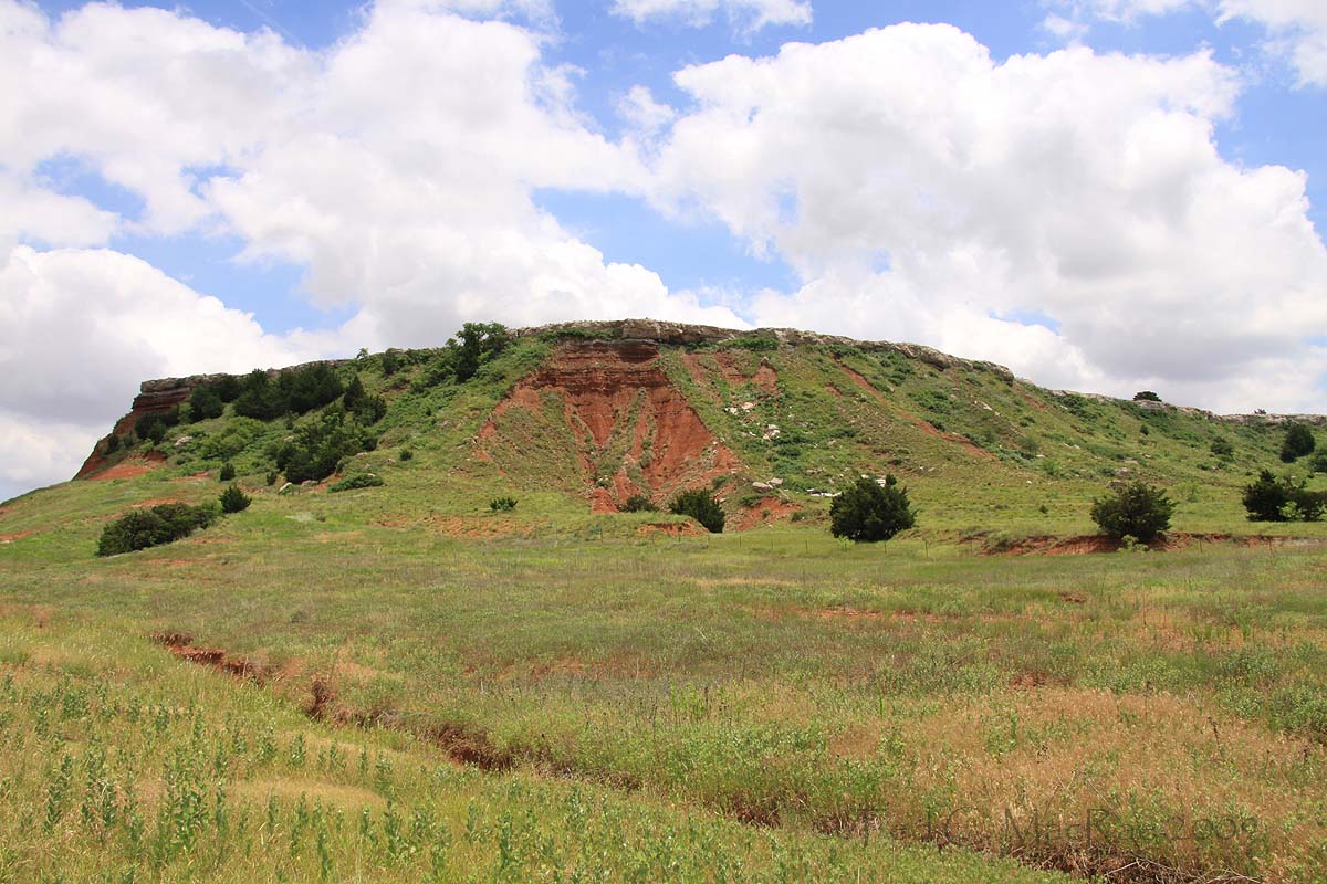
A few weeks ago, while waiting to begin my nocturnal hunt for the Great Plains giant tiger beetle (Amblycheila cylindriformis) in northwestern Oklahoma, I spent the daytime atop one of the red flat-topped mesas that meander through the area in nearby Gloss Mountain State Park.  Although my trip was all about seeing this giant of a tiger beetle in the wild for the first time (I could hardly wait for dusk to begin my search), I found enough splendid insects of other types atop the mesa to occupy my interest until that time.  One of these was the still-robust population of the Swift Tiger Beetle (Cylindera celeripes) that I discovered last summer and delighted in photographing yet again, while another was North America’s largest robber flyMicrostylum morosum!  I had just finished photographing one of the tiger beetles near the edge of the mesa when I turned and saw one of these impressively large flies sitting calmly on the ground nearby.
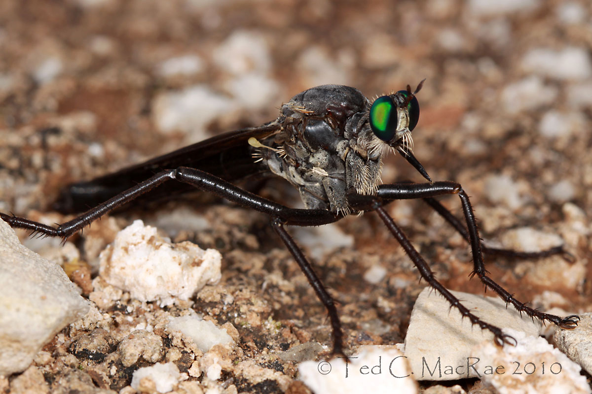
I first encountered this species last year in southwestern Missouri (a new state record!), so there was no question about its identity.  I also remembered how skittish they were and how difficult it was to get even the two mediocre photographs that I included in the resultant post.  Expecting the same, I kept my eye on the ground-sitter while preparing the camera and approached it with extreme caution.  To my surprise, it showed no sign of being alarmed or wanting to take flight.  I crouched down low and marveled at its monstrous impressiveness as I took frame after ever closer frame – eventually zeroing in on the head and its stunningly magnificent emerald-green eyes.

Satisfied that somewhere in the dozen and a half frames that I shot was at least one or two winners, I sat up and probed towards it with my finger to see how quickly it took flight.  It just sat there tenaciously until my touch caused it to finally take wing.  Winds were gusty atop the mesa, which may have accounted for its cooperativeness.  Standing up, I noted a few scattered eastern redcedars (Juniperus virginiana) in the mixed-grass prairie at the highest point of the mesa.  I recalled that robber flies are fond of “hilltopping” – a mating strategy whereby males fly to the highest point in their immediate landscape to defend a small territory or perch that provides a good vantage for spotting females and competing males (see Hilltopping by Eric Eaton at Bug Eric for a good discussion about this) – and my own experience with this species in Missouri and the way it tended to perch in the trees scattered across the upper part of the rocky, dolomite glade where I found them.  I wandered up to the redcedars, and as soon as I came close enough to one of them I saw another individual take flight – looking like some super-sized mosquito with it’s long legs spread wide as it clumsily flew to another tree.  As it turned out, I saw a number of individuals and mating pairs perching and flying among the trees on top of the mesa, each more spectacular than the previous.

Until recently, Microstylum morosum was considered a Texas-endemic.  However, Beckemeyer and Carlton (2000) documented this species to be much more broadly distributed in the southern Great Plains (from Texas up into Oklahoma and Kansas and west into New Mexico, Arizona, and Colorado), and Warriner (2004) recorded it shortly afterwards in Arkansas.  Although the species apparently occurs throughout Oklahoma (Beckemeyer and Carlton recorded from 13 counties across the state), my observation of it in Major County does seem to represent a new county record for the species.  There is another U.S. species in the genus, M. galactodes, and it has also been recorded from Oklahoma (the closest record is in nearby Woodward County).  However, it is easily distinguished by its generally smaller size, milky white wing membranes, reddish-brown body, and head and thoracic dorsum evenly covered with whitish pruinescence, while M. morosum has the wings and body black to brown and thoracic pruinescence restricted to the lateral margins (Beckemeyer and Carlton 2000).  I’m not sure I would have recognized that species for what it was had I seen it, but if it is anywhere near as impressive as M. morosum then I hope I have the fortune to find it someday as well.

Photo Details:
Landscape: Canon 50D w/ 17-85mm wide-angle lens (17mm), ISO 100, 1/100 sec, f/10, ambient light. Typical post-processing (levels, unsharp mask).
Insects: Canon 50D w/ 100mm macro lens, ISO 100, 1/250 sec, f/10 (photo 1), f/18 (photo 2), Canon MT-24EX flash (1/4 ratio) w/ Sto-Fen diffusers. Typical post-processing (levels, minor cropping, unsharp mask).

REFERENCES:

Beckemeyer, R. J. and R. E. Carlton.  2000. Distribution of Microstylum morosum and M. galactoides (Diptera: Asilidae): significant extensions to previously reported ranges.  Entomological News 111(2):84–96.

Warriner, M. D.  2004. First Arkansas record of the robber fly Microstylum morosum (Diptera: Asilidae).  The Southwestern Naturalist 49(1):83–84.

Copyright © Ted C. MacRae 2010

Add to FacebookAdd to DiggAdd to Del.icio.usAdd to StumbleuponAdd to RedditAdd to BlinklistAdd to TwitterAdd to TechnoratiAdd to Yahoo BuzzAdd to Newsvine

Email to a friend

Merci!

View from the Col du Soulor, French Pyrénées.

Most of you have probably surmised by now that I’ve been away for the past two weeks.   More specifically, I’ve been in Europe following the Tour de France and testing my own mettle as a cyclist in the French Pyrénées and the streets of Paris.  In the past two weeks, I’ve logged 710 km (I’m too tired to figure out what that is in miles) – most of it in the mountains over the same Cols and descents as this year’s Tour de France.  I’ve climbed (and descended) 10 mountain passes totaling well over 10,000 m of vertical ascent, reached speeds of 75 kph, rubbed elbows with more than 10,000 other cyclists in the 181-km Etape du Tour (finishing in the top 10%), seen six stages of the Tour de France, sought autographs from the world’s top pro cyclists, and sprinted against some seriously fast guys in Paris.  Add gorgeous 200-year old hotels, sumptuous French cuisine, and the comradery of 17 other like-minded individuals (including my lovely wife), and you have the makings of a trip that will not soon be forgotten.

My sincerest thanks to Anne McCormack, Alex Wild, James Trager, and Rich Thoma for filling in for me during my absence with their guest posts here at Beetles in the Bush.  I hope you enjoyed their contributions as much as I did (a safe bet, judging from the many comments their posts generated).  I’m a little bleary-eyed from the trip back home today, but life should return to normal quickly.  My trip was light on natural history – sometimes one has to make choices, and for this trip I decided to maintain cycling as the focus.  The big camera stayed home, and the point-and-shoot was used mostly for capturing race action.  Still, scenes like the one above – taken from the ascent of the Col du Soulor – captivated the natural historian in me and left me wanting to learn more about the unique flora and fauna that must exist in these gorgeous mountains.  Perhaps next time…

Copyright © Ted C. MacRae 2010

Add to FacebookAdd to DiggAdd to Del.icio.usAdd to StumbleuponAdd to RedditAdd to BlinklistAdd to TwitterAdd to TechnoratiAdd to Yahoo BuzzAdd to Newsvine

Email to a friend

The Power of Impulse

Glass Mountains, Oklahoma

Since figuring out a couple weeks that I had the larva of North America’s largest tiger beetle (Amblycheila cylindriformis, or Great Plains giant tiger beetle) in a rearing tub in the lab, I haven’t been able to think about anything except how cool it would be to go back out to the Glass Mountains in northwest Oklahoma (where I collected the larva last June) and look for the adults.  I have every reason not to do this trip – I just spent a long weekend up in northwest Missouri on follow up surveys for our newly discovered population of Cylindera celeripes (swift tiger beetle) (my second such trip in the past three weeks¹), and in a mere week and a half I leave for a 2-week trip to France.  Bills need to be paid, the grass needs cutting, and (as of today) a broken spoke needs to be repaired.  My collecting trips are normally planned far in advance – their timing and frequency part of a delicate balance between the goals I set for the season and the responsibilities that go along with having a job and a family.

¹ More on this in an upcoming post.

But for Amblycheila, it’s now or never – at least for this season, and the thought of waiting until next year before I can take my first valid shot at finding this species in the wild (and perhaps a previously unrecorded population, at that²) is just too unbearable.  So here I am, halfway to the Glass Mountains on as impulsive a trip as I’ve taken in a long time, hoping that my hunch pays off and I’ll find the strikingly large adults of A. cylindriformis lumbering below the flat-topped mesas in the mixed grass prairie where a little more than a year ago I was collecting its enormous larva. It’s a drive-collect-drive trip, and if successful I won’t be the first person to photograph them, even well, but it will nevertheless fulfill my longtime desire to locate this species in the wild and see it with my own eyes – a far more gratifying experience than looking at the lone dead specimen acquired long ago through trade that sits in my cabinet. Wish me luck!

² Drew and Van Cleave (1962) saw only a single specimen from the state in neighboring Woodward Co., although this is now a rather old reference.

REFERENCES:

Drew, W. A. and H. W. Van Cleave.  1962. The tiger beetles of Oklahoma (Cicindelidae).  Proceedings of the Oklahoma Academy of Science 42:101–122.

Copyright © Ted C. MacRae 2010

Add to FacebookAdd to DiggAdd to Del.icio.usAdd to StumbleuponAdd to RedditAdd to BlinklistAdd to TwitterAdd to TechnoratiAdd to Yahoo BuzzAdd to Newsvine

Email to a friend

Taum Sauk Mountain – Missouri’s High Point

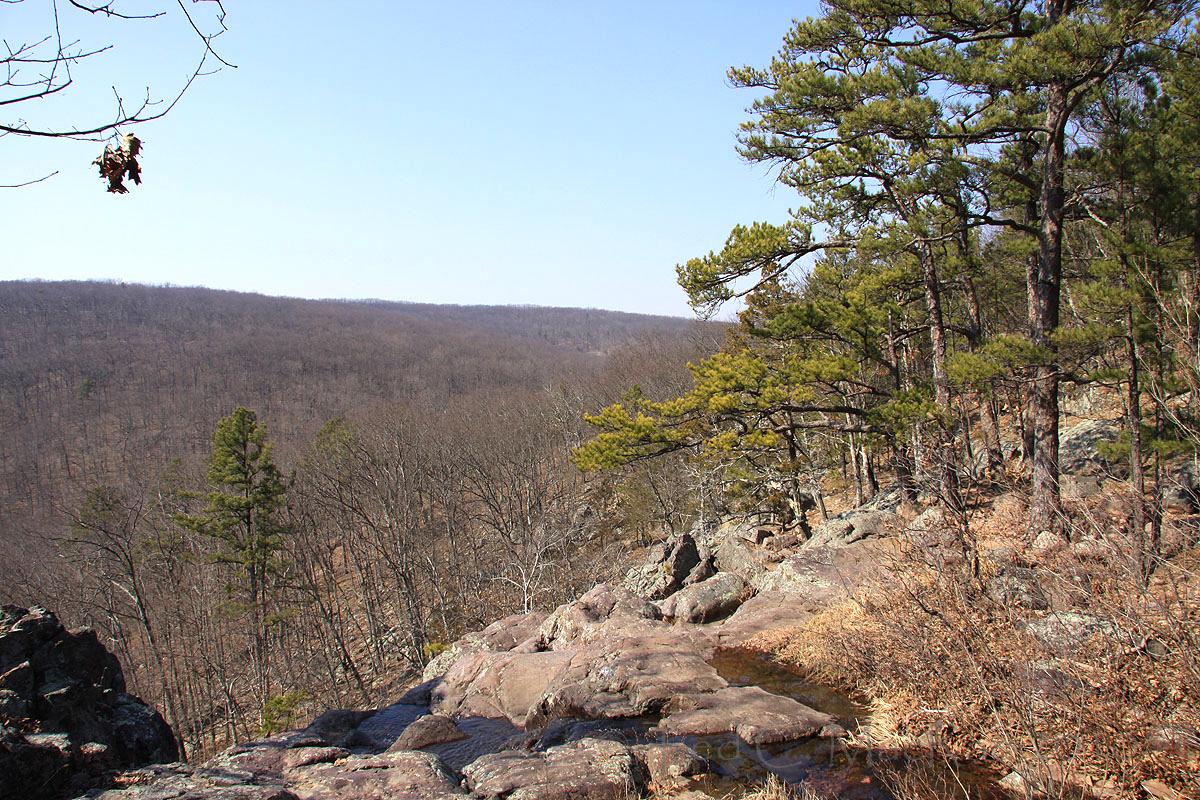
Although spring is now well underway in the middlin’ latitudes of Missouri, it was only a few short weeks ago that winter was still with us.  For my last winter hike of the season, I returned to perhaps my favorite stretch of my favorite trail in all of Missouri – the Mina Sauk portion of the Taum Sauk Trail on Taum Sauk Mountain.  Located in the rugged St. Francois Mountains (the “epicenter” of the Ozark Highlands), Taum Sauk Mountain is Missouri’s highest peak.  I say “peak” with a bit of reservation – at 1,772 feet it hardly compares with the high peaks of the Rocky Mountains or even the much mellower Appalachians (and certainly not with those of my beloved Sierra Nevada).  Nevertheless, unlike the remainder of the Ozark Highlands, the St. Francois Mountains are true mountains initially formed through a series of volcanic events occurring well over a billion years ago.  They, and the rest of the Ozark Highlands, have been shaped to their current form by repeated cycles of uplift and subsequent erosion.  

During their Precambrian prime, the St. Francois Mountains reached heights of 15,000 feet (the “ancient” Appalachians, in the meantime, were still just a twinkle in Mother Earth’s eye).  Rain and wind and the vastness of time have reduced them to nubs, leaving only the most ancient of volcanic rocks as testament to their former glory.  Although most of what is now the Ozark Highlands was inundated repeatedly later in the Palaeozoic (laying down the sediments that were then uplifted and “carved” to their current shape), the highest peaks of the St. Francois Mountains may be among the few areas in the United States never to have been completely submerged under those ancient seas.  Standing atop Taum Sauk Mountain, it is tempting to visualize today’s craggy terrain as a fossil of that ancient landscape – the peaks representing the former islands of rhyolite, their slopes barren and lifeless in stark contrast with the exploding diversity of bizarre life forms appearing in the tropical waters that surrounded them.

The sterile, volcanic rocks of the St. Francois Mountains support an abundance of open, rocky glades – especially on their peaks and southern and western slopes – that are home to a number of plants and animals more typically found in the tallgrass prairies further west.  Indian grass (Sorghastrum nutans) and little bluestem (Schizachyrium scoparium) thrive in clumps between the large, pink boulders that are strewn across the landscape and which provide shelter and sunning spots for animals ranging from the charismatic eastern collared lizard (Crotaphytus collaris) to the smaller but no less beautiful splendid tiger beetle (Cicindela splendida).  The surrounding forest is historically an open woodland with a rich, herbaceous understory and widely-spaced, drought-tolerant trees such as shagbark hickory (Carya ovata), post oak (Quercus stellata), and blackjack oak (Quercus marilandica).  These woodlands and glades are a fire-mediated landscape dependent upon periodic burns to maintain their vegetative character.

A trail begins at “High Point”, marking the summit of Taum Sauk Mountain and the highest point in Missouri.  A granite slab next to the summit rock documents the elevation at 1,772.68 feet MSL (Mean Sea Level).  The Mina Sauk Falls Trail, a rugged three-mile loop that joins the Taum Sauk Section of the Ozark Trail, leads to the tallest wet-weather waterfall in Missouri, Mina Sauk Falls.  During periods of high water flow, water gushes over the edge and drops 132 feet over a series of rocky ledges.  Water was flowing lightly during my late winter visit; nevertheless, looking out from above the falls (see photo above) offers one of the most spectacular vistas available in Missouri.  A rather difficult hike down the side of the mountain to the bottom of the falls is also well worth the effort, although clear views of the entire falls are difficult to find in the dense, moist forest below (it was here that I photographed the spectacular Ozark Witch Hazel).

A second unique geological feature lies about a mile farther down the Ozark Trail – Devil’s Toll Gate.  The rocks stand 30 feet high on either side of this eight-foot-wide, 50-foot-long fissure.  The gap probably began as a vertical fracture in the rock that has been enlarged by subsequent weathering. Over time the fissure will continue to widen, as the rocks on either side lose height.

Returning to High Point at the end of the hike, I noticed that the summit was a little higher than when I started my hike – whether this was through additional uplift of the underlying mountain or a depositional event I cannot say.  Nevertheless, I estimated Missouri’s new highest elevation to be approximately 1,773.01 feet MSL!

Copyright © Ted C. MacRae 2010

Add to FacebookAdd to DiggAdd to Del.icio.usAdd to StumbleuponAdd to RedditAdd to BlinklistAdd to TwitterAdd to TechnoratiAdd to Yahoo BuzzAdd to Newsvine

Email to a friend

Bicycle ride around Lake Tahoe

Overlooking Emerald Bay from Emerald Bay Pass.

Perhaps some of you have by now deduced that, in addition to insects and natural history, I have a second passion – cycling! In fact, I raced bikes competitively as an amateur for seven years (going by the local nickname “BugMan“) before hanging it up at the end of 2008.  However, even though I’m not racing anymore, I still ride as much as ever, only now it’s purely for the fun of it!  I’m a dedicated roadie, riding year-round and averaging around 5,000-6,000 miles a year.  I love the speed and the smoothness of the road and the opportunity it provides to cover long distances and enjoy the sights (not to mention the resulting freedom to eat like a horse and stay relatively trim!).

One of my most memorable cycling experiences was in 1995, when I joined a group that rode the entire circuit around Lake Tahoe.  I was living in Sacramento at the time and was a relative newbie – the 72-mile ride with 3,500 feet of climbing at elevations ranging from 6,200 feet at lake level to more than 7,000 feet near Carson Pass was without question the most difficult ride I had ever attempted at that point.  Now, as a seasoned ex-racer, such a ride is not extraordinarily difficult for me – in fact, I do rides in the 60-80 mile range with as much climbing or more almost every weekend.  Still, my memories of the challenge and the unbelievable scenery have kept that ride high in the ranks of my most epic, and since we began going back to Lake Tahoe two spring ago I’ve wanted to do it again.  It would not have been possible during our first trip back, as the roads still had quite a bit of snow on them; however, last year the roads were clean and dry, and I resolved to bring my bike with me on this year’s trip in the event that such was again the case.  Madonna del Ghisallo (patron saint of cycling) must have been smiling down upon me, because this year the roads were again in beautiful condition, despite the amount of snow blanketing the surrounding landscapes.  It made for one of the most beautiful bike rides I have ever done in my life.

There was a comforting familiarity to the ride, despite the 15 years since the last – the stunning landscape that I have come to cherish so dearly, the massively shaded solitude of the west shore, lunching on California cuisine in a quaint village along the north shore, and the long climbs and screaming descents through open Jeffrey pine forests along the east shore.  It was also different – I was by myself, yet despite that I was stronger and briming with confidence; not only a seasoned cyclist, but also much more knowledgeable of and closely attuned to the natural history of the area.  I didn’t fear the climbing, I relished it!  I didn’t overcome the challenge, I enjoyed it!  I stopped at a few places to take photographs (taken with my small point-and-shoot, for obvious reasons) and share some of them here – I hope they give you a tiny taste of the flavor of that day.

Near the summit of Emerald Bay Pass, looking back at Mt. Tallac.

High point on Emerald Bay Pass.

The descent to Eagle Falls at Emerald Bay.

 This is an avalanche zone (note deep snow deposits on steep slopes on left side – these extend high up the mountain here).  Moments after taking this photo, an avalanche fell onto the road right as I was descending by this spot. At ~35 mph there was no stopping – I rode right through it as the initial snow drop hit the pavement and then watched in amazement as the main drop dumped onto the road behind me.  It was not big enough to bury anything, but I surely would have crashed had I gotten there just a moment or two later!

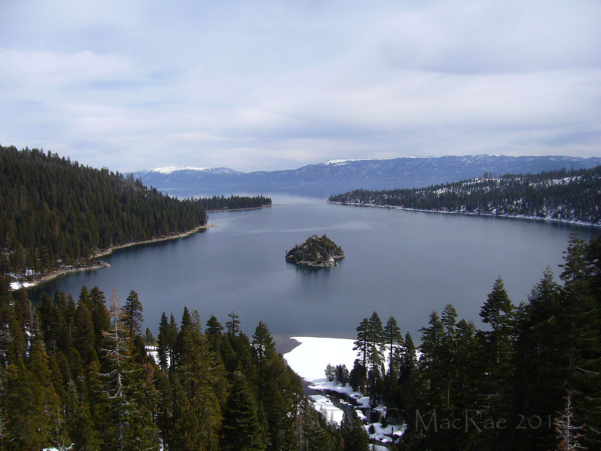
Overlooking Emerald Bay from Emerald Bay Pass.

Emerald Bay is a glacial scour formed during the last glacial period ending only 10,000 years ago. Fannette Island, Lake Tahoe’s only island, is thought to be a resistant rib of granite rock that was overridden by the glacial ice. Lateral glacial morraines enclose each side of the bay, and an incomplete terminal morraine connects Emerald Bay to the main lake. Last year, I stood atop the outermost rock of the left side of the terminal morraine and took photographs looking back in this direction

Grove of sugar pines at D. L. Bliss State Park.

Sugar pine, Pinus lambertiana, is among my favorite of all pines.  More common on the west shore due to their preference for higher levels of moisture, their towering, ragged, asymmetrical crowns with long, pendulous cones (usually a foot or more in length) hanging from the branch tips are immediately recognizable from afar.  These majestic trees are the world’s tallest pine and bear the longest cones in the genus; they stand in defiant contrast to the uniformly symmetrical crowns of the more common Jeffrey pines (Pinus jeffreyi) and white firs (Abies concolor) that surrounded them.  For a more thorough treatment of the trees of Lake Tahoe, please visit my three-part series covering the pines, the “other” conifers, and the deciduous trees.

Some might think it was still a little too early in the season for bike riding.

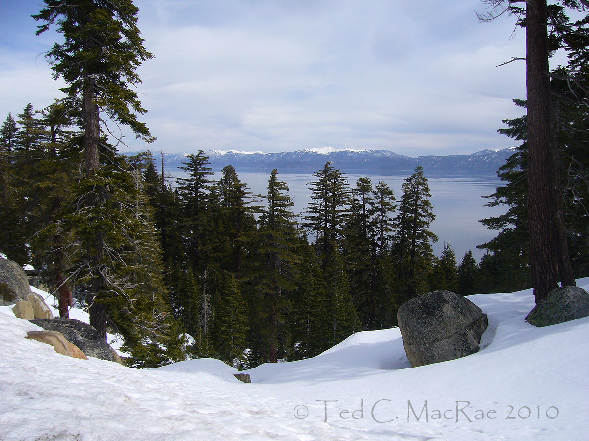
Looking west across Lake Tahoe from Logan Shoals Overlook.

The east shore in Nevada is decidedly drier than California’s west shore.  The forest on the Nevada side is a more open, fire-mediated landscape dominated by Jeffrey pine, as opposed to the denser forests on the west shore with higher incidence of shade-tolerant trees such as white fir and incense-cedar (Libocedrus decurrens).

View of Cave Rock (left center) from Logan Shoals Overlook.

Cave Rock was and still is a sacred place for people of the Washoe tribe, whose ancestors occupied Lake Tahoe during the summers and performed religious ceremonies inside the largest of its caves.  These caves, sitting several hundred feet above the current lake level, were carved by wave action shortly after Lake Tahoe’s formation nearly 3 million years ago when lake levels were much higher than they are today.  The first of two highway tunnels was blasted through the rock in 1931 (much to the dismay of the Washoes), and the second was added in 1957.

Looking north along Lake Tahoe's east shore from atop Logan Shoals Overlook.

Copyright © Ted C. MacRae 2010

Add to FacebookAdd to DiggAdd to Del.icio.usAdd to StumbleuponAdd to RedditAdd to BlinklistAdd to TwitterAdd to TechnoratiAdd to Yahoo BuzzAdd to Newsvine

Email to a friend

Up the Glacial Staircase

During last year’s visit to Lake Tahoe, we attempted to hike Eagle Falls Trail, one of Lake Tahoe’s most scenic and popular trails.  Beginning at the Hwy 89 trailhead above Emerald Bay, this trail climbs a dramatic ‘glacial staircase’ with steep, narrow gorges connecting a series of deep lakes and meadows.  Each of these lakes, and indeed Emerald Bay itself, was formed as a result of glaciers that carved Lake Tahoe’s granite shores until as recently as 10,000 years ago – leaving behind scars of incomparable beauty.  Eagle Lake perches atop one of these steps – only a short, one-mile hike up the trail but rising nearly 2,000 feet above the trailhead.  Summer hikers have trouble enough dealing with this elevation gain, but winter hikers – as we learned last year –  find it impossible without the assistance of snowshoes.  The first steep section just short of Upper Eagle Falls would prevent any further progress, leaving me with only a teasing view up the gorge and a commitment to try again on our next visit.

There was even more snow this year than last – a good 4-6′ it appeared, but our rented snowshoes made this irrelevant (even desirable), and the four of us began the arduous task of climbing the snow-laden slopes all the way up to Eagle Lake.  It was a family affair, so the pace was dictated by 10-yr old Madison, who got us to Eagle Lake – serenely beautiful and frozen solid – in a leisurely 1 hour 45 minutes.  The hike back down the gorge passed more quickly (almost too quickly) but provided spectacular views of Emerald Bay and Lake Tahoe below. Those of you with an interest in the geological history of Lake Tahoe may refer to my earlier posts, Lake Tahoe, California (Mar 2008) and Born of Glaciers (Mar 2009).  The rest of you may just enjoy these pretty pictures.

View of Upper Eagle Falls - it was here where our hike last year would end.

View back down the gorge from bridge over Upper Eagle Falls.

Looking back down at Emerald Bay from Eagle Falls Trail.

Further up the trail, one looks back upon this spectacular view of Jake's Peak.

Eagle lake lies at 8,500' elevation (frozen lake surface visible through trees left).

Copyright © Ted C. MacRae 2010

Add to FacebookAdd to DiggAdd to Del.icio.usAdd to StumbleuponAdd to RedditAdd to BlinklistAdd to TwitterAdd to TechnoratiAdd to Yahoo BuzzAdd to Newsvine

Email to a friend

Lake Tahoe – 2010 Preview

How does an entomologist/wannabe botanist-ecologist-geologist-cyclist-nature photographer spend his time on a family vacation?

  • Thursday evening to Saturday late afternoon:
    – Drive from St. Louis to Lake Tahoe.  In between driving shifts:
    – Complete manuscript on Cylindera cursitans surveys
    – Complete manuscript on Dromochorus pruinina surveys.
    – Arrive late afternoon, quick 1-hr bike ride before dark.
  • Sunday:
    – Cross-country skiing with the family: Spooner Lake (~6 miles).
    – Sight-seeing: Sand Harbor Overlook on the east shore.
    – Hang out at the hot tub with the family and a glass of wine.
  • Monday:
    – Drive to Sacramento with the family.
    – Visit buprestid-colleagues Chuck Bellamy (CDFA) and Mark Volkovitsh (Russian Academy of Science).
    – Private lesson from Mark on how to dissect buprestid larvae for taxonomic description.
    – Dinner with my favorite brothers-in-law.
    – Drive back to Lake Tahoe.
  • Tuesday:
    – Snowshoe hike with the family: Emerald Bay to Eagle Lake and back (2 miles, 1,900′ of climbing).
    – Bike ride: South Lake Tahoe to Bliss State Park and back (33 miles, 1,100′ of climbing).
  • Wednesday:
    – Bike ride: all the way around Lake Tahoe (72 miles, 3,500′ of climbing).
    – Hang out at the hot tub with the family and a glass of wine.
  • Thursday:
    – Botanizing and hiking with daughter Madison at Mt. Rose (4 miles, 1,300′ feet of climbing).
    – Hang out at the hot tub with the family and a glass of wine.
  • Friday:
    – Alpine skiing with the family at Heavenly Ski Resort.
    – Join a 2-hour ski tour with US Forest Service rangers discussing natural and cultural history of Lake Tahoe.
    – Hang out at the hot tub with the family and a glass of wine.
  • Saturday morning to Sunday night:
    – Drive from Lake Tahoe back to St. Louis.  In between driving shifts:
    – Process/file photographs from trip (~250).
    – Complete reports for 2009 collecting permits.
    – Complete new applications for 2010 permits.
    – Begin manuscript on Cylindera celeripes conservation status.
  • Monday:
    – Return to work mentally refreshed!

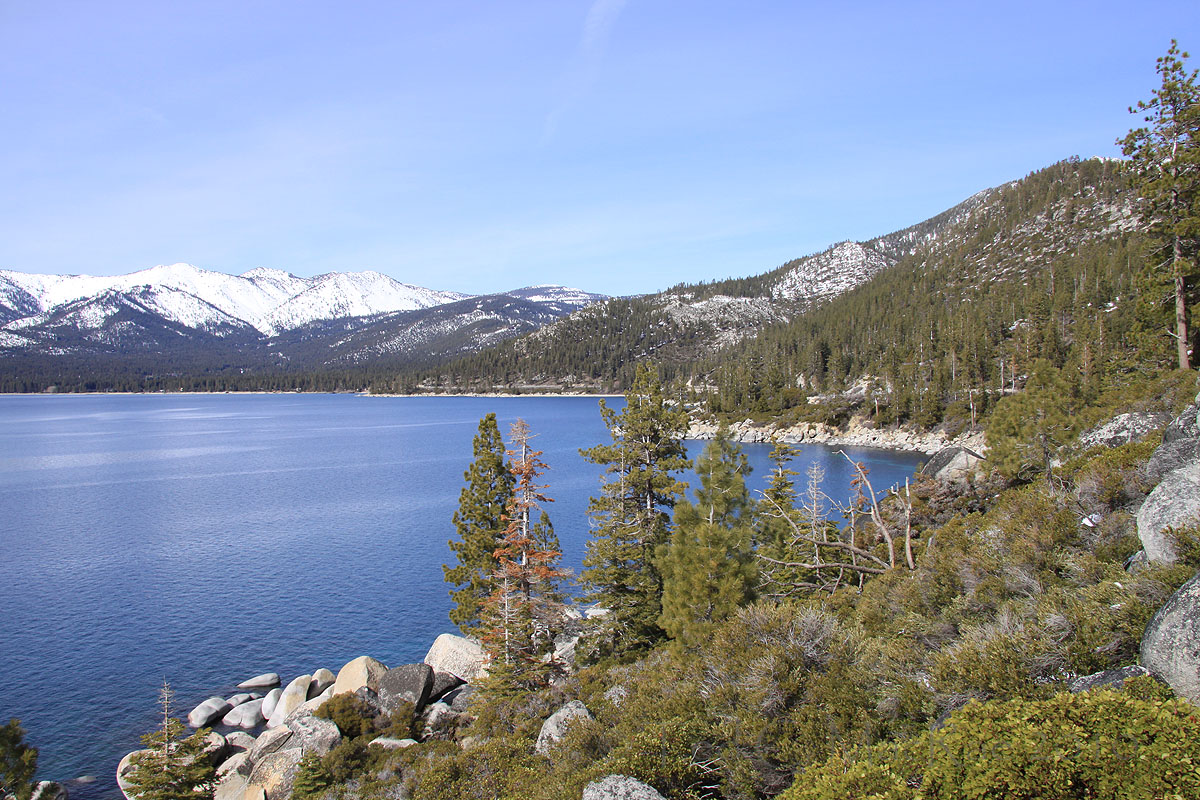
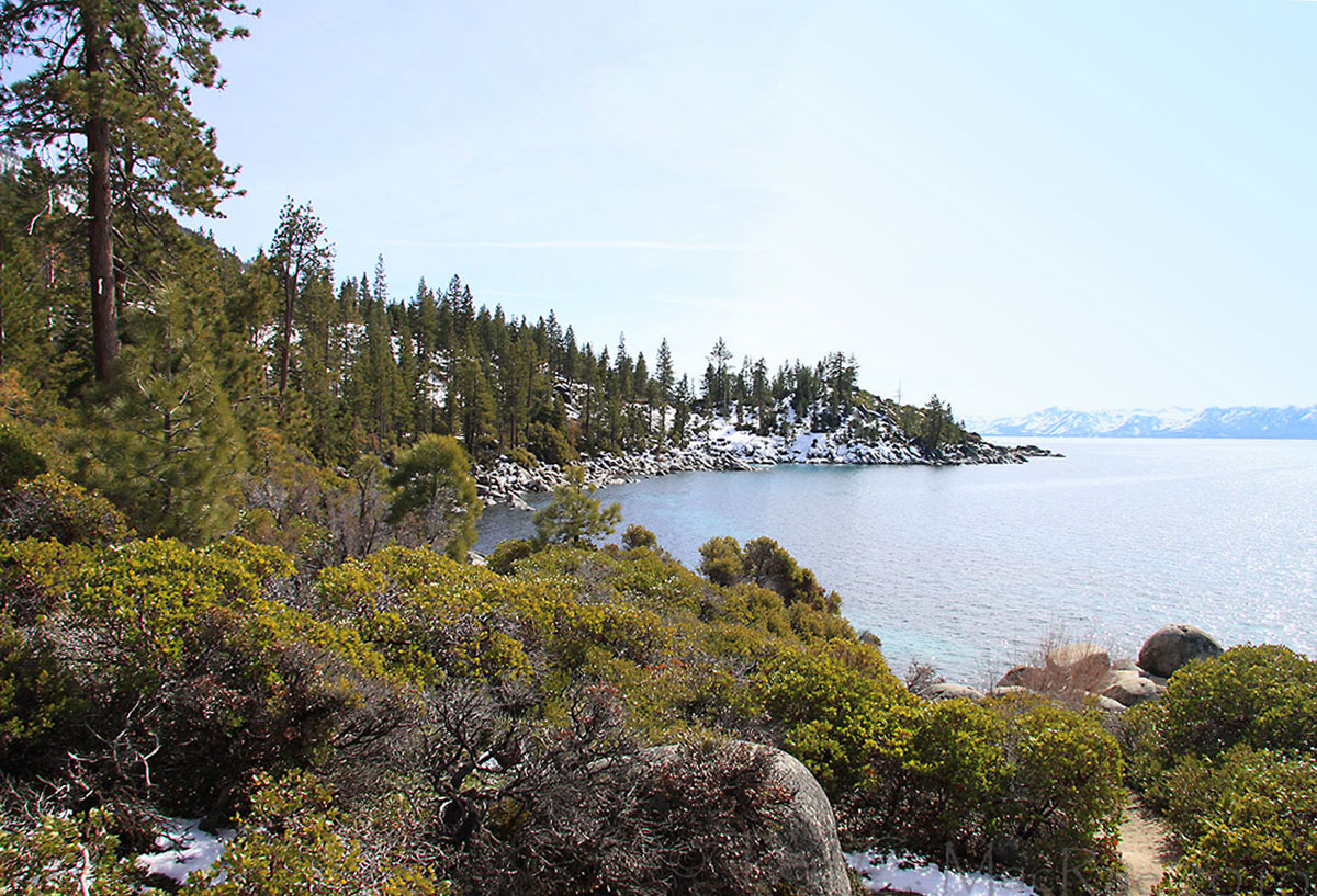
I’ve already shared a bit of the trip with a view of Mt. Rose from 7,000′ and ensuing pismire quagmire.  Today I share some views of one of the most scenic of lakeside spots on the east shore – Sand Harbor Overlook.  I featured this spot in this post from last year’s trip due to its stunning beauty, and this year I was no less impressed.  I still had that same, annoying, afternoon sun to deal with (next year I’ve resolved to get here during the morning) but managed to get some passable photographs.  The one above is my favorite, and I hope you enjoy the following as well. (p.s. if someone knows how to fix a sun-blown sky in Photoshop Elements, please let me know).

Copyright © Ted C. MacRae 2010

Add to FacebookAdd to DiggAdd to Del.icio.usAdd to StumbleuponAdd to RedditAdd to BlinklistAdd to TwitterAdd to TechnoratiAdd to Yahoo BuzzAdd to Newsvine

Email to a friend

Euhagena nebraskae in Kansas

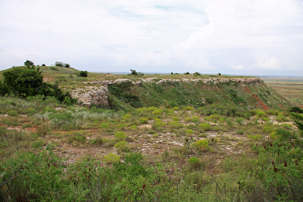
Gypsum Hills region of south-central Kansas (Barber Co.)

One of my favorite destinations for insect collecting is the Gypsum Hills region in Barber County of south-central Kansas.  I first went there in May 1986 after seeing a diverse selection of more typically Texan Buprestidae that J. Richard Heitzman, an iconic lepidopterist in the Kansas City area and author of Butterflies & Moths of Missouri, had collected there on soapberry (Sapindus saponaria).  I had my own success with Buprestidae as well during that trip, but in recent years I have returned to Barber County several times during the fall to look for one of North America’s most beautiful tiger beetles, Cicindela pulchra (Beautiful Tiger Beetle).  This species had been recorded in the area by the well-known cicindelophiles Ron Huber and Dave Brzoska, who suggested that I look in the red clay hills just west of Medicine Lodge.  My first trip to look for this beetle in 2004 was unsuccessful, and I suspect the early September timing of my trip may have been a tad too early.  I returned again in 2005, this time in early October and also enlisting the help of local entomologist “Beetle Bill” Smith, who knew of a population on private land near his home in Hardtner (south of Medicine Lodge).  Although at first it looked like success might again elude me, in the end I saw a robust population of these spectacular beetles and published an account of that marvelous experience (MacRae 2006).

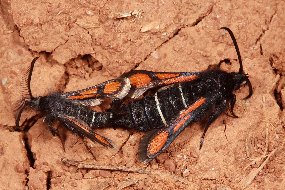
As with so many of the things that I have seen over the years, they came before my interest in photography, and I now find myself wanting to re-find some of the more spectacular insects that I’ve previously found so that I can properly photograph them.  Such is the case with C. pulchra, so in October of last year I returned to Barber County in hopes of seeing this species armed not only with an aerial net, but also a Canon 50D.  Sadly, this would not come to pass – the same sudden cold snap that dashed my hopes of finding this species in nearby Woodward/Major Counties, Oklahoma would keep any tiger beetle activity to a bare minimum the following day in Barber County as well.  Despite bright sunny skies, I would see only two tiger beetles the entire day, both representing the dreadfully ubiquitous Cicindela punctulata (Punctured Tiger Beetle).  Not all insect activity, however, was squelched, and after scanning the red soils for an hour or so without seeing the object of my desire I began to notice some of these other not-so-temperature-finicky species.  One of the more magnificent of these is shown in the photo below — Euhagena nebraskae in the family Sesiidae (cess-EYE-id-ee) (formerly Aegeriidae).

Euhagena nebraskae

Euhagena nebraskae (Lepidoptera: Sesiidae)

Although I wasn’t sure of the species at first, I recognized it immediately as a clearwing moth.  I had an interest in this family of moths for a time in my early days as a field entomologist with the Missouri Department of Agriculture.  Many species are important pests of woody plants in orchard and ornamental landscapes, and it was during that time that synthetic pheromones became widely used for monitoring purposes.  I often walked around with a pheromone tag pinned to my bag to attract the male moths — it was fun watching people seeing these moths “buzzing” me and thinking I was under attack by the wasps that they so effectively mimic (despite my calmness in these situations, I still found it hard to actually grab one from the air with my hand – so convincing is their mimicry).

Euhagena nebraskae is one of two species in the genus in North America, both of which develop as larvae in the roots of plants in the evening primrose family (Onagraceae) (Eichlin and Duckworth 1988).  In fact, I had seen its congener — E. emphytiformis — many times in the 1980s in pheromone traps that I used to place in the glades of Jefferson County just south of St. Louis, where it presumably breeds in one or both of two Oenetherea species growing there (O. gaura and O. macrocarpa).  Euhagena nebraskae is a more western species that does not occur in Missouri, occurring instead across the Great Plains west to California and from southern Alberta and Saskatchewan south to Mexico.  It is likely that many entomologists never see this species, as adults are active only during late fall.  Thus, its perception as an uncommon species may be an artifact of its late seasonality. 

I thought it odd that nearly every individual that I saw was sitting on the ground rather than perched higher on a plant.  At first I wondered if the cold temperatures were a reason for this, perhaps causing the moths to seek out the ground as a source of radiant heat.  This seems doubtful, however, since females always seemed to be “calling” – their tufted abdominal tips raised in the air with the scales spread apart, apparently releasing pheromone.  I was fortunate to find this mating pair, which shows nicely the rather high degree of sexual dimorphism seen in these moths.  Note the much more highly bipectinate antennae of the male (pectinate = resembling a comb, bipectinate = ‘teeth’ on both sides of the main stem) versus the simple antennae of the female — males use their antennae for detecting female pheromones, and the bipectinate form presumably provides greater surface area for placement of sensory pores. Note also the male’s smaller size, “hairier” head and thorax, and greater amount of white coloration on the abdomen and wings.  Engelhardt (1946) supposed that the excessive hairiness of adult Euhagena species was an adaptation to their late-season emergence (principally during October and sometimes as late as November), a time when frosty nights prevail in their high-elevation haunts.    

REFERENCES:    

Eichlin, T. D. and W. D. Duckworth. 1988. The Moths of America North of Mexico, Fascicle 5.1, Sesiodea: Sesiidae. Wedge Entomological Research Foundation, Washington, 176 pp.

Engelhardt, G. P. 1946.  The North American clear-wing moths of the family Aegeriidae. Bulletin of the United States National Museum 190:1-222.

MacRae, T. C. 2006. Beetle bits: The “beautiful tiger beetle”. Nature Notes, Journal of the Webster Groves Nature Study Society 78(4):9–12.

Copyright © Ted C. MacRae 2010

Add to FacebookAdd to DiggAdd to Del.icio.usAdd to StumbleuponAdd to RedditAdd to BlinklistAdd to TwitterAdd to TechnoratiAdd to Yahoo BuzzAdd to Newsvine

Email to a friend