Last fall, my good friend Richard Thoma and I visited “Snake Road” is a famous snake viewing area in southern Illinois—part of the LaRue-Pine Hills/Otter Pond Research Natural Area. Early October is prime season for viewing snakes there, principally northern cottonmouths (a.k.a. water moccasins—Agkistrodon piscivorus) as they move from the wetlands on the west side of the road to the towering limestone bluffs on the east side seeking crevices in which to shelter for the winter. With a string of cool nights and sunny skies and a forecasted high of 78°F, we couldn’t have picked a better day to look for them.
Shafts of morning sunlight stream through the forest.
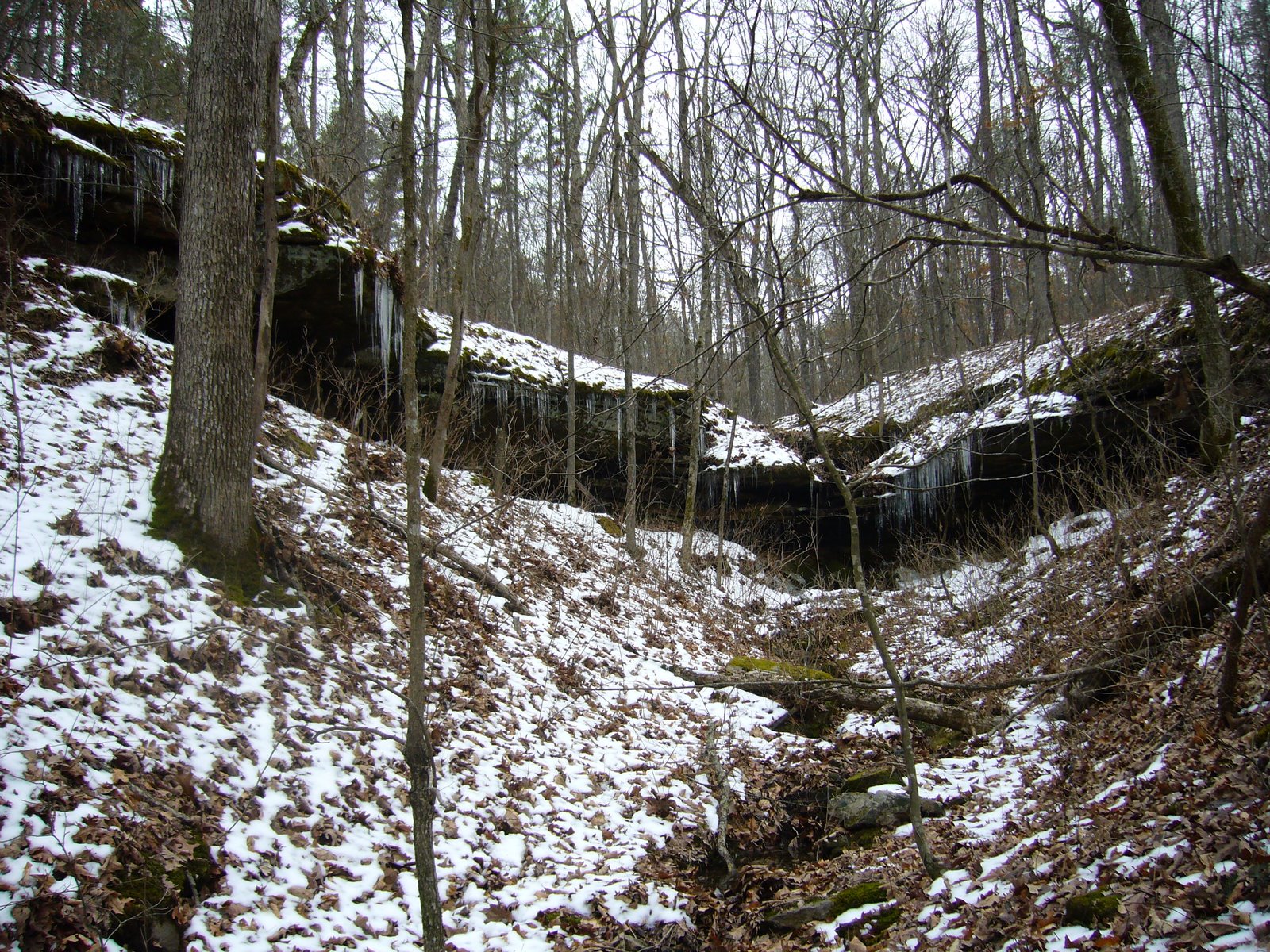
We arrived a little after 9am, so conditions were still a bit too cool for the snakes. Shafts of morning sunlight streaming through the trees were a sight to behold, and we used the opportunity to notice some plants that we’d not seen before, including two species of goldenrod—i.e., Solidago caesia (bluestem goldenrod) and S. flexicaulis (broadleaved or zigzag goldenrod), Decodon verticillatus (swamp loosestrife), and Laportea canadensis (wood nettle). I noticed small green berry-like structures on some of the latter, which I at first took to be fruits, but something about them said “gall” and I cut one open to find a small insect larva inside verifying this to be the case. I presume this to gall to have been caused by Dasineura investita (wood nettle gall midge) in the family Cecidomyidae.
Solidago caesia (blue-stemmed goldenrod) in mesic bluff base forest.
Inflorescence of Solidago caesia (blue-stemmed goldenrod) in mesic bluff base forest.
Solidago flexicaulis (broadleaved or zigzag goldenrod) in mesic bluff base forest.
Inflorescence of Solidago flexicaulis (broadleaved or zigzag goldenrod) in mesic bluff base forest.
Decodon verticillatus (waterwillow or swamp loosestrife) in Mississippi River floodplain oxbow lake.
Laportea canadensis (Canada nettle or wood-nettle) in mesic bluff base forest.
Gall on Laportea canadensis (Canada nettle or wood-nettle), presumably caused by Dasineura investita (wood nettle gall midge).
Dissected Dasineura investita (wood nettle gall midge) gall on Laportea canadensis (Canada nettle or wood-nettle) revealing the larval inhabitant.
As we hiked south along the road (closed to automobiles during spring and fall to protect the migrating snakes), and especially when temperatures climbed above 70°F, we began looking in earnest for snakes, reasoning that they might best be found by searching along the base of the bluffs and in nearby crevices. We searched one particularly promising rock ledge without success, then encountered a spring draining from the main bluffs and followed it to the base, where we split up and looked along the base in both directions. My direction took me around a bend and up the hillside, with many nice-looking crevices but no snakes in them, and when I reached to top of the exposed bluff face I turned back and retraced my steps. Just after reaching the bottom I noticed movement near where I’d taken a step, and there it was—a gorgeously-marked juvenile cottonmouth! I called Rich over, and together we spent about a half-hour taking turns trying to get the perfect photograph of the snake while trying to minimize the degree to which we disturbed it (lest it make a dash for the nearest crevice, or worse yet, take a lunge at one of us). The majority of the photos shown here are of this individual, and the only photo I wish I would have gotten was one with a fully-extended, flickering tongue.
Our spirits buoyed by the experience, we bushwhacked back to the road and almost immediately encountered not one but two fully mature individuals—both having already lost the distinctive patterning seen on the juvenile but beautiful nonetheless. We spent more time photographing these as well, as we were able to get several great shots of the distinctly marked throat and mandible as they reared their heads in cautious defiance. I used the big camera exclusively for these shots, as they were much too large and I would have had to have gotten much too dangerously close to photograph them with my iPhone (look for photos to appear eventually on my natural history blog—‘Beetles in the Bush’).
Further south we found an exposed bluff face very close to the road, and several additional mature individuals were seen there—two deeply ensconced within their chosen crevice but one fully exposed (two photos here) who even cooperated by gaping his mouth in alarm to show off the cottony-pink tissues inside.
Adult northern cottonmouth (Agkistrodon piscivorus) with mouth agape, revealing the cottony-pink tissues inside that give rise to its common name.
In all, we would see nine individuals by the time we hiked to the southern parking lot and turned around, and on the way back, not trying nearly as hard and making a more direct line to the car, we would see another five individuals (two of which could have been individuals we’d seen on the way out) for a total of 14. We also watched in amazement as a tiny juvenile eastern yellow-bellied racer (Coluber constrictor flaviventris) chased down a fly on the road before dashing back towards the forest, and we were particularly amused by a nine-banded armadillo (Dasypus novemcinctus) who lumbered stupidly out of the underbrush straight towards us, completely unaware of our presence until Rich made a sudden movement with his hand that sent the little brute scurrying back into the underbrush.
Nine-banded armadillo (Dasypus novemcinctus).
Almost as we reached the car, we found a ribbon snake (Thamnophis sauritus) stretched out across the road. Snake sightings notwithstanding, the return hike back to the car was not nearly as enjoyable as the hike out, as by this time quite a number of other people had shown up and we no longer had the place to ourselves. I can only imagine what it must be like here during the weekend! Nevertheless, we couldn’t have imagined a more successful and enjoyable outing than the one we experienced today.
Welcome to the 11th “Collecting Trip iReport”; this one covering a very short (4 days) trip to northwestern Oklahoma on May 3–7, 2022. My collecting partner for this trip was long-time friend and hymenopterist Mike Arduser. Mike is one of the best natural historians that I know and, like me, has a special love for the often overlooked beauty of western Oklahoma and its fascinating insect fauna. It had been 13 years, however—too long, in my opinion, since our last joint field trip when we sampled the bee (Mike) and beetle (me) fauna at The Nature Conservancy’s Four Canyon Preserve in Ellis Co. Thus, I was happy for the chance to once again spend some time in the field with such a knowledgeable naturalist in an area we that both know and love.
Day 1 – Gloss Mountain State Park (Major Co.) It took most of the day to get here—Tulsa threw us a couple of obstacles in the form of a construction-mediated wrong turn and a motorcycle engulfed in flames. I’ve been to Gloss Mountain a number of times, but never this early in the season. Skies were sunny (unlike St. Louis when we left this morning), but temps didn’t get much above 60°F and even dropped down into the upper 50s before we finished up at sunset.
Gloss Mountain State Park – early evening view from atop the mesa.
Surprisingly, despite the earliness of the season and cool temps, beating was quite productive. Working the low areas around the parking lot, I beat a fair number and diversity of beetles and hemipterans—mostly chrysomelids—but only a single Agrilus sp. off of Prosopis glandulosa.
This must be Oenothera macrocarpa ssp. oklahomensis (bigfruit evening primrose, Ozark sundrop, Missouri evening primrose).
I knew there were other trees, principally Celtis reticulata (net-veined hackberry) and Sapindus drummondii (soapberry), on top of the mesa and wanted to see if anything was on them. Bingo! Even before reaching the top, I beat a few Agrilus (several spp.) from the Celtis, and up on top I beat quite a few more off the same. There were also additional mesquite trees up top, off which I again beat a single Agrilus sp. along with a few other things, notably a series of ceresine treehoppers. The Sapindus was just starting to leaf out, and I found nothing by beating them other than a single ceresine. A notable find was the pile of larval frass of Plinthocoelium suaveolens (bumelia borer) at the base of a living Sideroxylon lanuginosum (gum bumelia) tree—a sure sign of active infestation by a beetle I have yet to formally record from this place.
Frass at the base of a small Sideroxylon lanuginosum (gum bumelia)—evidence of an active larval infestation by Plinthocoelium suaveolens (bumelia borer).
On the way back down from the top, we hit the sunset perfectly as it “touched” a peak in the foreground! Despite my success here this evening, Mike saw no bees of interest on the few flowers that were found due to the cold temps and chilling winds, so tomorrow we will continue west hoping for warmer conditions on the western edge of Oklahoma.
Dramatic sunset “landing” on a small foreground peak.
The opportunity lasted for only a minute!
Back in town, we searched for an open sit-down restaurant—fruitlessly because of the late hour—and ended up with a mediocre breakfast burrito from a fast food shop I’ve never been to before. The local Buick dealership, however, with its 1950s neon lights shining brightly in the night sky, was a taste of Americana that makes these trips so enjoyable. Life on the road!
Jensen’s Buick, Fairview, Oklahoma.
Day 2 – Black Mesa State Park (Cimmaron Co.) Welp! We awoke this morning to cold temps (low 60s), thick fog, and low hanging clouds, and the forecast for the area showed essentially no improvement through at least the day. Our plan had been to hit a spot about an hour southwest before heading back north to Beaver Dunes State Park, but the forecast for both those areas also was cold and wet. It was not until we looked at the forecast for Black Mesa—our last planned stop of the trip and a 4½-hour-drive to the west—that the forecast seemed to be in our favor, so we decided to blast on out there. We figured we would get there at about 2:00 pm and could spend the rest of the day there collecting, camp there tonight, and start heading back east tomorrow (assuming the forecast improved for the areas we missed).
Pronghorn antelope (Antilocapra americana).
Wrong! When we got there, it was not only cloudy and cold, but dry as a bone! Even if it had been sunny with warmer temps, there still would not have been any insect activity to speak of. The leaves of oaks and hackberries in the area were just barely starting to break bud, and the only flowers we saw at the park were a large willow in full bloom—but not a single insect visiting them. Knowing that there was no other place where conditions were better that we could drive to within the next couple of hours and collect for at least a short time, we instead decided to make it a hiking day and hike the High Point Trail at nearby Black Mesa Nature Preserve.
Black Mesa Nature Preserve (Cimmaron Co.) When we arrived and looked at the signage, we learned that the hike to the oracle at the official high point would be a more than 8-mile hike! Just reaching the top of the mesa itself would be a more than 3-mile-hike, with the high point another mile on top. Not knowing if we had the appetite for such a distance (or time to do it before sunset) and with the wind cold and biting, we started out anyway and gave ourselves permission to turn around at any point if we felt like it.
View along High Point Trail.
View along High Point Trail.
Berlandiera lyrata (lyreleaf greeneyes).
Nevertheless, we persevered. We checked the cholla (Cylindropuntia imbricata) along the way hoping to see Coenopoeus palmeri (one of the cactus longhorns, which I’m not sure has been recorded from Oklahoma) or at least one of the more widespread Moneilema species, but none were seen (nor really expected). The trail up the side of the mesa was steep and spectacular, and the trail atop the mesa was surreal—especially given the cold winds and low-hanging clouds. Eventually, we made it to the official high point and enjoyed the fun facts carved into each side of the granite obolisk marking the spot.
View along High Point Trail about halfway up the climb.
Juniperus monosperma (one-seed juniper).
Oklahoma High Point obolisk.
Oklahoma High Point marker.
Mike (right) and me at Oklahoma High Point.
Coming back down was not much easier than going up, the steepness of the trail jamming my toes into the toe box of my new hiking boots (which performed admirably!), but I did find an insect—a largish black weevil torpidly crawling on the trail. Even on the relatively level lower portion of the trail once we got there was difficult, our legs really starting to feel the miles now. As we hiked the last mile back to the car, the temperature continued to plummet as it started to sprinkle, turning to rain soon after we reached the car and then heavy rain as we headed down the highway back to the east. The irony of the situation—rain coming to a parched landscape just when we are ready to leave—did not escape us. We’ll spend the night in Boise City and hope for a better forecast tomorrow!
Descending the upper slope on the High Point Trail.
Day 3 – Beaver Dunes State Park (Beaver Co.) Temps were down in the mid-40s when we awoke this morning, but skies were sunny and we were heartened by a promising forecast of continued sun and highs in the low to mid-60s. Our first destination—Beaver Dunes—was a relatively short 2-hour drive further east, and when we arrived sunny skies still prevailed. Unfortunately, temps still hovered in the mid-50s with a biting wind that made using the beating sheet difficult to impossible.
Dunes at Beaver Dunes State Park.
That said, I managed to beat a fair series of Agrilus spp. (probably mostly one species) and a few other beetles off living Celtis reticulata (net-veined hackberry) dotting the roadside along the entrance to the Picnic Area. Under the main group of hackberries I noticed new growth of Cucurbita foetedissima (buffalo gourd) along with last year’s dead stems. I’ve never collected Dorcasta cinerea (a longhorn beetle that utilizes buffalo gourd as a larval host), so I began splitting open the old stems to see if I could find unemerged adults. I didn’t, but what I did note inside the stems was evidence of boring by some insects and, eventually, the tiniest little scolytine bark beetles that I’ve ever seen. They were always found right at the node, usually in pairs (perhaps male and female?), and I ended up collecting a series of about a dozen specimens from two different stems.
Tradescantia occidentalis (prairie spiderwort, western spiderwort).
Also in the main group of hackberries, I noticed a dead branch hanging from the tree, which had fallen but gotten snagged on a lower branch to remain off the ground. The branch was obviously infested and showed a few emergence holes indicative of both buprestids and cerambycids, and when I broke into it I found two unemerged adult Agrilus (different species), which caused me to cut and bundle the branch to being back for rearing. At the entrance, I went to examine the stand of yellow flowers that greeted our arrival, determining them to be Pyrrhopappus pauciflorus (smallflower desert-chicory, Texas false dandelion). While I was on the ground photographing the flowers, I noticed a red and black hister beetle that proved to be Spilodiscus sp.—aptly named considering the two red maculations on the elytra. I also noticed a couple of tiger beetle larval burrows in the hard-packed sandy soil and found a long, thin plant stem to “fish” the larvae out. I managed to snag the larva in one of the burrows, which I believe is Tetracha carolina (Carolina metallic tiger beetle) by virtue of the thin white margin around the prothorax and the open habitat in which the larval burrow occurred. If this is true, then it is a second instar because it is slightly smaller than a typical Cicindela sp. third-instar larva.
Afterwards, I went over to the dunes to see if Mike had found anything, but temps were still too cold to see anything flying. He did, however, show me an interesting stand of Penstemon that he’d found and that we determined to be P. fendleri (Fendler’s penstemon). The plants were all on the north side of the dune in apparently protected spots, and I noted that on iNaturalist our observation was the northernmost record for the species (save one suspicious, disjunct Colorado record).
Penstemon fendleri (Fendler’s penstemon).
Penstemon fendleri (Fendler’s penstemon).
On the way back to the car, I beat a few more beetles off living Celtis reticulata. By now, we’d seen all we needed to see here and decided to head southeast to one of the Brachys barberi locations (that were the reason for this trip in the first place).
5 mi E of Harmon (Ellis Co.) This
Recently, another coleopterist collected Brachys barberi—more typically a southwestern species—on Quercus harvardii (shinnery oak) at this spot. I’ve not managed to find the species myself yet, and as it was collected on May 3rd last year I hoped the timing would be right. Quercus havardii dominated the landscape at this spot, mostly as thick stands of low-growing shrubs but also as a copse of small trees.
At first, I swept the lowest-growing plants, collecting a variety of mostly chrysomelids and curculionids and even one Agrilus sp., before moving to beating along the sunny edges of the patches of taller shrubs and collecting similar species (but no Agrilus sp.). Just to the north, I noticed a stand of individuals tall enough to be considered trees (presumably a clonal stand) and began beating them. Immediately I began collecting not only the chrysomelids and curculionds that I was collecting before, but also several Agrilus spp. and what must be Agrilaxia texana—a species represented in my cabinet by just two specimens that I collected in northeastern Texas way back in 1984.
I worked nearly the full perimeter of the copse, noticing that most of the beetles were being collected only on the south-facing sunny (and leeward) side. When I was just about ready to call it quits, a much larger black and yellow beetle landed on the sheet. For an instant I thought it was a lycid, but it moved characteristically like a longhorned beetle, and I quickly realized that I had collected Elytroleptus floridanus—a quite rare southeastern U.S. species that I have only seen once before when I reared a single individual from dead oak that I collected in the Missouri bootheel (and representing a new state record). I wasn’t sure the species had ever been recorded from Oklahoma, so I found Gryzmala’s revision of the genus online and saw that it had been previously recorded from the state—but all the way over on the east side near the border of Arkansas. All records from Texas as well are from the eastern side of the state, so today’s capture appears to represent a significant northwestern extension of the species’ known geographic range by about 300 miles!
Sadly, I never saw Brachys barberi, but collecting Elytroleptus floridanus (in Oklahoma!) was a pretty good consolation prize.😊
Day 4 – Prologue (“Good to Go” coffee shop) We awoke to bright sunny skies, and though a tad chilly it was still warmer than the previous mornings and with a good forecast to boot! It would take about an hour to drive to the day’s collecting spot—the one and only Gloss Mountain State Park (where we visited briefly a few days ago to start the trip), but not until after an unexpected and hilariously bizarre experience at a coffee shop in town called “Good to Go”.
“Good to Go” coffee shop lounge.
Mike was the first to notice the velociraptor in the lounge—saddled up for a ride! Okay, that’s cute. Then he noticed the sign on the outdoor display that read “Stegosaurs roamed the Earth about 5,000 years ago.” At first I thought, okay, they’re a little confused on the timeline, but what they’re trying to say is that dinosaurs lived a long time ago.
“Stegosaurs roamed the Earth about 5,000 years ago.”
Then I noticed a granite plaque in the background that clearly read “The Holy Bible”, and it dawned on me that we had entered a creationist’s den! Had we not already ordered our coffee, I might have surreptitiously tiptoed my long-haired hippy butt out of there before somebody pointed at me and began slowly chanting “Lucifer!”
Apparently this is overwhelming evidence that humans saw living dinosaurs.
Once we were outside the shop, our coffee secured and the need for hushed tones no longer muffling our reactions, we took a quick walk with the dinosaurs to admire their seeming scientific accuracy. I was impressed with the T. rex in particular, it’s body axis realistically horizontal with the tail straight and strong—not the lumbering, upright, tail-dragging version that I learned about as a kid. At least they were accepting some of the current body of scientific evidence on dinosaurs and ignoring only that dealing with their age—or so I thought…
A remarkably scientifically accurate rendition of T. rex with the more recently advocated horizontal posture.
The stegosaur as well appeared to be fairly accurately rendered, its tail also straight and strong and a youngster trailing closely behind, until I noticed something atop the adult—an angel riding it! ‘God’s creatures big and small’, I guess.
Note the angel riding the stegosaur!
The coup de grace was the information plaque behind the stegosaur. Rather than providing information on dinosaurs, I was instead treated to a barrage of hilariously unsupported claims advocating the idea that humans and dinosaurs once lived together. Each “factoid” on the plaque was more bizarre and quotable than the one before. Did you know that the adult stegosaur probably died 4,000 years ago in the Great Flood, but that the baby—happily—likely survived by getting a ride on the Ark with Noah! And all that scientific evidence that pinpoints the Cretaceous extinction to 65 million years ago? Apparently it has merely been fabricated as part of a global conspiracy because scientists just don’t want to agree with the Bible. I just about lost it, however, when I reached “It is uncertain if humans ever rode Dinosaurs, but there is overwhelming evidence that humans saw living dinosaurs.” I mean—What?!
I don’t even know where to begin!
Our unplanned morning entertainment now done, we hit the road for our next—and final—collecting spot for the trip.
Gloss Mountain State Park (Major Co.) We arrived at about 10 am with a plan to spend the rest of the day there—whether the collecting was good or bad, this would be our final stand. We hiked up to the mesa, stopping at an accessible spot about halfway up to work the trees (me) or set out pan traps (Mike). Beating the Celtis reticulata (net-veined hackberry) yielded a similar assortment of beetles as last time—a couple of Agrilus spp. along with the occasional chrysomelid or curculionoid and a few other beetles, and the same was true with Prosopis glandulosa (mesquite), with the exception that I did not find any Agrilus this time.
Gloss Mountain State Park – view west from atop gypsum-capped red clay mesa.
Atop the mesa, I decided to do an entire perimeter hike—something I’ve always wanted to do but never actually accomplished. The idea was to beat all of the C. reticulata, P. glandulosa, and Sapindus drummondii (soapberry) that I could find in an effort to “leave no stone unturned” in my quest for beetles. Soon after starting out, I saw a nice Pasimachus elongatus ground beetle running across the mesa top and “forced” it to cooperate for photos by pinning a hind tarsus to the ground with my finger tip (barely visible in the upper left side of the photo). I collected it, as well as another that I saw a short distance away, and then proceeded with the beatings! Beating the C. reticulata was quite productive, with perhaps three Agrilus spp. and numerous other beetles being collected off of nearly every tree that I beat. Beating P. glandulosa also was productive for various beetles, though again no Agrilus were encountered. The biggest surprise came when I started beating S. drummondii, most of which were still in the earliest stages of leafing out. I got nothing from most of the trees (the majority of which were clustered in a small copse near the front of the mesa), but in the back part of the cluster were a couple of trees with noticeably more foliage—beating them yielded perhaps a dozen Agrilus limpiae, a soapberry specialist that I haven’t seen in numbers since 1986 when I collected a series on soapberry in south-central Kansas.
Gloss Mountain State Park – view west from atop gypsum-capped red clay mesa.
Pasimachus elongatus (family Carabidae) atop gypsum-capped red clay mesa.
I rarely get anything beating Sideroxylon lanuginosum (gum bumelia), but I beat most of the trees that I saw anyway and collected one cryptocephaline chrysomelid and two curculionoids. A single Eleodes hispilabris (apparently on its last leg) was seen near the north end of the mesa, which I photographed and collected, and on the way back I encountered a small patch of Sphaeralcea coccinea (scarlet globemallow) in bloom, from the flowers of which I collected a few small melyrid-type beetles and a small halictid bee for Mike. Also on the north part of the mesa I saw a young eastern collared lizard (Crotaphytus collaris), who posed just long enough for me to get off a shot before blasting away from my approaching lens.
Eleodes hispilabris (family Tenebrioindae) atop gypsum-capped red clay mesa.
Sphaeralcea coccinea (scarlet globemallow) atop gypsum-capped red clay mesa.
Crotaphytus collaris (eastern collared lizard) atop gypsum-capped red clay mesa.
Throughout the hike atop the mesa I kept my eye out for “new-to-me” plants (of which there are many), finding for the first time Toxicodendron radicans ssp. negundo (Midwestern poison ivy) and blooming individuals of Chaetopappa ericoides (rose heath). Physaria gordonii (Gordon’s bladderpod)—a relative of the federally threatened P. filiformis (Missouri bladderpod)—was blooming abundantly atop the mesa. At this point, Mike and I rejoined and relayed to each other our more notable findings. For Mike’s part, he had seen a couple of cacti that I had missed—Escobaria missouriensis (Missouri foxtail cactus) and Echinocereus reichenbachii perbellus (black lace cactus)—and took me to the spots where he had seen them. While retracing our steps, we also found Gaillardia suavis (pincushion daisy, perfumeballs) and the strikingly beautiful Penstemon cobaea (cobaea beardtongue, prairie beardtongue, foxglove penstemon).
By this time, I had been on the mesa top for five hours, and even though temperatures were mild (mid-70s) I desperately needed food and water. Mike, for his part, had also had a wildly successful day with bees, capturing many at the flowers and many more in the various pan traps (both in top and halfway up the slope). I descended the steep slope with its mixture of metal steps, cut rock, and wooden planks and enjoyed a quick feast of sardines and Triscuits (a decades-long bug-collecting-trip staple) washed down with Gatorade before getting back to work on the mesquite around the parking lot. I was committed to trying to find Agrilus on the plants—a single individual of which I’d beaten from the plants three days earlier, and after beating several plants and seeing none (but collecting a great number of clytrine and cryptocephaline chrysomelids along with other insects) I finally found one! I continued to work the trees and collect primarily chrysomelids, but no more Agrilus were seen. I am hopeful that it will be a southwestern species not currently known from Oklahoma—a situation I have found with several other Prosopis-associated beetles in this part of northwestern Oklahoma.
Gloss Mountain State Park – view north from atop gypsum-capped red clay mesa.
Gloss Mountain State Park – history of the name.
I hadn’t intended to work any additional Prosopis beyond the road into the parking lot, but there were a few particularly large trees along the front of the park next to the highway rest stop. The first one I beat yielded a very large cryptocephaline that I had not seen on any of the other Prosopis, so I continued beating them and collected a nice series along with a few other clytrines, pachybrachines, and curculionoids. At the furthest point west, I recalled having seen during a previous visit a western diamondback rattlesnake a bit further to the west, so I continued to the spot hoping to see another. No such luck, so I tiptoed through the tall grass back to safety and made my way back to the car to wrap up seven and a half hours of collecting on a spectacular day—sadly, the last of the trip!
Epilogue This trip was just a warm-up. In just over one week, I will head out again—this time to western Texas and southern Arizona for sure, and maybe elsewhere depending on how things go. At three weeks, it will be the longest collecting trip I’ve done since I went to South Africa in 1999 and Ecuador 10 years before that. I’m also looking forward to meeting up with a number of other coleopterists at various points during the trip—Jason Hansen, Joshua Basham, and Tyler Hedlund in Texas, and Norm Woodley and Steve Lingafelter in Arizona. If there is time, I may stop off at a place or two in northeastern New Mexico and at Black Mesa on the way back. Look for an iReport on that trip sometime in early-mid June!
For the past few years, I’ve been involved with the Missouri Native Plant Society (MONPS). To this point, however, my involvement has been limited to attending the monthly meetings of the St Louis Chapter—unfortunately, now only via Zoom since the beginning of the pandemic. I hope that soon we can return to in-person meetings (or, even better, a hybrid of the two, which allows person-to-person interaction without excluding participation by those who cannot attend in-person), but one activity that has resumed live are their periodic, multi-day field trips. The Spring 2022 Field Trip, held this past weekend in southwestern Missouri, was my first chance to participate in one of these events, and I looked forward to seeing the remnant prairies, limestone, dolomite, and sandstones glades, and chert woodland that were all on tap while rubbing elbows with some of the state’s best botanists and naturalists—some old friends and others new acquaintances!
Day 1 – Schuette Prairie I wasn’t able to make it to the actual Day 1, so I left St. Louis early in the morning to meet the group at the first stop of the following day—Schuette Prairie in Polk Co. Named after my friend and former Cuivre River State Park naturalist, Bruce Schuette, this recently acquired limestone/dolomite prairie with a wet swale contains many plants more typical of glades such as Silphium terebinthinaceum (prairie dock), Echinacea paradoxa (yellow coneflower), and Rudbeckia missouriensis (Missouri coneflower). Of course, on this cold, overcast, early-April morning, it was far too early to see any of these highly charismatic plant species (although some of the more astute botanists were about to point them out by their barely emergent foliage, which was easy to find in the recently-burned northern half of the parcel). Abundantly in bloom, however, was the more subdued Erythronium mesochoreum (prairie fawn lily, midland fawnlily, prairie dogtooth violet). Distinguished from the similar E. albidum (white trout lily) that occurs abundantly further east by its narrower, folded, usually unmottled leaves, all but a few of which remained stubbornly closed against the stiff, cold wind.
Precious few other blooms were seen—I recall somebody mentioning they had seen Viola sororia (common violet), and I photographed this little clump of Fragaria virginica (wild strawberry) that will eventually provide food for one of the area’s many box turtles.
Fragaria virginica (wild strawberry).
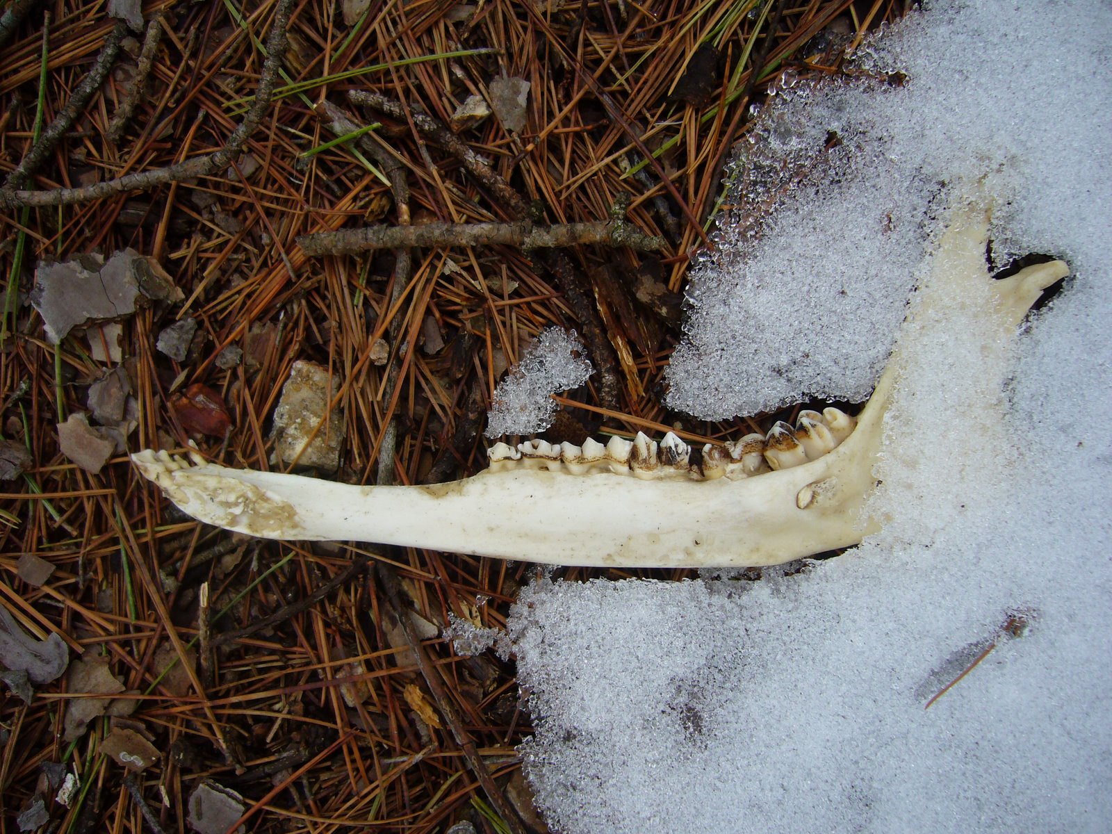
Speaking of box turtles, I found this completely naked, bleached carapace and at first hoped that it might have been from an ornate box turtle (Terrapene ornata)—limited in Missouri to western prairies and a species I have not yet seen. However, the presence of a midline ridge and its relatively more domed shape suggest it is from a three-toed box turtle (Terrapene carolina triunguis).
Many other carapaces were seen (though none in such good shape), and in fact bones of many types were easy to find in the burned portion of the prairie. This disarticulated skull from what appears to be a young calf (Bos taurus) was perhaps the most impressive bone find, but we did also find a dried skeleton of a smaller individual. Being the lone entomologist of the group, I just had to turn over the carcass and search for beetles and managed to capture a skin beetle (family Trogidae) and one other small unidentified beetle (but, unfortunately, no Necrobia rufipes [red-legged ham beetle]).
Disarticulated bovid skull – probably a young calf (Bos taurus).
Rocky Barrens Conservation Area Later in the morning, the group caravaned to Rocky Barrens Conservation Area, a 281-acre area in Greene Co. featuring Mississippian limestone glades and site for the federally-endangered Physaria filiformis (Missouri bladder-pod). This plant, in the mustard family, is found only in four counties in southwest Missouri. The plants were readily found, but we were too early to see them in bloom—or anything else, for that matter. For me, however, the glade alone was still interesting, and I couldn’t help but take note of the similarities—and differences—between this limestone example and the dolomite glades south of St. Louis with which I am so much more familiar. Almost immediately, I noted the presence of Sideroxylon lanuginosum (gum bumelia), host for Plinthocoelium suaveolens (bumelia borer)—surely one of North America’s most beautiful longhorned beetles! I didn’t see any frass piles at the base of any of the trees, the presence of which would indicate larval activity, but I’m sure the beetle is here. It would be interesting to come back during the season and look for it. While I didn’t find any signs of the beetle, I couldn’t miss the bright orange-yellow gold-eye lichens (Teloschistes chrysophthalmus) colonizing it’s branches.
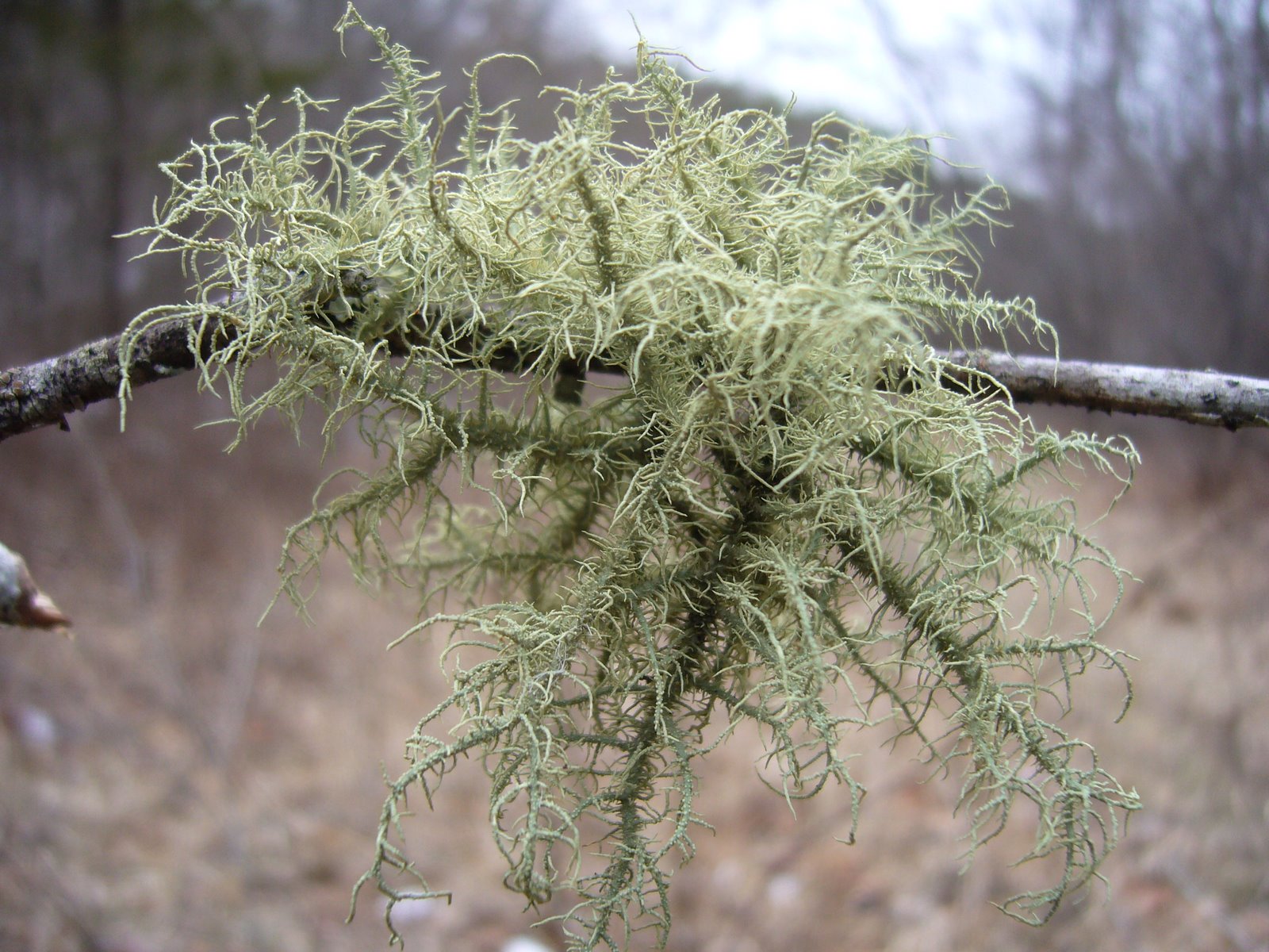
Teloschistes chrysophthalmus (gold-eye lichen) on branch of living Sideroxylon lanuginosum (gum bumelia).
Another tree that caught my interest was Celtis tenuifolia (dwarf hackberry). I see these small, gnarly versions of the genus in glades and other xeric habitats, and they always catch my interest because of the diversity of interesting woodboring beetles associated with it. As I looked at the trees, I noticed one small tree in particular that was the perfect stage of dead—branches brittle but bark mostly still intact with a little bit of peeling on the trunk revealing woodboring beetle larval galleries underneath! There were only a few emergence holes present—strong evidence that the tree was still infested and worth bringing back to put in an emergence box to trap the emerging adult beetles. With luck, I’ll be pinning a series of Agrilus ferrisi next winter!
Corry Flatrocks Conservation Area After lunch at a nearby city park, the group caravaned to Corry Flatrocks Consevation Area in Dade Co.—site of another federally-endangered plant, Mononeuria minima (formerly Geocarpon minima) (tiny-Tim, earth fruit). The sandstone glades at this site are among the largest in the area and, thus, host a large population of the plant. By this time of day, the sun had been out for awhile and the day had warmed considerably, so we hoped to see other flowering plants as well. Among the first that we encountered while walking towards the glade proper was Ranunculus fascicularis (early buttercup), distinguished from other “large-flowered buttercups” by its canescent (grayish due to hairiness) leaves with long and narrow lobes, their tips bluntly pointed or rounded. The dry, gladey habitat also distinguishes the species from the similar R. hispidus (hairy buttercup), which flowers at the same time but prefers moister habitats.
Ranunculus fascicularis (early buttercup).
On the glade proper, we quickly encountered tiny little saxifrages in bloom, which turned out to be Micranthes texana (Texas saxifrage), restricted in Missouri to this part of the state (and thus with a high CC value of 9) and distinguished from the more widespread M. virginiensis (early saxifrage) by its small, compact stature. These first individuals we encountered had especially reddish-tinged flowers.
Micranthes texana (Texas saxifrage).
Micranthes texana (Texas saxifrage).
As soon as we reached the more open part of the glade with large expanses Of exposed rock, the group dropped to their hands and knees to find the diminutive plants we were looking for.
MONPS Field Trip participants looking for Mononeuria minima (formerly Geocarpon minima) (tiny-Tim, earth fruit).
The plants were not uncommon, even abundant, in shallow, sand-filled depressions in the rock. Nevertheless, careful observation was still required to see and recognize them. Fortunately, the plants were already in bloom, their tiny styles barely visible to the naked eye within the green, not-much-bigger, petalless flowers. Photographing these plants, and especially those in bloom, proved to be a task almost beyond the capabilities of the smart phones that most in the group were using (me included).
Mononeuria minima (formerly Geocarpon minima) (tiny-Tim, earth fruit).
Mononeuria minima (formerly Geocarpon minima) (tiny-Tim, earth fruit).
The glades stretched on for quite a distance, inviting further exploration. At the margins, white flowering trees were noticed, and moving closer they proved to be Amelanchier arborea (downy serviceberry, common serviceberry)—among the first we have seen open this spring. (I typically see the first blooms of these trees in the final days of March, at least around my home in east-central Missouri.) an even closer looked revealed tiny insects (also among the first insects I have seen active this spring) flying around and crawling about on the flowers. These proved to be parasitic hymenopterans—family ID is still pending, but I suspect they will prove to be a species in one of the many families of “microhymenopterans” that are egg parasitoids. I am not sure whether they were visiting the flowers as pollinators (which behavior I am not aware of) or in hopes of encountering other pollinators which could potentially serve as hosts—a subject with which I will need to follow up.
Amelanchier arborea (downy serviceberry, common serviceberry) with numerous tiny parasitic wasps (family undetermined).
Near the back end of the glade, we encountered a few more Micranthes texana (Texas saxifrage), these having more typical white flowers in perfect peak bloom.
Micranthes texana (Texas saxifrage) with white flowers.
Micranthes texana (Texas saxifrage) with white flowers.
Also in that part of the glade we found a few scattered individuals of Selenia aurea (golden selenia). While not quite as conservative as M. texana (CC value = 6), it has a similar range in the U.S. and in Missouri is also restricted to a handful of counties in the southwestern part of the state. The plant is known to occur in large colonies (which I have seen at nearby Corry Branch Glade)—its brilliant yellow flowers forming a spectacular display.
Selenia aurea (golden selenia).
To this point, the only insect I had seen besides the microhymenopterans was a skin beetle (family Trogidae), which I found when I kicked over some dried mammal scats. However, on the way back to the cars we finally encountered an insect large enough in size and striking enough in appearance to pique the interest of not just me but the group as a whole—a large caterpillar feeding on the foliage of Penstemon digitalis (smooth beard-tongue). It’s appearance—dark with longitudinal yellow stripes and blue spotting—immediately called to mind one of the tiger moths (formerly Arctiidae, now a subfamily in the Erebidae), specifically the genus Haploa (commonly called haploa moths). A little detective work on BugGuide comparing photos and recorded host plants narrowed the likely choice to H. confusa (confused haploa moth).
Haploa sp. prob. confusa (confused haploa moth) caterpillar feeding on foliage of Penstemon digitalis (smooth beard-tongue).
Day 2 – Lead Mines Conservation Area The final day of the MONPS Field Trip featured a morning trip to Lead Mine Conservation Area in Dallas Co. Of particular interest to the group were several parcels within the area designated as Niangua River Hills Natural Area and featuring a diversity of habitats including dolomite glades, chert woodlands, and calcareous wet meadows (fens). Most in the group visited the northern parcel to see the dolomite glades; however, a few of us—primarily from St. Louis and well-familiar with dolomite glades—opted to visit the smaller southern unit of the natural area to see the fen and riparian woodland we needs to pass through to get there. It was a much warmer morning than yesterday, though still chilly starting out, so blooms were sparse as we hiked the woodland trail searching for any hint of color. At one point, someone noticed a shrub a bit off the trail with large, reddish pink flowers—the color seeming a bit unexpected for the situation. Bushwhacking toward it, we realized it was Chaenomelesspeciosa (common flowering quince), a common, ornamental non-native plant that rarely—but obviously sometimes—escapes cultivation. While the group looked at the plant, I saw my first insect of the day—Paraulacizes irrorata (speckled sharpshooter), one of our largest and most recognizable leafhoppers, sitting head-down on the stem of a small sapling.
Paraulacizes irrorata (speckled sharpshooter).
Among the first native blooms we saw was Ranunculus hispidus (hairy buttercup). Though similarly “large-flowered” as R. fascicularis (early buttercup), it differs by its sprawling growth habit, differently shaped-leaves, and preference for moist habitats. Buttercups are a favorite flower host for jewel beetles (family Buprestidae) in the genus Acmaeodera, and one species —A. tubulus—is among our earliest-emerging beetles in the spring, so I checked each buttercup flower that I saw hoping to see these little beetles signaling the beginning of insect activity for the season. Sadly, none were seen.
Ranunculus hispidus (hairy buttercup).
At last we reached the fen—a large open area on the toe-slopes of the adjacent hillside where water draining through the underlying strata emerged to the surface to maintain a continually wet environment. The fen here is special, as two species of Cyprepedium (lady’s slipper orchids) are know to occur in the fen (and in fact, all four of the state’s Cyprepedium spp. can be found with Lead Mine Conservation Area). At this early date, the orchids would not be anywhere close to blooming; however, the group looked for evidence of their presence, walking gingerly through the fen so as to avoid inadvertently stepping upon any emergent foliage. No putative clumps were found, but already in my mind I’m thinking a mid-May trip back to the fen might be warranted! Unlike the orchids, Castilleja coccinea (Indian paintbrush) was abundantly evident throughout the fen, with an occasional plant almost ready to burst forth their scarlet blooms. Senescent flower stems of composites, presumably Rudbeckia, were also seen throughout the glade, which, combined with the abundance of Castilleja, created the promise of a stunning early-summer display across the fen.
Castilleja coccinea (Indian paintbrush).
During our time in the fen, two species of butterflies were seen flitting about the herbaceous vegetation: tiny blue Celastrina ladon (spring azure), and one of the dustywing skippers in the genus Erynnis. The former were impossible to photograph due to their persistent flitting and skittish behavior, and the latter almost were as well. Only when I locked the focus on a preset 2x zoom and fired shots in rapid succession while moving the smartphone ever closer to the subject did I manage this one imperfect but passable photograph of the last one I tried. The genus Erynnis is diverse and notoriously difficult to identify, and my expertise with skippers and butterflies pales compared to my skills with beetles, so the ID will have to remain Erynnis sp. until a more authoritative opinion is offered. [Edit 4/6/22, 11:38 am: According to my lepidopterist friend Phillip Koenig, Erynnis horatius and E. juvenalis both fly in early spring, and they cannot be reliably separated from the dorsal side. Erynnis juvenalis has one or two dots on the ventral hind wing that E. horatius lacks and only flies in the early spring, while E. horatius can be seen through the summer. If only I could turn the picture over to see what it looks like on the ventral side!]
Erynnis horatio or E. juvenalis (Horatio’s or Junenale’s duskywing) in fen habitat.
Returning through the riparian woodlands after visiting the fen, the day had warmed considerably, and numerous flowers not seen earlier were suddenly in full bloom. These included Erythronium mesochorium (prairie fawn lily midland fawnlily, prairie dogtooth violet)—the same species we saw yesterday so reluctantly in bloom at Schuette Prairie. Most were of the familiar form with unmottled leaves; however, we found one individual with notably mottled leaves that resembled those of E. albidum (white dogtooth violet) (1st photo). Nevertheless, the leaves were still narrower than that species and folded, and the plant was growing a mere 12” from another individual with no trace of mottling (2nd photo).
Claytonia virginca (spring beauty) was also blooming in abundance as we took the trail back. I am always amazed at the variability seen in the flowers of this species—from pure white to vividly pink-striped to pink at the tips. This especially vivid pink individual was about as pink as they come.
Claytonia virginca (spring beauty)—an especially vivid pink example.
Sanguinaria canadensis (bloodroot) also was popping up regularly. We had seen isolated plants sitting the trailsides when we first part through—their flowers tightly folded in stubborn response to the chilly morning temperatures. By early afternoon, however, they were spread wide open as invitation to any of the flying insects that had surely also been awakened by the warmer temperatures of the afternoon. While most were seen as isolated individuals, a particularly idyllic clump captured our attention, almost begging “photograph me!”
Sanguinaria canadensis (bloodroot).
Sanguinaria canadensis (bloodroot).
With that, we rejoined the main group to recount the days experiences and cement new relationships before heading back towards our respective home areas.
Long Ridge Conservation Area On the way back home, I decided to check out this conservation area in Franklin Co., which I’ve never visited before. The afternoon had gotten quite warm, so I reasoned that maybe today would be the day when insects start coming out in abundance. I was right! As soon as I pulled into the parking lot, I saw a Prunus mexicana (Mexican plum) in full bloom, and walking up to it I immediately saw an abundance of bees and small beetles all over the flowers. The latter turned out to be Orsodacne atra (a leaf beetle) and Ischnomera ruficollis (rednecked false blister beetles).
Orsodacne atra (leaf beetle) on flowers of Prunus mexicana (Mexican plum).
Orsodacne atra (leaf beetle) mating pair on flowers of Prunus mexicana (Mexican plum).
Ischnomera ruficollis (rednecked false blister beetle) mating pair on flowers of Prunus mexicana (Mexican plum).
Inside the woods along the Blue Trail, there were the usual suspects in bloom—Claytonia virginica (spring beauty), Cardamine concatenata (toothwort), Antennaria parlinii (Parlin’s pussytoes) and Ranunculus hispidus (hairy buttercups).
Antennaria parlinii (Parlin’s pussytoes).
Eventually I happened upon an Amelanchier arborea (downy serviceberry) in full bloom. There were more O. atra and I. ruficollis on the flowers (though not so many as on the Mexican plum), along with a Mecaphesa sp. crab spider that had caught and was feeding on a male Andrena carlini (Carlin’s mining bee)*.
Mecaphesa sp. crab spider with male Andrena carlini (Carlin’s mining bee) prey on flowers of Amelanchier arborea (downy serviceberry). *Bee ID by Mike Arduser.
On the back third of the trail, I found two fallen branches under a Quercus shumardii (Shumard’s oak) that had been pruned by longhorned beetles—presumably Anelaphus villosus. At the end of the trail I found a third such branch of the same species of oak. All three will be placed in an emergence box, and hopefully the culprits will emerge as adults.
Anelaphus villosus-pruned branches of Quercus shumardii (Shumard’s oak)—both collected under the same tree.
The first three days of this year’s Fall Tiger Beetle Trip had been fun, and finding a new state record jewel beetle and an unusual seasonal activity record for another were definitely icing on the cake. Still, tiger beetles (at least adults) had been notably absent, with my hunch that Cicindela pulchra (Beautiful Tiger Beetle) might occur in the Red Hills of northwestern Oklahoma not playing out. My next goal was to go down to northern Texas and look for Cicindelidia politula (Limestone Tiger Beetle)—a species I have not yet encountered in the field. When I saw that the route south took me through the Wichita Mountains of southwestern Oklahoma, I recalled seeing this photo of Cicindelidia obsoleta vulturina (Prairie Tiger Beetle) on BugGuide taken in these very mountains during the fall. I have seen on many occasions the greenish Missouri / Arkansas disjunct population of this subspecies, but I had not yet seen the main population and its decidedly black individuals, so this became my quarry for Day 4 of the trip. I had nothing more to go on for a locality than “Wichita Mountains NWR” and a sense of its habitat preferences based on my own experience with the MO/AR disjuncts, so after arriving at the refuge I began to look for access to a 2-track leading to higher, unforested ground (reminiscent of the dolomite glades of southwestern Missouri). I quickly found a parking lot with a 2-track leading from it, so I pulled off, geared up, and set out on what I figured was surely a wild goose chase. The track looked good, but no beetles were seen, and after walking about a half-mile I happened to look up and see this not too far ahead:
American bison | Wichita Mountains National Wildlife Refuge, Oklahoma
Call me chicken, but bison can and will charge without warning. Even though they seemed unconcerned by my presence, I wasn’t with anybody that I knew I could outrun 🙂 and decided that a cautious, tip-toeing retreat would the best course of action (even taking the above photo—uncropped, I might add—made me nervous). What now? I was quickly back at the car and not sure what to do next when I saw a foot path leading into a cedar woods, behind which the land rose up to treeless heights. I decided that might be a good place to explore—as long as I didn’t run into any bison along the way! As I was hiking through the woodland—an open, obviously long ago planted grove of eastern red cedar (Juniperus virginiana)—I passed by a small opening and almost by instinct veered into the opening to have a look. As soon as I stepped into the opening I saw the unmistakable escape flight of two large tiger beetles—what the…?! No doubt about it, they were C. o. vulturina, and they had been hanging out by a fairly fresh bovid chip (bison or cow, I don’t know). (I have seen this behavior also with the MO/AR disjuncts.) I watched them land and decided which one I would try to photograph. I guess I picked right, because the following photo was among the first few that I got:
Despite the jet-black dorsal surface (which contrasts with the green to greenish-black to bronzy dorsal surface of the MO/AR disjuncts), these were colorful beetles with gorgeous metallic blue genae (cheeks) and intense violaceous tibia (lower legs). This first individual was quite cooperative (usually it’s the tenth or more beetle that I try to photograph that actually allows me to do so), so I spent a bit of time trying to coax it back to the bovid chip from which it flew. Eventually I succeeded in this and took a few more photos, the following of which I liked the best:
Shade seeking next to a bovid chip.
I’m still a bit puzzled about the habitat in which I found these beetles. I would have considered it an anomaly had I not seen two beetles at the same time and then subsequently seen a mating pair in almost the exact same spot. Prairie tiger beetles are known for their preference of open grassland habitats rather than woodlands, and indeed I saw more individuals back along the 2-track that I had abandoned earlier (once I got the courage to stray down it again later in the day). The photo below shows almost the entirety of the opening where I found the beetles, with the bovid chip located on the ground in the lower center of the photo:
An unusually wooded habitat for Cicindelidia obsoleta vulturina.
Seeing these two individuals in the small woodland opening gave me greater optimism that I would be able to find more on the grassy higher slopes above the cedar grove. I crossed the creek and climbed to the top of the first ridge, passing through what seemed to be ideal habitat for the beetle but seeing none. Although igneous in origin, the rocky landscape reminded me very much of the dolomite glades that lace through the White River Hills of southwestern Missouri and that harbour robust populations of this beetle (but occurring nowhere else in the state).
Rocky grasslands extend towards Mt. Scott.
After posting one of these landscape photos on my Facebook page, I got a comment from Thomas Shahan saying he had been to the area recently and seen a “dark Cicindela” atop nearby Elk Mountain. Low and behold, the beetle in the photo that he included was none other than this subspecies, so at least now I know they do occur in this more expected habitat despite my not having seen them on this day.
Failing to find the beetle on higher ground, and wanting to try for even closer photographs, I returned to “the opening” and immediately found another individual to photograph. A female, she may (or may not) have been the partner to the male I photographed earlier, but at any rate she was not nearly as cooperative. I chased her back and forth through the opening for about a half-hour before I finally got close enough to get a shot (my use of tube extensions required that I get even closer than before). As typically happens, however, she gradually became more and more accustomed to my presence, and eventually I was able to get a few photos with the beetle in fairly relaxed, candid poses. The following are my favorites:
A less trusting individual relunctantly allows herself to be photographed.
She looks angry, but in reality I caught her mandibles half open in the midst of chewing movements.
After photographing these individuals, I returned to the car and decided to wander (tentatively) down the 2-track that I had to abandon earlier in the day. This time I fouund the beetles easily, seeing perhaps half a dozen individuals in just the first quarter-mile. My wanderings, however, were once again cut short when I came around a tree bank and saw those same two bison, much closer to the road this time. I really wanted to get a better photograph than the one above, but common sense at first prevented me from getting any closer. I studied the two magnificent behemoths looking for any sign of annoyance, and seeing none I began to creep ever so tiny a bit closer. Eventually my heart rose too high in my throat to approach any closer, and I snapped the following photo and began a hasty, horse-eyed retreat—not even knowing for sure if the shot was good but feeling a little too proud of myself and my stupidity courage!
Photo 1 - Cylindera celeripes at Alabaster Caverns State Park in northwestern Oklahoma.
When my hymenopterist friend, Mike Arduser, came back from his first trip to Oklahoma’s Four Canyon Preserve last September, my first thought upon seeing his photos of the area was, “Ooh, that looks like a good place for tiger beetles!” Its rugged red clay and gypsum exposures reminded me of similar country I had seen in the not-too-distant Gypsum Hills of south-central Kansas, where I was fortunate enough to observe a nice population of the fantastically beautiful Cicindela pulchra (beautiful tiger beetle) back in 2005. When I later realized that the area was only 30 miles southwest of a confirmed recent sighting of Cicindela celeripes (swift tiger beetle, now Cylindera celeripes), I thought, “Ooh, I wonder if celeripes might occur there also.”
Photo 2 - Cylindera celeripes on lichen-encrusted clay soil at Alabaster Caverns State Park.
Recall that C. celeripes is one of North America’s rarest and least understood tiger beetles. This tiny, flightless, ant-like species has been recorded historically from eastern Nebraska south to north-central Texas, but its range appears to have become highly restricted over the past century. It hasn’t been seen in Nebraska for nearly 100 years now, and most recent records have come from its last known stronghold in the Flint Hills of Kansas. In 2003, however, a photographer by the name of Charles Schurch Lewallen posted on BugGuide a photograph of this species taken at Alabaster Caverns State Park in northwestern Oklahoma, and last year small numbers of adults were seen in the Loess Hills of western Iowa. This last sighting triggered an immediate trip to the site by myself and Chris Brown, who has been co-investigating the tiger beetle fauna of Missouri with me for several years now. The occurrence of this species in Iowa’s Loess Hills had reignited our hopes – faint as they were – that the beetle might yet occur in extreme northwestern Missouri, where the Loess Hills reach their southern terminus. We wanted to see the beetle in the wild to better understand its habitat requirements before resuming our search for this species in northwestern Missouri. We succeeded in finding the beetle – an amazing experience in itself – and brought three adults of this never-before-reared species back to the lab for photographs and an attempt at rearing. We did manage to obtain viable eggs, but we were not successful in rearing the larvae beyond first instar. I wrote about that experience last August in a post entitled, “The hunt for Cicindela celeripes” (that post is now currently in press as an article in the journal CICINDELA).
Photo 3 - Cylindera celeripes on gypsum exposure at Alabaster Caverns State Park.
Thus, when my friend Mike asked me earlier this year if I might be interested in joining him on his return trip to Four Canyon Preserve in June, I jumped at the chance. I figured I could look for celeripes at the preserve, and if I failed to find it there then I would go to Alabaster Caverns and see if I could relocate the beetle where it had been photographed in 2003. My goals were modest – I simply wanted to find the beetle and voucher its current presence in northwestern Oklahoma (and if possible photograph it in the field with my new camera!). Before leaving, I wrote to Charles Lewallen, who graciously responded with details regarding the precise location and time of day that he had seen the beetle at Alabaster Caverns, and on the first Friday of June I followed behind Mike and his lovely wife Jane during our ten-hour drive out to Four Canyon Preserve. For three days, I roamed the mixed-grass prairie atop the narrow ridges and dry woodland on the steep, rugged canyon slopes of the preserve – always on the lookout for that telltale “flash” between the clumps of bluestem and grama, ever hopeful that one would prove not to be the ant or spider that it appeared to be (and, indeed, always was). Many tiger beetles would be seen – chiefly the annoyingly ubiquitous Cicindela punctulata (punctured tiger beetle), but celeripes would not be among them. Whether this is due to historical absence from the site or a more recent consequence of the wildfires that swept the area a year earlier is hard to say, but its absence at Four Canyon meant that I would need to make a quick, 1-day detour to Alabaster Caverns before rejoining Mike and Jane at Tallgrass Prairie Preserve in northeastern Oklahoma, where we planned to spend the second half of the week.
Photo 4 - Cylindera celeripes on gypsum exposure at Alabaster Caverns State Park.
Arriving at Alabaster Caverns I was filled with nervous, excited anticipation. Would I find the species, as Charles Lewallen had, or would I get skunked? I kitted up and started walking towards the area where Charles wrote that he had seen the beetle, noting the annoying “Removal of plants and animals prohibited” sign along the way. I hadn’t taken ten steps off the parking lot when I saw it! I froze at first, hardly believing that I had found it that quickly, then started watching the tiny beetle as it bolted urgently from one grass clump to the next. Recalling my experience with this beetle in Iowa (and fearing I would lose it amongst the vegetation), I captured the specimen and placed it live in a vial – I would talk to the park staff later about taking the beetle, but for now I needed to guarantee I had a backup for the lab in case I was unable to get field photographs of the beetle. I started walking again, and within a few minutes I saw another one – okay, they’re here in numbers. I carefully took off my camera bag and assembled the components, all the while keeping my eye on the beetle, and then I began trying to do what last year had seemed impossible – getting field photographs. It was easier this time – the vegetation was not so dense, so I could keep an eye on the beetle as he darted from one clump to another. I tried to wait until he settled in an open spot, but it soon became apparent that just wasn’t gonna happen without a “helping” hand. I started blocking the path of the beetle as he tried to dart away and then removing my hand to see if he would stay put. There were a few false starts, where the beetle looked like he would sit still and then dart just as I was set to take the shot, but eventually it wore down and started sitting still long enough for me to shoot a few frames. Torn between the need to get as many photographs as possible and the desire to look for more beetles, I decided to look around more to see how common the beetle was. As I walked out into the shortgrass prairie above the canyons, I began to see adults quite commonly. Most often they were seen as they bolted out into the open from a clump of vegetation when disturbed by my approach. The substrate was red clay and gypsum – just as I had seen in Four Canyon Preserve, but unlike that area the clay exposures were heavily colonized by a mottling of green, blue, and gray lichens. It made the beetles almost impossible to see when they were not moving – even at close range! I spent about an hour taking photographs of several individuals, even managing to photograph one that appeared to be parasitized by what I take to be a dryinid hymenopteran.
Photo 5: Cylindera celeripes with parasite (dryinid hymenopteran?). Note also the ant head attached to right antenna.
After getting a sufficient series of photographs (is there really such thing?), I went to the park office hoping to convey the significance of this find to the Park Naturalist and to convince him/her to let me take some live individuals with me for another attempt at rearing. The Park Naturalist was out of the office, but the Park Historian was there. I could hardly contain my excitement as I explained to her what I had found, why it was so important, and my hope to try to rear the species with adults collected in the field. She not only responded as positively as I had hoped, but accompanied back out into the field so that I could show her the beetles. She told me it would be no problem to take some live individuals for rearing and to please let them know if there was anything else they could do to help me. She then provided me with the day’s natural history “dessert” by pointing out a Mexican free-tailed bat (Tadarida brasiliensis) – Oklahoma’s state flying mammal – roosting up in the top of a nearby picnic shelter. Standing atop the picnic table put me within arm’s length of the little chiropteran – close enough to see his tiny little eyes looking quizzically back at me.
Photo 6 - Cylindera celeripes macrohabitat at Alabaster Caverns State Park. Note rather widely spaced clumps of vegetation.
It had begun sprinkling rain by then, so with some urgency I got my tools, extracted a couple of chunks of native soil and transferred them to the small “Critter Totes” that I had brought for the purpose, and began searching for live individuals to place within them. The beetles had become scarce as the drizzle turned to light rain, and by the time I had split about a dozen individuals between the two containers the rain was coming down hard enough to start puddling. I continued a last ditch effort to find “just one more,” but a lightning strike within a mile of the park put an end to that – the air now felt electric as I hurriedly walked back to the car (gloating unabashedly inside) and began the three-hour drive towards Tallgrass Prairie Preserve… (to be continued).
Photo 7 - Cylindera celeripes microhabitat at Alabaster Caverns State Park. Note thick encrustation of lichens on clay substrate amidst white gypsum exposures.
Photo details:
#1-3, 5: Canon 100mm macro lens w/ 68mm extension on Canon EOS 50D, ISO 100, 1/250 sec, f/13 (photo 3, f/11), MT-24EX flash 1/4 power through diffuser caps.
#4: Same except Canon 65mm 1-5X macro lens, flash 1/8 power.
#6: Same except Canon 17-85mm zoom lens (17mm), 1/64 sec, f/8, natural light.
#7: Same except Canon 17-85mm zoom lens (35mm), 1/100 sec, f/7, natural light.
We stood a moment to contemplate the sublime and beautiful scene before us, which was such an assembly of rocks and water—of hill and valley—of verdant woods and naked peaks—of native fertility and barren magnificence… – Henry Rowe Schoolcraft, 1818-1819
In the Ozark Border south of St. Louis, a series of natural openings punctuate the dry, rocky forests of Jefferson County. Commonly called “glades” or “cedar glades,” these islands of prairie in a sea of forest are home to plants and animals more commonly associated with the Great Plains region further to the west. Extending in a narrow arc from central Jefferson County east and south into northern Ste. Genevieve County, these glades occur most commonly on south and southwest-facing slopes below forested ridges and are characterized by thin soils and exposed dolomite bedrock of Ordovician age. Glades are, in fact, a common natural feature throughout much of the Ozark Highlands, an extraordinary plateau where the great eastern deciduous forest begins to yield to the western grasslands. A much more extensive system of dolomite glades occurs in the White River Hills of southwest Missouri, where they often extend up steep slopes and over the tops of knobs to form what Schoolcraft called “naked peaks” and are now called “balds” (and spawning the “Baldknobbers” of Branson fame). Additional glade complexes occur throughout the Ozark Highlands on different rock substrates – igneous glades abound in the St. Francois Mountains, sandstone glades dot the Lamotte landscape in Ste. Genevieve County and the northern and western Ozarks, limestone glades can be found in the northern Ozarks near Danville and Lake of the Ozarks, and chert glades occur in extreme southwest Missouri. These different glade systems share a common feature – shallow soils where tree establishment is limited due to summer moisture stress. They differ vegetationally, however, due to differences in hydrology and soil chemistry as a result of their different substrates. Floristically, dolomite glades exhibit a high degree of diversity relative to other glade types.
The term “glade” is derived from the Old English “glad,” meaning a shining place – perhaps the early settlers found their open landscapes a welcome respite after emerging from the confining vastness of the eastern deciduous forest. Whatever the meaning, the glades of Jefferson County hold a special place in my heart, for I “grew up,” entomologically speaking, in those glades. As a young entomologist, fresh out of school, I spent many a day scrambling through the glades and surrounding woodlands. It was here where my interest in beetles, especially woodboring beetles, was born and later grew into a passion. For eight years I visited these glades often – attracted by the extraordinary diversity of insects living within the glades and congregating around its edges. My earliest buprestid and cerambycid papers contain numerous records from “Victoria Glades” and “Valley View Glades” – the two best-preserved examples of the glades that once occurred extensively throughout the area (more on this later). My visits to these glades ended in 1990 when I moved to California, and although I moved back to the St. Louis area in 1995, the focus of my beetle research has more often taken me to places outside of Missouri. It had, in fact, been some 10 years since my last visit to these glades until last week, when I was able to once again spend some time in them.
Ozark glades differ from the true cedar glades of the southeastern U.S. in that they are not a climax habitat – they depend upon periodic fires to prevent succession to forest. Some recent authors have suggested the term “xeric dolomite/limestone prairie” be used to distinguish the fire-dependent glades of the Ozarks from the edaphic climax cedar glades of the southeast (Baskin & Baskin 2000, Baskin et al. 2007). Fires have been largely suppressed throughout Missouri since European settlement, leading to encroachment upon the glades by eastern red-cedar (Juniperus virginiana). Pure stands of red-cedar have developed on many former glades, crowding out the herbaceous plants that depend upon full sun and leading to soil formation that supports further encroachment by additional woody plant species such as post oak (Quercus stellata), blackjack oak (Q. marilandica), flowering dogwood (Cornus florida), and fragrant sumac (Rhus aromatica) from the surrounding woodlands. Fire has returned to many of the Ozark glades situated on lands owned or managed by state and federal agencies such as the Missouri Department of Conservation, Missouri Department of Natural Resources, and U.S. Forest Service, as well as private conservation-minded organizations such as The Nature Conservancy. These agencies have begun adopting cedar removal and fire management techniques to bring back the pre-settlement look and diversity of the Ozark Glades. This is particularly true at Victoria Glades and Valley View Glades, the two largest and most pristine examples of the Jefferson County dolomite glade complex. Fires have been used to kill small red-cedars in the glades, as well as rejuvenate their herbaceous plant communities. Larger red-cedar trees are not killed outright by fire and must be removed by chainsaws. This above distant view of the TNC parcel at Victoria Glades shows many such burned red-cedars. The glades themselves are not the only habitat to benefit from this aggressive management – when I was doing my fieldwork here in the 1980’s the surrounding woodlands were a closed post oak forest bordered by fragrant sumac and with little or no understory in the interior. The photo at right now shows an open savanna with a rich understory of not only sumac and other shrubs, but also many herbaceous plants as well such as black-eyed susan (Rudbeckia hirta) and American feverfew (Parthenium integrifolium). Such open woodland more closely resembles what Schoolcraft saw across much of the Ozarks during his journey almost two centuries ago.
Victoria and Valley View Glades are dominated by little bluestem (Schizachyrium scoparium), Indian grass (Sorghastrum nutans), big bluestem (Andropogon gerardii) and prairie dropseed (Sporobolus heterolepis). A smaller but highly charismatic non-grass flora is also found on the glades – species such as Missouri evening primrose (Oenethera macrocarpa) (left), pale purple coneflower (Echinacea simulata) (pictured above and below), and prairie dock (Silphium terebinthinaceum) not only add beautiful color but also support both vertebrate and invertebrate wildlife. The Fremont’s leather flower (Clematis fremontii) is a true endemic, occurring only in this part of Missouri and entirely dependent upon these glades for its survival. Less well studied is the vast insect fauna associated with the glades. It is here where I first discovered the occurrence of Acmaeodera neglecta in Missouri. This small jewel beetle is similar to the broadly occurring A. tubulus but at the time was known only from Texas and surrounding states. In collecting what I thought were adults of A. tubulus on various flowers in the glades, I noticed that some of them were less shining, more strongly punctate, and exhibited elytral patterning that was often coalesced into longitudinal “C-shaped” markings rather than the scattered small spots typical of A. tubulus. These proved to be A. neglecta, which I have since found on many glade habitats throughout the Ozark Highlands. Both species can be seen in this photo feeding on a flower of hairy wild petunia (Ruellia humilis) – the lower individual is A. neglecta, while the upper individual and two inside the flower are A. tubulus. Another interesting insect-plant association I discovered at these glades was the strikingly beautiful Dicerca pugionata – another species of jewel beetle – and its host plant ninebark (Physocarpus opulifolius). Only a single Missouri occurrence had been reported for D. pugionata, despite the common occurrence of its host plant along rocky streams and rivers throughout the Ozark Highlands. This plant also grows at Victoria and Valley View Glades along the intermittent streams that drain the glades and in the moist toeslopes along the lower edges of the glades where water that has percolated through the rocks and down the slopes is forced to the surface by an impermeable layer of bedrock. Unlike the tall, robust, lush plants that can be found in more optimal streamside habitats with good moisture availability, the ninebark plants of Victoria and Valley View Glades are small and scraggly, usually with some dieback that results from suboptimal growing conditions. I surmise these plants have reduced capabilities for fending off attacks by insects, including D. pugionata, and as a result a healthy population of the insect thrives at these glades. Some might be inclined to call this beetle a pest, threatening the health of one of the glade’s plants. In reality, the insect finds refuge in these glades – unable to effectively colonize the vast reserves of healthy plants that grow along streams throughout the rest of the Ozarks, it strikes a tenuous balance with plants that are themselves on the edge of survival.
Despite the success in moving Victoria and Valley View Glades closer to their pre-settlement character, the integrity of these areas continues to be challenged. Poachers take anything of real or perceived value, and ATV enthusiasts view the open spaces as nothing more than tarmac. Pale purple coneflower occurs abundantly on these Jefferson County glades (but sparingly in other habitats – primarily rocky roadsides), where they provide a stunning floral display during June and sustain innumerable insect pollinators. Plants in the genus Echinacea also have perceived medicinal value, as herbalists believe their roots contain an effective blood purifier and antibiotic. There are no conclusive human clinical trials to date that fully substantiate this purported immune stimulating effect (McKeown 1999). Nevertheless, demand for herbal use has skyrocketed in recent decades, prompting widespread illegal harvesting of several coneflower species throughout their collective range across the Great Plains and Ozark Highlands. I witnessed massive removals of this plant from both Victoria and Valley View Glades during the 1980’s, but the pictures I took this year suggest that such illegal harvests have been suppressed and that the populations at both sites are recovering nicely.
The same cannot be said for the practice of rock flipping. This was a problem I witnessed back in the 1980’s, and I saw fresh evidence of its continued occurrence at both sites. The thin soils and sloping terrain leave successive layers of dolomite bedrock exposed, the edges of which shatter from repeated freeze-thaw cycles to create rows of loose, flat rocks along the bedrock strata. Lizards, snakes, tarantulas, and scorpions find refuge under these loose rocks, only to be ripped from their homes by flippers and transferred to a dark, cold terrarium to endure a slow, lingering death. As if poaching the glade’s fauna and watching them slowly die isn’t bad enough, the flippers add insult to injury by not even bothering to replace the rock in its original position after stealing its inhabitant, amounting to habitat destruction three times greater than the area of the rock itself. Firstly, the habitat under the rock is destroyed by sudden exposure of the diverse and formerly sheltered microfauna to deadly sunlight. Next, the habitat onto which the rock is flipped is also destroyed, as the plants growing there begin a slow, smothering death. Lastly, the upper surface of the rock, sometimes colonized by mosses and lichens that might have required decades or longer to grow, usually ends up against the ground – its white, sterile underside becoming the new upper surface. Rock flipper scars take years to heal, and nearly all of the flat, loose rocks seen in the more accessible areas of the glades exhibit scars of varying ages next to them. If a scar is fresh (first photo), I generally return to the rock to its original position – the former inhabitants cannot be brought back, but at least the original habitats are saved and can recover quickly. However, if a scar is too old (2nd photo) it is best to leave the rock in its new position – replacing it only prolongs the time required for recovery.
Even more damaging is ATV use. Herbaceous plants and thin soils are no match for the aggressive tread of ATV tires, and it doesn’t take too many passes over an area before the delicate plants are killed and loose soils ripped apart. I witnessed this become a big problem particularly on Victoria Glades during the 1980’s – actually finding myself once in a face-to-face confrontation with an ATV’er. Fortunately, he turned tail and ran, and it appears (for now) that such abuses have stopped, as I saw no evidence of more recent tracks during this visit. But the scars of those tracks laid down more than two decades ago still remain painfully visible. I expect several more decades will pass before they are healed completely.
My return to Victoria and Valley View Glades was a homecoming of sorts, and I was genuinely pleased to see the progress that has been made in managing these areas while revisiting the sites where my love affair with beetles was first kindled. Sadly, however, the larger glade complex of Jefferson County continues to deteriorate. Restoration acreage aside, red-cedar encroachment continues unabated on many of the remaining glade parcels – large and small – that dot the south and southwest facing slopes in this area. It has been conservatively estimated that as much as 70% of the original high quality glades in Missouri are now covered in red-cedar. Many of these are privately held – their owners either do not recognize their ecological significance or are loathe to set fire to them. An example can be seen in the picture here – this small parcel is part of the Victoria Glades complex but lies on private land in red-cedar choked contrast to the Nature Conservancy parcel immediately to the south. Small numbers of herbaceous plants persist here, but without intervention by fire or chainsaw their numbers will continue to dwindle and the glade will die. Aside from the loss of these glades, the continuing reduction of glade habitat complicates management options for preserved glades as well. Many glade associated invertebrates are “fire-sensitive” – i.e., they overwinter in the duff and leaf litter above the soil and are thus vulnerable to spring or fall fires. While these fires are profoundly useful for invigorating the herbaceous flora, they can lead to local extirpation of fire-sensitive invertebrate species within the burn area. Recolonization normally occurs quickly from unburned glades in proximity to the burned areas but can be hampered if source habitat exists as small, highly-fragmented remnants separated by extensive tracts of hostile environment. Grazing also continues to threaten existing remnants in the Jefferson County complex. Grazing rates are higher now than ever before, with greater negative impact due to the use of fencing that prevents grazers from moving to “greener pastures”. Over-grazing eliminates native vegetation through constant depletion of nutrient reserves and disturbance of the delicate soil structure, leading to invasion and establishment of undesirable plant species. Eventually, the glade becomes unproductive for pasture and is abandoned – coupled with fire suppression this leads to rapid woody encroachment. It is truly depressing to drive through Jefferson County and recognize these cedar-choked glades for what they were, able to do nothing but watch in dismay as yet another aspect of Missouri’s natural heritage gradually disappears. The continued loss of these remnant glades makes careful use of fire management on Victoria and Valley View Glades all the more critical – ensuring that a patchwork of unburned, lightly burned, and more heavily burned areas exists at a given time will be critical for preventing invertebrate extirpations within these managed areas.
I close by sharing with you a few more of the many photographs I took during this visit – stiff tickseed (Coreopsis palmata), three-toed box turtle (Terrapene carolina triunguis), climbing milkweed (Matelea decipiens – see the excellent post about this plant on Ozark Highlands of Missouri), downy phlox (Phlox pilosa), green milkweed (Asclepias viridiflora), and a “deerly” departed native browser.
…at last the Lake burst upon us — a noble sheet of blue water lifted six thousand three hundred feet above the level of the sea, and walled in by a rim of snow-clad mountain peaks that towered aloft full three thousand feet higher still! It was a vast oval, and one would have to use up eighty or a hundred good miles in traveling around it. As it lay there with the shadows of the mountains brilliantly photographed upon its still surface I thought it must surely be the fairest picture the whole earth affords. – Mark Twain, Roughing It (1872)
Mark Twain may not have liked the name “Lake Tahoe” – preferring its then-official, patronimic designation as “Lake Bigler.” However, he was clearly overwhelmed by its beauty, and surely no person who has ever seen this place can find fault with the words he so eloquently penned almost a century and a half ago. The view above of Emerald Bay, on the south side of the lake, may not be where Twain first viewed Lake Tahoe, but for me it is the most iconic place from which to view it. I first fell in love with Lake Tahoe almost 18 years ago, when my then fiancée and I first moved to Sacramento. We married up there, and for the 5 years we lived in California we spent many a weekend enjoying Tahoe’s 4-season charm. It has been 12 years since we moved back to St. Louis, and I hadn’t been back — until this past weekend. The reasons for the delay are many, but returning to this place reminded me why I consider it the most beautiful place in the world. I shall not let so long a time pass before my next visit.
Lake Tahoe is a relatively young lake, forming within the last several million years (in contrast, the block of granite that was to become the Sierra Nevada mountains – and in which Lake Tahoe lies – began forming during the Paleozoic Era and was then exposed by erosion beginning about 130 million years ago). The basin in which the lake lies was formed by fault-induced block slippage between two uplifted blocks, with the lake itself forming after magma upwellings dammed the northern part of the basin. Glacial action in more recent years (2 million to 20,000 years ago) caused additional damming, causing drastic fluctuations in the lake level — maximum levels reached nearly 800 feet higher than present. The most recent glaciations (~10,000 years ago) carved out Donner Lake (just east of Lake Tahoe), Emerald Bay (above), and nearby Fallen Leaf Lake (below — the frozen lake surface can just be seen above the trees in the foreground).
Emerald Bay is actually part of a glacial “staircase” featuring intermittent flat stretches containing lakes and meadows before ultimately ending at Emerald Bay. Eagle Lake lies immediately above Emerald Bay on one of these “steps,” and the 1-mile trail to it is one of the most popular hikes in the area — below is a view towards Eagle Lake from Emerald Bay:
On the day we arrived (Sat 3/15), a late winter storm was dumping new snow on the surrounding mountains, as seen in this view across the south end of the lake towards the city of South Lake Tahoe. Heavenly Ski Resort was shrouded from view on this day, but the fresh powder being dumped there would provide for some delightful spring skiing over the next few days.
In the meantime, there would be plenty of activities to keep ourselves occupied. With the amount of snow on the ground, one might think there would be little opportunity for botanizing. However, I favor the woody flora, and I was excited about the chance to begin reacquainting myself with some of the western conifers for a change. Of these, one of my favorites is incense-cedar (Calocedrus decurrens) — mature trees develop thick, deeply furrowed, brick red bark that stands out in beautiful contrast from the other trees. Even dead trees maintain a rustic and majestic beauty, and this large dead snag is as stately as any I’ve seen:
On Monday we rented snowshoes and hiked the cross-country ski trails at Camp Richardson. None of us had ever snowshoed before, but the girls quickly got the hang of it (note the live incense-cedar in the background):
We encountered a few cross-country skiers during our hike, but for the most part we spent the day in solitude. Shortly after beginning our hike, however, we came upon this impression in the snow. At first we thought someone had attempted to make a “snow angel,” but after studying it more carefully we realized it was made by a cross-country skier who had fallen and then struggled to get back up:
At this altitude, conifers dominate the flora. I was a little rusty on my knowledge of western U.S. plants, but I think I have things figured out (please let me know if you see any needed corrections to my identifications). The aforementioned incense-cedar was a conspicuous component of this lake-level forest, and its foliage – arranged in flattened, elongated, rumpled sprays – makes this tree easily identifiable amongst the other coniferous genera with which it grows:
Huge pine trees also dominanted the forest in this area. At first I thought they were ponderosa pines (Pinus ponderosa) due to their large size, irregular crown, and large plate-like patterns on the trunk caused by deep cross-checked fissuring of the bark. Eventually, however, I decided they must instead be Jeffrey pine (Pinus jeffreyi), a closely related species (that was once considered a variety of ponderosa pine), since the bark was more orange than yellow.
A closeup of the needles, which are in bundles of three and measure around 6-8 inches in length:
Another dominant coniferous component of this forest, also reaching massive size, was white fir (Abies concolor). The first photo below shows a large, mature tree in the distance, while the second shows a closeup of the foliage. At first I thought this might be Douglas-fir (Pseudotsuga menziesii), as the needles appeared to be irregularly 2-ranked; however, I asked Prof. Ronald Lanner to take a look, and he confirmed it is white fir. He said Douglas-fir needles are shorter, thinner, darker green, and have a skinny stalk, while fir needles have a fat round base and are wider and flatter. The latter also have a citrusy smell when crushed, which he describes as one of the best smells in the woods! Too bad I did not try it.
This decaying stump also represents white fir based on the scaly gray bark. I suspect the outer layers of the lower portion of the trunk (core still standing) were ripped off over time by animals looking for grubs and insects as decay progressed, eventually weakening it to the point that the upper portion (laying on the ground) finally broke off and fell:
As we hiked, I realized what an important part fire plays in the ecology of these forests. During the drive up from Sacramento, we passed several areas along Hwy 50 that had suffered severe damage due to the wildfires that swept through Lake Tahoe recently. One such area was even seen in the far eastern slopes of Heavenly Ski Resort itself. The forests around Camp Richardson had largely escaped these fires, and I wondered if fire management had contributed to this. Along the trail, evidence of fire was common on the trunks of trees, but few trees – even small ones – had been killed. I presumed the charring was evidence of fires that had been intentionally set and managed by the Forest Service with the objective of preventing fuel accumulation that could lead to the larger conflagrations that caused so much damage in other parts of the basin. These small incense-cedars trunks show obvious fire charring but otherwise looked healthy:
In a few areas it appears even these “cool” fires burned a little hot, killing some of the smaller trees but still avoiding the “torched-earth” damage seen in areas affected by uncontrolled burns:
I’m not much of a birder, but I do love woodpeckers. I got a glimpse of one during our hike, but I didn’t see it well enough to identify it. We did find this woodpecker hole in the trunk of a large, dead Jeffrey pine — a feather can even be seen clinging to the upper rim of the hole. The Lake Tahoe basin is home to several species of woodpeckers — whether this hole belongs to the black-backed woodpecker (Picoides arcticus), white-headed woodpecker (P. albolarvatus), or (more likely) hairy woodpecker (P. villosus) I can’t say for sure:
At the beginning of our hike, signs warning of bears and pleading not to feed them caught the girls attention. I told them it was winter and that they would be hibernating, but I wondered if at this late stage they might actually be starting to become active. It wasn’t long before we encountered these unmistakably bear tracks, made fresh in the new-fallen snow, and the more we looked the more abundant the tracks were to be found. I secretly (and the girls outwardly!) hoped we would see a live bear, but I don’t think the girls would have handled such an encounter very calmly:
I had intended to photograph some of the conifers seen at higher elevations while skiing at Heavenly Ski Resort, but I decided not to bring my camera. Pity, as I not only saw nearly pure stands of what I presume to be red fir (Abies magnifica), but also beautifully twisted and wind-gnarled pines at the highest elevations (+10,000 ft) that probably represent whitebark pine (Pinus albicaulis), judging by their highly forked trunks and upswept limbs. These magically grotesque trees were made even more beautiful by the previous day’s storms, which had deposited thick cakes of ice on their windward sides.
We coudn’t leave Lake Tahoe without one final visit to Emerald Bay. Below is a close up photograph of Fannette Island, the only island to be found in all of Lake Tahoe, and its famed “Tea House”:
We concluded our visit to Lake Tahoe by driving up Hwy 89 to Tahoe City for dinner at the Bridgetender Cafe before heading back to Sacramento. Next up — Muir Woods!
The Courtois Section is the northern terminus of the Ozark Trail (OT). Despite its proximity to the St. Louis metro area, it feels just as remote and wild as the more southern sections. Rich and I played hooky from work on Friday and made our first visit to this stretch of the Ozark Trail. At 40 miles in length, we’ll need to break it up into at least three parts, so for our first attempt we hiked the lower portion from Hazel Creek (where the Trace Creek section begins) north to the Hwy 8 trailhead. Apparently this portion of the OT is very popular with mountain bikers and equestrians; however, we didn’t encounter a single person all day.
I expected the terrain to be rather mild at this northern end of the OT, but the first few miles were quite up and down. There was still some snow on the ground from a big storm a few days earlier – mild temps and sunny skies since then had caused a lot of melt. As a result, south facing slopes were completely devoid of snow cover, while north facing slopes still had and inch or two of snow, creating “split” scenes such as this:
Right away we noticed a lot of fresh woodpecker damage on oak trees. This is likely the result of infestations by the red oak borer (Enaphalodes rufulus), a cerambycid beetle that preferentially attacks red and black oaks suffering from drought or other environmentally-induced stress. The larvae of these beetles mine beneath the bark on the trunks of these trees before tunneling into the sapwood to pass the winter. Overwintering larvae are tasty morsels for woodpeckers, who hammer into the trunks with their beaks and extract the larvae with their barbed tongues. Interestingly, conventional wisdom has it that the tongue “stabs” the larva, and the barbs aid in pulling the larva out of its gallery. However, recent experiments with a West Indian species suggest this is not the case. Rather, the larva “sticks” to saliva on the tongue, and the barbs help to grab the larva as the tongue is wrapped around it. This picture shows a small black oak (Quercus velutinus) tree with fresh damage, probably from a pileated woodpecker (Dryocopus pileatus) judging by the size, going after one of these larvae.
A few miles into the trail, we came upon some curious “pits” covering one hillside. We speculated what they might be – sinks was an early thought, but I didn’t think that was so because the ground was mounded around the edge like they had been intentionally dug. Rich then remembered reading something about miners digging such pits in past years looking for minerals – we decided that must be what they were, and this was later confirmed in our Ozark Trail guidebook. Certain hillsides were literally covered with these pits, spaced ~10-15 feet apart.
After passing through Snapps Branch (where we noticed a small calcareous wet meadow, or fen – thankfully fenced), the trail leveled out for awhile before descending down to Boiling Springs Hollow where we stopped for lunch. Many of the larger valleys along the OT show some evidence of prior habitation – either by remains of old structures or by the stage of succession exhibited by the bottomland forest. Right at Boiling Springs, I noticed this large, old oak tree along with several large sugar maples (Acer saccharum) surrounded by younger forest – I suspect these “founder trees” were planted at some point when people lived near the spring (or at least spared from “the saw”) and remain as the only evidence of the people who lived here in the past.
I love bones and pick them up whenever I get the chance. After leaving Boiling Springs I noticed this half mandible of a white tailed deer (Odocoileus virginianus) laying on the trail, still partially embedded in the snow. It was remarkably clean and complete, containing all of its dentition and with no remaining tissue except for a small piece attached to the nerve fossa. It’s completeness begged the question – where was the other half? We looked around and couldn’t find it. We then wondered if it had been dragged there by a scavenger, although we thought that if that was the case it should show signs of gnawing or at least have lost some of its dentition. At any rate, I have a white tailed deer cranium in my collection but not a mandible, so this will be a welcome addition.
Eventually we entered Machell Hollow, where we followed a beautiful stretch through the upper reaches of the valley. In this area we noticed a large number of dead white oaks (Quercus alba) that were all about the same size (~4-8″ dbh) and in about the same stage of decay, as if they had all died about the same time (maybe 4-5 years ago). There were still plenty of larger living trees, and I began to suspect that a fire had moved through this area and began looking for the evidence. Soon we found several larger trees showing some blackening around the base of the trunk that seemed to confirm this thought. We had a lot of fun “pushing over” some of these trees, with one in particular probably representing our champion pushover to this point. I didn’t think it was gonna go, but Rich chipped in, and against our formidable combined weight the tree gave way and came down with a crash. I noticed evidence of tunneling by wood boring beetles (probably a species of Buprestidae) inside the trunk of this tree where it cracked upon falling and lamented that I could not take a piece with me for rearing. All of the dead white oaks had this one type of shelf fungus growing from their trunks, which were particularly numerous on this already fallen tree:
Climbing up (briefly) out of Machell Hollow, we saw this cut shortleaf pine (Pinus echinata) laying by the side of the trail. Interestingly, the accumulated ice on the cut end of the trunk was not the result of water running off the trunk, but through the trunk, apparently through insect galleries and perhaps even the vascular bundles of the wood itself. The slow melt and freeze resulted in these interesting little ice columns joining the trunk to the moss-covered ground below.
Back down into the lower reaches of Machell Hollow, evidence of prior settlement was obvious, as the bottomland forest in this area was replaced by young successional forest comprised primarily of chokecherry (Prunus virginiana), honey locust (Gleditsia triacanthos), and brambles (Rubus sp.). We saw this lone little fruticose lichen growing on a small honey locust. Apparently, of the three main groups of lichens, fruticose lichens are the most sensitive to environmental disturbance. Perhaps the existence of this one colony suggests that the health of this bottomland forest is returning as succession proceeds along the path to maturity.
Here’s a picture of Rich taking his own picture of the lichen. I don’t know why he didn’t just wait and steal mine once it got posted 😉
Much more abundant on the honey locust trees were these foliose lichens. Lichens in this group are probably the most commonly noticed lichens in the Missouri Ozarks (although the less conspicuous crustose lichens may actually be more diverse). If you click on the photo to see the full-sized version, you can see long, black “hairs” around the margin of each “leaf” – if anyone knows the identity of this or any of the other lichens pictured on this site please let me know.
While ascending out of Machell Hollow, we noticed this small canyon about a hundred yards off to the left and decided to go investigate. Along the way we noticed the small creek coming from it was actually a ‘losing creek’ – which means that the water flows into the ground at certain points and is ‘lost.’ This is another feature of the limestone/dolomite-based Karst geology so common here in southern Missouri that results in its abundance of caves and springs. When we got to the canyon we saw it was comprised of a layer of sandstone. This must be a rare western exposure of the LaMotte sandstones that are more common just to the east in Ste. Genevieve County (see earlier posts on Hawn State Park and Pickle Springs Natural Area). This sandstone layer overlying dolomite has created an interesting geological feature, where a losing creek originates from a box canyon. Ice stalactites were dripping from the north facing slope of the canyon walls.
Back down into another hollow leading to Lost Creek we saw more dead white oaks with shelf fungi growing from the trunks. This one was interesting in that the shelf fungi were themselves supporting the growth of algae on their surface – an exquisite example of the interconnectedness of life.
We had seen a flock of wild turkeys (Meleagris gallopavo) moving through the forest earlier in our hike. We were too clumsily noisy to get close enough for more than a cursory look at them as they trotted off on high alert, but evidence of their activity was obvious as we saw their fresh “scratchings” over a wide swath through the forest as they searched for acorns to eat. Tracks were abundant in the snow around the area also, but I couldn’t get a good picture of them. Later, as we neared Lost Creek, I saw more tracks in the mud, so I was able to get a good picture of one. It looked fairly fresh (well defined, with nail holes evident):
Lost Creek represented the end of our hike, but it proved to be a more than insigificant final hurdle, as the water level was quite high due to all the recent snow melt. There was no choice, we would have to get wet. Rich is smarter than I and had thought to bring along some flip flops, so he took off his boots and socks, rolled up his pants, and forded the creek. I let him go first to see how deep the water was – it reached above his knees and got is rolled up pants wet. I decided to get my boots wet – I didn’t want to walk on those rocks barefoot, which would slow me down far more than I wanted in that cold water. I could handle wet boots for the final quarter mile in exchange for the comfort and speed they would provide on the rocks. Rich may be smarter, but I took a better line and didn’t even get my pants wet, so for me it was only a matter of changing into my comfy shoes back at the car, with no need for a change of clothes (which I also wasn’t smart enough to bring, either). We completed the hike in 7 hours – yes, we’re lollygaggers, constantly distracted by little things that most people either don’t see or don’t care about. It was a wonderful hike on another beautiful day, and we ended it with another traditional post-hike visit to the nearest pizza parlor before the short drive back to St. Louis.

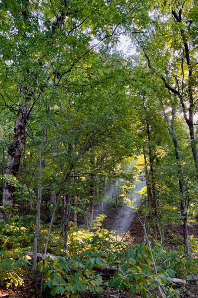


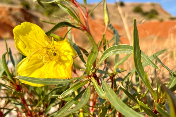
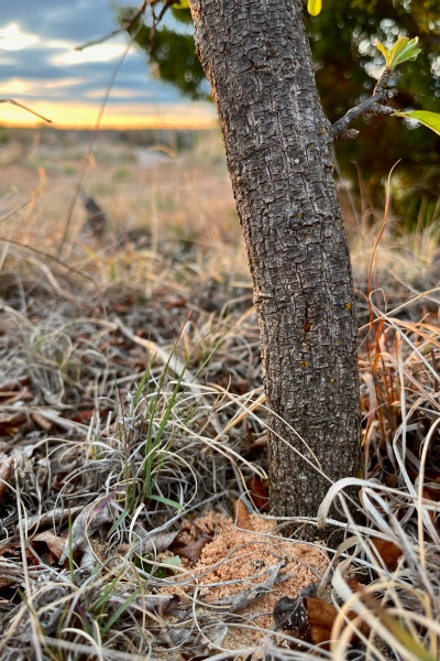
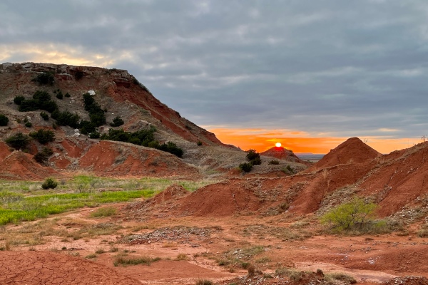
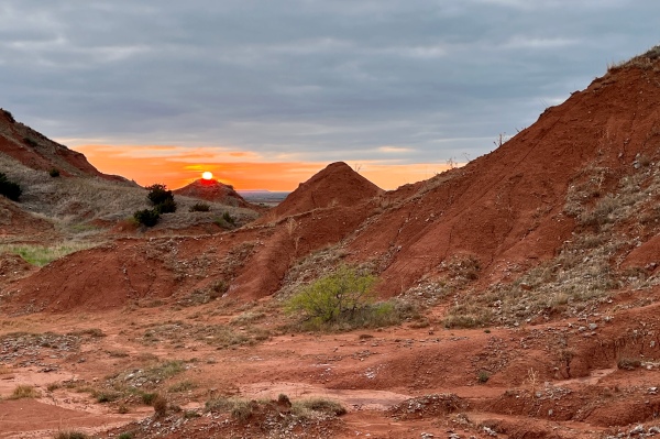

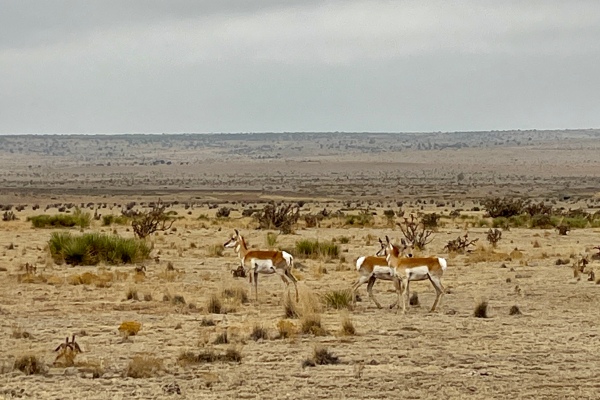
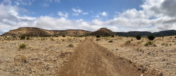


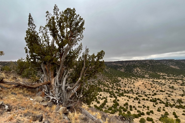


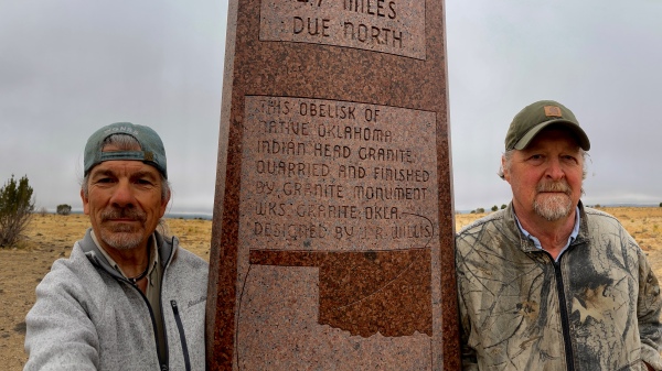
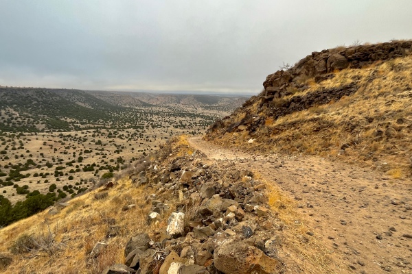
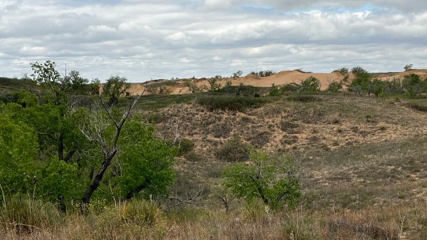
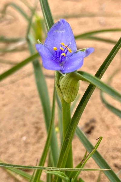
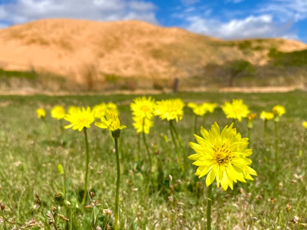
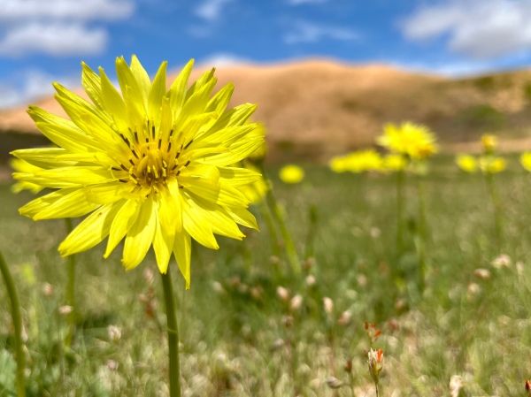
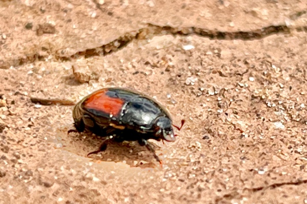
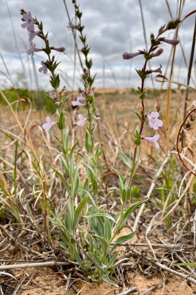
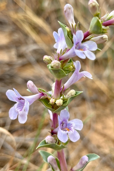

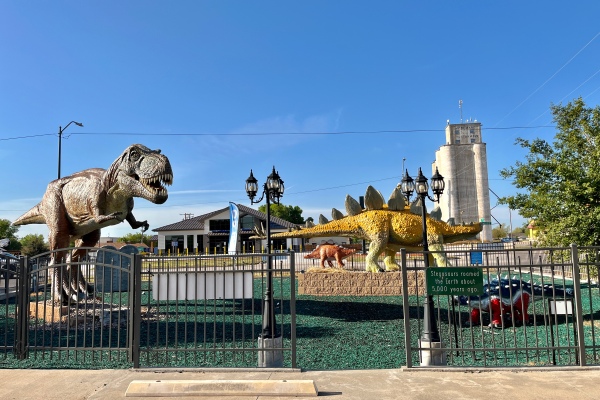


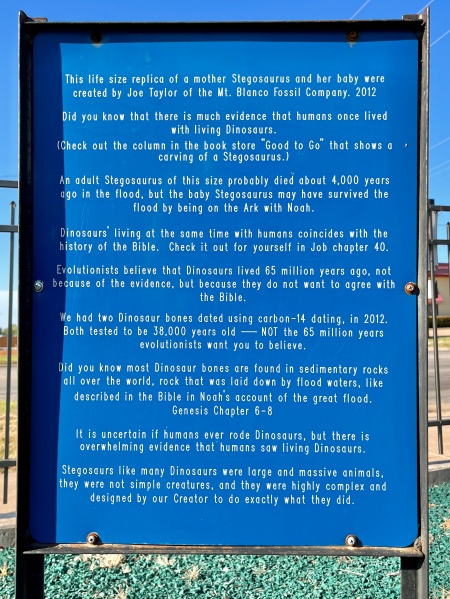
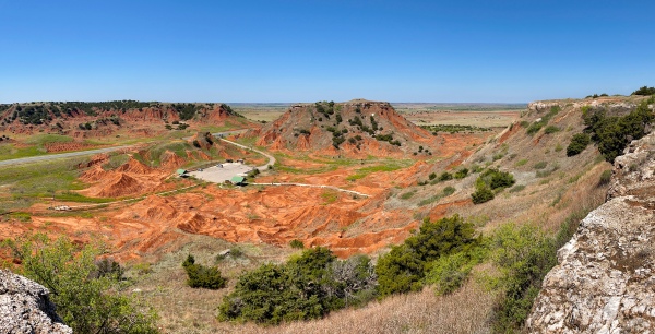
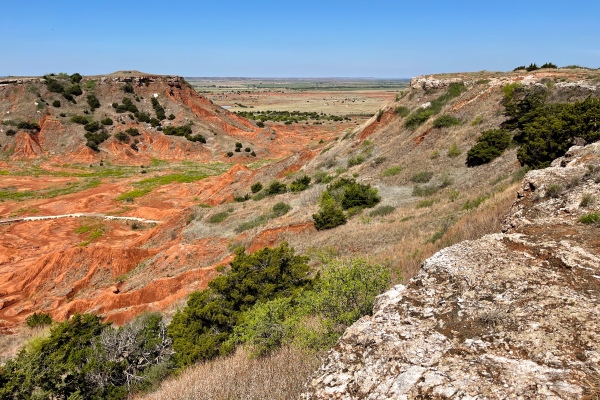
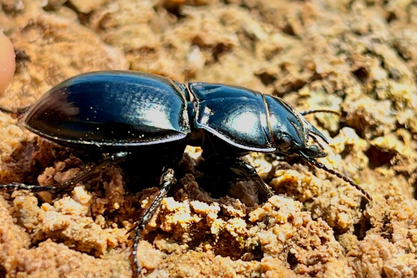


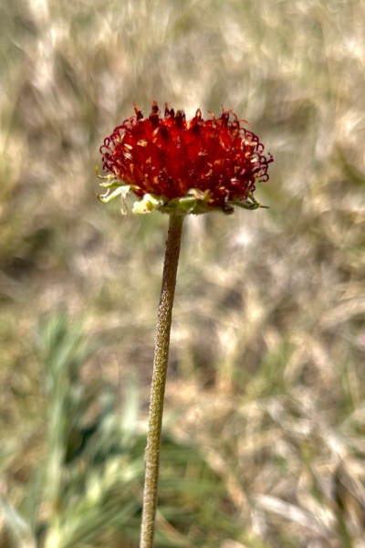
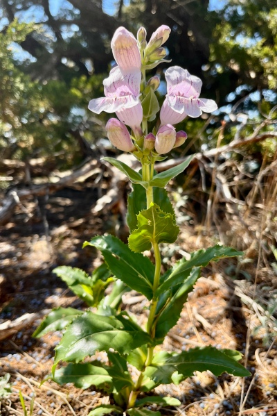

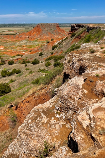
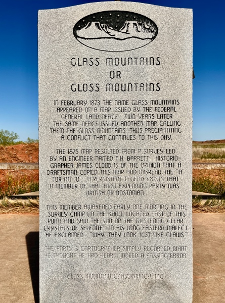


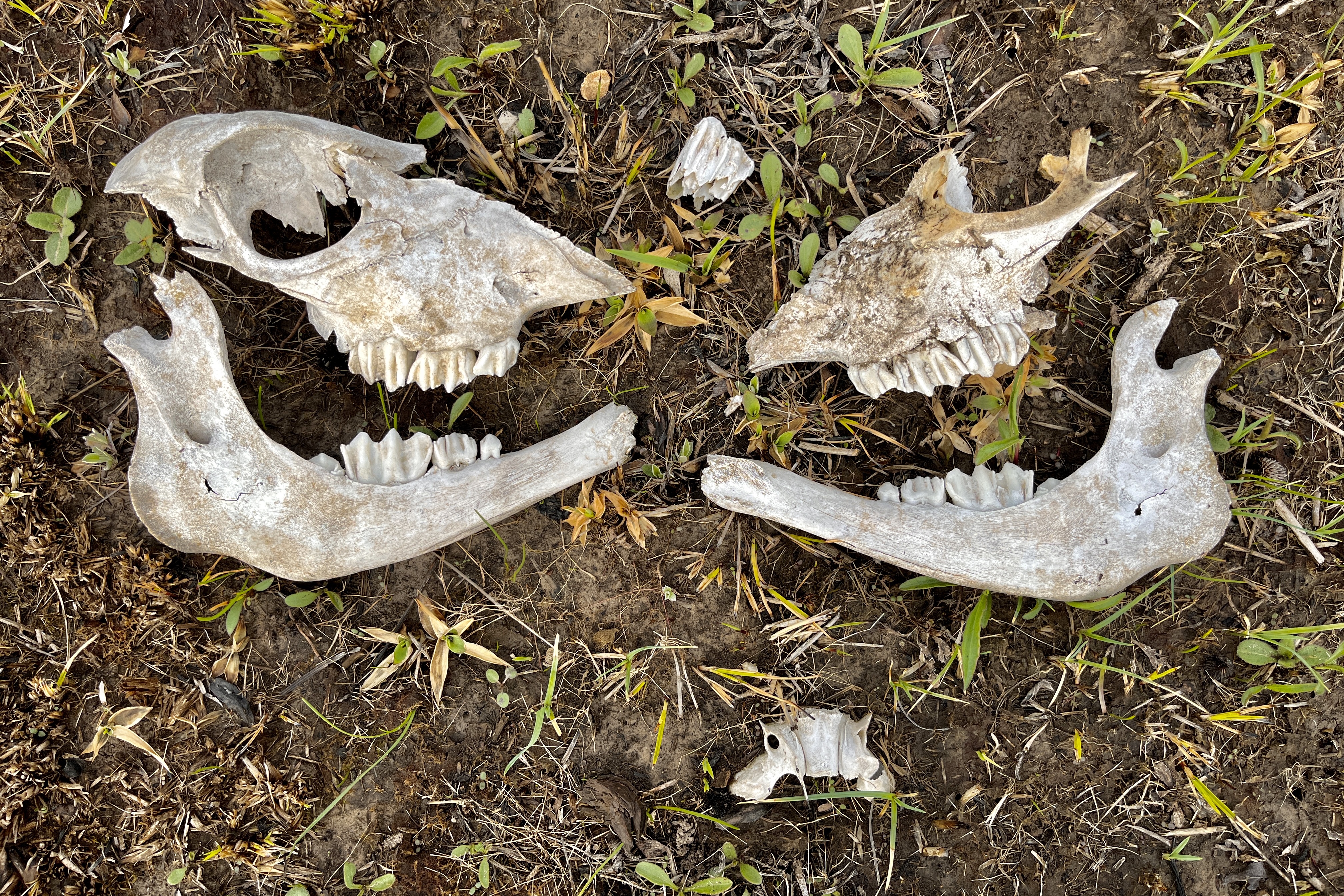
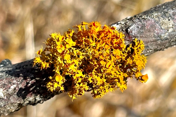


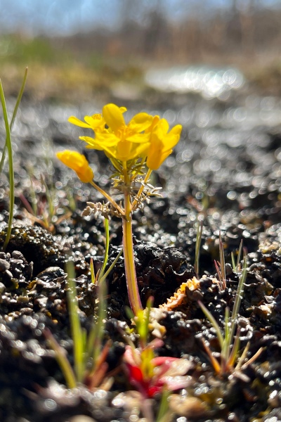

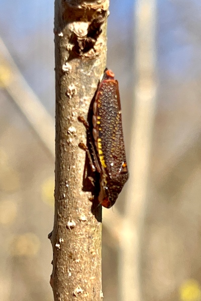
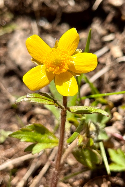

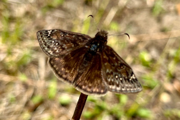


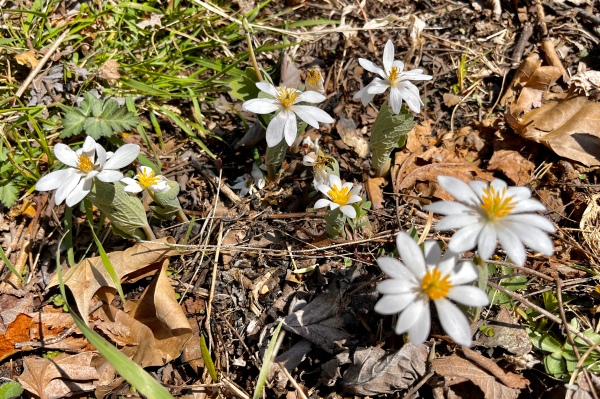
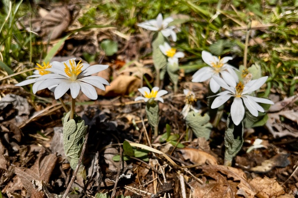

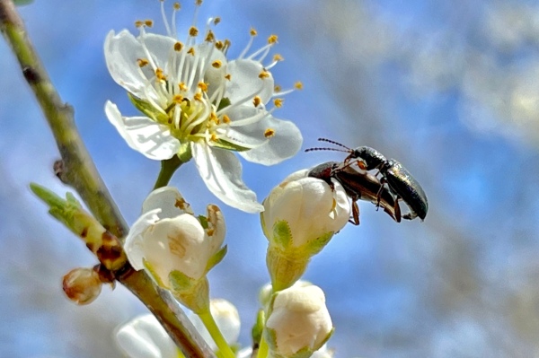
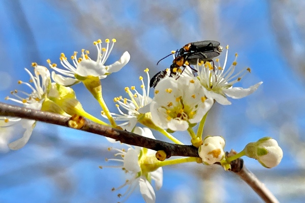


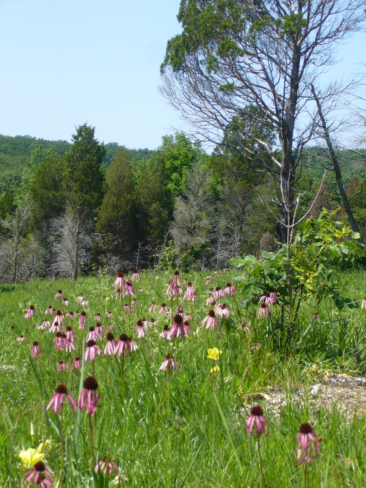
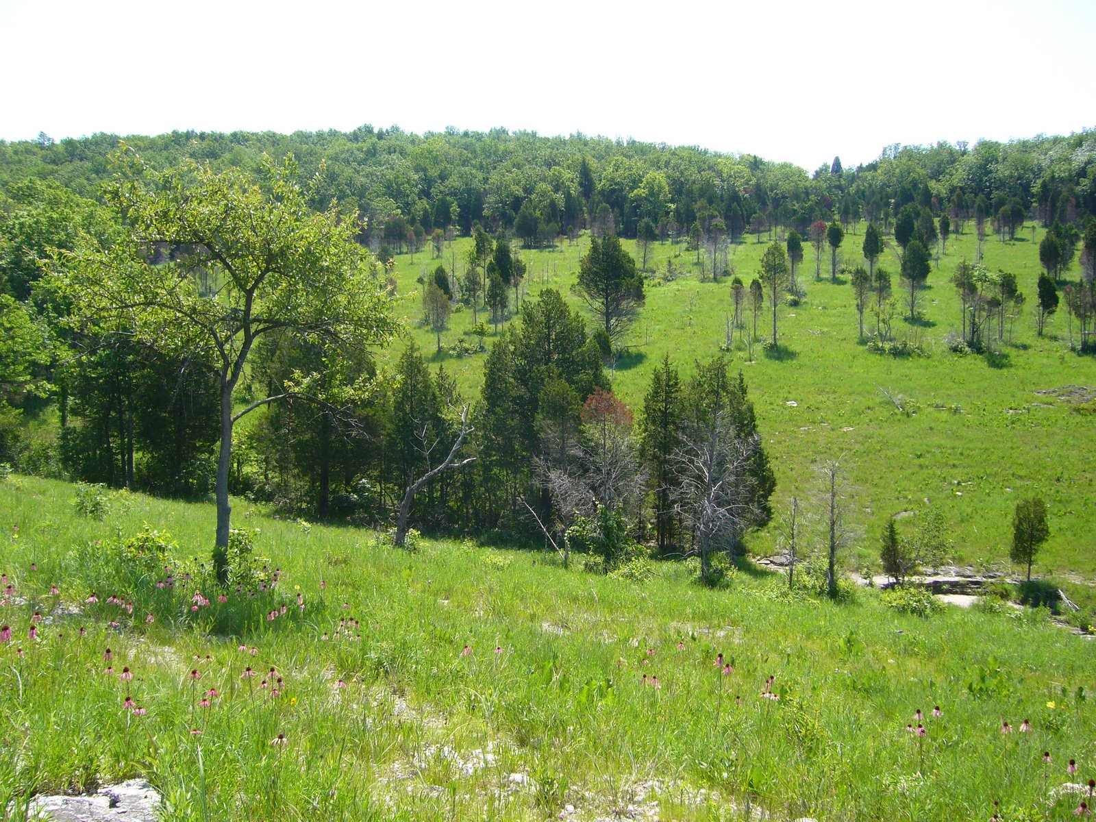
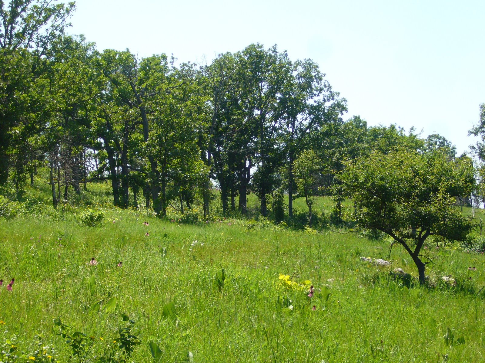


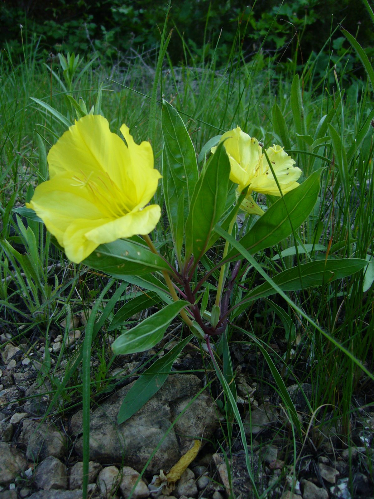
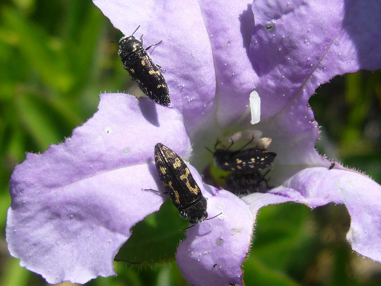
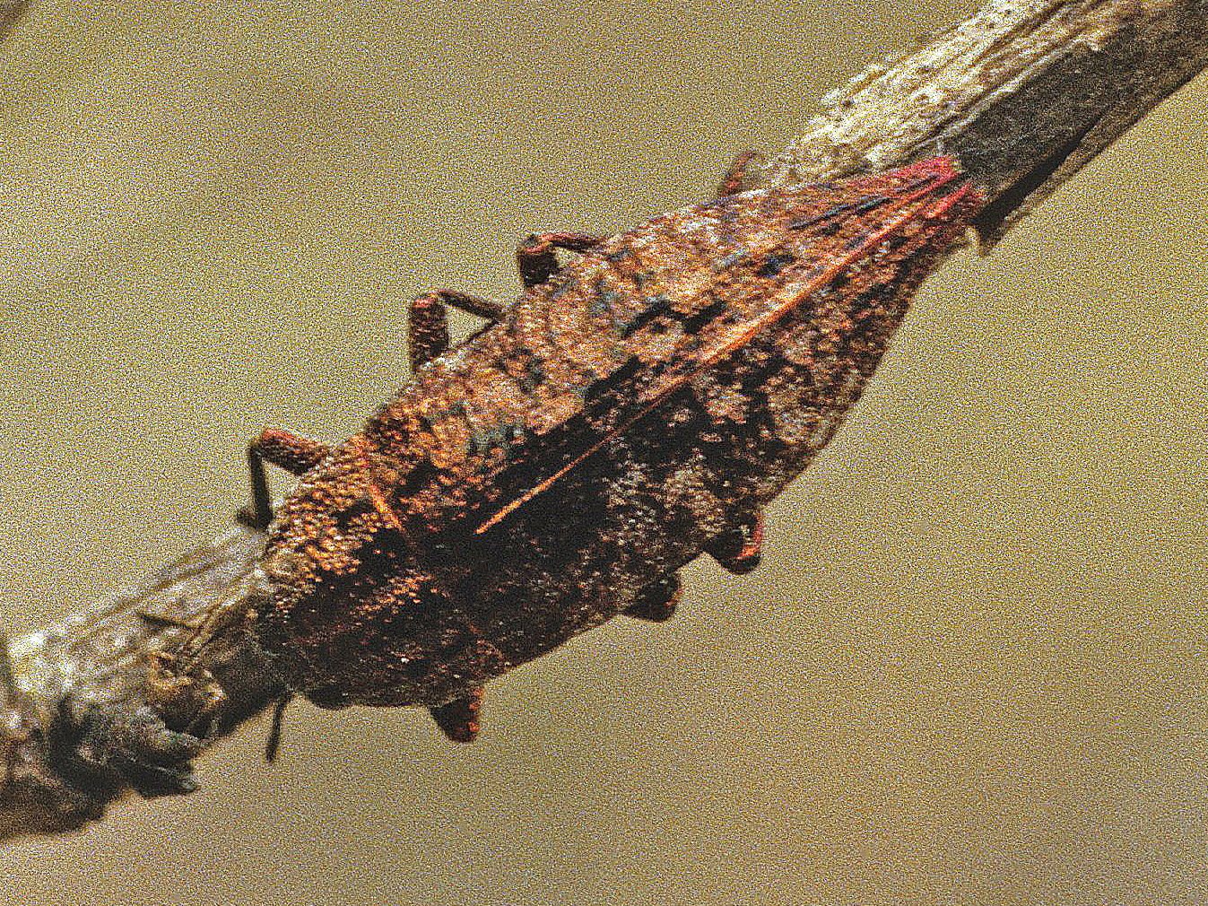


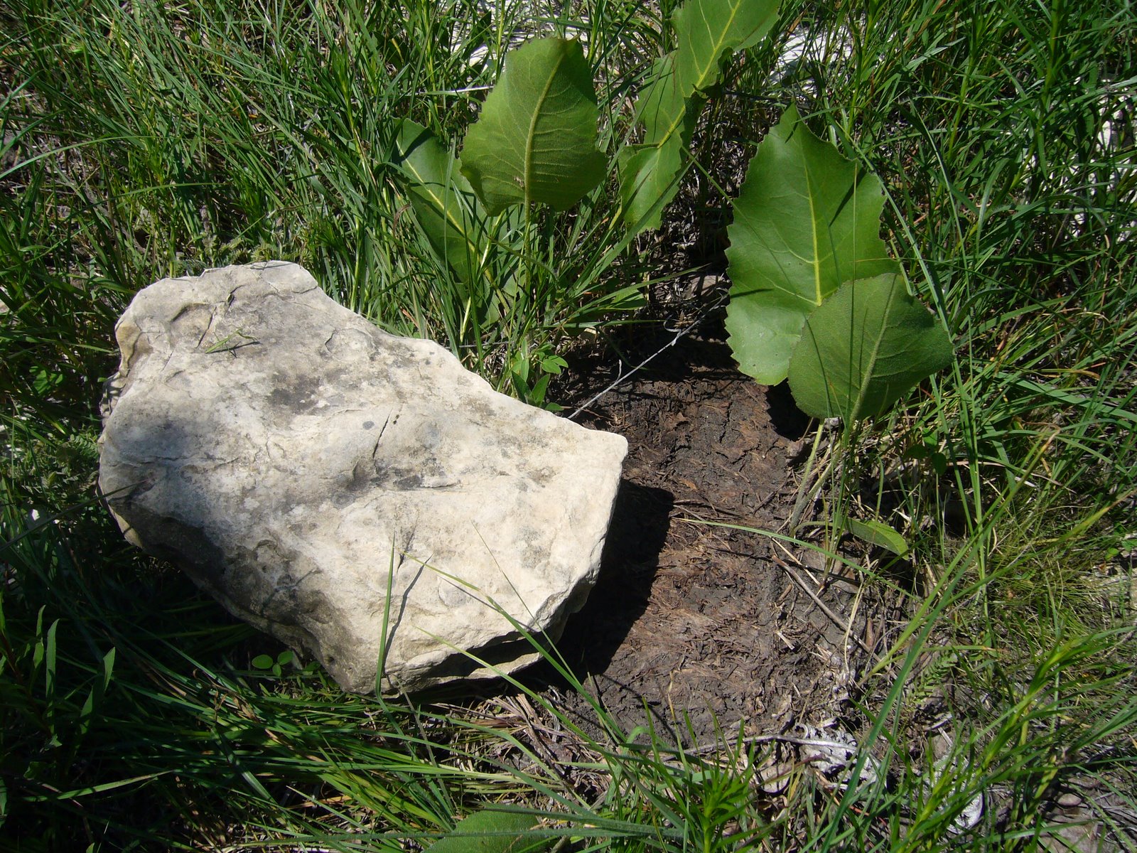


.JPG)