Botanizing at Castlewood State Park

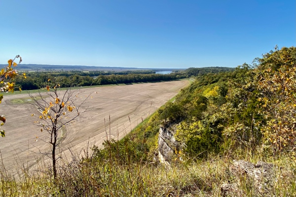
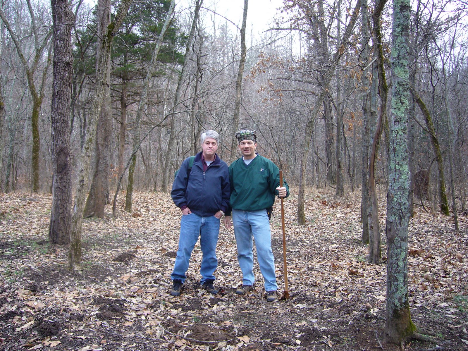
Fall color was the goal of today’s Webster Groves Nature Study Society (WGNSS) Botany Group field trip, and Castlewood State Park—with its breathtaking bluff-top views over the Meramec River Valley—is as good a place to see the autumn spectacle as any. It was a well-attended group despite the cool temps, blustery winds, and hint of moisture in the air, likely helped by the park’s closer-than-usual proximity to St. Louis.

Meramec River viewed from Lone Wolf Trail Overlook.

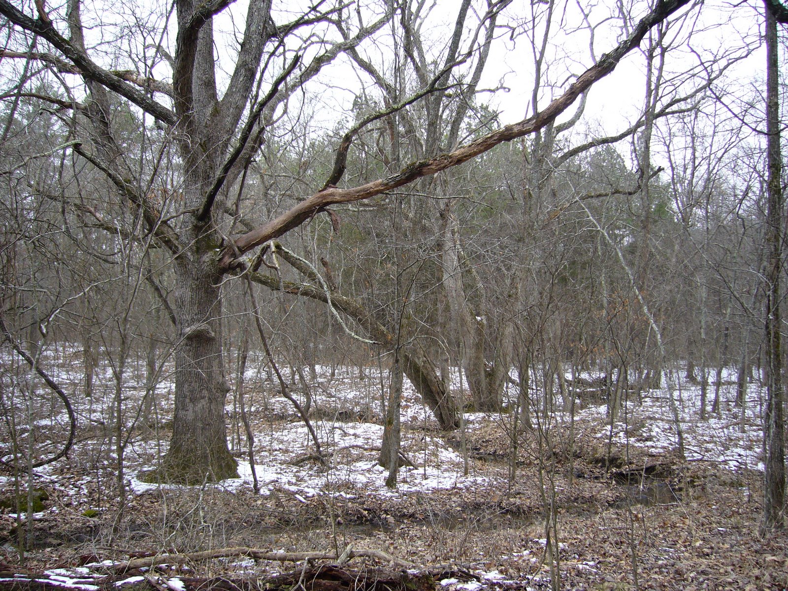
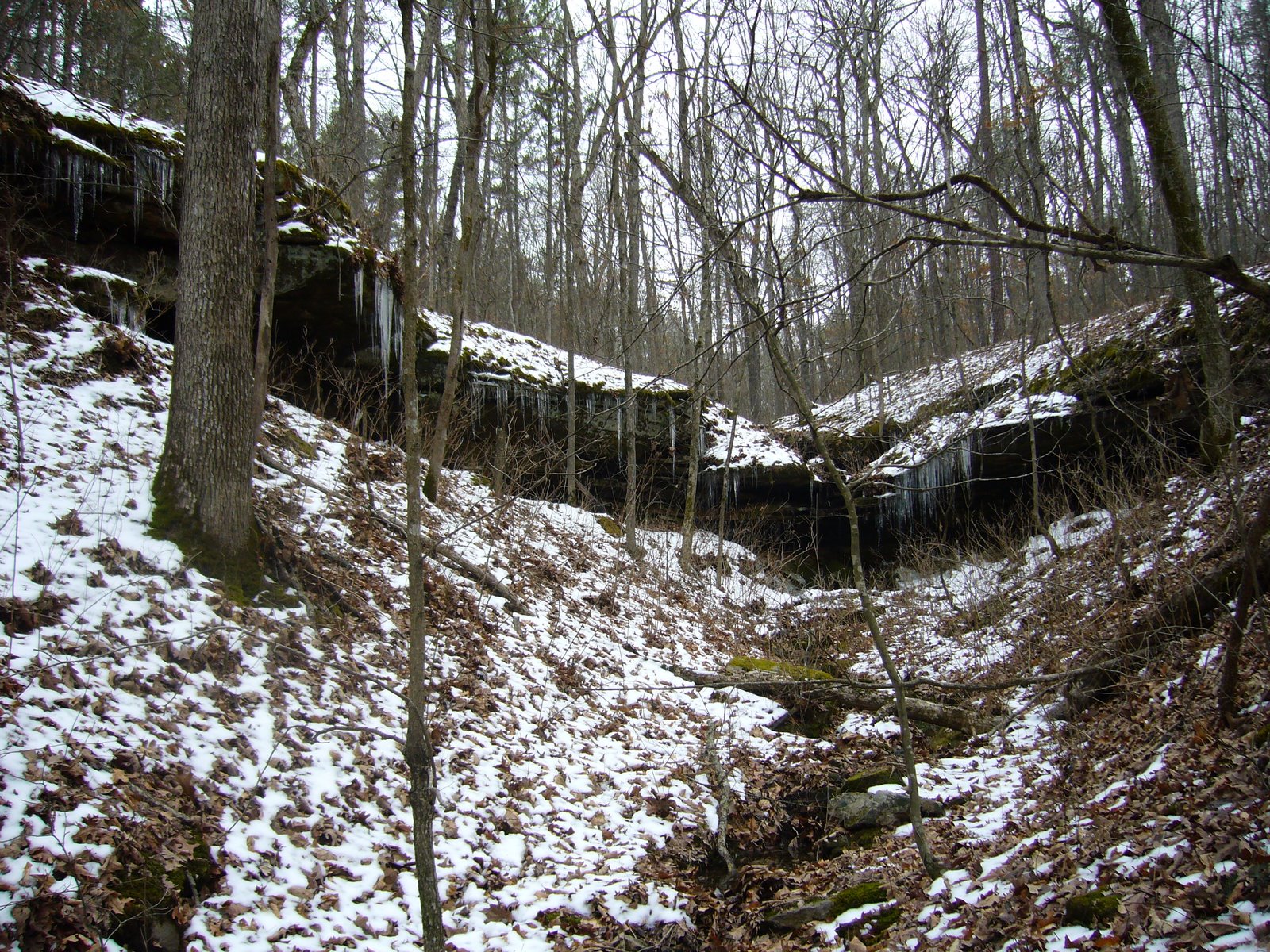
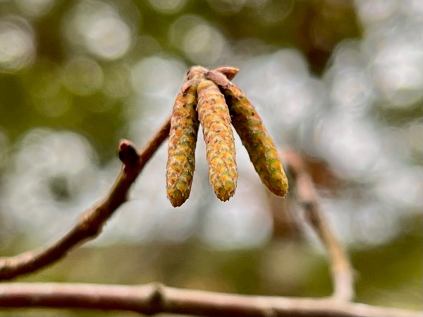
The group decided to hike the Lone Wolf Trail, which traverses both dry forest along the bluffs and riparian forest along Kiefer Creek. We got the climbing out of the way quickly by making the long, steep ascent up to the bluffs from the parking lot—giving ample opportunity for all to make it up before exploring the bluffs. John pointed out a small tree with developing male catkins that identified it as Ostrya virginiana (hop hornbeam). The catkins will remain closed through the winter and flower next spring. Ostrya (pronounced “oh-STRY-uh”) bark is usually vertically striate (pronounced “STRY-ate”), but the bark on this tree was still relatively smooth—a “non-striate Ostrya”!

Male catkins of Ostrya virginiana (hop hornbeam).

Reaching the wooden deck overlooking the Meramec River Valley, the size of our group apparently intimidated three youngsters that were on the deck, and they quickly yielded way. The expected fall colors had not yet materialized, leading some to engage in what seems to be an annual tradition of debating whether this year’s colors are abnormally late. While at the deck and walking further along the trail from it, debates centered mostly around distinguishing the various oaks and hickories. Fallen (squirrel-clipped?) twigs from one of the large oaks exhibited large, fuzzy, quadrangular buds typical of Quercus velutina (black oak), but the leaves had usually deep sinuses. After consulting a Missouri oaks field guide, we decided they must represent Q. velutina despite the atypical leaves. Close examination of the hickories with magnification revealed distinct pubescence on the buds and petioles, suggesting Carya texana (black hickory).

The WGNSS Botany Group takes in the view from the Lone Wolf Trail Overlook.

There was little still remaining in bloom along the bluffs, and what was still in bloom was in pretty rough shape. We found two blue fall asters near each other, but a closer look revealed that they were actually two different species—Symphyotrichum turbinellum (prairie aster), distinguished by its vase-shaped involucre and branchy growth with simple leaves, and Symphyotrichum patens (creeping aster), recognizable at once by its basally clasping leaves. Another fall aster without blooms caused some debate—the recurved phyllaries of the involucre and chordate lower leaves suggested Symphyotrichum anomalum (manyray aster), but the toothed leaf edges suggested something else. Without a flower to see the color, it was suggested it could be an “anomalous anomalum.” Otherwise, only the occasional, scraggly Solidago ulmifolia (elm-leaf goldenrod) completed the list of still-barely-blooming plants along the bluffs.

Acalypha virginca (Virginia copperleaf) provides the forest floor with subtle fall color.

Descending from the bluffs along a north-facing slope and more mesic conditions provided much more color than along the bluff. Patches of Asimina triloba (pawpaw)—their large, simple leaves now vivid yellow, brightened the understory, while the ubiquitous Acer saccharum (sugar maple) lifted the yellows higher into the canopy. Only the giant oaks, mostly Q. alba (white oak) and the aforementioned Q. velutina soared above the maples, their great height no doubt a result of rich, deep soils on the north-facing slope. On the ground below, a multitude of ferns colonized the moister areas, with three species found growing side-by-side: Adiantum pedatum (northern maidenhair fern), Phegopteris hexagonoptera (broad beech fern), and Polystichum acrostichoides (Christmas fern).

Apioperdon pyriforme (pear-shaped puffball, stump puffball) on dead oak trunk base.

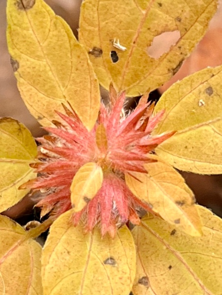
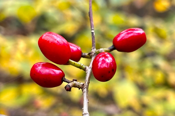
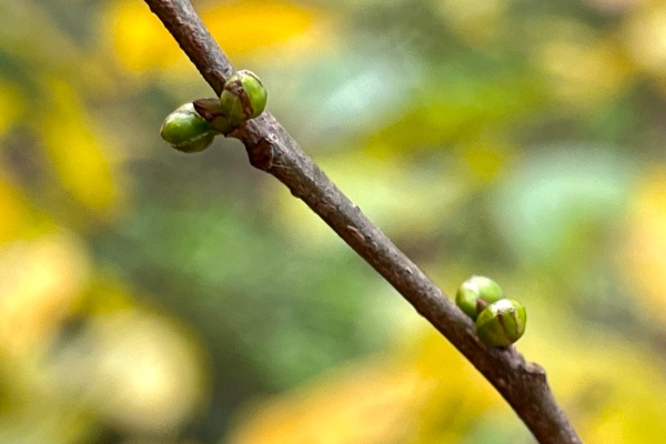
Fall color was not restricted to the leaves of the trees—fruits also provided dazzling points of color. Cornus florida (flowering dogwood) and Lindera benzoin (spicebush) both sported bright red berries similar enough in appearance to each other that close examination was required to distinguish those that had fallen to the ground. The former is synecious (i.e., all flowers bisexual), thus, all individuals can bear fruit. The latter, however, is dioecious (i.e., some individuals bear only male flowers, while others bear only female flowers); thus, only female trees produce the red berries. Comparing male versus female trees provided a chance to compare also the now-developing flower buds that will be among the first to open of any plant next spring. Since male plants tend to flower earlier than females, their flower buds were observed to be ever so slightly larger and further developed than those on female plants.

Lindera benzoin (spicebush) female fruits.
Lindera benzoin (spicebush) female flower buds.
Lindera benzoin (spicebush) male flower buds.

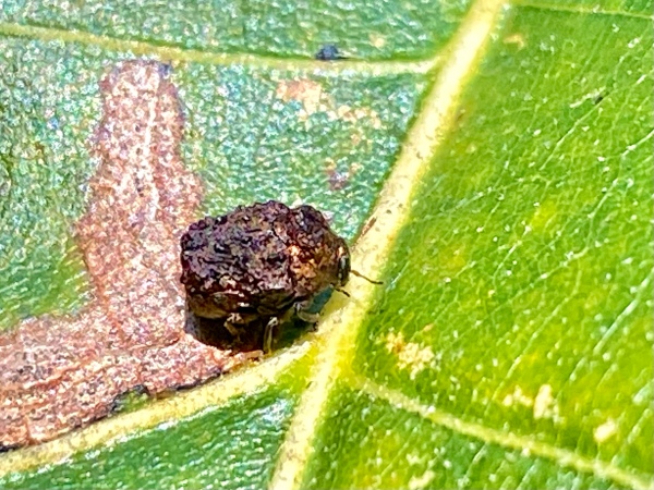
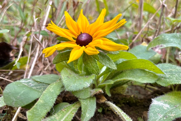
Along Kiefer Creek, flowers were limited to the occasional Campanula americana (tall bellflower) until we came upon a small area where a few late-blooming and very short-stemmed Rudbeckia hirta (black-eyed Susan) were found (regrowth?), but the remnants of green garden netting found around them indicated that they might have been planted. Definitely native in the same area, however, were a few still-flowering Eupatorium serotinum (late boneset) plants, a couple of which were found to be hosting a small, dark blue and yellow striped caterpillar. Neither of the two entomologists present knew what it was, although both had suggestions, but a little bit of sleuthing revealed them to be the larval stage of Haploa clymene (clymene moth), one of the tiger moths (subfamily Arctiinae) and known to feed on Eupatorium.

An unusually short-stemmed Rudbeckia hirta (black-eyed Susan).
Haploa clymene (clymene moth) caterpillar on Eupatorium serotinum (late boneset). Species ID based on host.

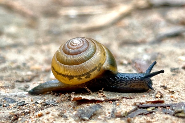
After returning to the parking lot and chatting with the group, I went back to the Eupatorium plants to take additional photographs of the Haploa clymene caterpillars with the big camera (look for those in a future post). On the way back to the car, I found a small snail actively crawling over the trail surface—its body fully stretched and antennae fully extended. I couldn’t resist putting the iPhone to the test to see if it could capture good photos of this small snail, and both the lateral and head-on shots were more than adequate. iNaturalist identifies it as a species in the genus Ventridens (dome snail), a member of the family Zonitidae (true glass snails).

Ventridens sp. (dome snail) on trail through mesic riparian deciduous forest.

©️ Ted C MacRae 2021

Hiking at Grand Bluffs Conservation Area

300-ft bluffs tower above the Missouri River valley.

Balmy conditions continue as we head into the back half of October. For today’s hike, I decided to try something new and settled on Grand Bluffs to check out the spectacular views that are said to be available from atop its 300-ft bluffs that overlook the Missouri River valley.

The Missouri River Valley stretches off to the west.

I expected fall colors to be well advanced by now, but at least in this area the forests remain mostly green with only hints of the yellows, reds, and oranges that will soon explode across the canopy. The parking lot is near the valley, so the hike to the overlook is mostly up, sometimes for fairly long stretches. The views from the lookout, however, are breathtaking and well worth the effort to get there.

Warty leaf beetle (Neochlamisus sp.).

On the way up, fall asters (Symphyotrichum spp.) and goldenrods (Solidago spp.) bloomed prolifically along the trailsides under mesic deciduous forest—I saw three species of the former (anomalum, oolentangyense, and turbinellum) and two of the latter (nemoralis and petiolaris).

Gemmed satyr butterfly (Cyllopsis gemma).

Insects seen included syrphid flies and halictid bees on the fall asters, several warty leaf beetles (Neochlamisus sp.) feeding on foliage of black oak (Quercus velutina), and gemmed satyr (Cyllopsis gemma) butterflies flitting above the forest floor. A male eastern harvestman (Leiobunum vittatum) sitting in the trunk of a shagbark hickory (Carya ovata) proudly displayed his elongated, spiny pedipalps for all to see.

Eastern harvestman (Leiobunum vittatum).

The hike back down was almost as deliberate as the hike up, taking care to watch my footing as the late afternoon shadows grew longer and sharper through the dappled sunlight. While 2.7 miles is not a long hike, it was sufficient for the day, and I look forward to returning during the winter when an open canopy will afford even more spectacular views from atop the bluffs.

One of the dark-spored mushrooms (family Psathyrellaceae) at the base of a sugar maple (Acer saccharum).

©️ Ted C. MacRae 2021

I’m a fun guy!

The habit of looking at things microscopically as the lichens on the trees & rocks really prevents my seeing aught else in a walk.—Henry David Thoreau

I should have loved an opportunity to go for a walk in the woods with Thoreau—especially during the winter when my preoccupation with insects no longer restrains my fascination with all things natural. While many entomologists see winter as a break from field work—a time to indulge/suffer (depending on mood) the more mundane curatorial tasks associated with their studies, my time in the field continues uninterrupted with long walks in the woods. Hiking stick replaces insect net. Energy foods replace vials. I still pry bark and flip rocks—I cannot completely ignore the potential to find insects. But I also peer through miniature forests of moss, poke about the mushrooms on a fallen log, and squint at the lichens encrusting a rock. Yes, insect specimens collected during the previous summer still need to be pinned, but there is time for that. There will always be time for that—if not now then in my later years when my ability to scramble through the bush begins to wane. For now, the woods sing their siren song, and I must listen.

Trichaptum biforme (purple tooth) on fallen river birch (Betula nigra) | Reynolds Co., Missouri

Trichaptum biforme on fallen trunk of Betula nigra | Reynolds Co., Missouri

Purple tooth (Trichaptum biforme) on dead red maple (Acer rubrum) | Reynolds Co., Missouri

Trichaptum biforme on fallen branch of Acer rubrum | Reynolds Co., Missouri

Multicolored gilled polypore (Lenzites betulina) on river birch (Betula nigra) stump | Reynolds Co., Missouri

Lensites betulina on dead stump of Betula nigra | Reynolds Co., Missouri

"Gills" distinguish this shelf fungus from turkey tails and other similar types.

“Gills” distinguish this shelf fungus from turkey tails and other similar types.

Cladonia chlorophaea or C. pyxidata on chert-trail | Reynolds Co., Missouri

Cladonia sp. (poss. C. chlorophaea or C. pyxidata) on chert-trail | Reynolds Co., Missouri

(Cladonia pyxidata)

A forest in miniature!

Irpex lacteus? on fallen branch of Acer rubrum | Iron Co., Missouri

Irpex lacteus (?) on fallen branch of Acer rubrum | Iron Co., Missouri

Spores are released from the toothy cap underside

Spores are released from the toothy cap underside

Leucobryum glaucum on forest floor | Reynolds Co., Missouri

Leucobryum glaucum on forest floor | Reynolds Co., Missouri

Postscipt: all photos shown taken on 30 November 2013 while hiking a 7-mile stretch of the Ozark Trail (Karkaghne Section in Reynolds Co. and Middle Fork Section in Iron Co.).

Copyright © Ted C. MacRae 2014

Ozark Trail – lower Courtois Section

The Courtois Section is the northern terminus of the Ozark Trail (OT). Despite its proximity to the St. Louis metro area, it feels just as remote and wild as the more southern sections. Rich and I played hooky from work on Friday and made our first visit to this stretch of the Ozark Trail. At 40 miles in length, we’ll need to break it up into at least three parts, so for our first attempt we hiked the lower portion from Hazel Creek (where the Trace Creek section begins) north to the Hwy 8 trailhead. Apparently this portion of the OT is very popular with mountain bikers and equestrians; however, we didn’t encounter a single person all day.

I expected the terrain to be rather mild at this northern end of the OT, but the first few miles were quite up and down. There was still some snow on the ground from a big storm a few days earlier – mild temps and sunny skies since then had caused a lot of melt. As a result, south facing slopes were completely devoid of snow cover, while north facing slopes still had and inch or two of snow, creating “split” scenes such as this:


Right away we noticed a lot of fresh woodpecker damage on oak trees. This is likely the result of infestations by the red oak borer (Enaphalodes rufulus), a cerambycid beetle that preferentially attacks red and black oaks suffering from drought or other environmentally-induced stress. The larvae of these beetles mine beneath the bark on the trunks of these trees before tunneling into the sapwood to pass the winter. Overwintering larvae are tasty morsels for woodpeckers, who hammer into the trunks with their beaks and extract the larvae with their barbed tongues. Interestingly, conventional wisdom has it that the tongue “stabs” the larva, and the barbs aid in pulling the larva out of its gallery. However, recent experiments with a West Indian species suggest this is not the case. Rather, the larva “sticks” to saliva on the tongue, and the barbs help to grab the larva as the tongue is wrapped around it. This picture shows a small black oak (Quercus velutinus) tree with fresh damage, probably from a pileated woodpecker (Dryocopus pileatus) judging by the size, going after one of these larvae.


A few miles into the trail, we came upon some curious “pits” covering one hillside. We speculated what they might be – sinks was an early thought, but I didn’t think that was so because the ground was mounded around the edge like they had been intentionally dug. Rich then remembered reading something about miners digging such pits in past years looking for minerals – we decided that must be what they were, and this was later confirmed in our Ozark Trail guidebook. Certain hillsides were literally covered with these pits, spaced ~10-15 feet apart.

After passing through Snapps Branch (where we noticed a small calcareous wet meadow, or fen – thankfully fenced), the trail leveled out for awhile before descending down to Boiling Springs Hollow where we stopped for lunch. Many of the larger valleys along the OT show some evidence of prior habitation – either by remains of old structures or by the stage of succession exhibited by the bottomland forest. Right at Boiling Springs, I noticed this large, old oak tree along with several large sugar maples (Acer saccharum) surrounded by younger forest – I suspect these “founder trees” were planted at some point when people lived near the spring (or at least spared from “the saw”) and remain as the only evidence of the people who lived here in the past.


I love bones and pick them up whenever I get the chance. After leaving Boiling Springs I noticed this half mandible of a white tailed deer (Odocoileus virginianus) laying on the trail, still partially embedded in the snow. It was remarkably clean and complete, containing all of its dentition and with no remaining tissue except for a small piece attached to the nerve fossa. It’s completeness begged the question – where was the other half? We looked around and couldn’t find it. We then wondered if it had been dragged there by a scavenger, although we thought that if that was the case it should show signs of gnawing or at least have lost some of its dentition. At any rate, I have a white tailed deer cranium in my collection but not a mandible, so this will be a welcome addition.


Eventually we entered Machell Hollow, where we followed a beautiful stretch through the upper reaches of the valley. In this area we noticed a large number of dead white oaks (Quercus alba) that were all about the same size (~4-8″ dbh) and in about the same stage of decay, as if they had all died about the same time (maybe 4-5 years ago). There were still plenty of larger living trees, and I began to suspect that a fire had moved through this area and began looking for the evidence. Soon we found several larger trees showing some blackening around the base of the trunk that seemed to confirm this thought. We had a lot of fun “pushing over” some of these trees, with one in particular probably representing our champion pushover to this point. I didn’t think it was gonna go, but Rich chipped in, and against our formidable combined weight the tree gave way and came down with a crash. I noticed evidence of tunneling by wood boring beetles (probably a species of Buprestidae) inside the trunk of this tree where it cracked upon falling and lamented that I could not take a piece with me for rearing. All of the dead white oaks had this one type of shelf fungus growing from their trunks, which were particularly numerous on this already fallen tree:


Climbing up (briefly) out of Machell Hollow, we saw this cut shortleaf pine (Pinus echinata) laying by the side of the trail. Interestingly, the accumulated ice on the cut end of the trunk was not the result of water running off the trunk, but through the trunk, apparently through insect galleries and perhaps even the vascular bundles of the wood itself. The slow melt and freeze resulted in these interesting little ice columns joining the trunk to the moss-covered ground below.


Back down into the lower reaches of Machell Hollow, evidence of prior settlement was obvious, as the bottomland forest in this area was replaced by young successional forest comprised primarily of chokecherry (Prunus virginiana), honey locust (Gleditsia triacanthos), and brambles (Rubus sp.). We saw this lone little fruticose lichen growing on a small honey locust. Apparently, of the three main groups of lichens, fruticose lichens are the most sensitive to environmental disturbance. Perhaps the existence of this one colony suggests that the health of this bottomland forest is returning as succession proceeds along the path to maturity.


Here’s a picture of Rich taking his own picture of the lichen. I don’t know why he didn’t just wait and steal mine once it got posted 😉


Much more abundant on the honey locust trees were these foliose lichens. Lichens in this group are probably the most commonly noticed lichens in the Missouri Ozarks (although the less conspicuous crustose lichens may actually be more diverse). If you click on the photo to see the full-sized version, you can see long, black “hairs” around the margin of each “leaf” – if anyone knows the identity of this or any of the other lichens pictured on this site please let me know.


While ascending out of Machell Hollow, we noticed this small canyon about a hundred yards off to the left and decided to go investigate. Along the way we noticed the small creek coming from it was actually a ‘losing creek’ – which means that the water flows into the ground at certain points and is ‘lost.’ This is another feature of the limestone/dolomite-based Karst geology so common here in southern Missouri that results in its abundance of caves and springs. When we got to the canyon we saw it was comprised of a layer of sandstone. This must be a rare western exposure of the LaMotte sandstones that are more common just to the east in Ste. Genevieve County (see earlier posts on Hawn State Park and Pickle Springs Natural Area). This sandstone layer overlying dolomite has created an interesting geological feature, where a losing creek originates from a box canyon. Ice stalactites were dripping from the north facing slope of the canyon walls.


Back down into another hollow leading to Lost Creek we saw more dead white oaks with shelf fungi growing from the trunks. This one was interesting in that the shelf fungi were themselves supporting the growth of algae on their surface – an exquisite example of the interconnectedness of life.


We had seen a flock of wild turkeys (Meleagris gallopavo) moving through the forest earlier in our hike. We were too clumsily noisy to get close enough for more than a cursory look at them as they trotted off on high alert, but evidence of their activity was obvious as we saw their fresh “scratchings” over a wide swath through the forest as they searched for acorns to eat. Tracks were abundant in the snow around the area also, but I couldn’t get a good picture of them. Later, as we neared Lost Creek, I saw more tracks in the mud, so I was able to get a good picture of one. It looked fairly fresh (well defined, with nail holes evident):

Lost Creek represented the end of our hike, but it proved to be a more than insigificant final hurdle, as the water level was quite high due to all the recent snow melt. There was no choice, we would have to get wet. Rich is smarter than I and had thought to bring along some flip flops, so he took off his boots and socks, rolled up his pants, and forded the creek. I let him go first to see how deep the water was – it reached above his knees and got is rolled up pants wet. I decided to get my boots wet – I didn’t want to walk on those rocks barefoot, which would slow me down far more than I wanted in that cold water. I could handle wet boots for the final quarter mile in exchange for the comfort and speed they would provide on the rocks. Rich may be smarter, but I took a better line and didn’t even get my pants wet, so for me it was only a matter of changing into my comfy shoes back at the car, with no need for a change of clothes (which I also wasn’t smart enough to bring, either). We completed the hike in 7 hours – yes, we’re lollygaggers, constantly distracted by little things that most people either don’t see or don’t care about. It was a wonderful hike on another beautiful day, and we ended it with another traditional post-hike visit to the nearest pizza parlor before the short drive back to St. Louis.

Ozark Trail – upper Trace Creek Section

Last Saturday Rich and I finished the Trace Creek Section of the Ozark Trail by hiking the upper 12.5 miles of the section – from Hazel Creek to the Hwy DD crossing. Today was a special day for us – we would be completing our 200th mile of the Ozark Trail! Unfortunately, I came down with a cold the day before, making it somewhat difficult to fully enjoy that milestone. Nevertheless, it was a milestone that we’re quite proud of. Since we started hiking the Ozark Trail some 7 years ago, we’ve completed the Taum Sauk, Middle Fork, Blair Creek, Current River, Between The Rivers, Eleven Point, and – now – Trace Creek Sections. Of these, the Taum Sauk Section is unquestionably the finest, crossing the rugged granite outcroppings of the St. Francois Mountains, and the Eleven Point Section with its towering bluff top views is a close second. We still have much to see, however. Completed sections still awaiting us are the Karkaghne, Marble Creek, Wappapello, and Victory Sections, and the Coutois and North Fork Sections are nearing completion. By the time we complete these sections, I expect additional parts of the planned route will be constructed and ready for our enjoyment.

But back to Saturday’s hike. We started at Hazel Creek with mild temps and cloudy skies but no precip in the forecast. We talked briefly to a mountain biker with a 29er who took this photo of us:


These cabin remains lie in the campground at the trailhead – those are sandstone blocks which I suppose must have been transported from the Lamotte formations some 30 miles to the east near Ste. Genevieve.


There was much to see in the vicinity of Hazel Creek. As an orchid enthusiast, I was pleased to find these Adam and Eve orchids (Aplectrum hymenale), also known as puttyroot, growing in healthy numbers on the hillside above the valley. The single leaf of this unusual plant is dusky grey-green in color, deeply creased and looking like crepe paper. They appear in late summer and persist until the plant flowers the following spring.


Another of the shelf fungi was found growing on the trunk of a large, dead deciduous tree.


My preoccupation with lichens continues. This colony of British Soldiers (Cladonia cristatella) was found growing in trailside rocks. This lichen is named for its resemblance to the uniforms worn by English soldiers during the Revolutionary War, although the spore-producing reproductive structures are not the brilliant red color as seen during the summer. Lichens are not plants, or even a single organism, but instead a symbiotic association between an alga (in this case, Trebouxia erici) and a fungus (in this case, Cladonia cristatella). Lichen scientific names are derived from the fungus part of the relationship.


Puffball mushrooms have been a favorite of mine since I found my first colony during childhood and delighted in watching the ‘smoke’ fly as I slapped them with my hands. These days I’m satisfied to just look at them (and maybe poke one or two).


The term “puffball” actually refers to a polyphyletic assemblage of fungi distributed within several orders in the division Basidiomycota. I’m no expert (or even a novice), but I wonder if these apparently mature individuals might represent the pear-shaped Morganella pyriforme, a saprobic species that is considered a choice edible while still young. Please leave a comment if you know its identity.


The trail was not particularly rugged but traversed across a number of ridges between the Hazel Creek and Trace Creek valleys. The bedrock was mainly chert, and along the trail we saw this quartz formation with its intricately formed interior exposed.


Approaching Trace Creek, this fireplace and chimney were all that remained of what was probably once a cozy little homestead. Obviously this house had not been constructed of sandstone blocks like the one at Hazel Creek. On each side of where the house once must have been stood two grand, old sugar maple trees (Acer saccharum) – we speculated they had been planted by the former residents and wondered what life was like in this isolated little part of the Ozarks back in the day.


We reached the trails namesake, Trace Creek, about halfway through our hike, and by this time we were the Ozark Trail’s newest 200-mile veterans. It was a pretty little valley, and we stopped here for a bit to eat and rest. Adam and Eve orchids were plentiful here, and in looking for them I became surprised to notice how large a variety of green, herbaceous plants one can find in these deciduous forests during the winter, especially in the lower elevations (moister?).


On these hikes, it has become customary to ‘push over’ trees – dead trees, that is. The larger the better, but of course the larger they are the ‘deader’ they must be for us to be able to push them. I did not push over a single tree on my previous hike of the lower Trace Creek Section, so I made up for it this time and found three trees to push over. Here, Rich finds out what all the fun is about:

The final miles of the hike became more difficult, as my sore throat and congestion combined with the miles started taking their toll on me. We finished our hike at the Hwy DD crossing after 7 hrs of hiking, portaged back to the other car, and met up in Sullivan for our traditional post-Ozark Trail hike pizza dinner.

Ozark Trail, lower Trace Creek Section

The Ozark Trail is a part of a vision, conceived in 1977, to build a scenic and varied route through the Missouri Ozarks, stretching from the St. Louis metropolitan area southwestward to the Arkansas border, eventually connecting to the Ozark Highlands trail–creating a 700 mile through-trail. Almost 550 miles of trail have been completed, with 350 miles in Missouri.
Ozark Trail Association

My friend Rich and I have been hiking sections of the Ozark Trail for several years now. So far, we have completed ~175 miles, and we hope to eventually hike the entirety of the trail. Yesterday we hiked the 11.5-mile southern stretch of the Trace Creek Section, starting at the Hwy DD crossing in Iron Co. and finishing at the Hwy A trailhead, where the Trace Creek Section joins the Bell Mountain portion of the Taum Sauk Section. The first few miles traversed relatively mild terrain as we followed the Telleck Branch, but after crossing the upper reaches of the Big River the terrain became progressively more rugged. The trail ended with a spectacularly steep descent down to Ottery Creek at the foot of Bell Mountain.

It was a gray day with light drizzle and increasing fog. The air was heavy with moisture, but with temperatures in the upper 30s and only light winds it didn’t feel too cold. While many sections of the Ozark Trail offer spectacular vistas overlooking the regions many spring-fed rivers, few such vistas are found on this section. What we did see were bright green lichens on rocks, on oak trunks, and on the ground underneath pines, small openings in the forest eerily shrouded in fog, and a variety of ferns along stream banks and in rock crevices, dripping with moisture. It rained lightly at one point, forcing us to break out our ponchos, but the rain didn’t last and we were able to stow the ponchos for good afterwards. It was a serene, beautiful experience with not another soul in sight during the entire day. The solutide contributed as much to the splendor as did the visual beauty. Following are some pictures from the day:

A foliose lichen plasters the surface of a rock outcrop

Closeup of the above, showing an highly convoluted 3-dimensional structure

I believe this is type of “reindeer lichen” – Cladina sp. – growing in a colony on sandy soil underneath a pine tree

Close up of the above, showing the intricacies of its fruticose structure

Water hangs heavy from leafless petioles of a downed oak tree

One of the shelf or crust mushrooms, growing on the trunk of an oak tree

Closeup of the above