Sanctuary for the Betulaceae

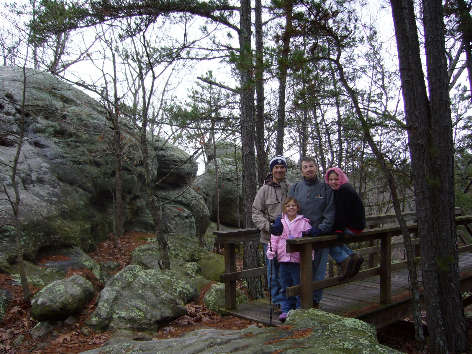
Nestled on the eastern side of the St. Francois Mountains, where the craggy exposures of the Ozarks most ancient rocks begin to subside underneath the Cambrian sandstones laid down over them, lies Hawn State Park – considered by many to be the loveliest of Missouri’s state parks. I have written previously about Hawn – in fact, it was the subject of my very first post on this blog. I have long treasured Hawn for its excellent insect collecting, diversity of plants and habitats, and unbridled beauty. I have hiked the incomparable Pickle Creek and Whispering Pine Trails many times – far more than any other trail in the state, and each time I fall more deeply in love with what, to me, represents the essence of the Missouri Ozarks in their most pristine state.

Lamotte sandstone cut
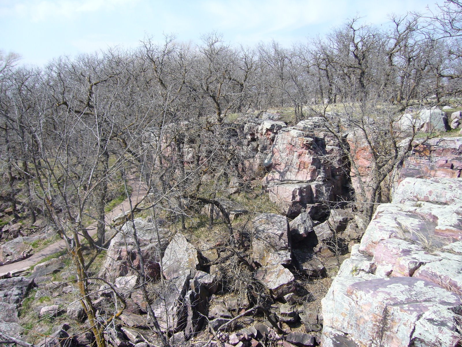
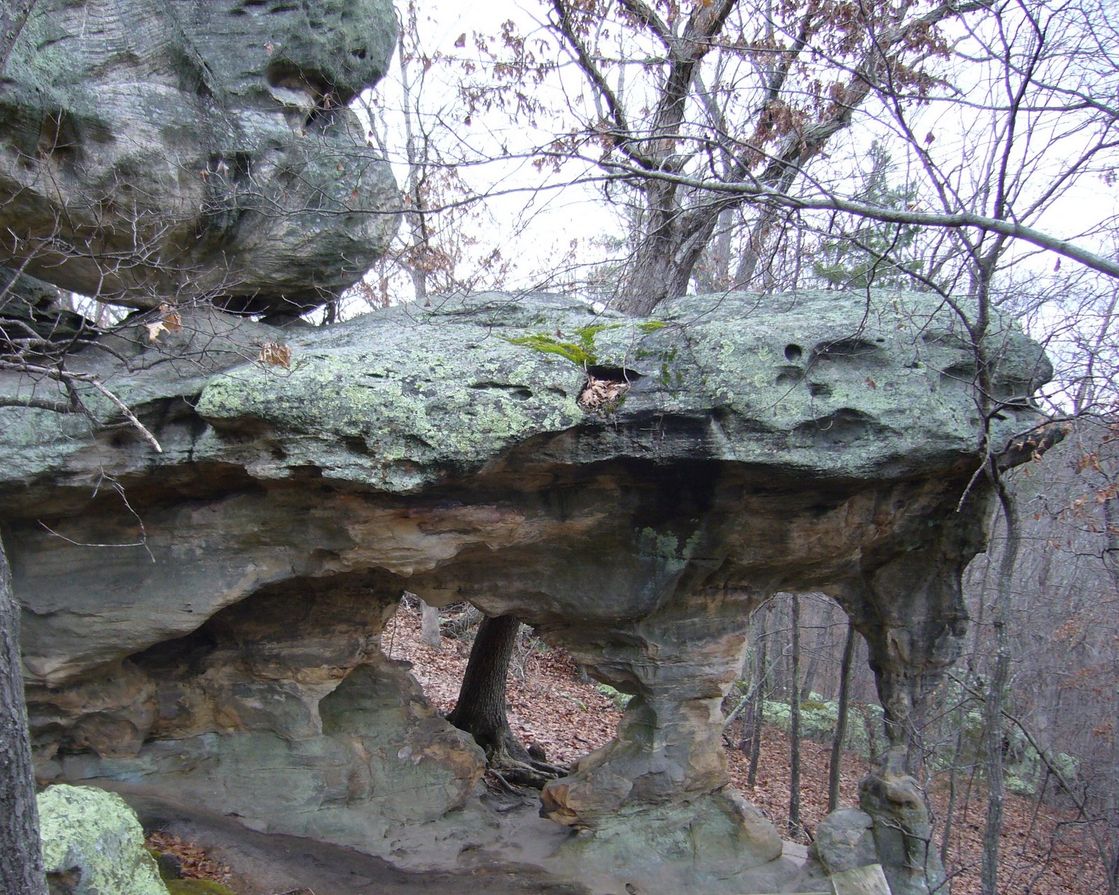
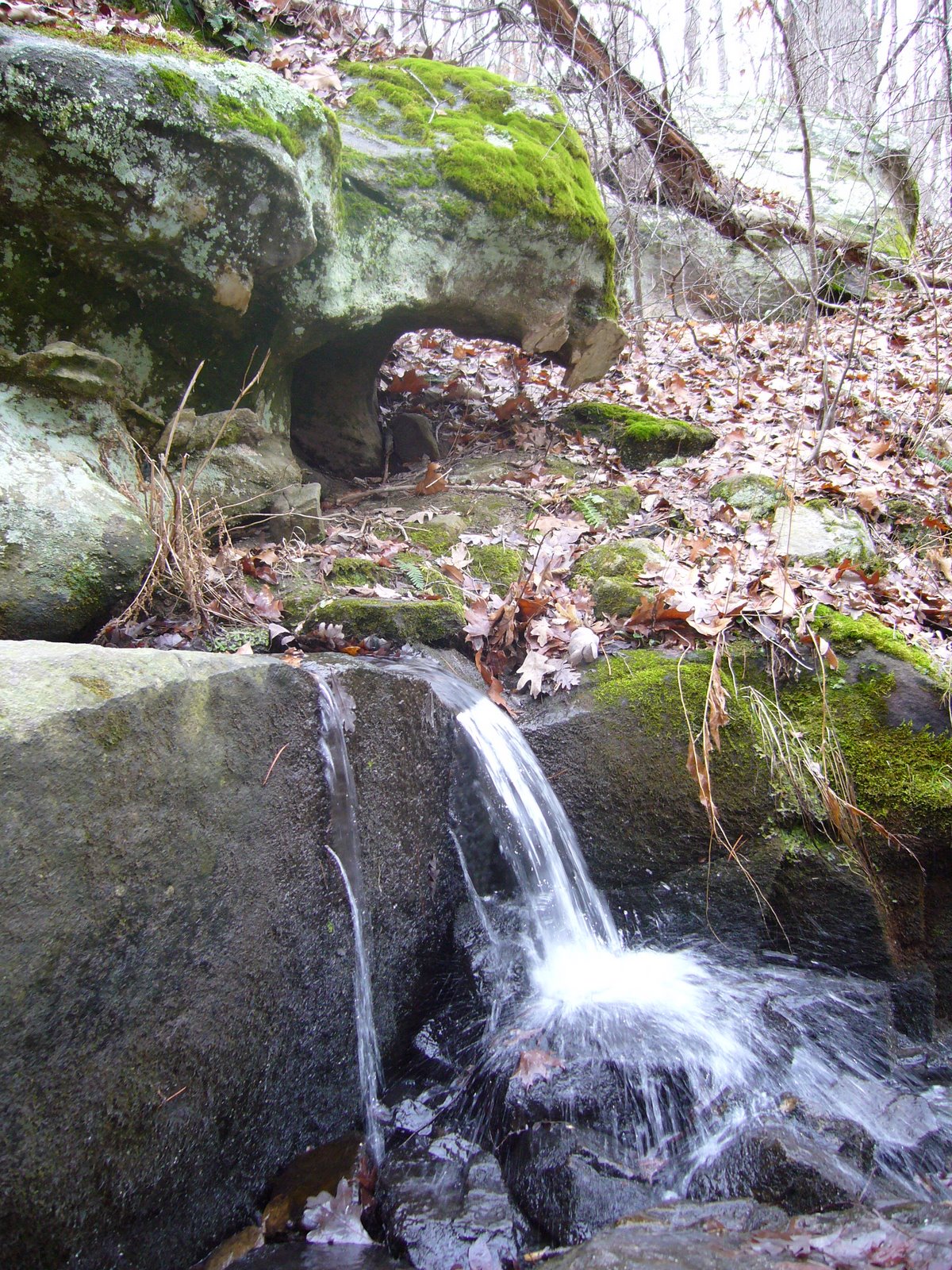
The charm of Hawn results from a unique combination of geological features. The Lamotte sandstone outcrops that dominate Hawn’s landscape are the oldest sedimentary rocks in the state, formed from coarse sand deposits that were laid down over the Precambrian rhyolites and granites that form the core of the St. Francois Mountains. These sand deposits were themselves buried under limestone and dolomite layers formed at the bottom of vast seas that later covered much of the interior of the continent. Subsequent periods of uplift and erosion once again exposed these sandstones, whose unique ability to hold groundwater has resulted in the formation of spring-fed streams that have cut deep into their soft layers to create canyon-rimmed valleys with tall vertical cliffs. rhyolite shut-ins 
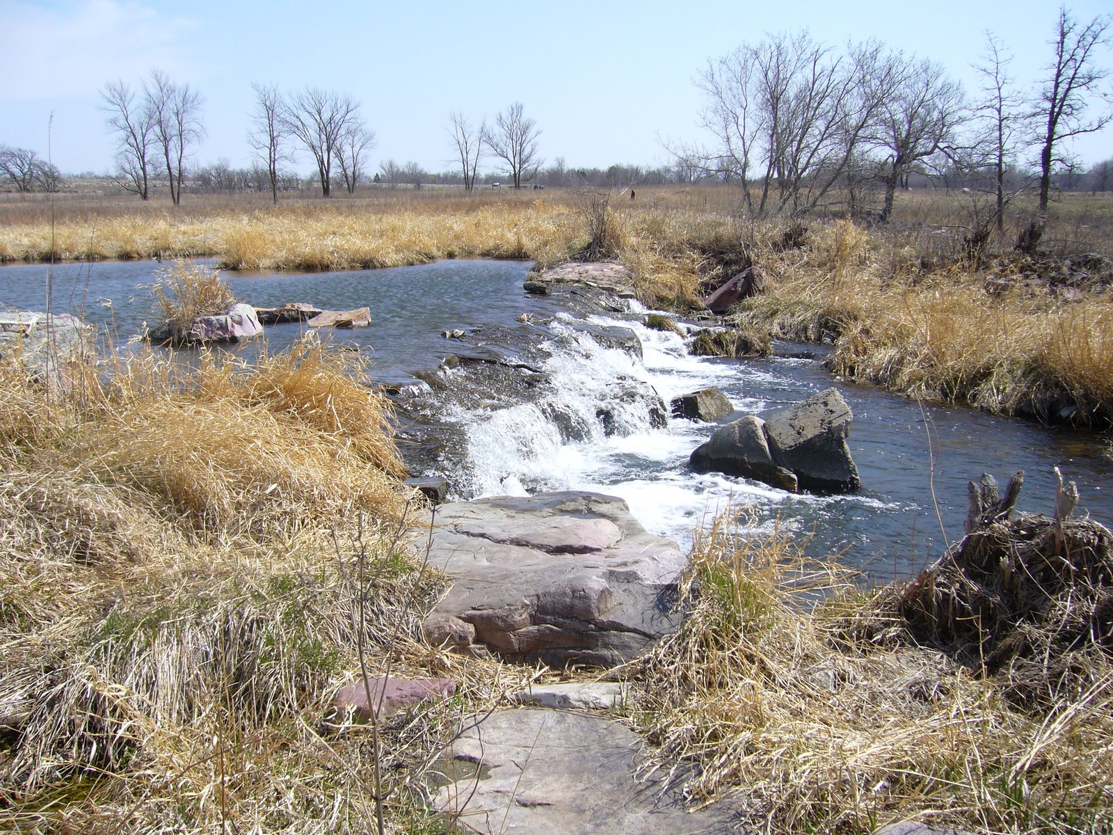
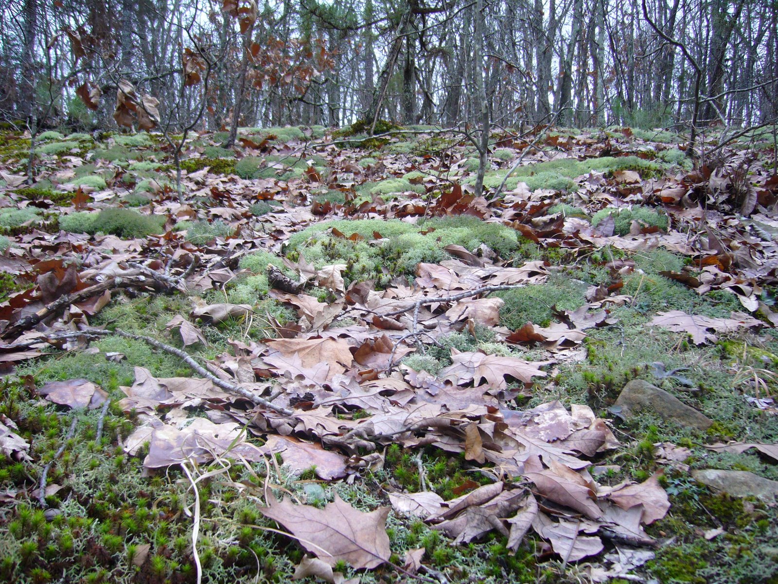
One of these streams is Pickle Creek, which is fed throughout the year by Pickle Spring and has in some places cut all the way down to the underlying igneous rock to form “shut-ins.” In contrast to the slow, sandy bottomed stretches where Pickle Creek is still cutting through sandstones, the water in these igneous shut-ins rushes through narrow openings in the highly resistant rock. The igneous and sandstone exposures found in Hawn are spectacularly beautiful and support a unique flora due to the acid soils they produce. One group of plants that have taken sanctuary in these moist, acid soils is the Betulaceae, or birch family. Missouri is home to five native species of Betulaceae¹, and while none of them are extraordinarily uncommon they are limited in their occurrence to natural communities with sufficient moisture and exhibit a clear preference for acidic soils. This confluence of conditions occurs perfectly along Pickle Creek, allowing all five native species to grow here side-by-side – a betulaceous “hot spot” that represents not only the full diversity of the family in Missouri, but also the total generic diversity of the family in North America. In fact, only one other genus (Ostryopsis, shrubs related to Corylus and restricted to China) is assigned to the family on a global basis (Furlow 2004).

¹ Dr. George Yatskievych, in his recently published Steyermark’s Flora of Missouri (2006), regarded the presence of Corylus cornuta in Missouri as unlikely despite earlier reports of such. Dr. Yatskievych also recorded a single escape of the European species Alnus glutinosa from Springfield, Missouri.

The Betulaceae are deciduous trees and shrubs that occur primarily in the boreal and cool temperate zones of the Northern Hemisphere, although outposts are also known from high elevations in the Neotropics and, as mentioned above, China. Fossils of this ancient lineage of flowering plants are traceable to the late Mesozoic (upper Cretaceous), and the family appears to form a clade with hamamelidaceous plants. As would be expected from a group with boreal affinities, most species exhibit adaptations for survival in cold climates, such as small stature, shrubby growth habits, and small leaves. Several of Missouri’s species have performed well and gained acceptance as ornamental trees and shrubs, while others are important as sources of hazelnuts (genus Corylus) or ecologically for their ability to fix nitrogen (genus Alnus). My interest in these plants has nothing to do with their economic importance, but rather in their role as host plants for several rarely encountered species of woodboring beetles. Often, insects in this group may be collected on foliage of their hosts during the summer, making host identification fairly easy due to the presence of leaves. This is not always possible, however, due to limited periods of adult activity or low population densities. Rearing these insects from their hosts provides additional opportunity to document their occurrence, and winter is often the best time to collect the dead branches in which they breed, since by that time they have nearly completed their development and will be ready to emerge as soon as temperatures rise during spring. Identifying woody plants without foliage can be a challenge, but the ability to distinguish host plants by non-foliage characters such as bark, growth habit, bud shape, etc. greatly facilitates studies of wood boring beetles through rearing. In the past I have relied heavily on Cliburn and Klomps’ (1980), A Key to Missouri Trees in Winter, which utilizes mostly details of the twigs and buds to discriminate among Missouri’s 160+ species of trees. However, after a certain level of familiarity is gained, one eventually learns to recognize winter trees and even downed logs or fallen branches simply by their “look”.

Betula nigra - habit

Betula nigra - habit

Betula nigra - old bark

Betula nigra - old bark

Betula nigra - sapling

Betula nigra - sapling

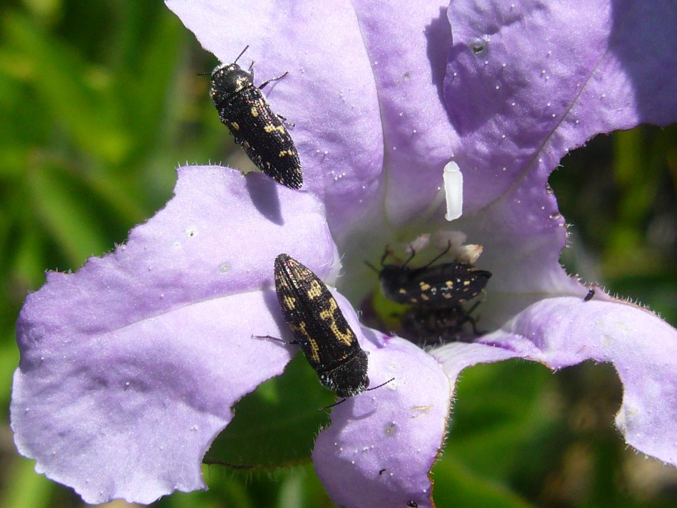
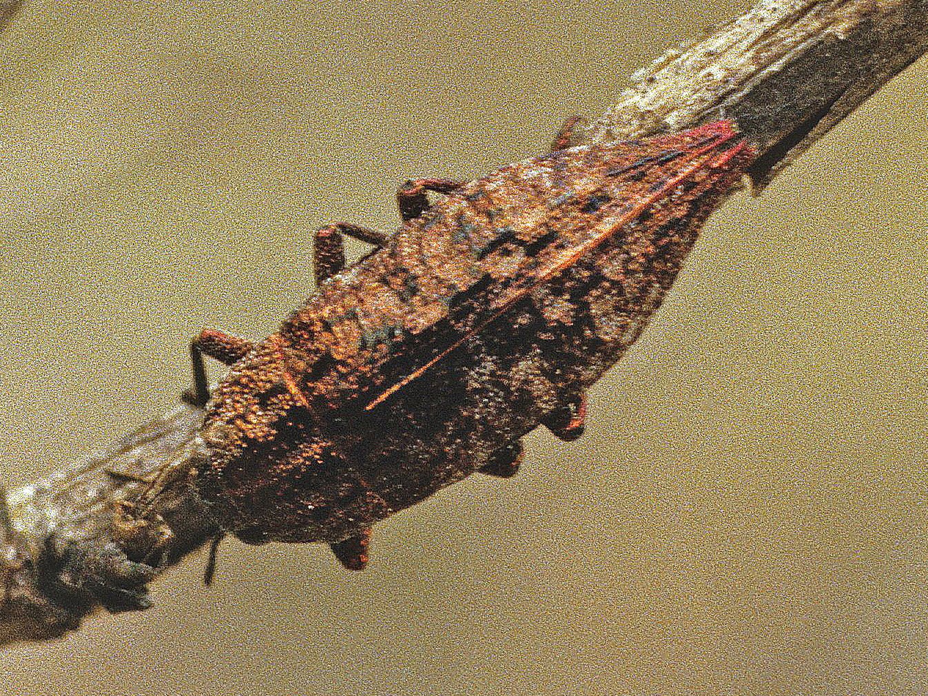
Betula nigra (river birch) is the only member of this largely boreal genus found in the middle and southern latitudes of the U.S. and, thus, cannot be confused with any of Missouri’s other betulaceous species². It is the largest of the five and, along with the following species, is the most demanding in terms of keeping its “feet” wet. Trees are usually encountered right at the water’s edge, with tall, slender, often twisted or leaning trunks. Young trees and large branches on older trees exhibit gorgeous reddish brown bark peeling in thin, papery sheets, becoming thick and scaly on the main trunks of older trees. Small branches are dark, purplish brown in color with smooth bark and distinctly horizontal lenticels.  I have reared a small jewel beetle from fallen, dead branches of this tree collected at several locations in Missouri – this beetle turned out to be new to science, which I described and named Agrilus betulanigrae in reference to its (then) only known host (MacRae 2003).  I have also reared tremendous series of another jewel beetle, Anthaxia cyanella, which at the time was not known to utilize this host and was considered uncommon.  As it turns out, Betula nigra is its preferred host, and the rearing of large series from many locations resulted in improved knowledge about color forms and variability in this species (MacRae & Nelson 2003).

² The widely planted but dreadfully non-adapted Betula pendula (European white birch) and B. papyrifera (paper birch) can be recognized by their distinctly white bark. These species are limited to urban landscapes where they rarely achieve significant stature before declining and eventually succumbing to insect pests such as Agrilus anxius (bronze birch borer). River birch provides an equally attractive and much more durable choice!

Alnus serrulata - habit

Alnus serrulata - habit

Alnus serrulata - sapling

Alnus serrulata - sapling

Alnus serrulata - old cones

Alnus serrulata - old cones

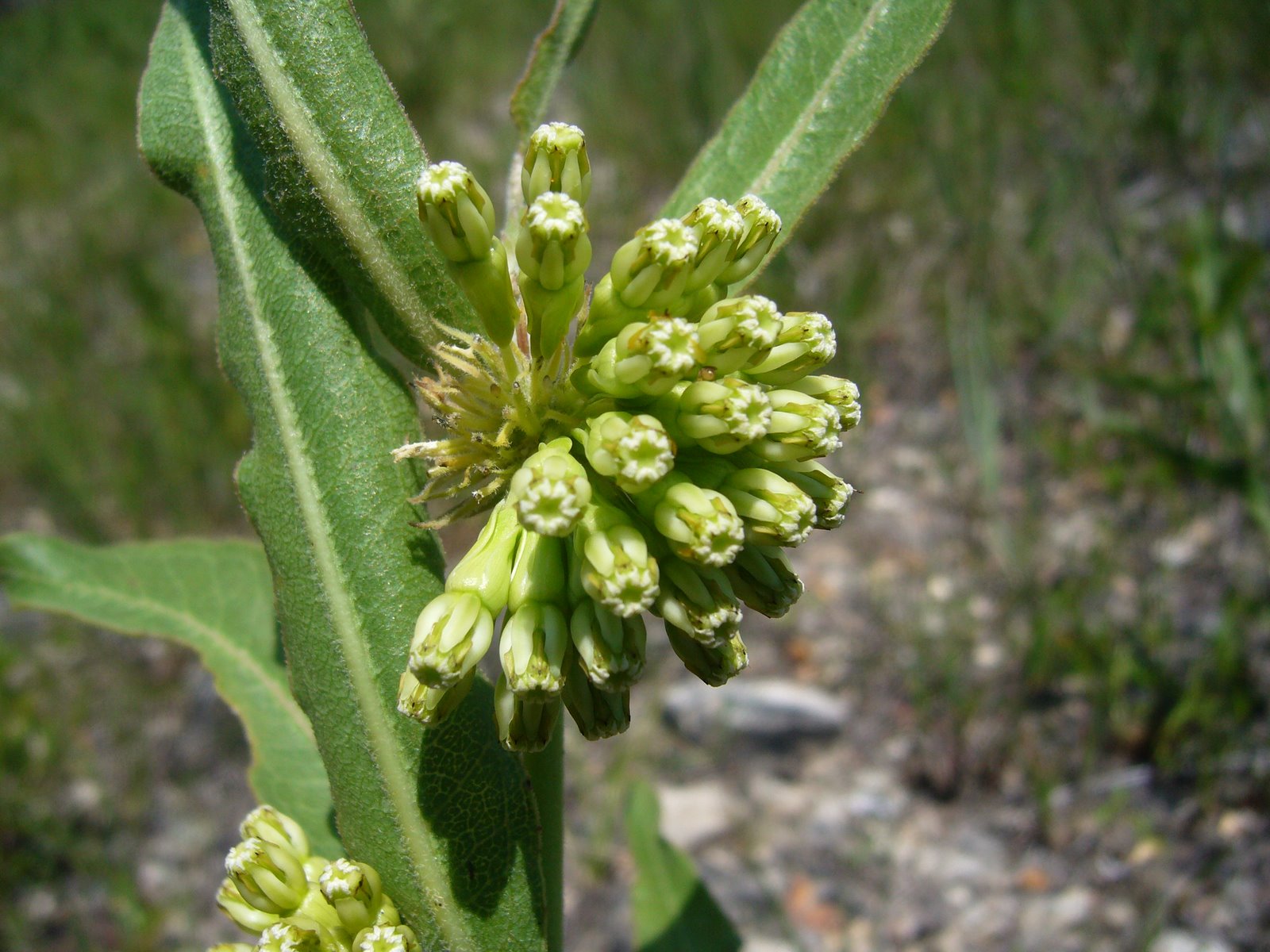
Alnus serrulata (common alder, hazel alder, smooth alder, tag alder…) also demands to be next to (or even in) the water.  Unlike B. nigra, however, this species rarely reaches true tree status, instead usually forming shrubby thickets along the water’s edge.  Saplings can resemble those of B. nigra due to their smooth brownish bark, but the latter is usually more purplish, and the lenticels of A. serrulata are not distinctly horizontal as in B. nigra. The large purple-red buds also differ from the small brown buds of B. nigra, and during winter A. serrulata is adorned with numerous staminate catkins.  The persistent woody cones also cannot be mistaken for those of any other species of Betulaceae in Missouri. Associated with this plant is the longhorned beetle, Saperda obliqua, which reaches its southwesternmost distributional limit in Missouri on the basis of a single specimen collected some 25 years ago right here along Pickle Creek and given to me by lepidopterist George Balogh. Numerous attempts to find this species here since then have not (yet!) been successful.

Carpinus caroliniana - habit

Carpinus caroliniana - habit

Carpinus caroliniana (blue beech, hornbeam, musclewood) is one of my favorite betulaceous species. The beautifully fluted trunks and smooth, light gray bark are remniscent of the limbs of a sinewy, muscular person – every time I see this tree I cannot resist the temptation to grab and stroke the hard limbs (should I be admitting this?). This character begins to show even in very young trees, making its identification during winter quite easy. These trees also like to be near water, but they are not so demanding to be right at the water’s edge as are the previous two species. They usually form small trees, often in clumps with multiple trunks.  There are some notable insect associations that I’ve found with this plant.  One is a small jewel beetle, Agrilus ohioensis, which I reared from dead branches of this plant collected along Pickle Creek (Nelson & MacRae 1990), and which after more than 20 years still remain the only known Missouri specimens of this species.  Another is the longhorned beetle, Trachysida mutabilis, a single adult of which I reared from a dead (almost rotting) branch of this plant collected not too far from Pickle Creek in Iron Co.  This beetle also is the only representative of its species known from Missouri (MacRae & Rice 2007).

Ostrya virginiana - habit

Ostrya virginiana - habit

Ostrya virginiana - trunk

Ostrya virginiana - trunk

Ostrya virginiana (hop hornbean, American hornbeam) has a form and growth habit very similar to C. caroliniana, but its leaves that persist through the winter make it instantly recognizable from afar.  In Missouri, this habit is most often seen with the oaks (Quercus spp.).  This species can be found even further away from the water than the previous species, and its small stature combines with the orangish, persistent leaves to form a distinctive understory layer during winter.  Also, in contrast to the smooth gray bark of Carpinus, this species exhibits scaly, light reddish brown to brownish gray bark.  I have succeeded in rearing one of the two known Missouri specimens of another jewel beetle, Agrilus champlaini, from O. virginiana collected along Pickle Creek (the other specimen was reared from wood collected at Graham Cave State Park, another site where sandstone bedrocks favor an O. virginiana understory).  Unlike most other jewel beetles, A. champlaini forms galls in small living branches of its host.  I have collected the distinctive swellings during winter on many occasions but managed to rear only these two individuals (plus one ichneumonid parasitoid).  I have also noted similar swellings on Carpinus but have not yet managed to definitely associated them with this beetle.

Corylus americana (hazelnut, American hazelnut) is the smallest of Missouri’s five betulaceous species, always forming shrubs, sometimes in thickets, and never assuming the form of a tree. Its staminate catkins present during winter immediately identify plants of this species as Betulaceae, but the small, globe-shaped buds are unlike the more pointed buds of Ostrya and the elongated, reddish buds of Alnus. This species is the least demanding in terms of being near water and can be found even in upland prairies and glades. I haven’t yet associated any woodboring beetles with this plant in Missouri, but there are several jewel beetles known from the eastern U.S. that utilize Corylus (Agrilus corylicola, A. fulgens, and A. pseudocoryli) and could occur in Missouri.

pine savanna - fire management
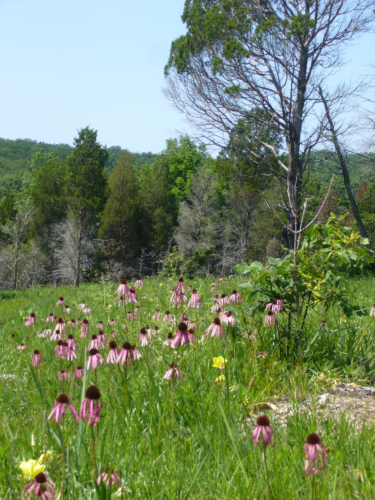
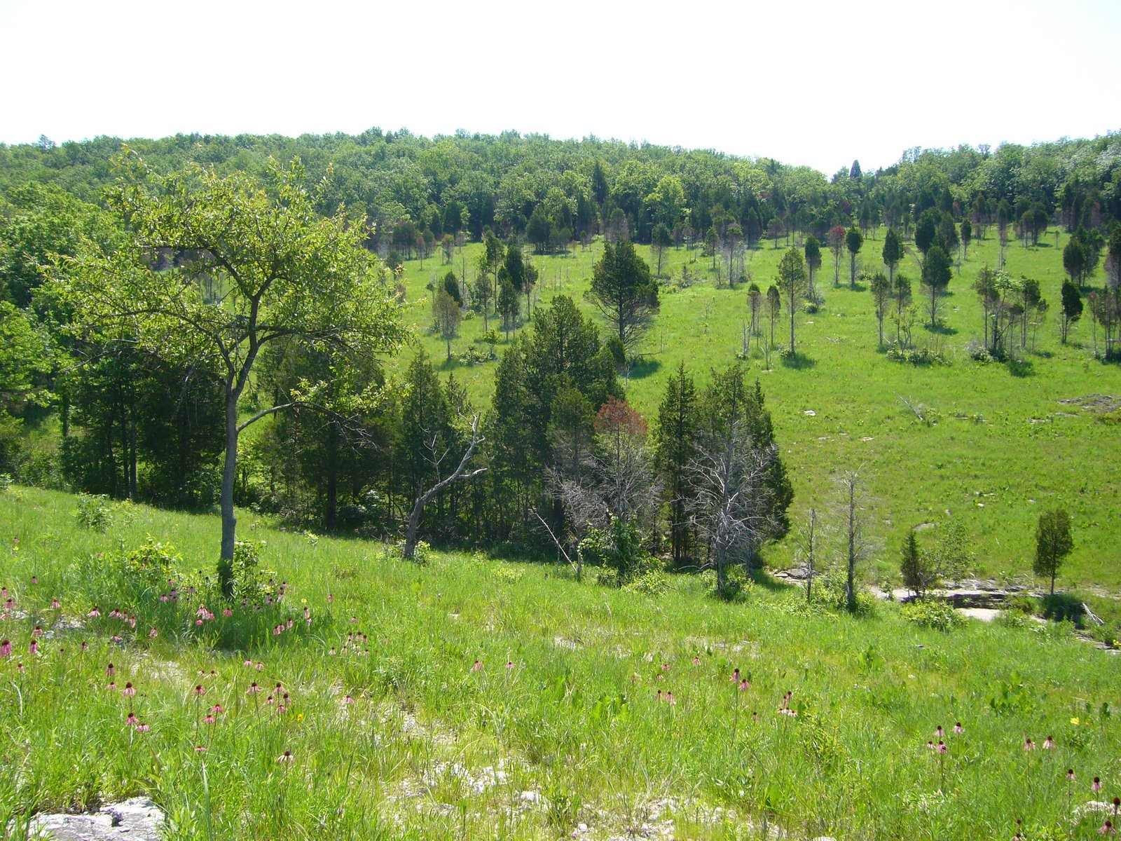
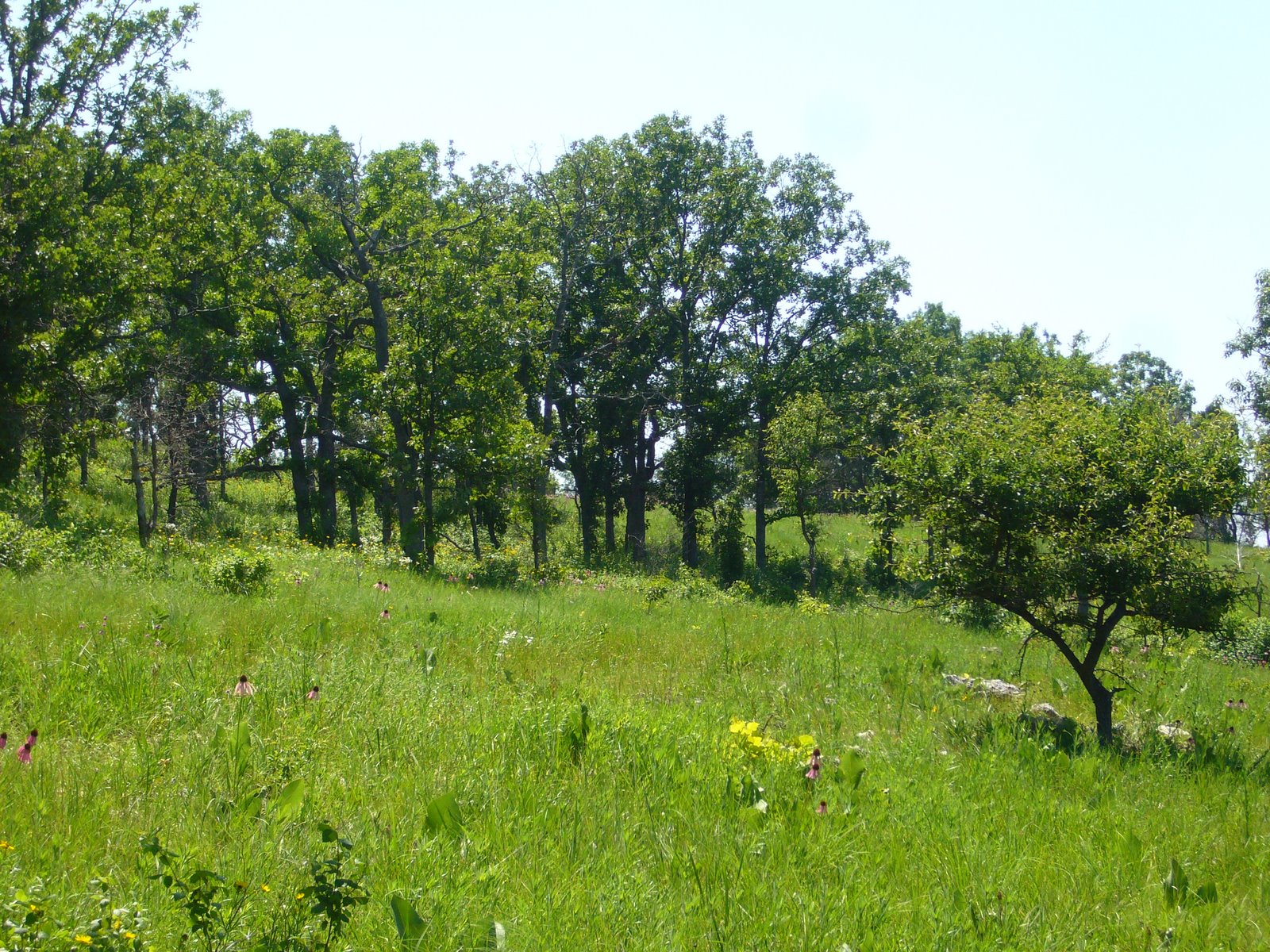
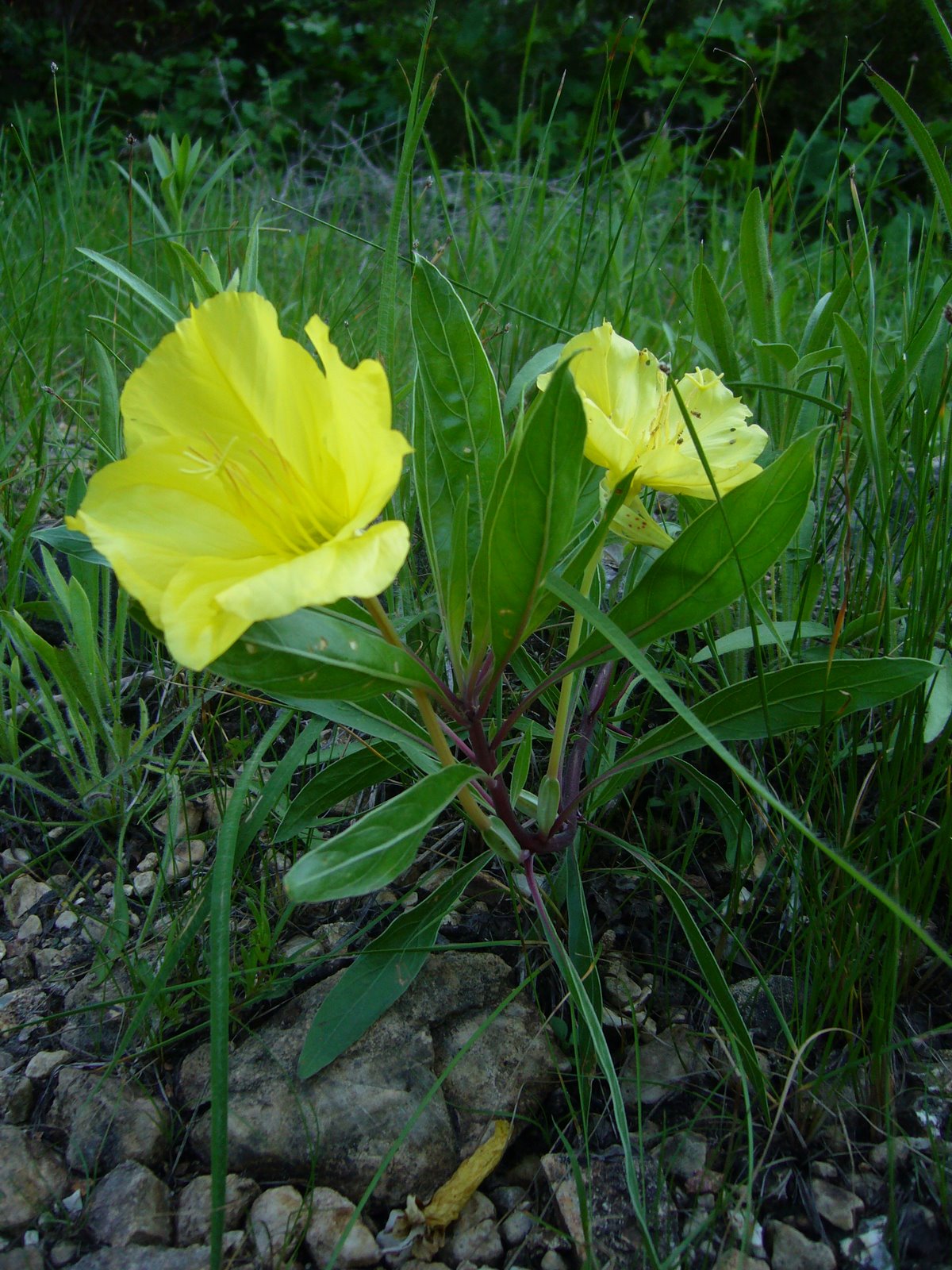
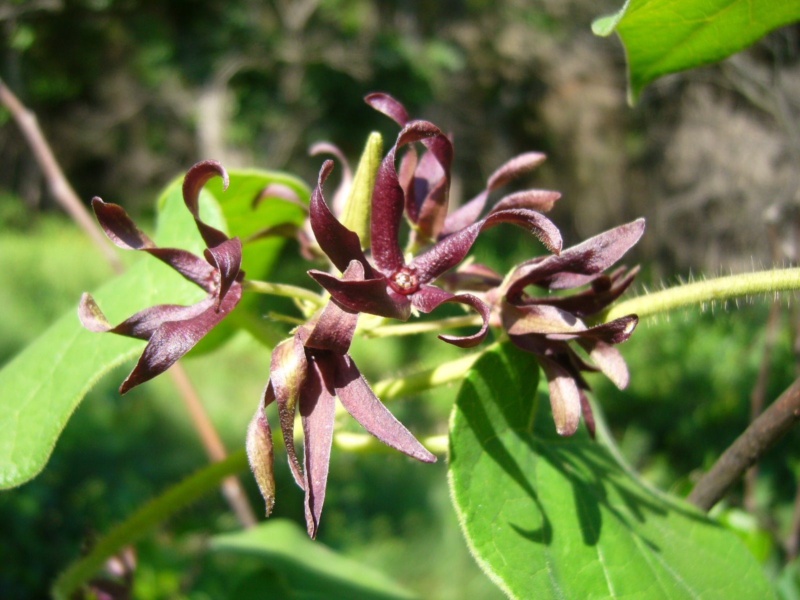
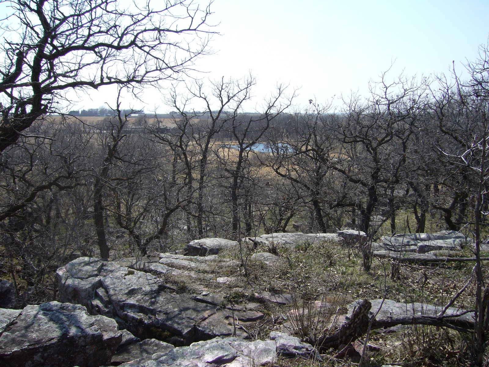
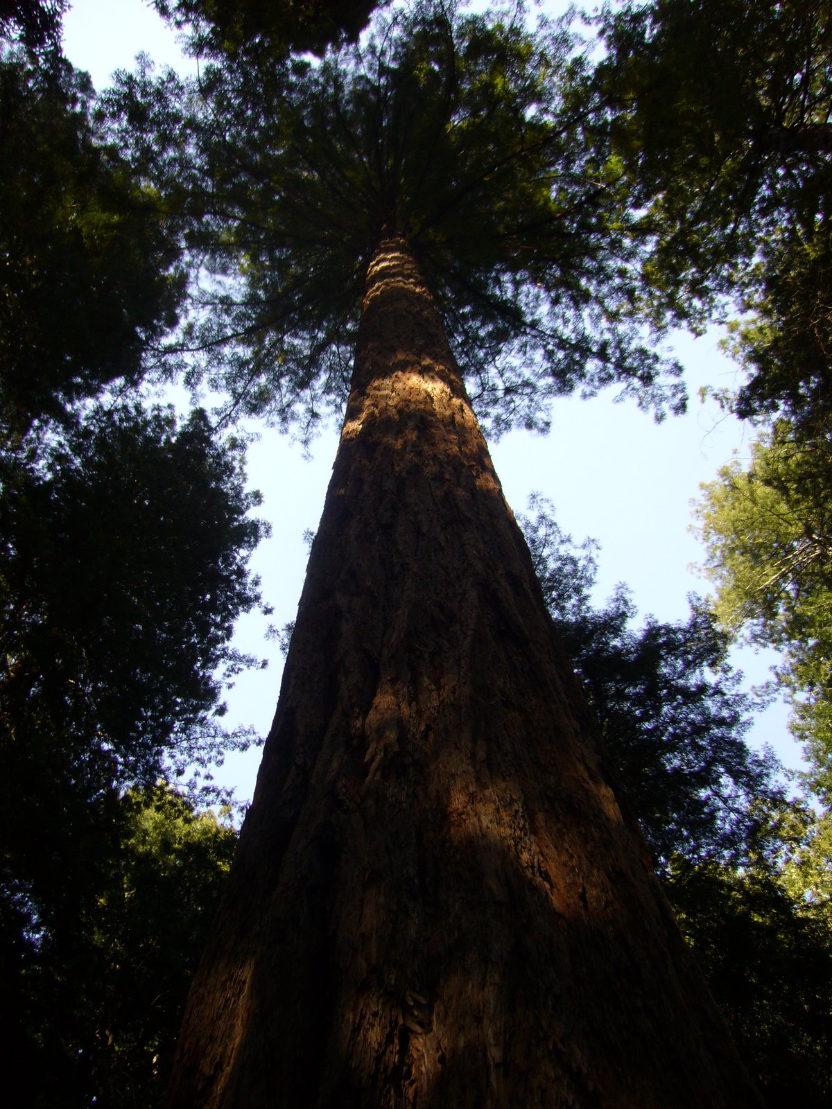
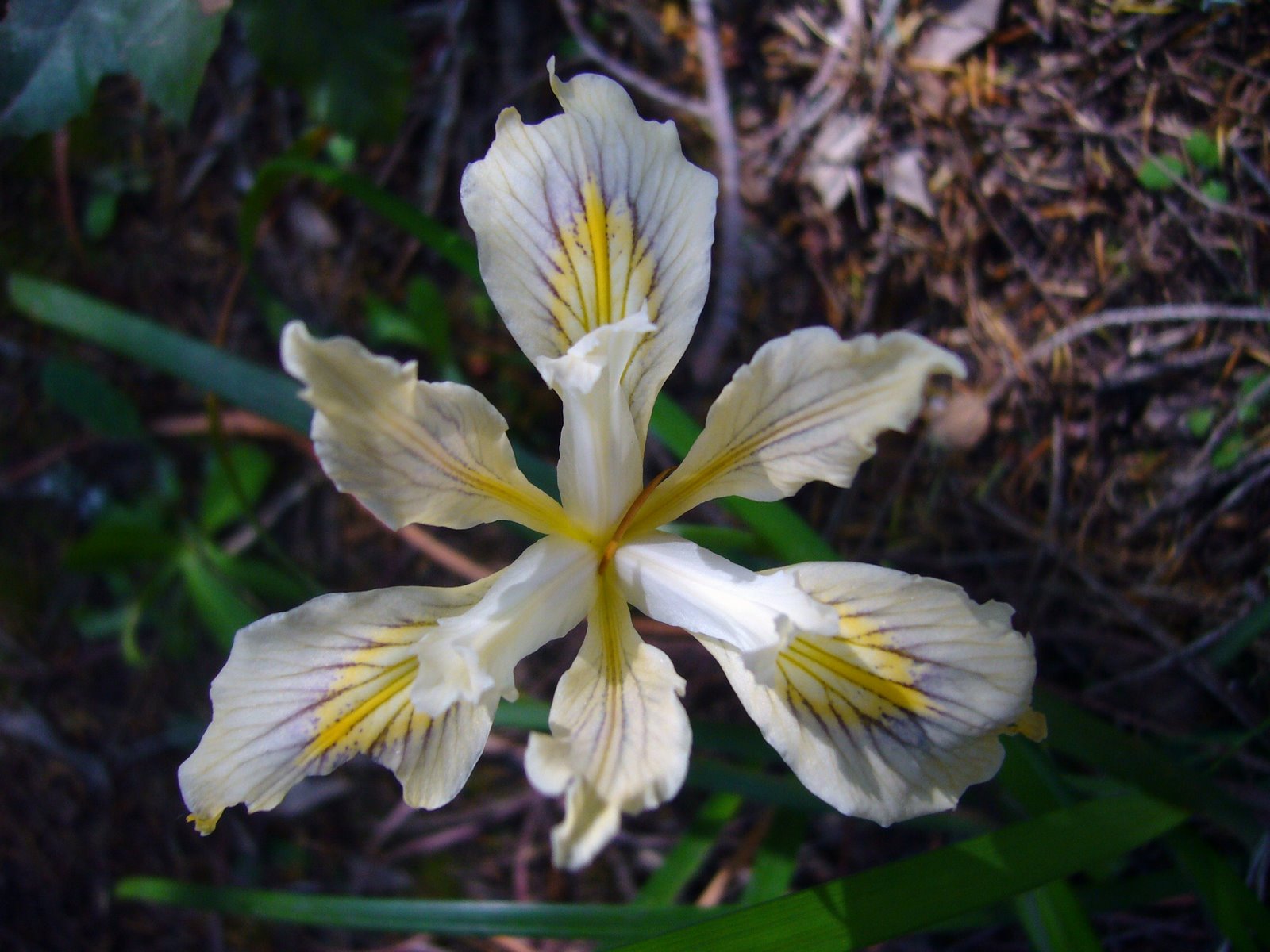
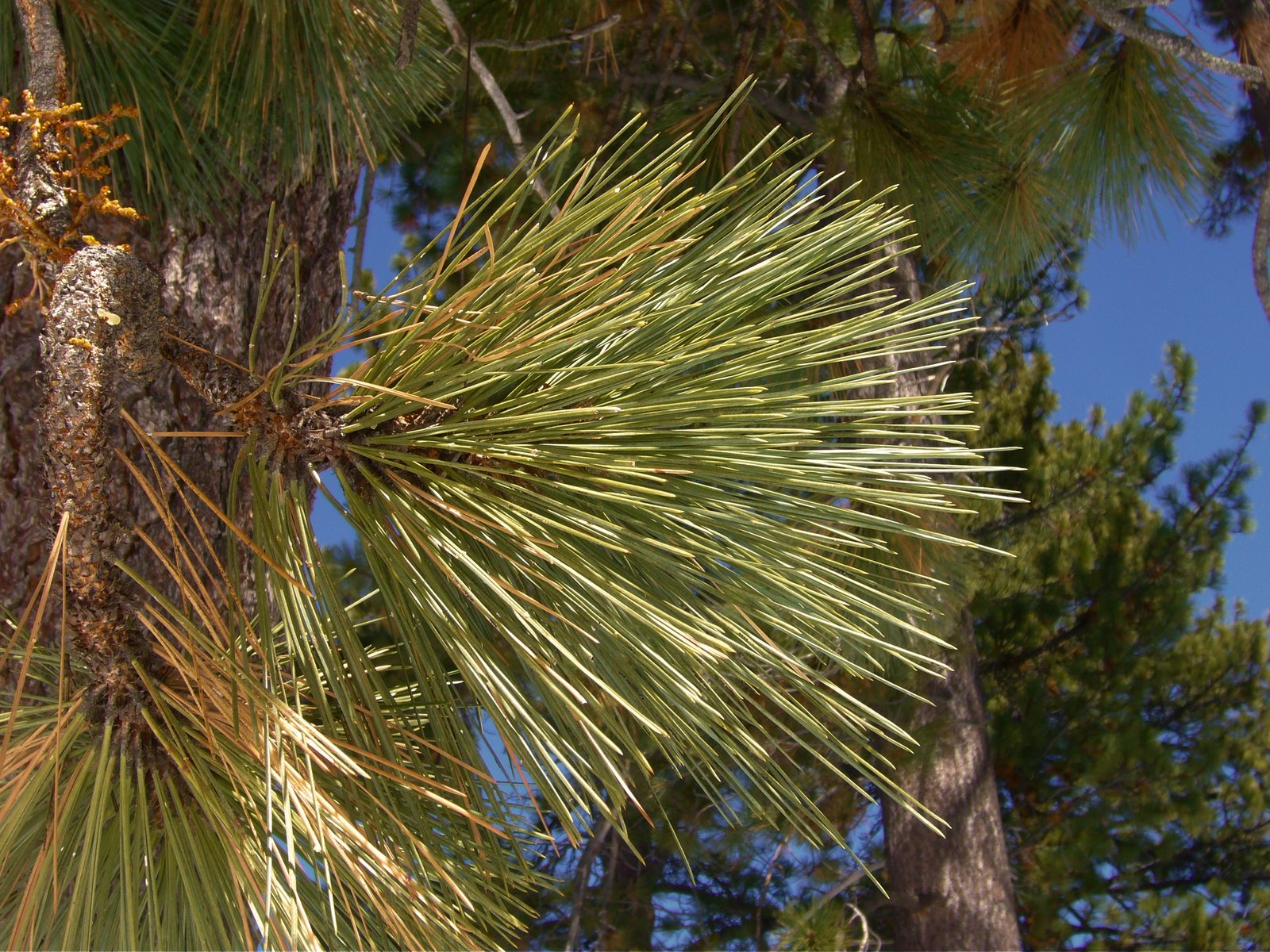
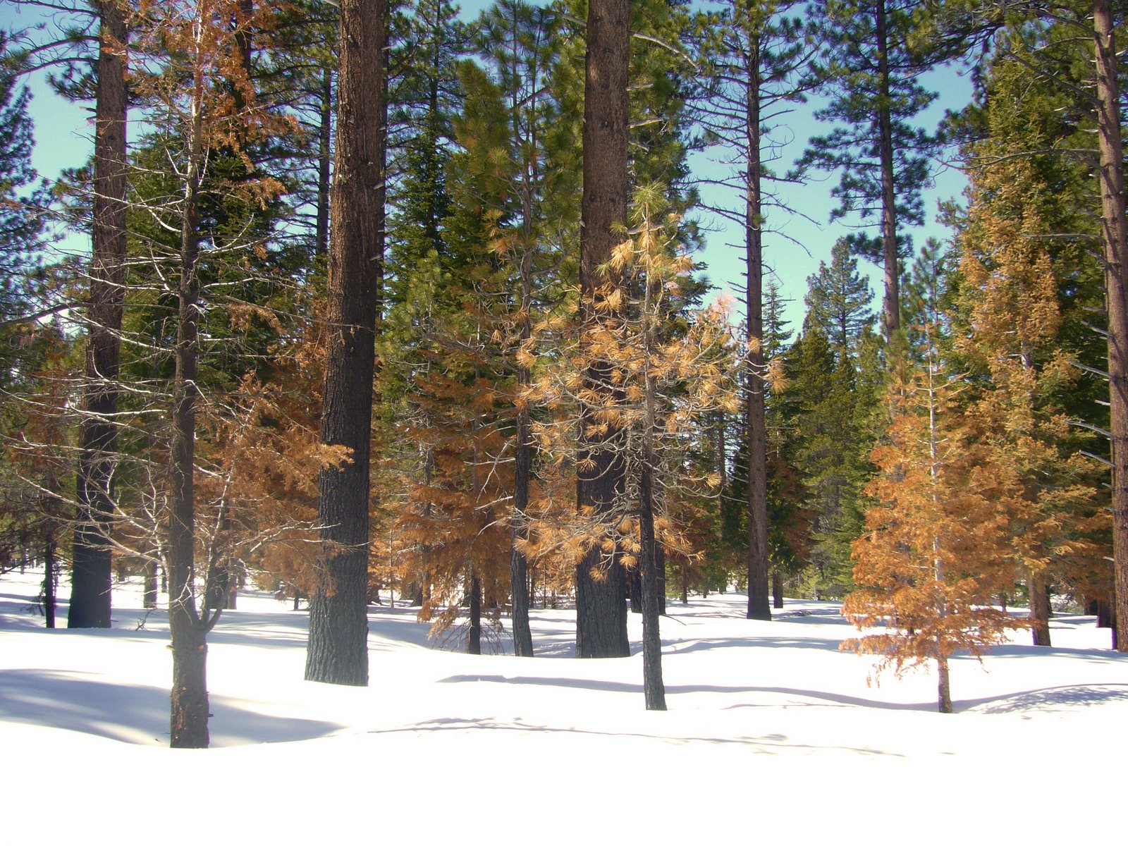
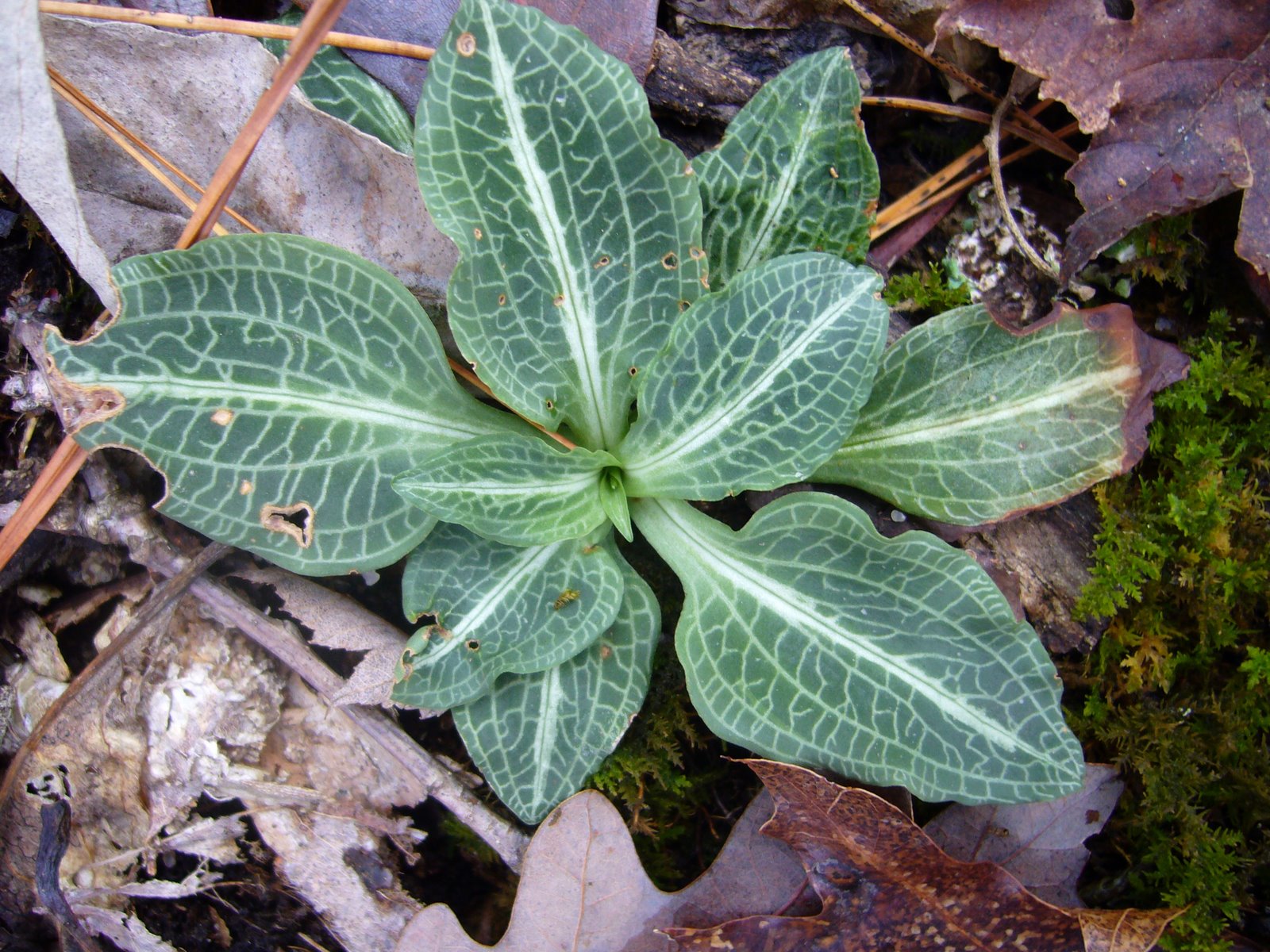
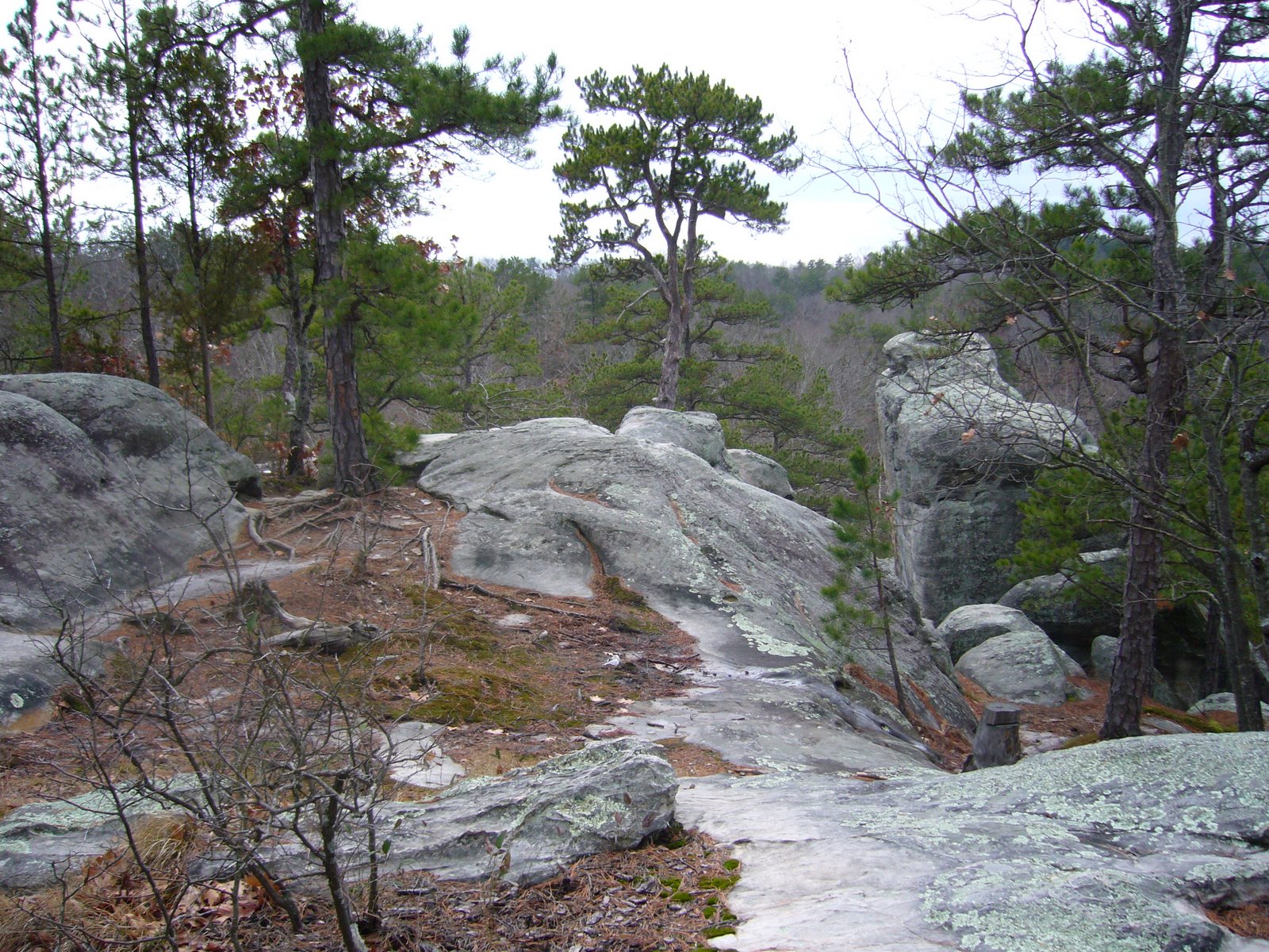
The upland habitats at Hawn are of interest as well. Lamotte sandstones are the dominant bedrock, creating acid soils that support a canopy dominated by Missouri’s only native species of pine, Pinus echinata (shortleaf pine), several species of oak, and a diversity of acid-loving shrubs primarily in the family Ericaceae (including the stunningly beautiful Rhododendron prinophyllum, or wild azalea). Historically, so-called “pine savanna” was prevalent in this area, a natural community in which periodic fires maintained an open structure amongst the fire-adapted pines and allowed a diverse herbaceous layer beneath the open canopy. Much of Hawn has closed up after decades of fire suppression; trail through pine savannahowever, the Department of Natural Resources has implemented a rotational burn management regime to recreate pine savanna habitat within Hawn’s Whispering Pines Wild Area. Evidence of what appeared to be very recent burns could be seen at several places as I hiked along the Whispering Pines Trail, and while many visitors might have been alarmed at the apparent “damage” they were observing, my heart sang with the prospect of seeing mature pine savanna communities taking hold throughout my beloved Hawn. As I stood atop this ridge and looked back down from where I had come, I could almost see Henry Schoolcraft and Levi Pettibone in the distance on horseback, perhaps pausing to gaze at an elk.

REFERENCES:

Cliburn, J. and G. Klomps. 1980. A Key to Missouri Trees in Winter, 2nd edition. Missouri Department of Conservation, Jefferson City, 43 pp. (subsequently revised)

Furlow, J. J.  2004. Betulaceae in Flora of North America @ efloras.org. http://www.efloras.org/florataxon.aspx?flora_id=1&taxon_id=10101.

MacRae, T. C. 2003. Agrilus (s. str.) betulanigrae MacRae (Coleoptera: Buprestidae: Agrilini), a new species from North America, with comments on subgeneric placement and a key to the otiosus species-group in North America. Zootaxa 380:1–9.

MacRae, T. C., and G. H. Nelson. 2003. Distributional and biological notes on Buprestidae (Coleoptera) in North and Central America and the West Indies, with validation of one species. The Coleopterists Bulletin 57(1):57–70.

MacRae, T. C. and M. E. Rice. 2007. Distributional and biological observations on North American Cerambycidae (Coleoptera). The Coleopterists Bulletin 61(2):227–263.

Nelson, G. H. and T. C. MacRae. 1990. Additional notes on the biology and distribution of Buprestidae (Coleoptera) in North America, III. The Coleopterists Bulletin 44(3):349–354.

Yatskievych, G. 2006. Steyermark’s Flora of Missouri, Volume 2. The Missouri Botanical Garden Press, St. Louis, 1181 pp.

Copyright © Ted C. MacRae 2009

Add to FacebookAdd to NewsvineAdd to DiggAdd to Del.icio.usAdd to StumbleuponAdd to RedditAdd to BlinklistAdd to Ma.gnoliaAdd to TechnoratiAdd to Furl

Top Ten of 2008

For the first post of 2009, I begin with a look back at some of my favorite photos from 2008 (idea stolen from Alex Wild and others).  I initially hesitated to do a “best photos” post since I’m not really a photographer – just an entomologist with a camera.  Nevertheless, and with that caveat in mind, I offer ten photos that represent some of my favorites from this past year. To force some diversity in my picks, I’ve created “winning” categories (otherwise you might just see ten tiger beetles!). Click on the photos to see larger versions, and feel free to vote for your favorite. If so, what did you like about it? Was there a photo I didn’t pick that you liked better?  Enjoy!

Best tiger beetle

Cicindela formosa generosa

From “All the better to see you with, my dear!” (September 2008).  Picking a top tiger beetle photo was tough with so many to choose from.  Ultimately, I decided I really like these face-on shots, and of the several I’ve posted this one of Cicindela formosa generosa has the overall best composition, balance and symmetry.  I considered this one of Cicindela formosa formosa – with its half-cocked jaws, it probably has better personality.  However, the one above got the final nod because it is a true field shot of an unconfined, unmanipulated individual.

Best jewel beetle

Aegelia petelii

From Buppies in the bush(veld) (December 2008).  Although taken back in 1999, I just recently scanned and posted this photo of Agelia petelii from South Africa.  I like the bold, contrasting colors of the beetle combined with the soft colors of the host foliage.  Runners up included these photos of Evides pubiventris with its sumptuous iridescent green blending beautifully with the green background (but suffering slightly from shallow depth of field) and Chrysobothris femorata with its intricate surface sculpturing.

Best longhorned beetle

Tetraopes femoratus

From Rattled in the Black Hills (September 2008).  This was an easy choice – none of the other longhorned beetle photos that I posted during 2008 matched this photo of Tetraopes femoratus for clarity, composition, and the striking contrast between the red color of the beetle and the green color of the host plant.  I especially like the detailing of the body pubescence.

Best non-beetle insect

Proctacanthus milbertii

From Magnificently Monstrous Muscomorphs (November 2008).  I do like other insect besides beetles, and robber flies are hard to beat for their charisma.  This photo of Proctacanthus milbertii (which, as Chris Taylor pointed out, literally translates to “Milbert’s spiny butt”), has great composition and nice, complimentary colors.  I like contrast between the fine detail of the fly and the soft background.

Best non-insect arthropod

Argiope aurantia

From Happy Halloween! (October 2008). I didn’t have many non-insect arthropod photos to choose from, but this photo of a female Argiope aurantia (yellow garden spider) would be deserving of recognition no matter how many I had to choose from. I like the bold, contrasting colors and symmetry of the spider in front of the dappled background of this photo.

Best non-arthropod animal

Prairie rattlesnake (Crotolus viridis)

Another one from Rattled in the Black Hills (September 2008).  This is admittedly not the best photo from a purely technical perspective – it’s a little out of focus, and the color is a bit off.  However, no photo could better convey the moment – confronted with a live, angry prairie rattlesnake (Crotalus viridis) (among the more aggressive species in the genus).  The forked tongue and rattle – blurred in motion – were icing on the cake.

Best wildflower

Victoria Glades

From Glades of Jefferson County (July 2008).  I had several wildflower closeups to choose from, but I kept coming back to this field shot of pale purple coneflower (Echincea simulata) and Missouri evening primrose (Oenethera macrocarpa).  The eastern redcedars (Juniperus virginiana) in the background are at once indicative of their preferred habitat (limestone/dolomite glades) and also testament to their threatening encroachment.

Best tree

Calocedrus decurrens

From the very simply and aptly named Lake Tahoe, California (March 2008).  Incense cedar (Calocedrus decurrens), with its reddish, deeply furrowed bark and great height, is one of the most majestic of western conifers.  I was captivated by this tree – beautiful even in death and contrasting nicely with the surrounding green foliage.

Best rockscape

Pipestone National Monument, Old Stone Face

From Pipestone National Monument (April 2008).  “Old Stone Face” is one of Pipestone’s most recognizable geologic features, and the short angle of the sun on this early spring day provided nice detail to the cracks and fissures of the rock – almost appropriately adding a weathered “age” to this old man.

Best landscape

Emerald Isle, Lake Tahoe

Another one from Lake Tahoe, California (March 2008).  Few places on earth are more photogenic than Lake Tahoe, and this perspective overlooking Emerald Bay is among the finest views I’ve seen.  Brilliant blue skies and majestic snow covered mountains reflected perfectly from the still surface, with Fannette Island providing a perfect focal point for the photo.

Best miscellaneous

Water drops, Ozark Trail, Trace Creek SectionFrom Ozark Trail, lower Trace Creek Section (December 2007).  While technically not a 2008 photo, it’s close enough.  This was one of the first macro photographs I took with my camera, and it remains one of my favorites.  A chance occurence of an unlikely subject, created by cold temperatures and heavy moisture-laden air. I like the contrast between the water drops – sharp, round, and clear – with the vertical shapes of the leaf petioles and background trees.  Viewing the image full-sized reveals the reflection of the photographer in the leftmost water drop.

Subsequent edit: Okay, so after I put this post together, I realized I actually featured eleven photos – too much difficulty choosing, I guess. Let’s call it a baker’s ten.

Glades of Jefferson County

We stood a moment to contemplate the sublime and beautiful scene before us, which was such an assembly of rocks and water—of hill and valley—of verdant woods and naked peaks—of native fertility and barren magnificence… – Henry Rowe Schoolcraft, 1818-1819

In the Ozark Border south of St. Louis, a series of natural openings punctuate the dry, rocky forests of Jefferson County. Commonly called “glades” or “cedar glades,” these islands of prairie in a sea of forest are home to plants and animals more commonly associated with the Great Plains region further to the west. Extending in a narrow arc from central Jefferson County east and south into northern Ste. Genevieve County, these glades occur most commonly on south and southwest-facing slopes below forested ridges and are characterized by thin soils and exposed dolomite bedrock of Ordovician age. Glades are, in fact, a common natural feature throughout much of the Ozark Highlands, an extraordinary plateau where the great eastern deciduous forest begins to yield to the western grasslands. A much more extensive system of dolomite glades occurs in the White River Hills of southwest Missouri, where they often extend up steep slopes and over the tops of knobs to form what Schoolcraft called “naked peaks” and are now called “balds” (and spawning the “Baldknobbers” of Branson fame). Additional glade complexes occur throughout the Ozark Highlands on different rock substrates – igneous glades abound in the St. Francois Mountains, sandstone glades dot the Lamotte landscape in Ste. Genevieve County and the northern and western Ozarks, limestone glades can be found in the northern Ozarks near Danville and Lake of the Ozarks, and chert glades occur in extreme southwest Missouri. These different glade systems share a common feature – shallow soils where tree establishment is limited due to summer moisture stress. They differ vegetationally, however, due to differences in hydrology and soil chemistry as a result of their different substrates. Floristically, dolomite glades exhibit a high degree of diversity relative to other glade types.

The term “glade” is derived from the Old English “glad,” meaning a shining place – perhaps the early settlers found their open landscapes a welcome respite after emerging from the confining vastness of the eastern deciduous forest. Whatever the meaning, the glades of Jefferson County hold a special place in my heart, for I “grew up,” entomologically speaking, in those glades. As a young entomologist, fresh out of school, I spent many a day scrambling through the glades and surrounding woodlands. It was here where my interest in beetles, especially woodboring beetles, was born and later grew into a passion. For eight years I visited these glades often – attracted by the extraordinary diversity of insects living within the glades and congregating around its edges. My earliest buprestid and cerambycid papers contain numerous records from “Victoria Glades” and “Valley View Glades” – the two best-preserved examples of the glades that once occurred extensively throughout the area (more on this later). My visits to these glades ended in 1990 when I moved to California, and although I moved back to the St. Louis area in 1995, the focus of my beetle research has more often taken me to places outside of Missouri. It had, in fact, been some 10 years since my last visit to these glades until last week, when I was able to once again spend some time in them.

Ozark glades differ from the true cedar glades of the southeastern U.S. in that they are not a climax habitat – they depend upon periodic fires to prevent succession to forest. Some recent authors have suggested the term “xeric dolomite/limestone prairie” be used to distinguish the fire-dependent glades of the Ozarks from the edaphic climax cedar glades of the southeast (Baskin & Baskin 2000, Baskin et al. 2007). Fires have been largely suppressed throughout Missouri since European settlement, leading to encroachment upon the glades by eastern red-cedar (Juniperus virginiana). Pure stands of red-cedar have developed on many former glades, crowding out the herbaceous plants that depend upon full sun and leading to soil formation that supports further encroachment by additional woody plant species such as post oak (Quercus stellata), blackjack oak (Q. marilandica), flowering dogwood (Cornus florida), and fragrant sumac (Rhus aromatica) from the surrounding woodlands. Fire has returned to many of the Ozark glades situated on lands owned or managed by state and federal agencies such as the Missouri Department of Conservation, Missouri Department of Natural Resources, and U.S. Forest Service, as well as private conservation-minded organizations such as The Nature Conservancy. These agencies have begun adopting cedar removal and fire management techniques to bring back the pre-settlement look and diversity of the Ozark Glades. This is particularly true at Victoria Glades and Valley View Glades, the two largest and most pristine examples of the Jefferson County dolomite glade complex. Fires have been used to kill small red-cedars in the glades, as well as rejuvenate their herbaceous plant communities. Larger red-cedar trees are not killed outright by fire and must be removed by chainsaws. This above distant view of the TNC parcel at Victoria Glades shows many such burned red-cedars. The glades themselves are not the only habitat to benefit from this aggressive management – when I was doing my fieldwork here in the 1980’s the surrounding woodlands were a closed post oak forest bordered by fragrant sumac and with little or no understory in the interior. The photo at right now shows an open savanna with a rich understory of not only sumac and other shrubs, but also many herbaceous plants as well such as black-eyed susan (Rudbeckia hirta) and American feverfew (Parthenium integrifolium). Such open woodland more closely resembles what Schoolcraft saw across much of the Ozarks during his journey almost two centuries ago.

Victoria and Valley View Glades are dominated by little bluestem (Schizachyrium scoparium), Indian grass (Sorghastrum nutans), big bluestem (Andropogon gerardii) and prairie dropseed (Sporobolus heterolepis). A smaller but highly charismatic non-grass flora is also found on the glades – species such as Missouri evening primrose (Oenethera macrocarpa) (left), pale purple coneflower (Echinacea simulata) (pictured above and below), and prairie dock (Silphium terebinthinaceum) not only add beautiful color but also support both vertebrate and invertebrate wildlife. The Fremont’s leather flower (Clematis fremontii) is a true endemic, occurring only in this part of Missouri and entirely dependent upon these glades for its survival. Less well studied is the vast insect fauna associated with the glades. It is here where I first discovered the occurrence of Acmaeodera neglecta in Missouri. This small jewel beetle is similar to the broadly occurring A. tubulus but at the time was known only from Texas and surrounding states. In collecting what I thought were adults of A. tubulus on various flowers in the glades, I noticed that some of them were less shining, more strongly punctate, and exhibited elytral patterning that was often coalesced into longitudinal “C-shaped” markings rather than the scattered small spots typical of A. tubulus. These proved to be A. neglecta, which I have since found on many glade habitats throughout the Ozark Highlands. Both species can be seen in this photo feeding on a flower of hairy wild petunia (Ruellia humilis) – the lower individual is A. neglecta, while the upper individual and two inside the flower are A. tubulus. Another interesting insect-plant association I discovered at these glades was the strikingly beautiful Dicerca pugionata – another species of jewel beetle – and its host plant ninebark (Physocarpus opulifolius). Only a single Missouri occurrence had been reported for D. pugionata, despite the common occurrence of its host plant along rocky streams and rivers throughout the Ozark Highlands. This plant also grows at Victoria and Valley View Glades along the intermittent streams that drain the glades and in the moist toeslopes along the lower edges of the glades where water that has percolated through the rocks and down the slopes is forced to the surface by an impermeable layer of bedrock. Unlike the tall, robust, lush plants that can be found in more optimal streamside habitats with good moisture availability, the ninebark plants of Victoria and Valley View Glades are small and scraggly, usually with some dieback that results from suboptimal growing conditions. I surmise these plants have reduced capabilities for fending off attacks by insects, including D. pugionata, and as a result a healthy population of the insect thrives at these glades. Some might be inclined to call this beetle a pest, threatening the health of one of the glade’s plants. In reality, the insect finds refuge in these glades – unable to effectively colonize the vast reserves of healthy plants that grow along streams throughout the rest of the Ozarks, it strikes a tenuous balance with plants that are themselves on the edge of survival.

Despite the success in moving Victoria and Valley View Glades closer to their pre-settlement character, the integrity of these areas continues to be challenged. Poachers take anything of real or perceived value, and ATV enthusiasts view the open spaces as nothing more than tarmac. Pale purple coneflower occurs abundantly on these Jefferson County glades (but sparingly in other habitats – primarily rocky roadsides), where they provide a stunning floral display during June and sustain innumerable insect pollinators. Plants in the genus Echinacea also have perceived medicinal value, as herbalists believe their roots contain an effective blood purifier and antibiotic. There are no conclusive human clinical trials to date that fully substantiate this purported immune stimulating effect (McKeown 1999). Nevertheless, demand for herbal use has skyrocketed in recent decades, prompting widespread illegal harvesting of several coneflower species throughout their collective range across the Great Plains and Ozark Highlands. I witnessed massive removals of this plant from both Victoria and Valley View Glades during the 1980’s, but the pictures I took this year suggest that such illegal harvests have been suppressed and that the populations at both sites are recovering nicely.

The same cannot be said for the practice of rock flipping. This was a problem I witnessed back in the 1980’s, and I saw fresh evidence of its continued occurrence at both sites. The thin soils and sloping terrain leave successive layers of dolomite bedrock exposed, the edges of which shatter from repeated freeze-thaw cycles to create rows of loose, flat rocks along the bedrock strata. Lizards, snakes, tarantulas, and scorpions find refuge under these loose rocks, only to be ripped from their homes by flippers and transferred to a dark, cold terrarium to endure a slow, lingering death. As if poaching the glade’s fauna and watching them slowly die isn’t bad enough, the flippers add insult to injury by not even bothering to replace the rock in its original position after stealing its inhabitant, amounting to habitat destruction three times greater than the area of the rock itself. Firstly, the habitat under the rock is destroyed by sudden exposure of the diverse and formerly sheltered microfauna to deadly sunlight. Next, the habitat onto which the rock is flipped is also destroyed, as the plants growing there begin a slow, smothering death. Lastly, the upper surface of the rock, sometimes colonized by mosses and lichens that might have required decades or longer to grow, usually ends up against the ground – its white, sterile underside becoming the new upper surface. Rock flipper scars take years to heal, and nearly all of the flat, loose rocks seen in the more accessible areas of the glades exhibit scars of varying ages next to them. If a scar is fresh (first photo), I generally return to the rock to its original position – the former inhabitants cannot be brought back, but at least the original habitats are saved and can recover quickly. However, if a scar is too old (2nd photo) it is best to leave the rock in its new position – replacing it only prolongs the time required for recovery.

Even more damaging is ATV use. Herbaceous plants and thin soils are no match for the aggressive tread of ATV tires, and it doesn’t take too many passes over an area before the delicate plants are killed and loose soils ripped apart. I witnessed this become a big problem particularly on Victoria Glades during the 1980’s – actually finding myself once in a face-to-face confrontation with an ATV’er. Fortunately, he turned tail and ran, and it appears (for now) that such abuses have stopped, as I saw no evidence of more recent tracks during this visit. But the scars of those tracks laid down more than two decades ago still remain painfully visible. I expect several more decades will pass before they are healed completely.

My return to Victoria and Valley View Glades was a homecoming of sorts, and I was genuinely pleased to see the progress that has been made in managing these areas while revisiting the sites where my love affair with beetles was first kindled. Sadly, however, the larger glade complex of Jefferson County continues to deteriorate. Restoration acreage aside, red-cedar encroachment continues unabated on many of the remaining glade parcels – large and small – that dot the south and southwest facing slopes in this area. It has been conservatively estimated that as much as 70% of the original high quality glades in Missouri are now covered in red-cedar. Many of these are privately held – their owners either do not recognize their ecological significance or are loathe to set fire to them. An example can be seen in the picture here – this small parcel is part of the Victoria Glades complex but lies on private land in red-cedar choked contrast to the Nature Conservancy parcel immediately to the south. Small numbers of herbaceous plants persist here, but without intervention by fire or chainsaw their numbers will continue to dwindle and the glade will die. Aside from the loss of these glades, the continuing reduction of glade habitat complicates management options for preserved glades as well. Many glade associated invertebrates are “fire-sensitive” – i.e., they overwinter in the duff and leaf litter above the soil and are thus vulnerable to spring or fall fires. While these fires are profoundly useful for invigorating the herbaceous flora, they can lead to local extirpation of fire-sensitive invertebrate species within the burn area. Recolonization normally occurs quickly from unburned glades in proximity to the burned areas but can be hampered if source habitat exists as small, highly-fragmented remnants separated by extensive tracts of hostile environment. Grazing also continues to threaten existing remnants in the Jefferson County complex. Grazing rates are higher now than ever before, with greater negative impact due to the use of fencing that prevents grazers from moving to “greener pastures”. Over-grazing eliminates native vegetation through constant depletion of nutrient reserves and disturbance of the delicate soil structure, leading to invasion and establishment of undesirable plant species. Eventually, the glade becomes unproductive for pasture and is abandoned – coupled with fire suppression this leads to rapid woody encroachment. It is truly depressing to drive through Jefferson County and recognize these cedar-choked glades for what they were, able to do nothing but watch in dismay as yet another aspect of Missouri’s natural heritage gradually disappears. The continued loss of these remnant glades makes careful use of fire management on Victoria and Valley View Glades all the more critical – ensuring that a patchwork of unburned, lightly burned, and more heavily burned areas exists at a given time will be critical for preventing invertebrate extirpations within these managed areas.

I close by sharing with you a few more of the many photographs I took during this visit – stiff tickseed (Coreopsis palmata), three-toed box turtle (Terrapene carolina triunguis), climbing milkweed (Matelea decipiens – see the excellent post about this plant on Ozark Highlands of Missouri), downy phlox (Phlox pilosa), green milkweed (Asclepias viridiflora), and a “deerly” departed native browser.

Pipestone National Monument

Grandson, do not expect to accomplish much in this lifetime, for no one shares your vision… – The Oracle


Wednesday was my birthday, and it has been my custom for many years now to take the day off and go hiking/bugging somewhere. Coming as it does in early spring, it is usually the first real bug collecting trip of the year. This year, however, I was roped into a short business trip to visit a USDA lab in Brookings, South Dakota, so tradition would have to take a back seat. My visit at the lab ended early, though, and my flight back home from Sioux Falls didn’t leave until that evening, so I studied the map to look for any possible nearby points of interest in this landscape that has, for the most part, been unforgivingly converted to fields of corn, soybean, and wheat. I quickly noted a place called Pipestone National Monument just over the border into Minnesota. I love stopping at national monuments while traveling – they usually have some significant historical or geological interest, and their typically (though not always) small size means one can fully explore the area in a relatively short time. I did not know or had never heard of this place, but what I found was a charming little jewel tucked within a remnant of tallgrass prairie. At this far northern latitude, spring is still in its earliest of states. Few insects would be seen, but nevertheless I felt thankful for the chance to spend time outdoors and in a place of beauty where I could reflect on the years gone by and those (hopefully) still to come.

The area is named for a thin layer of catlinite – pipestone – exposed in this small area that has been quarried for centuries by Native Americans for carving into pipes (both war and peace). Quarrying within the monument continues to this day, with permission to do so reserved by law only to registered Native Americans. The area is identified as a sacred site associated with Native American spiritual beliefs and is preserved as a significant cultural and ethnographic landscape. Of particular interest to me was the site’s distinct hydrologic/geologic landscape and the native tallgrass prairie associated with it. A short ¾-mile trail loops through the area, providing a diverse glimpse of the area’s unique features. Pipestone may have provided the area’s namesake, but a narrow exposure of Sioux quartzite is the area’s most prominent geologic feature. Sioux quartzite is derived from billion and a half year-old layers of sand/silt sediments deposited thickly on the floors of ancient, Precambrian seas and compressed over the vastness of time into a hard, reddish metamorphic rock. Normally covered in this area by glacial till, the layers at this site are tilted upward 5–10 degrees towards the west and break through the surface to form a jagged, mile-long west-facing escarpment 23-30 feet high. Underneath the quartzite is the pipestone, a thin layer of metamorphosed shale. This fine-grained rock is derived from clay deposits, thus it is much softer and redder than the harder-than-steel quartzite. Pipestone Creek bisects the escarpment, giving rise to the lovely Winnewissa Falls, flowing over the escarpment and running down to a small, natural empoundment (Hiawatha Lake) before continuing its journey back into the glacial till and tallgrass prairie (for anybody surprised that there should be “falls” in this part of the country, it is interesting to note that nearby Sioux Falls is named after a grander example of of such flowing over quartzite exposures in its downtown).

Precious little remains of the expansive tallgrass prairie that once extended from horizon to horizon in this area. A few small parcels managed to escape the plow, but even in those tiny remnants dramatic alterations in plant communities have occurred due to fire suppression and the introduction of more than 70 non-native plant species. Prescribed burning programs are now being used at the Monument to restore the prairie’s native plant composition and appearance. Looking out over the tallgrass prairie remnants above and below the quartzite escarpment, it I was tempted to visualize circles of teepees on the higher ground away from the quarries (all Native American tribes worshipped this site and would never camp directly within it), with herds of American bison dotting the landscape in the distance. Contrasting with the openness of the prairie, the escarpment itself is densely studded with trees – American elm (Ulmus americana) along the top edge, and bur oak (Quercus macrocarpa) in the escarpment itself. Unlike the large, sometimes towering examples of their kind found further to the east, the trees here are dwarfed and spreading, almost gnarled. Below the escarpment, woodland quickly gives way to pure stands of smooth sumac (Rhus glabra) and choke cherry (Prunus sp.), which just as quickly yield to the surrounding sea of prairie. Along Pipestone Creek below the escarpment, lower layers of exposed quartzite provide nooks and crannys where enough moisture collects to support the growth of green ash (Fraxinus pennsylvanica) trees, until glacial till once again covers the quartzite, and riparian woodland yields to grasses and forbes. It’s not hard to imagine why this became a special place to the Native Americans, even before they discovered the pipestone that was to become so important to their culture.

The pipestone quarries are located a short distance to the west of the escarpment – where the hard quartzite layer is thin enough to break through – and, thus, have had little impact on altering the physical appearance of the escarpment itself. Winnewissa Falls (meaning “Jealous Maiden” in the Dakota language), lies at the center of the escarpment, providing a stunning centerpiece. Despite its beauty, it is but a shadow of what it was before early settlers in the area blasted away the top 18 feet of the ledge to create a reservoir for drinking water. A century of weathering and recolonization by lichens and mosses have softened the scars on the rocks, leaving little to indicate that such a dramatic alteration took place. However, standing in front of the falls, finding that “zone” where the temperature suddenly drops and cool wet mist blows on the face, and thinking about the significance of this place to the Native American tribes who held it so sacred, I was left feeling bewildered at how such drastic measures could have been contemplated for so beautiful a place.

In addition to the falls, nature has created some striking sculptures in the rock. “Old Stone Face” can hardly be mistaken for anything else – despite its human likeness, it was created entirely by natural forces. “The Oracle” is another naturally-formed human likeness found (though not as easily as Old Stone Face) in the outlines of the rocks. Tribal Shamans (Medicine Men) believed it served as a guardian of the valley and that voices issued from it’s cold stone lips. I stared for awhile and strained to listen, trying to imagine what words it might have spoken. At first, it seemed as if all was silent. Then I noticed the sound of the wind rolling over the prairie and twirling through the gnarled oaks. I heard the falls in the distance. I heard birds in the midst of frantic early-spring songs. I thought perhaps these might be the voices that guided the Shamans – spoken so loudly, yet so easily unheard.

The first U.S. government expedition to the quarry occurred in 1838 with Joseph Nicollet, a French scientist who was sent to map the upper Mississippi country. He and the members of his expedition carved their names in the rocks atop the escarpment, as did many of the early pioneers that first settled in the area. In studying the surface of these rocks, I couldn’t help but notice the incredible diversity of lichens to be found. Around 75 species are known from the area, and as shown in the photos I share below they come in a fantastic array of forms and colors. Lichens are primary colonizers of rock surfaces, able to do so as a result of their nutritional autonomy. Lichens are merely fungi that have evolved a specialised mode of nutrition: symbiosis with photosynthetic microalgae or cyanobacteria. Often, the algal component is capable of fixing nitrogen from the atmosphere, while the fungal organism attacks the rock with organic acids to release minerals. This is the basis of soil formation. Over time, enough soil accumulates in small depressions to allow mosses to colonize the rock surface. As successive generations of moss grow and die, more and more organic material accumulates on the rock surface, eventually supporting the growth of vascular plants (which extract nitrogen from the soil, rather than from atmospheric sources). These cycles of growth and death act in concert with the forces of erosion to ultimately convert barren rock to tallgrass prairie, hardwood forest, or other climax habitat. Mind you, this is an extraordinarily slow process – it can take a full century for a lichen to grow one inch! As I looked at the abundance and diversity of lichens on the rock surfaces, I tried to visualize the breadth of time encompassed by what was before me and quickly became lost in eternity.

While the trail that loops through the area is less than a mile in length, it took me an hour and a half to complete it. What started out as a few hours to kill ended as a hurried rush through the museum and interpretive center, trying to cram a few last morsels of knowledge into my head in those final moments before I would have to submit to the drive back to Sioux Falls. As I left the area, I noticed these oddly out-of-place boulders known as “The Three Maidens.”
Native Americans believe that these boulders shelter the spirits of maidens who demand offerings before permitting them to quarry the pipestone. Science tells us that the boulders are composed of granite and were likely carried here by glaciers during the past 1 million to 10,000 years ago. Originally a single boulder some 50 feet in diameter, repeated freezing and thawing over the millenia since it was dropped here have split the boulder into the several pieces seen here. Perhaps only The Oracle knows which is true.

For a more detailed, yet highly readable account of the geology of this area, please consult Minnesota Geology, Field Trip, Summer 2000 and Other MN DNR Workshops, by Arlyn DeBruyckere.

Muir Woods National Monument

This is the best tree-lovers monument that could possibly be found in all the forests of the world. – John Muir

Coastal redwood (Sequoia sempervirens) is the tallest type of tree in the world, with maximum recorded heights approaching 380 feet. This majestic conifer grows only along the Pacific Coast in a narrow strip from Monterey to Oregon. Most of the estimated 2 million acres of original redwood forest are now gone — victims of the saw! One of the small groves that managed to escape this fate due to its relative inaccessibility grows along Redwood Creek and adjacent slopes in what is now Muir Woods National Monument. At heights approaching 260 feet, the redwoods growing here are not the tallest to be found; however, their proximity to San Francisco (just 15 miles from the Golden Gate Bridge) makes them the most heavily viewed examples of this ancient tree. Lynne and I visited Muir Woods a few times in the 90’s after moving to Sacramento — today (3/20) was our first visit since then, and the first ever for Mollie and Madison. In addition to getting to see these marvelous trees once again, we were also treated to a spectacular display of spring wildflowers.

We began our hike on the main paved trail. This is where most visitors confine themselves during a visit to this place, so the picture here documents a rare sight — no people! I apologize for its lack of focus, a consequence of the limitations of my little point-and-shoot camera in the limited amount of light that makes it through these towering trees during late afternoon.

Standing beneath one of these trees and looking up is a lesson in insignificance — the feeling one gets looking straight up the trunk of one of these giants cannot be adequately captured on film (er… microchip).

We quickly tired of the crowds and decided to hike up the Ocean View Trail, which climbs quite steeply up the east side of the valley. This marvelous trail was nearly devoid of people, and we found ourselves winding through thick, dark, cool forest with numerous side ravines. The lower elevations of the trail were dominated by redwood trees and a spectacular array of spring wildflowers. Among the most common was California toothwort (Cardamine  californica [=Dentaria californica]), a member of the mustard family (Brassicaceae). I noticed that the leaves at the base of the plant were broad and oval, while those arising from the flower stalk were slender and lanceolate, often divided into 3 leaflets.

Wake robins (genus Trillium), belonging to the lily family (Liliaceae, sometimes separated into the lily-of-the-valley family, Convallariaceae), are among my favorite wildflowers. We soon noticed Western wake robin (Trillium ovatum) growing commonly in shaded areas along the trail. We were also seeing some purple-flowered wake robins — at first I thought they were a different species, but it soon became apparent that these were older Western wake robin flowers, which change color from white to purple as they age.

A little further up the trail we began encountering small patches of Mountain iris (Iris douglasiana, family Iridaceae). Flower color for this native species ranges from cream-white to lavender, but all of the flowers we saw were of the white variety.

We saw this fat Solomon’s seal (Maianthemum racemosum ssp. amplexicaule [=Smilacina racemosa var. amplexicaulis]) growing in one of the cool, moist, side ravines. This is another member of the Liliaceae (sometimes separated into the Convallariaceae). The large, oval leaves clasping around the distinct, unbranched stem were almost as attractive as the flowers, which apparently give rise to bright scarlet berries in the summer.

In the middle elevations the redwood forest transitioned to drier oak woodland containing a mixture of Douglas-fir (Pseudotsuga menziesii), Pacific madrone (Arbutus menziesii), bigleaf maple (Acer macrophyllum), and tan oak (Lithocarpus densiflorus). Some of the Douglas-firs were enormous.


Indian warrior (Pedicularis densiflora) is a member of the figwort family (Scrophulariaceae, sometimes separated into the Orobanchaceae). This plant, with its striking bright red flowers and finely divided, fern-like leaves, is a facultative parasite on the roots of other plants. Apparently, the genus name refers to an old superstition that sheep could become infested with lice if they ate this plant.


The juncture of the Ocean View Trail with the Lost Trail was closed, so we backtracked down the 1+ miles back to the main paved trail. By now it was fairly late in the afternoon, and the crowds had thinned considerably. Having gotten lots of good views of the giant trees, we began turning our attention downwards to the smaller understory flora. Ferns, of course, are a dominant component of this understory, especially along Redwood Creek. This large specimen may represent Western sword fern (Polystichum munitum) (family Dryopteridaceae), which can apparently be distinguished by small hilt-like projections from the base of the pinnae (leaflets), but I couldn’t get close enough to see for sure.


Abundant on the ground in the valley was redwood sorrell (Oxalis oregana), a member of the family Oxalidaceae. In places this plant covered the ground in thick carpets.


Among the more interesting plants we saw in the valley was California fetid adder’s tongue (Scoliopus bigelovii), yet another member of the Liliaceae or Convallariaceae. I wasn’t sure what this plant was at first, despite its highly distinctive, glossy, mottled foliage. We were too late to see the blooms, which apparently have a fetid odor to attract flies for pollination, but did find the maturing pods on their slender, drooping stems.


Close to the creek’s edge we saw this colony of horsetails (Equisetum sp.), primitive plants in the family Equisetaceae. Members of this group belong to one of the most ancient lineages of vascular plants, dating back to the Devonian period (416-359 million years ago). Their Paleozoic ancestors (Calamitaceae and Archaeocalamitaceae) were giants, reaching heights of 50 ft or more, and were major components of the Carboniferous swamplands. Along with lycopod trees (Lepidodendrales), they were important contributors to coal formation and, like the lycopods, became extinct by the mid-Permian (~270 million years ago). The genus Equisetum represents the only surviving descendants of this lineage. Unlike their extinct progenitors, these small, herbaceous plants rarely exceed 4 ft in height; however, they share many of the same characters such as articulate stems with microphylls arranged in whorls. Recent phylogenetic studies, using both molecular and morphological characters, suggest that horsetails, together with ferns, form a clade representing one of the three major lineages of vascular plants (Pryer et al. 2001).


Nearby we saw a patch of Giant wake robin (Trillium chloropetalum) in flower. These were taller than the California wake robins we saw on the slopes of the Ocean View Trail but similarly characterized by a whorl of 3 leaves and flowers composed of 3 erect petals. Mature flowers darken to a deep red purple, so it seems these plants had just begun flowering. Muir Woods appears to be a good place for observing a diversity of Convallariaceae!


Also along Redwood Creek we found this bigleaf maple (Acer macrophyllum) in full bloom. As its specific epithet suggests, this maple has the largest leaves of any member of the genus — in this example the newly-expanded leaves were distinctly purplish. The picture below shows the greenish-yellow flowers (petals inconspicuous) produced on long, pendulous racemes.


Interpretive signs along the paved main trail pointed out a redwood “family group,” formed by sprouts growing from the base of a larger tree. Eventually, the central “mother” tree died and decayed away, leaving a ring of offspring that mature into an enormous, characteristic circle of trees. This apparently also happens with other types of trees, though on a smaller scale, as demonstrated in this picture of an oak (Quercus sp.) family group.


As the day drew to a close we found ourselves back in the parking lot, where this California icon, a clump of Coast live oak (Quercus agrifolia), was spreading its wide, majestic crown from multiple, twisted trunks and gnarled branches.


Much too soon, it was time to leave this beautiful valley, but before heading back to Sacramento we stopped to take one last look down towards the valley and out to the Pacific Ocean from the Panoramic Highway.

Lake Tahoe, California

…at last the Lake burst upon us — a noble sheet of blue water lifted six thousand three hundred feet above the level of the sea, and walled in by a rim of snow-clad mountain peaks that towered aloft full three thousand feet higher still! It was a vast oval, and one would have to use up eighty or a hundred good miles in traveling around it. As it lay there with the shadows of the mountains brilliantly photographed upon its still surface I thought it must surely be the fairest picture the whole earth affords. – Mark Twain, Roughing It (1872)


Mark Twain may not have liked the name “Lake Tahoe” – preferring its then-official, patronimic designation as “Lake Bigler.” However, he was clearly overwhelmed by its beauty, and surely no person who has ever seen this place can find fault with the words he so eloquently penned almost a century and a half ago. The view above of Emerald Bay, on the south side of the lake, may not be where Twain first viewed Lake Tahoe, but for me it is the most iconic place from which to view it. I first fell in love with Lake Tahoe almost 18 years ago, when my then fiancée and I first moved to Sacramento. We married up there, and for the 5 years we lived in California we spent many a weekend enjoying Tahoe’s 4-season charm. It has been 12 years since we moved back to St. Louis, and I hadn’t been back — until this past weekend. The reasons for the delay are many, but returning to this place reminded me why I consider it the most beautiful place in the world. I shall not let so long a time pass before my next visit.

Lake Tahoe is a relatively young lake, forming within the last several million years (in contrast, the block of granite that was to become the Sierra Nevada mountains – and in which Lake Tahoe lies – began forming during the Paleozoic Era and was then exposed by erosion beginning about 130 million years ago). The basin in which the lake lies was formed by fault-induced block slippage between two uplifted blocks, with the lake itself forming after magma upwellings dammed the northern part of the basin. Glacial action in more recent years (2 million to 20,000 years ago) caused additional damming, causing drastic fluctuations in the lake level — maximum levels reached nearly 800 feet higher than present. The most recent glaciations (~10,000 years ago) carved out Donner Lake (just east of Lake Tahoe), Emerald Bay (above), and nearby Fallen Leaf Lake (below — the frozen lake surface can just be seen above the trees in the foreground).


Emerald Bay is actually part of a glacial “staircase” featuring intermittent flat stretches containing lakes and meadows before ultimately ending at Emerald Bay. Eagle Lake lies immediately above Emerald Bay on one of these “steps,” and the 1-mile trail to it is one of the most popular hikes in the area — below is a view towards Eagle Lake from Emerald Bay:


On the day we arrived (Sat 3/15), a late winter storm was dumping new snow on the surrounding mountains, as seen in this view across the south end of the lake towards the city of South Lake Tahoe. Heavenly Ski Resort was shrouded from view on this day, but the fresh powder being dumped there would provide for some delightful spring skiing over the next few days.


In the meantime, there would be plenty of activities to keep ourselves occupied. With the amount of snow on the ground, one might think there would be little opportunity for botanizing. However, I favor the woody flora, and I was excited about the chance to begin reacquainting myself with some of the western conifers for a change. Of these, one of my favorites is incense-cedar (Calocedrus decurrens) — mature trees develop thick, deeply furrowed, brick red bark that stands out in beautiful contrast from the other trees. Even dead trees maintain a rustic and majestic beauty, and this large dead snag is as stately as any I’ve seen:


On Monday we rented snowshoes and hiked the cross-country ski trails at Camp Richardson. None of us had ever snowshoed before, but the girls quickly got the hang of it (note the live incense-cedar in the background):


We encountered a few cross-country skiers during our hike, but for the most part we spent the day in solitude. Shortly after beginning our hike, however, we came upon this impression in the snow. At first we thought someone had attempted to make a “snow angel,” but after studying it more carefully we realized it was made by a cross-country skier who had fallen and then struggled to get back up:


At this altitude, conifers dominate the flora. I was a little rusty on my knowledge of western U.S. plants, but I think I have things figured out (please let me know if you see any needed corrections to my identifications). The aforementioned incense-cedar was a conspicuous component of this lake-level forest, and its foliage – arranged in flattened, elongated, rumpled sprays – makes this tree easily identifiable amongst the other coniferous genera with which it grows:


Huge pine trees also dominanted the forest in this area. At first I thought they were ponderosa pines (Pinus ponderosa) due to their large size, irregular crown, and large plate-like patterns on the trunk caused by deep cross-checked fissuring of the bark. Eventually, however, I decided they must instead be Jeffrey pine (Pinus jeffreyi), a closely related species (that was once considered a variety of ponderosa pine), since the bark was more orange than yellow.


A closeup of the needles, which are in bundles of three and measure around 6-8 inches in length:


Another dominant coniferous component of this forest, also reaching massive size, was white fir (Abies concolor). The first photo below shows a large, mature tree in the distance, while the second shows a closeup of the foliage. At first I thought this might be Douglas-fir (Pseudotsuga menziesii), as the needles appeared to be irregularly 2-ranked; however, I asked Prof. Ronald Lanner to take a look, and he confirmed it is white fir. He said Douglas-fir needles are shorter, thinner, darker green, and have a skinny stalk, while fir needles have a fat round base and are wider and flatter. The latter also have a citrusy smell when crushed, which he describes as one of the best smells in the woods! Too bad I did not try it.


This decaying stump also represents white fir based on the scaly gray bark. I suspect the outer layers of the lower portion of the trunk (core still standing) were ripped off over time by animals looking for grubs and insects as decay progressed, eventually weakening it to the point that the upper portion (laying on the ground) finally broke off and fell:


As we hiked, I realized what an important part fire plays in the ecology of these forests. During the drive up from Sacramento, we passed several areas along Hwy 50 that had suffered severe damage due to the wildfires that swept through Lake Tahoe recently. One such area was even seen in the far eastern slopes of Heavenly Ski Resort itself. The forests around Camp Richardson had largely escaped these fires, and I wondered if fire management had contributed to this. Along the trail, evidence of fire was common on the trunks of trees, but few trees – even small ones – had been killed. I presumed the charring was evidence of fires that had been intentionally set and managed by the Forest Service with the objective of preventing fuel accumulation that could lead to the larger conflagrations that caused so much damage in other parts of the basin. These small incense-cedars trunks show obvious fire charring but otherwise looked healthy:


In a few areas it appears even these “cool” fires burned a little hot, killing some of the smaller trees but still avoiding the “torched-earth” damage seen in areas affected by uncontrolled burns:


I’m not much of a birder, but I do love woodpeckers. I got a glimpse of one during our hike, but I didn’t see it well enough to identify it. We did find this woodpecker hole in the trunk of a large, dead Jeffrey pine — a feather can even be seen clinging to the upper rim of the hole. The Lake Tahoe basin is home to several species of woodpeckers — whether this hole belongs to the black-backed woodpecker (Picoides arcticus), white-headed woodpecker (P. albolarvatus), or (more likely) hairy woodpecker (P. villosus) I can’t say for sure:


At the beginning of our hike, signs warning of bears and pleading not to feed them caught the girls attention. I told them it was winter and that they would be hibernating, but I wondered if at this late stage they might actually be starting to become active. It wasn’t long before we encountered these unmistakably bear tracks, made fresh in the new-fallen snow, and the more we looked the more abundant the tracks were to be found. I secretly (and the girls outwardly!) hoped we would see a live bear, but I don’t think the girls would have handled such an encounter very calmly:


I had intended to photograph some of the conifers seen at higher elevations while skiing at Heavenly Ski Resort, but I decided not to bring my camera. Pity, as I not only saw nearly pure stands of what I presume to be red fir (Abies magnifica), but also beautifully twisted and wind-gnarled pines at the highest elevations (+10,000 ft) that probably represent whitebark pine (Pinus albicaulis), judging by their highly forked trunks and upswept limbs. These magically grotesque trees were made even more beautiful by the previous day’s storms, which had deposited thick cakes of ice on their windward sides.

We coudn’t leave Lake Tahoe without one final visit to Emerald Bay. Below is a close up photograph of Fannette Island, the only island to be found in all of Lake Tahoe, and its famed “Tea House”:


We concluded our visit to Lake Tahoe by driving up Hwy 89 to Tahoe City for dinner at the Bridgetender Cafe before heading back to Sacramento. Next up — Muir Woods!

Pickle Springs Natural Area

Pickle Springs Natural Area lies in Ste. Genevieve County, about an hour south of St. Louis. Like Hawn State Park, the geology of this area and its effect on the flora have resulted in a unique collection of geologic features and plants found in few other places. The Lamotte sandstone outcrops that dot the landscape were formed nearly half a billion years ago when sand deposited in an extensive maze of braided river channels was cemented and buried under younger layers of limestone and dolomite formed from deposits on the floors of ancient seas that covered the interior of the continent. Later, the periods of uplift that created the St. Francois Mountains and resulting erosion of overlying strata once again exposed the sandstones at the surface. Millions of years of water, ice, rain, wind, and plants have further shaped the exposed sandstones, creating fanstastic shapes and formations and cool, deep canyons. The weathered sandstone created acid soils which support many unique plants. During the ice ages, northern plants and animals moved into the area ahead of the advancing glaciers. Mammoths roamed the landscape grazing on the northern vegetation supported by the area’s acid soils. Eventually the ice retreated, and so did the mammoths. But many of the plants remained – able to hang on in the cool, moist canyons long after the mammoths that once roamed these canyons disappeared. Because of this unique concentration of rare plants and geologic features, the area has been designated a Missouri Natural Area and a National Natural Landmark.

Yesterday I hiked the aptly-named ‘Trail Through Time’ with my family. This 2-mile trail is one of the most “feature-packed” trails in the state, with something to look at around almost every bend. Almost immediately the trail leads to the Slot, the result of a vertical fracture in the Lamotte sandstone that was loosened by leaching and then widened by erosion. The unique partridge berry (Mitchella repens) was seen on the moist, vertical walls of the rock, growing among strange holes, pockets, and ridges that formed as a result of the sand grains being variably cemented.


A short distance from The Slot lie Cauliflower Rocks – large moundlike formations (also called hoodoos or rock pillars) formed from jointed or fractured sandstone that undergoes deep solutional weathering followed by erosion and weather-mediated shaping. Hoodoos occur primarily in this type of rock due to its granular, variably cemented and cross-bedded matrix.


On the south side of Cauliflower Rocks lies a special type of buttress arch called Double Arch. It occurs at almost a right angle to the adjacent rock outrcrops, suggesting formation along a set of fractures running perpendicular to the main fracture trend of the area, but the precise details of its formation remain a mystery.


After leaving Cauliflower Rocks the trail descends steeply into a deep valley, at the bottom of which lies Pickle Creek just below its origin in a box canyon south of the Natural Area. Lush vegetation in this cool, moist valley contrasts with the stark rocks seen earlier.


The creek is fed by a series of seeps, allowing the valley to remain moist even during the dry summer months, and along with the acid soils support a unique plant community. Lush colonies of ferns (I believe this is Polypodium virginianum L.) covered the rocks adjacent to the creek…


…while this rattlesnake plantain orchid (Goodyera pubescens) was seen in a colony growing at the base of a black oak tree (Quercus velutina) just above the creek.


Mosses and lichens were also abundant in the valley. This little hair cap moss (Polytrichum sp.) with its distinctive fruiting structures was growing in a colony at the base of another black oak tree. The members of this genus prefer acidic environments.


Further ahead, along Bone Creek, several colonies of wooly aphids (family Aphididae) were seen on the branches of a small hop hornbeam tree (Ostrya virginiana).


The highlight of the hike had to be in Spirit Canyon at Owl’s Den Bluff. The horizontal layers of sandstone, each deposited on the steep downstream slopes of sandbars, are clearly visible in the towering bluff face. At the bottom lie bluff shelters – formed where lower sandstone layers collapse due to weathering or leaching, and where native Americans almost surely camped out. The sun never reaches parts of these shelters, providing ideal conditions for a variety of mosses and liverworts – many of which are known only from this area. Fallen boulders and collapsed portions of the bluff face provided photo opps for the daring…


…and good exploring for the nimble.


By now, the trail has passed the halfway point and is looping back to the west, where it ascends to Dome Rock Overlook. Along the way, a fascinating variety of lichens, including reindeer lichen, covers the forest floor where they are supported by the acid soils.


Dome Rock Overlook is a the largest hoodoo complex in the Natural Area. The thin soils and exposed conditions create a harsh, dry, windswept environment that only the hardiest of plants can withstand. Only a few small blackjack oaks (Quercus marilandica), shortleaf pines (Pinus echinata), and farkleberry (Vaccinium arboreum) survive here. Despite their small size, some of the trees growing here are at least 150 years old.


The trail descends from Dome Rock Overlook and passes underneath, providing spectacular views of the sheer rock face below the overlook. The trail completes its descent back into Pickle Creek Valley, where Pickle Spring can be seen. This small, permanent spring – an unusual feature in sandstone where seeps are more common – was an important source of water for early settlers.


Further along the trail lies one of the areas most unusual features – Rockpile Canyon – formed some 50 years ago (a fraction of a second in geologic time) when part of a sandstone bluff collapsed in a rumble, leaving behind a sheer bluff face and a jumbled pile of large boulders. A short spur in the trail leads to the head of a small box canyon, where some of the 20+ ice age relict plant species can be seen growing in the acid soils and cool, moist canyon walls.

Near the end of the loop lies Piney Glade, an area where the exposed sandstone bedrock once again creates a dry, harsh environment. Poverty grass and little bluestem grow in small, shallow pockets of soil scattered amongst stunted shortleaf pines and blackjack oaks – creating a small prairie surrounded by a sea of forest. All three forms of lichens can be found on the rocks and soils of the glade – the aptly named crustose lichens cling tightly to rock surfaces amongst foliose (leafy) and fruticose (branched) lichens.