Winter botany quiz #3

I won’t be coy about the location of these trees, all of which were photographed within the Lake Tahoe Basin during my recent trip. A further clue: I have already alluded to these species in a previous post. Once again, comment moderation has been turned on to give everyone a fair shot, and I’ll let the quiz go for a couple days or so. I think this quiz will be easier for my North American readers than Winter botany quiz #2, but maybe still harder than Winter botany quiz #1. Anyone who can correctly identify all six species wins my undying admiration 😉

EDIT: Pedant that I am, attention to nomenclature will serve as a tie-breaker if needed.

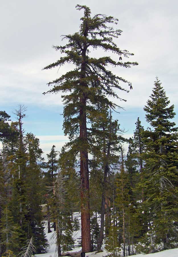
#1.

p1020642_2

HINT: Needles in bundles of 3 and about 10" long.

#2.

p1020583_2

HINT: Needles in bundles of 3 and about 10" long.

MORE HINTS:

p1020662_2

Cones for #1 (left) and #2 (right).

#3.

p1020717_2

HINT: Needles in bundles of 2 and about 2" long.

#4.

p1020718_2

HINT: Needles in bundles of 5 and about 4" long.

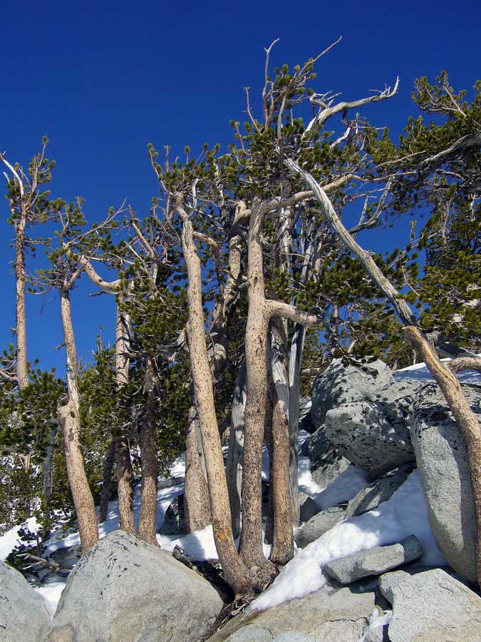
#5.

p1020795_2

HINT: Needles in bundles of 5 and about 4" long.

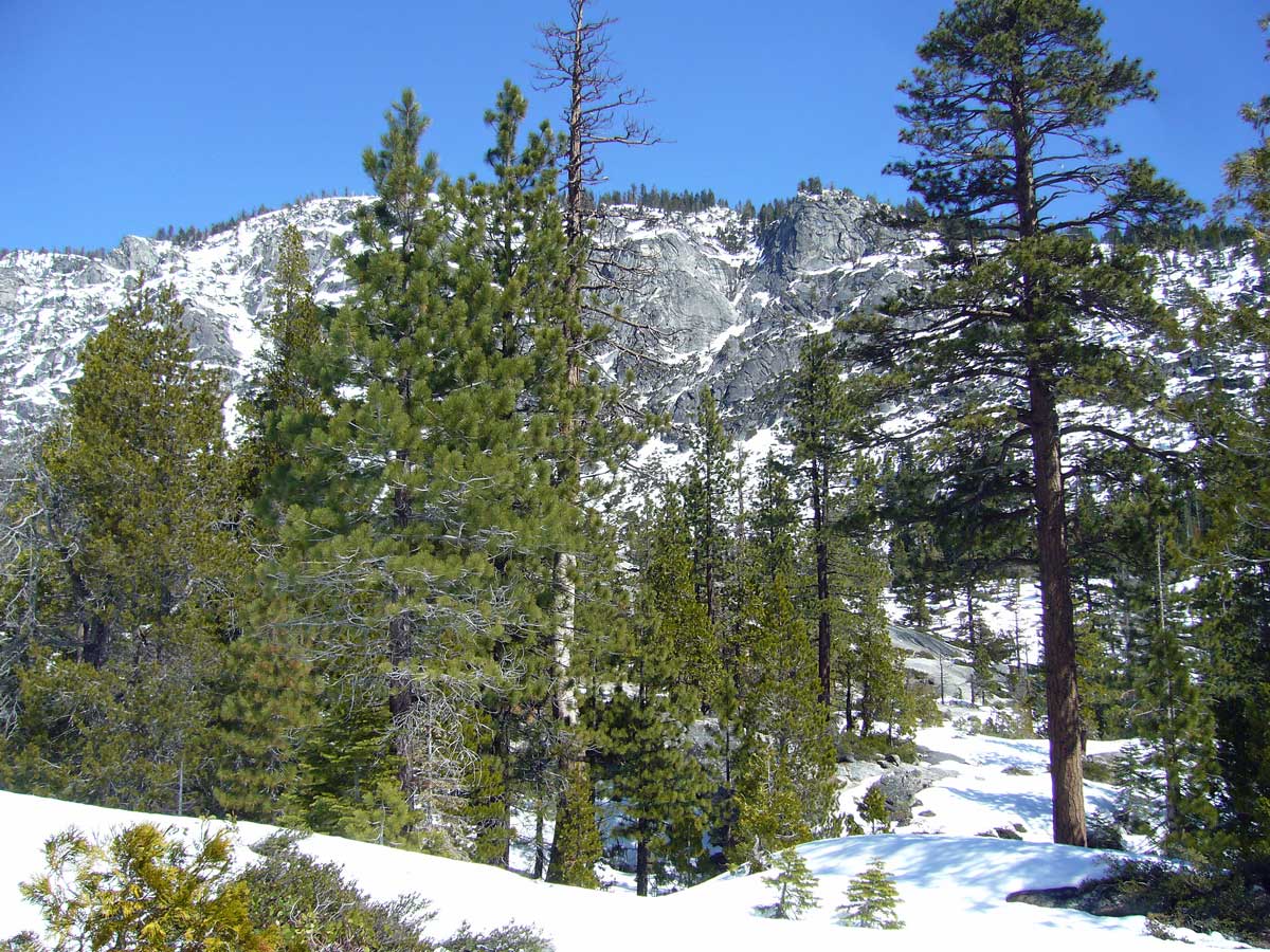
#6.

p1020790_2

HINT: Needles in bundles of 5 and about 3" long.

Copyright © Ted C. MacRae 2009

Add to FacebookAdd to NewsvineAdd to DiggAdd to Del.icio.usAdd to StumbleuponAdd to RedditAdd to BlinklistAdd to Ma.gnoliaAdd to TechnoratiAdd to Furl

Sand Harbor Overlook, Nevada

Lake Tahoe is fabulously beautiful from almost any perspective. There are certain places around the lake, however, whose beauty is so striking, so stunning, that one begins to believe they must have been copied from a starving artist’s painting or some inspirational poster. I have already highlighted one of these places – Emerald Bay, sitting at the lake’s southeastern corner on the California side. Emerald Bay is, in fact, the most dramatic example of the beauty that characterizes Lake Tahoe’s entire western shore – a boulder-strewn landscape sprouting rich forests of white fir, pine, and incense-cedar, massively trunked and often draped with lime-green mosses and lichens.

p1020749_2

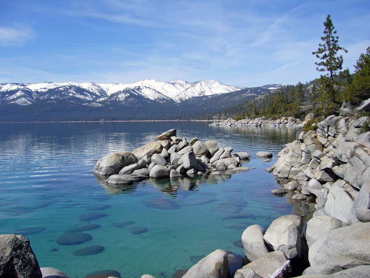
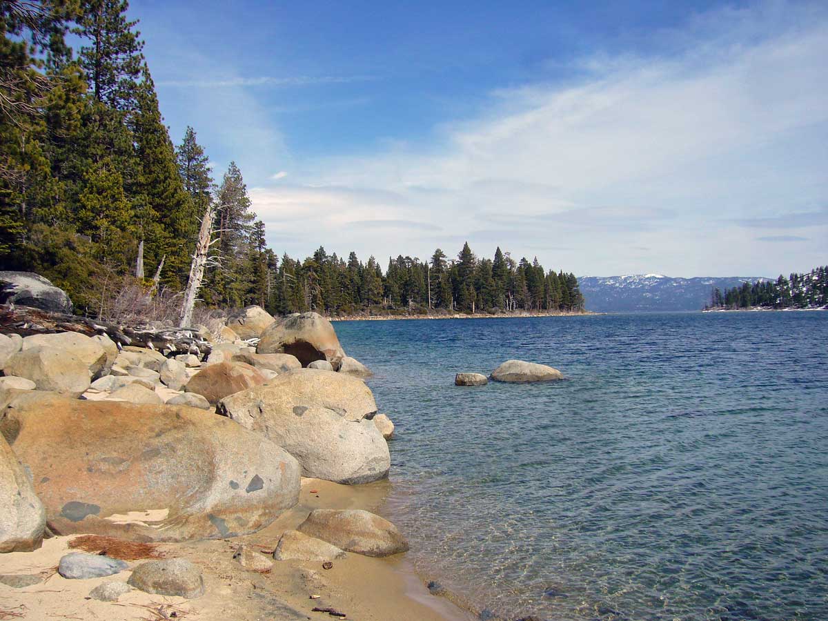
Nevada’s eastern shore, in contrast, has a different feel – its forests more open and dominated by Jeffrey pine due to the relatively lower amounts of rain and snow that reach the eastern shore. I do not mean to imply, however, that the eastern shore is any less beautiful than the western shore – far from it, and after a day of cross-country skiing at Spooner Lake (just below Spooner Summit, elevation 7,200′), my family and I discovered an eastern shore jewel with as much raw, overwhelming beauty as any of Lake Tahoe’s other premier scenic vantage points – Sand Harbor Overlook.

p1020741_2

While the views from Sand Harbor Overlook may not match the grandeur of Emerald Bay, they certainly equal (and perhaps surpass) its more famous landmark in their intimacy and varied perspectives. Whether viewed from high atop the granite point that jutts out into shallow, sandy-bottomed bay, or from lake level atop one of the half-submerged granite boulders, no other vista around the lake shows off Lake Tahoe’s famously clear waters better than Sand Harbor Overlook. Moreover, unlike most of scenic points around the lake, views of the vantage point itself are as dramatic as the views from it.

p1020743_2

I suspect that during the summer months, Sand Harbor Overlook is trampled daily by an unending stream of sightseers, many of whom quickly jump out of their cars and briskly search for a spot or two from which they can take photographs before jumping back into their cars and rushing off to the next scenic spot. Such “power” sightseers rarely experience the full beauty offered by Sand Harbor Overlook – their photographs cluttered by strangers in bright clothes, and their memories of what they saw limited to an instant in time. Similar to our experience at Pyramid Creek Geological Area, we had the good fortune to experience the beauty of Sand Harbor Overlook in complete solitude – able to slowly imbibe the subtlties of scale and nuances of each vantage as we explored the area with leisure and reverence. Unmolested by strangers, our contemplations were free to meander slowly, unintruded by persistent background chatter and adolescent shouting. While I came to Lake Tahoe this winter to enjoy the skiing, I walk away with renewed awe at its extraordinary, unending beauty.

Copyright © Ted C. MacRae 2009

Add to FacebookAdd to NewsvineAdd to DiggAdd to Del.icio.usAdd to StumbleuponAdd to RedditAdd to BlinklistAdd to Ma.gnoliaAdd to TechnoratiAdd to Furl

Pyramid Creek Geological Area

On the western slopes of the Sierra Nevada, Hwy 50 follows the American River Valley on its way up to Echo Summit before dropping precipitously into Lake Tahoe Basin. A few miles from the summit and 13 miles east of the quaint mountain town of Strawberry lies a spectacular gorge – born of glaciers and boasting one of California’s top ten waterfalls. During the warmer months, the small Forest Service parking lot that provides access to the gorge is constantly choked with cars, and throngs of people can be seen milling about. I have passed this place many times during the five years I lived in Sacramento, and though the crowds suggest that the area truly is spectacular, the idea of sharing a visit with so many strangers and their dogs was always out of the question. Yesterday, as daughter Madison and I drove down Hwy 50 to that very spot, I wondered what crowds we might encounter, hopeful that during this winter “off-season” we might luck out and enjoy at least some fragments of the kind of solitude that befits such a magnificent example of California wilderness.

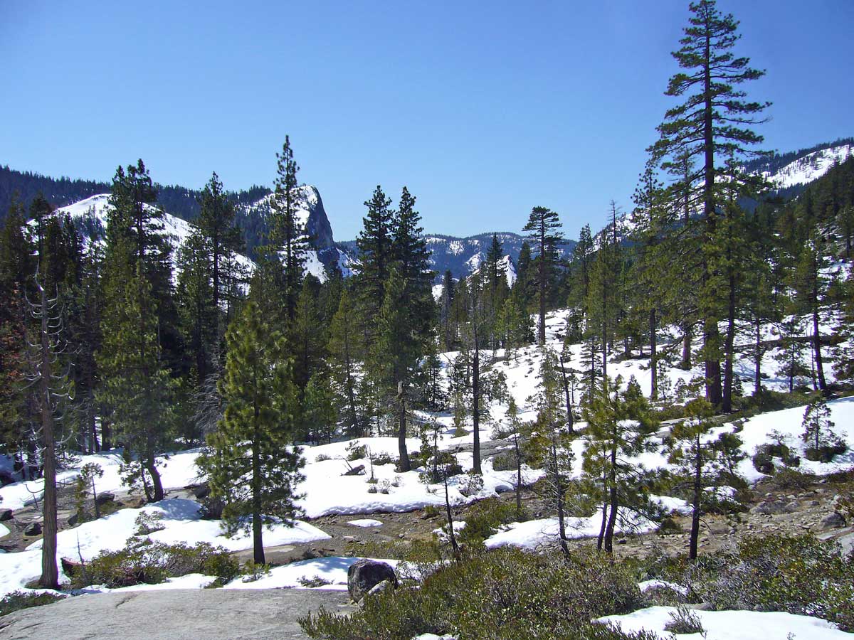
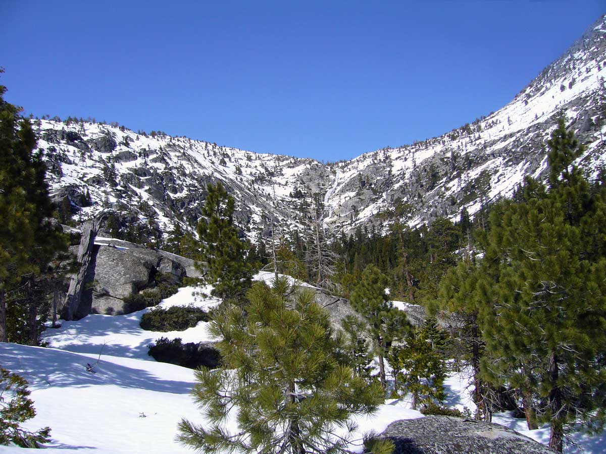
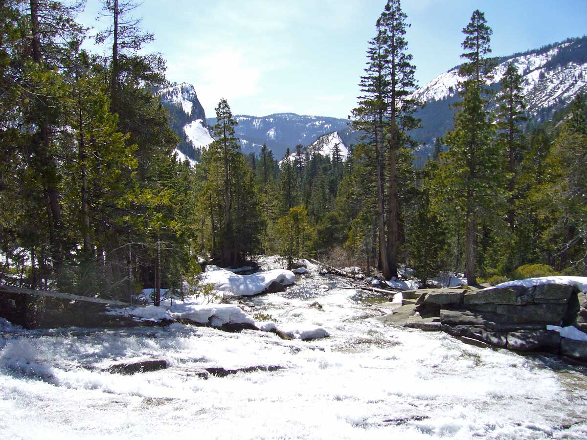
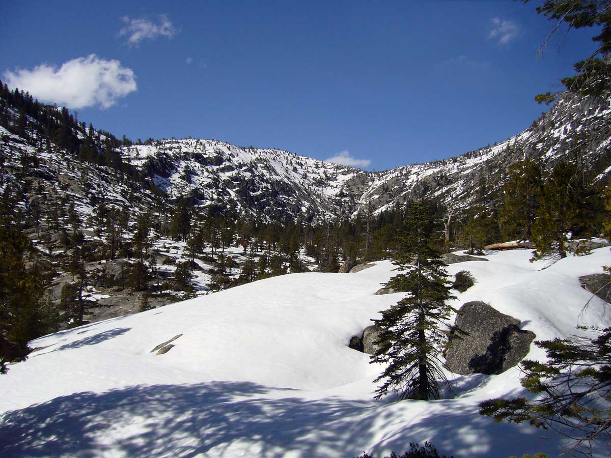
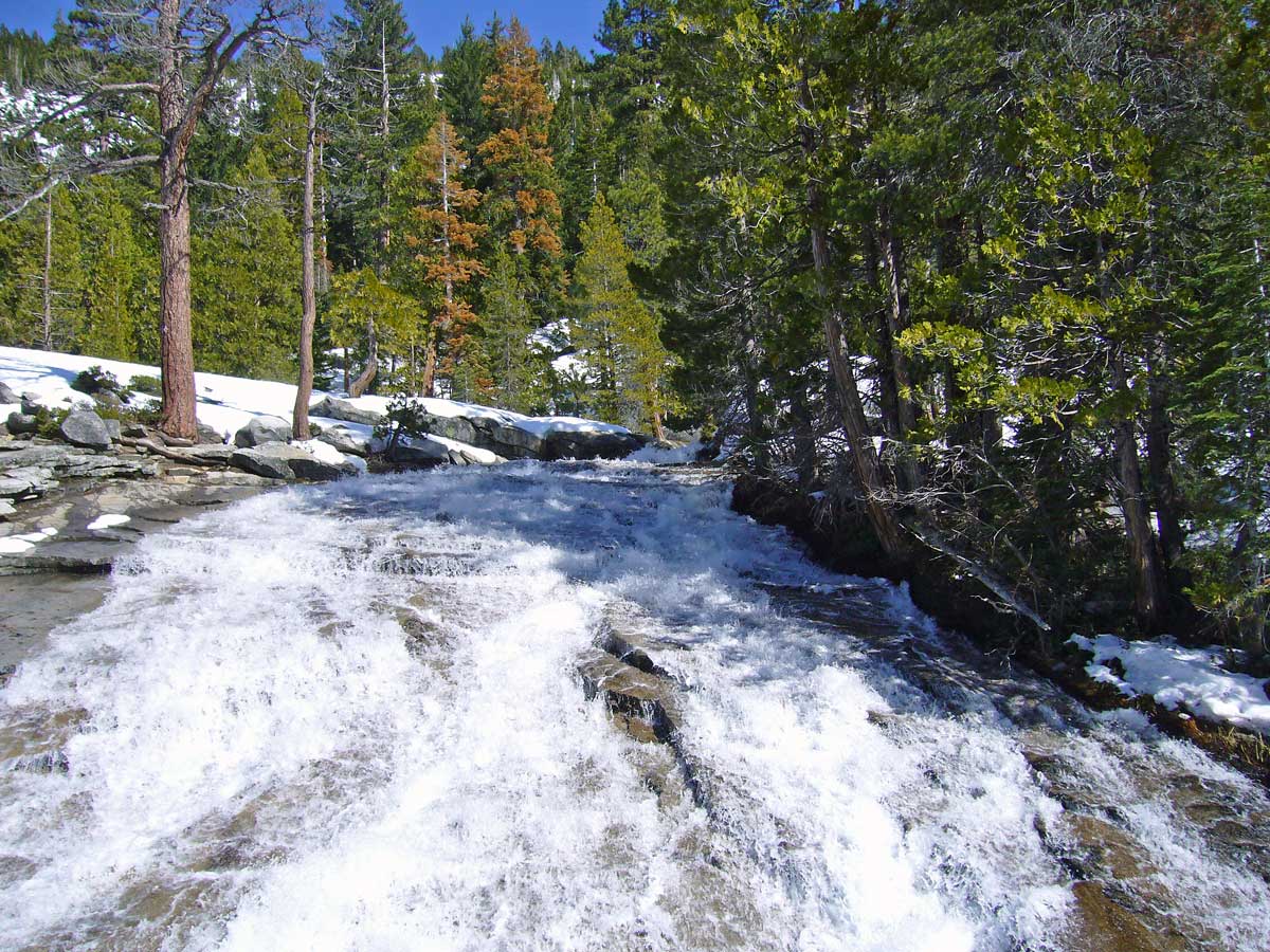
At 6,200 feet elevation, there was still plenty of snow on the ground, and unbeknown to me this USDA Recreation Site is officially closed during the winter months. The parking lot gates were locked, and there was not a car nor a person to be seen anywhere in the vicinity. That did not deter us – despite the many “No Parking” signs along each side of the highway – necessary during the summer months to prevent the throngs from creating chaos – we found a small turnoff in which we were able to tuck away the car and begin our little adventure to see Pyramid Creek Geological Area and its main attractions – Horsetail Falls and Cascade Vista. The gorge – named for the creek that originates at the base of the falls – was formed during the same late Pleistocene glaciations that formed Emerald Bay in Lake Tahoe. Vertical cliffs of granite tower above the U-shaped gorge, whose smooth granite domes remain littered with glacial scree (boulders and smaller rocks of assorted sizes). We lost the trail almost immediately due to snow, but since we knew we could not get lost (with a mountain on each side of us) we decided to bushwhack as far as we could. It was rough going, and with a hiking partner only 4′ in height the deep snow was a formidable obstacle. Still, we soldiered on, zigzagging from this granite exposure to that, testing (and often sinking) into the snow-covered plains between them, and splashing along the many meltwater streams that were gushing on this warm, early-spring day, until finally we could go no further. We were still a quarter mile from the falls (only a 1.25-miles hike from the trailhead if one uses the established trail), yet still the view was mesmerizing! As a father, I should probably be glad we did not make it all the way to the falls, as a number of people have been killed over the years when they got too close to the edge of the constantly wet rocks. On the way back, we spotted some granite exposures that we hadn’t seen earlier that suggested we might be able to get all the way up next to the Cascade Vista, and in this we were successful. We scrambled over the rocks and snow, ever careful but proud for giving the effort, before retracing our tracks back to a clear shot out of the gorge.

Words cannot express the overwhelming beauty of the landscape we explored, the joy in doing so without ever encountering another human being and the expansive feeling of solitude that that allows, and the exhausted satisfaction that results from hiking over rough, snowy terrain for more than 5 hours. Daughter Madison did great, and I almost had to rip her from the area she was having so much fun. She asked question after question as I showed her cracks in the rocks and explained the carving actions of water over the millennia, how water can create such a landscape. “Water always wins,” I told her. My botanizing trip to Emerald Bay two days before had also prepared me well for this trip, as I was able to recognize every single woody plant I encountered in the gorge (the mosses and ferns will have to wait for another day).

Of the many photographs I took during the day, I share with you here some of my favorites:

p1020760_2

Jeffrey pine and white fir soften the stark, towering granite walls

p1020761_2

Evidence of glacial carvings can be seen in the American River valley below.

p1020763_2

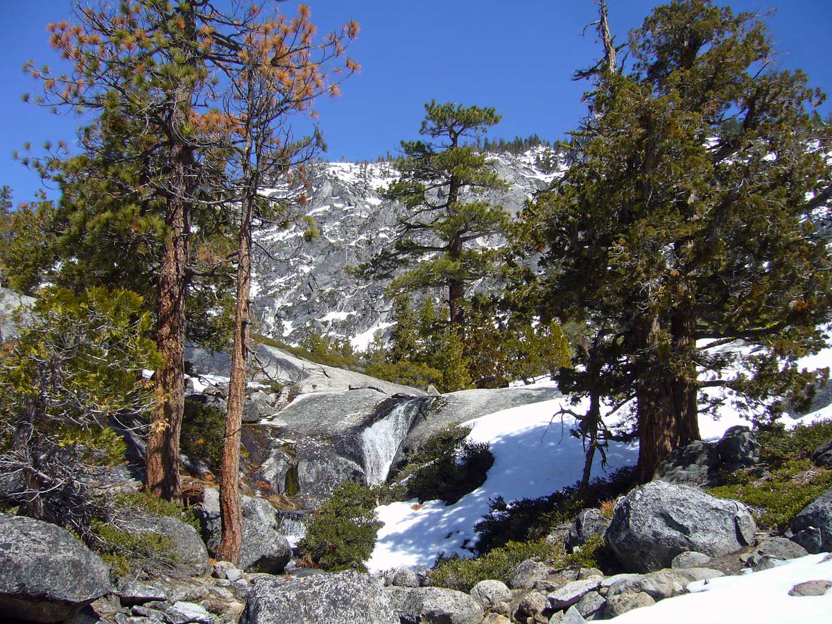
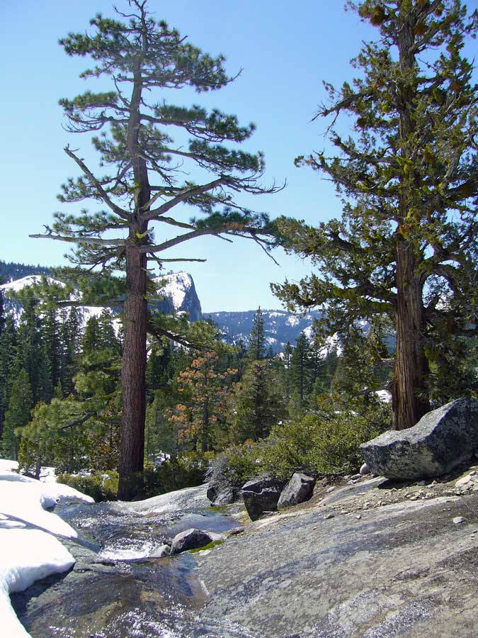
A small waterfall flanked by Jeffrey pine and Sierra juniper previews what is still to come.

p1020765_2

Another view south into the American River valley from a little higher up.

p1020769_2

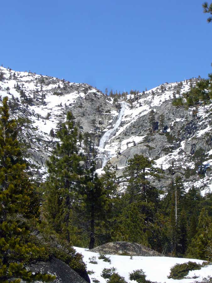
Horsetail Falls is gushing from the snowmelt.

p1020771_2

A distant view of Horsetail Falls.

p1020773_2

Looking down on the Cascade Vista and the American River valley.

p1020777_2

A distant view of Horsetail Falls from the Cascade Vista.

p1020780_2

Pyramid Creek sheets in a continuous cascade over the granite bedrock.

p1020782_3

Deep snow was a continuous obstacle for myself, and for 4'-tall Madison.

Copyright © Ted C. MacRae 2009

Add to FacebookAdd to NewsvineAdd to DiggAdd to Del.icio.usAdd to StumbleuponAdd to RedditAdd to BlinklistAdd to Ma.gnoliaAdd to TechnoratiAdd to Furl

Emerald Bay State Park – Vikingsholm and Rubicon Trails

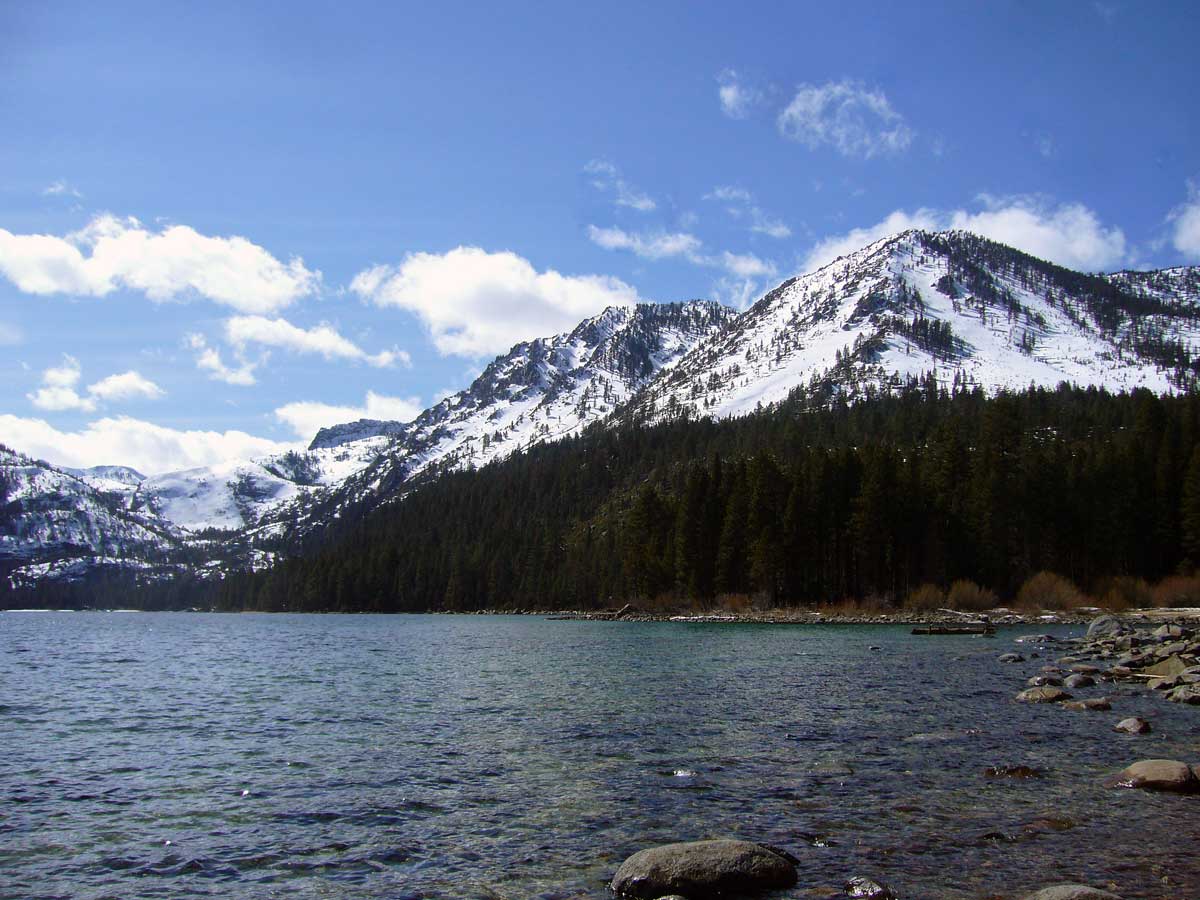
I had attempted to hike the Eagle Falls Trail two days ago, but deep snow stopped us just below the Upper Falls before reaching the lake. I had noticed, however, that the lower elevations on the west shore of Emerald Bay looked fairly free of snow, and a conversation the following morning with an extraordinarily helpful staff member at the USDA Forest Service’s Lake Tahoe Basin Management Unit headquarters in South Lake Tahoe confirmed that the entire Vikingsholm Trail in Emerald Bay State Park and much of the Rubicon Trail in Emerald Bay State Park and D. L. Bliss State Park immediately to the north should be passable. My objectives were two-fold – hiking and botanizing. I wanted to get in at least 6 miles, and up to 10 would be even better; and I also wanted to locate and identify as many of the woody plants known from the area as possible. I probed the incredibly helpful USDA representative about the subtleties of distinguishing ponderosa pine from the ubiquitous but very similar Jeffrey’s pine, where I might see magnificently mature specimens of sugar pine and the grotesquely beautiful Sierra juniper, how to recognize the moisture loving lodgepole pine, and the slim chance of seeing western white pine due to its preference for higher altitudes. I commented about how I looked forward to seeing stately red firs and wind-swept whitebark pine when I went skiing later in the week – maybe I would be fortunate enough to find western white pine amongst them. I purchased three books: Conifers of California by Ronald Lanner, Discovering Sierra Trees by Stephen Arno, Plants of the Tahoe Basin by Michael Graf and National Geographic’s Trails Illustrated Map™ for Lake Tahoe Basin (my souvenirs for the trip), thanked the wonderfully knowledgeable USDA representative for her help, and bolted up to Emerald Bay. On an extraordinarly warm and delightful mountain day in spring, I hiked down the Vikingsholm Trail to Vikingsholm Castle, stopping frequently to sample and photograph plants, then hiked the Rubicon Trail all the way to Emerald Point at the mouth of Emerald Bay. I hopped on rocks out into the point until I could not go any further and turned around to admire a view that few people have experienced by foot. I lost the trail along the way due to snow, but I did not get lost – I could not get lost with a lake on one side of me and a mountain on the other. Going beyond Emerald Point the snow got too deep – a few steps where I sunk up to my hip confirmed that further passage without snow shoes would be impossible. I bushwhacked back until I found the trail and chose alternate paths the rest of the way. By the time I returned to my car, I had hiked 7 miles in 5½ hours (yes, I’m pokey), encountered only a handful of people (all within a quarter mile of the parking lot) and taken 110 photographs. I share seven of them with you here:

East shore (lateral glacial morraine) of Emerald Bay from Vikingsholm Trail.  Heavenly Ski Resort and the southeast shore of Lake Tahoe can be seen in the distance.

East shore (lateral glacial morraine) of Emerald Bay from Vikingsholm Trail. Heavenly Ski Resort and the southeast shore of Lake Tahoe can be seen in the distance.

Mt. Tallac (L) and Maggie's Peaks (R) from Vikingsholm Trail

Mt. Tallac (L) and Maggie's Peaks (R) from Vikingsholm Trail

Fannette Island from Vikingsholm Castle

Fannette Island from Vikingsholm Castle

Emerald Point from the west shore of Emerald Bay

Emerald Point from the west shore of Emerald Bay

Emerald Bay and Maggie's Peaks (L) from Emerald Point

Emerald Bay and Maggie's Peaks (L) from Emerald Point

West shore of Emerald Bay from Emerald Point

West shore of Emerald Bay from Emerald Point

Zoom view of Emerald Bay from Emerald Point

Zoom view of Emerald Bay from Emerald Point

Copyright © Ted C. MacRae 2009

Add to FacebookAdd to NewsvineAdd to DiggAdd to Del.icio.usAdd to StumbleuponAdd to RedditAdd to BlinklistAdd to Ma.gnoliaAdd to TechnoratiAdd to Furl

Answers to “Winter botany quiz #2”

Finally, I present to you the answers to “Winter botany quiz #2 “. The delay in providing these answers was two-fold. Firstly, I knew this would be a hard test, so I wanted to give people plenty of time to figure out the answers. Secondly, the answers were delayed an extra day due because of some debate that arose among the experts I consulted about #3 – more on that below. I thank all those who participated, and while there was no clear-cut “winner”, several honorable mentions are deserved:

  • Doug Taron, who was the first to properly deduce the South African nature of these plants.
  • James C. Trager, a myrmecologist (yet still my friend!) who correctly identified the genus of #1.
  • Everyone, for guessing that #2 was “an orchid” – although Tom @ Ohio Nature was the only one to use the formal scientific name for the family, and Doug Taron was the only one to attempt a generic identification (and came close – Oncidium and Ansellia are both assigned to the tribe Cymbidieae in the subfamily Epidendroideae).

#1.  Ornithogalum seineri (family Hyacinthaceae)
Ornithogalum is a large genus occurring mostly in the drier habitats of southern Africa and around the Mediterranean.  The genus and its relatives were formerly included in the Liliaceae (as many of the participants guessed), but the group is now given familial status as the Hyacinthaceae.  This genus contains numerous species of horticultural note.  One is (as James noted) O. umbellatum, or  “star of Bethlehem”, which in North America has escaped cultivation as a garden ornamental and gained status as an invasive weed.  Another is O. longibracteatum (syn. caudatum), a popular houseplant with the common name “pregnant onion”.  This species, native to the Cape and Natal Provinces of South Africa, is easily recognized by its bulb that “gives birth” to tiny replicas of itself just beneath a thin, transparent ‘onion’ skin (as shown in the photo at right from Trans-Pacific Nursery).  At flowering, a long spike grows from the center of the green strap leaves, eventually giving rise to a spearhead of tiny white flowers situated at the end.

While I couldn’t find much information about O. seineri, I did find this spectacular photo of numerous blooming plants in bushveld habitat amongst grazing zebra (photo by ingrid1968 in this post at SANParks.org Forum).  My view of this species was not quite so spectacular, as I saw only the lone plant in the photographs posted earlier.

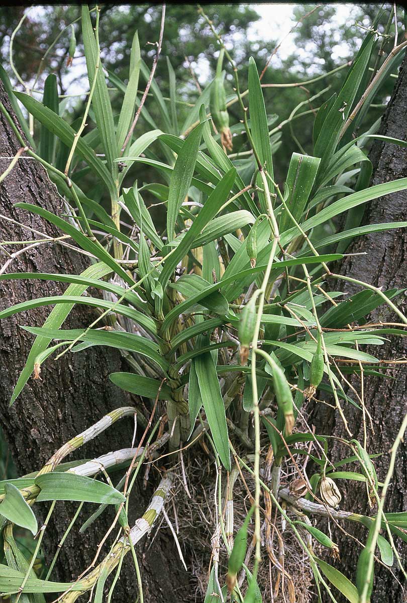
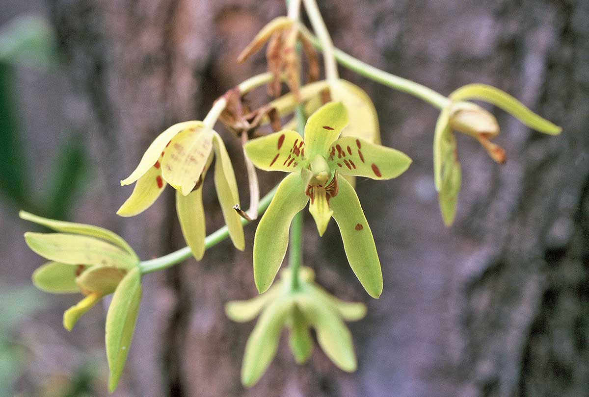
#2.  Ansellia africana (family Orchidaceae)
Ansellia is an African genus of orchid commonly called Leopard Orchid or African Ansellia.  There is some degree of morphological, geographical and ecological variation in Ansellia populations, with the result that several species, subspecies and varieties have been described.  Flower color varies from pure yellow to variably splotched with brown to almost completely black with finely indicated yellow divisions.  Recent taxonomic work has concluded that there are no discontinuities within the spectra of variations exhibited and the populations are thus attributable to the single, polytopic species, A. africana (Khayota 1999).

Ansellia africana is a large, perennial, epiphytic species that usually grows attached to the branches of tall trees but is sometimes found growing on rocks.  This genus is immediately recognizable by its large, cane-like pseudobulbs that arise from a basal rhizome and is notable for the white, needle-like, upward pointing aerial roots that form a sort of “trash basket” around the clump.  The term is surprisingly appropriate, since the root basket seems to function in catching dropping leaves, flowers and detritus which provide nutrients for the plant as they decay.  This species can grow to enormous size and often forms spectacular clumps, some of which have an estimated weight of more than one ton.

Of the three plants featured in the quiz, this was the one I expected someone would guess, since the species is popularly cultivated by orchid enthusiasts.  Unfortunately, the pressures of wild collection for commercial purposes has caused declines in its population.  The problem is exacerbated by the unsustainable methods use to harvest, transport, and cultivate wild-born plants.  Host trees are usually cut down and sections with the orchid removed, resulting in wholesale destruction of both orchids and hosts. After harvesting, plants are cut up and transported slowly in open handcarts, to be sold along roadsides where they may sit exposed to full sun for days or weeks.  Cutting the clumps damages the roots, and exposure results in dessication, making it difficult for harvested plants to recover once in cultivation.  Plants that do survive harvest and transplant suffer high mortality rates in cultivation due to improper attention to light and moisture regimes.

#3. Adenia sp., poss. glauca (family Passifloraceae)
To be completely honest, not only did I not expect anyone to guess this one, I didn’t think I was even going to be able to provide an answer. I sent the photos to my friend and colleague, George Yatskievych, director of the Flora of Missouri Project (and author of the recently published Steyermark’s Flora of Missouri, 1999 and 2006), who forwarded the photographs to several more colleagues, and at the same time I posted the photos on SANParks.org Forum (a fantastic resource, which I just recently discovered myself, for those interested in South Africa National Parks and their natural history). It took some time for these sources to weigh in with their opinion, which in the end were in agreement that it represented a species of African passion flower in the genus Adenia of the family Passifloraceae (not to be confused with Adenium, a genus of flowering plants in the family Apocynaceae – also occurring in Africa). As for which species, the choices had been narrowed down to either A. glauca or A. fruticosa. According to Imberbe, a photo of the leaves would have been diagnostic, and the flowers are also different (A. glauca has yellow flowers while those of A. fruticosa are green). Fred Dortort, in an article on the University of California at Berkely Botanical Garden website titled, “Passion and Poison“, notes that A. fruticosa has a tall, spindle-shaped caudex topped with a few thin, sparsely-leafed, arching branches, while in A. glauca the caudex is roughly globose and can become quite large. This description seems to favor A. glauca, which Imberbe also noted was known to occur in the area where I took the photographs.

Species identification aside, the genus Adenia is notable for its bizarre adaptations for water storage. Most of the 100 or so species in this Afrotropical and Indomalaysian genus have underground tubers. Those of species adapted to drier environments have grown proportionately larger, with some turning into above ground caudices that can take several different forms and that, in some species, may reach up to eight feet in diameter and height. Even more notable than these succulent adaptations are the poisonous properties that many plants in the genus possess. Not all species have been analyzed (and I found little or conflicting information about A. glauca and A. fruticosa), but one species in the genus – A. digitata – has gained notoriety as perhaps the most poisonous plant in the world. Two different toxins are found within its tuber, one a cyanogenic glycoside, the other a particularly potent toxin called modeccin. The latter is a 57kD protein that resembles ricin and acts a powerful inhibitor of protein synthesis by binding to ribosomes (Gasperi-Campani et al. 1978). Imberbe, in her comments about the photos I posted on SANParks.org Forum, noted the following about plants in this group:

…take heed of the Afrikaans name “Bobbejaangif” (Baboon poison)… It has been used as a fish poison, as well as in suicide and murder. It causes nausea, fits and liver and kidney damage.

REFERENCES:

Gasperi-Campani, A., L. Barbieri, E. Lorenzoni, L. Montanaro, S. Sperti, E. Bonetti, & F. Stirpe. 1978. Modeccin, the toxin of Adenia digitata. Biochemistry Journal 174:491-496.

Khayota, B. N. 1999. Notes on systematics, ecology and conservation of Ansellia (Orchidaceae), pp. 423-425. In: J. Timberlake & S. Kativu (eds.), African Plants: Biodiversity, Taxonomy and Uses, Royal Botanic Gardens, Kew.

Copyright © Ted C. MacRae 2009

Add to FacebookAdd to NewsvineAdd to DiggAdd to Del.icio.usAdd to StumbleuponAdd to RedditAdd to BlinklistAdd to Ma.gnoliaAdd to TechnoratiAdd to Furl

Winter botany quiz #2

In the first winter botany quiz, I learned that I have some rather astute botanists amongst my readership. They were not only able to quickly identify to species every plant I had pictured but also identify their commonality, sometimes from quite afar. As a result, this one is harder.  I use the term “winter botany quiz” in the broadest possible sense – just because it’s winter here doesn’t mean it’s cold everywhere! All of the photos were taken in the same general (for now unspecified) locality during late November and early December (this paragraph simply reeks of clues!).

To give everyone a fair chance, I’ve turned on comment moderation so people can submit their answers without seeing what has already been submitted.  I’ll remove moderation after a couple days or so.  First one with all the right answers wins the admiration and jealousy of their peers!

424046-r1-e018_018_21

#1A

424046-r1-e019_019_21

#1B - closeup of flowers in #1A

424046-r1-e020_020_2

#2A

424046-r1-e021_021_2

#2B - closeup of flowers of #2A

424046-r1-e022_022_2

#3A - the vine, not the trees

424046-r1-e023_023_2

#3B - closeup of vine base

Copyright © Ted C. MacRae 2009

Add to FacebookAdd to NewsvineAdd to DiggAdd to Del.icio.usAdd to StumbleuponAdd to RedditAdd to BlinklistAdd to Ma.gnoliaAdd to TechnoratiAdd to Furl

Sanctuary for the Betulaceae

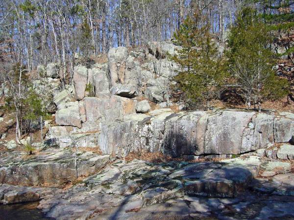
Nestled on the eastern side of the St. Francois Mountains, where the craggy exposures of the Ozarks most ancient rocks begin to subside underneath the Cambrian sandstones laid down over them, lies Hawn State Park – considered by many to be the loveliest of Missouri’s state parks. I have written previously about Hawn – in fact, it was the subject of my very first post on this blog. I have long treasured Hawn for its excellent insect collecting, diversity of plants and habitats, and unbridled beauty. I have hiked the incomparable Pickle Creek and Whispering Pine Trails many times – far more than any other trail in the state, and each time I fall more deeply in love with what, to me, represents the essence of the Missouri Ozarks in their most pristine state.

Lamotte sandstone cutThe charm of Hawn results from a unique combination of geological features. The Lamotte sandstone outcrops that dominate Hawn’s landscape are the oldest sedimentary rocks in the state, formed from coarse sand deposits that were laid down over the Precambrian rhyolites and granites that form the core of the St. Francois Mountains. These sand deposits were themselves buried under limestone and dolomite layers formed at the bottom of vast seas that later covered much of the interior of the continent. Subsequent periods of uplift and erosion once again exposed these sandstones, whose unique ability to hold groundwater has resulted in the formation of spring-fed streams that have cut deep into their soft layers to create canyon-rimmed valleys with tall vertical cliffs. rhyolite shut-ins One of these streams is Pickle Creek, which is fed throughout the year by Pickle Spring and has in some places cut all the way down to the underlying igneous rock to form “shut-ins.” In contrast to the slow, sandy bottomed stretches where Pickle Creek is still cutting through sandstones, the water in these igneous shut-ins rushes through narrow openings in the highly resistant rock. The igneous and sandstone exposures found in Hawn are spectacularly beautiful and support a unique flora due to the acid soils they produce. One group of plants that have taken sanctuary in these moist, acid soils is the Betulaceae, or birch family. Missouri is home to five native species of Betulaceae¹, and while none of them are extraordinarily uncommon they are limited in their occurrence to natural communities with sufficient moisture and exhibit a clear preference for acidic soils. This confluence of conditions occurs perfectly along Pickle Creek, allowing all five native species to grow here side-by-side – a betulaceous “hot spot” that represents not only the full diversity of the family in Missouri, but also the total generic diversity of the family in North America. In fact, only one other genus (Ostryopsis, shrubs related to Corylus and restricted to China) is assigned to the family on a global basis (Furlow 2004).
¹ Dr. George Yatskievych, in his recently published Steyermark’s Flora of Missouri (2006), regarded the presence of Corylus cornuta in Missouri as unlikely despite earlier reports of such. Dr. Yatskievych also recorded a single escape of the European species Alnus glutinosa from Springfield, Missouri.

The Betulaceae are deciduous trees and shrubs that occur primarily in the boreal and cool temperate zones of the Northern Hemisphere, although outposts are also known from high elevations in the Neotropics and, as mentioned above, China. Fossils of this ancient lineage of flowering plants are traceable to the late Mesozoic (upper Cretaceous), and the family appears to form a clade with hamamelidaceous plants. As would be expected from a group with boreal affinities, most species exhibit adaptations for survival in cold climates, such as small stature, shrubby growth habits, and small leaves. Several of Missouri’s species have performed well and gained acceptance as ornamental trees and shrubs, while others are important as sources of hazelnuts (genus Corylus) or ecologically for their ability to fix nitrogen (genus Alnus). My interest in these plants has nothing to do with their economic importance, but rather in their role as host plants for several rarely encountered species of woodboring beetles. Often, insects in this group may be collected on foliage of their hosts during the summer, making host identification fairly easy due to the presence of leaves. This is not always possible, however, due to limited periods of adult activity or low population densities. Rearing these insects from their hosts provides additional opportunity to document their occurrence, and winter is often the best time to collect the dead branches in which they breed, since by that time they have nearly completed their development and will be ready to emerge as soon as temperatures rise during spring. Identifying woody plants without foliage can be a challenge, but the ability to distinguish host plants by non-foliage characters such as bark, growth habit, bud shape, etc. greatly facilitates studies of wood boring beetles through rearing. In the past I have relied heavily on Cliburn and Klomps’ (1980), A Key to Missouri Trees in Winter, which utilizes mostly details of the twigs and buds to discriminate among Missouri’s 160+ species of trees. However, after a certain level of familiarity is gained, one eventually learns to recognize winter trees and even downed logs or fallen branches simply by their “look”.

Betula nigra - habit

Betula nigra - habit

Betula nigra - old bark

Betula nigra - old bark

Betula nigra - sapling

Betula nigra - sapling

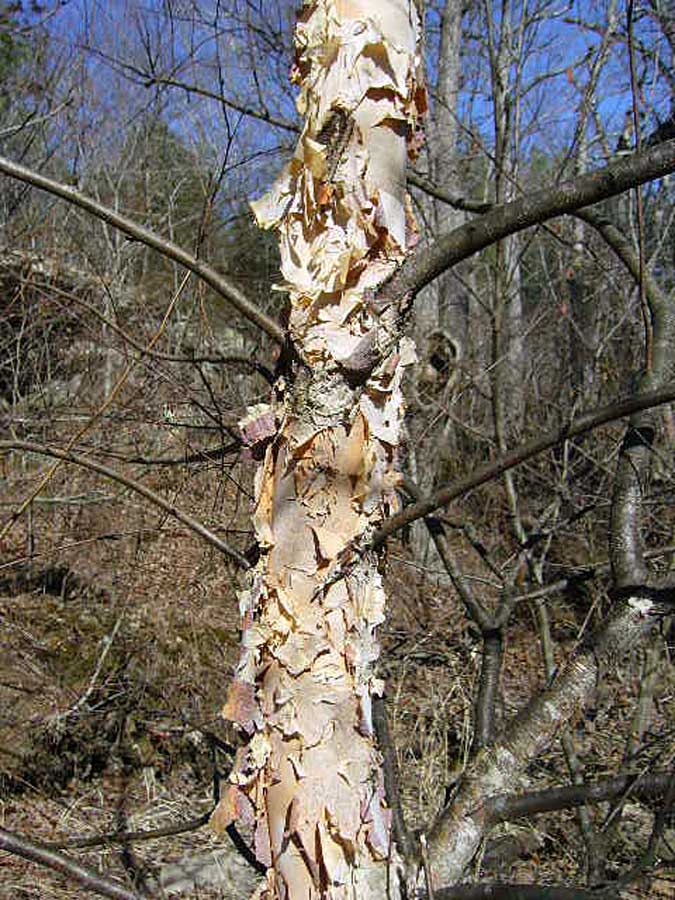
Betula nigra (river birch) is the only member of this largely boreal genus found in the middle and southern latitudes of the U.S. and, thus, cannot be confused with any of Missouri’s other betulaceous species². It is the largest of the five and, along with the following species, is the most demanding in terms of keeping its “feet” wet. Trees are usually encountered right at the water’s edge, with tall, slender, often twisted or leaning trunks. Young trees and large branches on older trees exhibit gorgeous reddish brown bark peeling in thin, papery sheets, becoming thick and scaly on the main trunks of older trees. Small branches are dark, purplish brown in color with smooth bark and distinctly horizontal lenticels.  I have reared a small jewel beetle from fallen, dead branches of this tree collected at several locations in Missouri – this beetle turned out to be new to science, which I described and named Agrilus betulanigrae in reference to its (then) only known host (MacRae 2003).  I have also reared tremendous series of another jewel beetle, Anthaxia cyanella, which at the time was not known to utilize this host and was considered uncommon.  As it turns out, Betula nigra is its preferred host, and the rearing of large series from many locations resulted in improved knowledge about color forms and variability in this species (MacRae & Nelson 2003).

² The widely planted but dreadfully non-adapted Betula pendula (European white birch) and B. papyrifera (paper birch) can be recognized by their distinctly white bark. These species are limited to urban landscapes where they rarely achieve significant stature before declining and eventually succumbing to insect pests such as Agrilus anxius (bronze birch borer). River birch provides an equally attractive and much more durable choice!

Alnus serrulata - habit
Alnus serrulata - habit

Alnus serrulata - sapling
Alnus serrulata - sapling

Alnus serrulata - old cones

Alnus serrulata - old cones

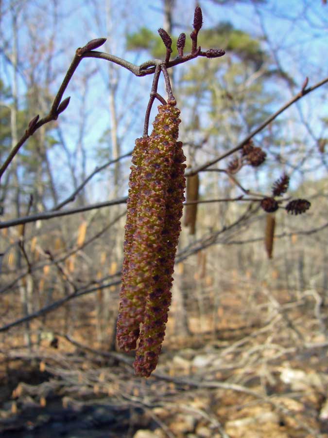
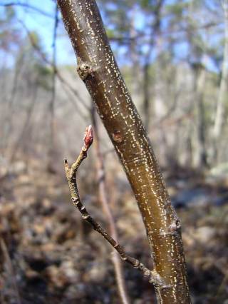
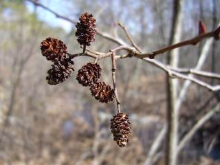
Alnus serrulata (common alder, hazel alder, smooth alder, tag alder…) also demands to be next to (or even in) the water.  Unlike B. nigra, however, this species rarely reaches true tree status, instead usually forming shrubby thickets along the water’s edge.  Saplings can resemble those of B. nigra due to their smooth brownish bark, but the latter is usually more purplish, and the lenticels of A. serrulata are not distinctly horizontal as in B. nigra. The large purple-red buds also differ from the small brown buds of B. nigra, and during winter A. serrulata is adorned with numerous staminate catkins.  The persistent woody cones also cannot be mistaken for those of any other species of Betulaceae in Missouri. Associated with this plant is the longhorned beetle, Saperda obliqua, which reaches its southwesternmost distributional limit in Missouri on the basis of a single specimen collected some 25 years ago right here along Pickle Creek and given to me by lepidopterist George Balogh. Numerous attempts to find this species here since then have not (yet!) been successful.

Carpinus caroliniana - habit

Carpinus caroliniana - habit

Carpinus caroliniana (blue beech, hornbeam, musclewood) is one of my favorite betulaceous species. The beautifully fluted trunks and smooth, light gray bark are remniscent of the limbs of a sinewy, muscular person – every time I see this tree I cannot resist the temptation to grab and stroke the hard limbs (should I be admitting this?). This character begins to show even in very young trees, making its identification during winter quite easy. These trees also like to be near water, but they are not so demanding to be right at the water’s edge as are the previous two species. They usually form small trees, often in clumps with multiple trunks.  There are some notable insect associations that I’ve found with this plant.  One is a small jewel beetle, Agrilus ohioensis, which I reared from dead branches of this plant collected along Pickle Creek (Nelson & MacRae 1990), and which after more than 20 years still remain the only known Missouri specimens of this species.  Another is the longhorned beetle, Trachysida mutabilis, a single adult of which I reared from a dead (almost rotting) branch of this plant collected not too far from Pickle Creek in Iron Co.  This beetle also is the only representative of its species known from Missouri (MacRae & Rice 2007).

Ostrya virginiana - habit

Ostrya virginiana - habit

Ostrya virginiana - trunk

Ostrya virginiana - trunk

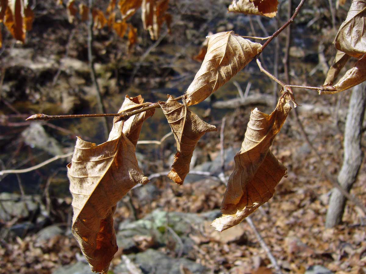
Ostrya virginiana (hop hornbean, American hornbeam) has a form and growth habit very similar to C. caroliniana, but its leaves that persist through the winter make it instantly recognizable from afar.  In Missouri, this habit is most often seen with the oaks (Quercus spp.).  This species can be found even further away from the water than the previous species, and its small stature combines with the orangish, persistent leaves to form a distinctive understory layer during winter.  Also, in contrast to the smooth gray bark of Carpinus, this species exhibits scaly, light reddish brown to brownish gray bark.  I have succeeded in rearing one of the two known Missouri specimens of another jewel beetle, Agrilus champlaini, from O. virginiana collected along Pickle Creek (the other specimen was reared from wood collected at Graham Cave State Park, another site where sandstone bedrocks favor an O. virginiana understory).  Unlike most other jewel beetles, A. champlaini forms galls in small living branches of its host.  I have collected the distinctive swellings during winter on many occasions but managed to rear only these two individuals (plus one ichneumonid parasitoid).  I have also noted similar swellings on Carpinus but have not yet managed to definitely associated them with this beetle.

Corylus americana (hazelnut, American hazelnut) is the smallest of Missouri’s five betulaceous species, always forming shrubs, sometimes in thickets, and never assuming the form of a tree. Its staminate catkins present during winter immediately identify plants of this species as Betulaceae, but the small, globe-shaped buds are unlike the more pointed buds of Ostrya and the elongated, reddish buds of Alnus. This species is the least demanding in terms of being near water and can be found even in upland prairies and glades. I haven’t yet associated any woodboring beetles with this plant in Missouri, but there are several jewel beetles known from the eastern U.S. that utilize Corylus (Agrilus corylicola, A. fulgens, and A. pseudocoryli) and could occur in Missouri.

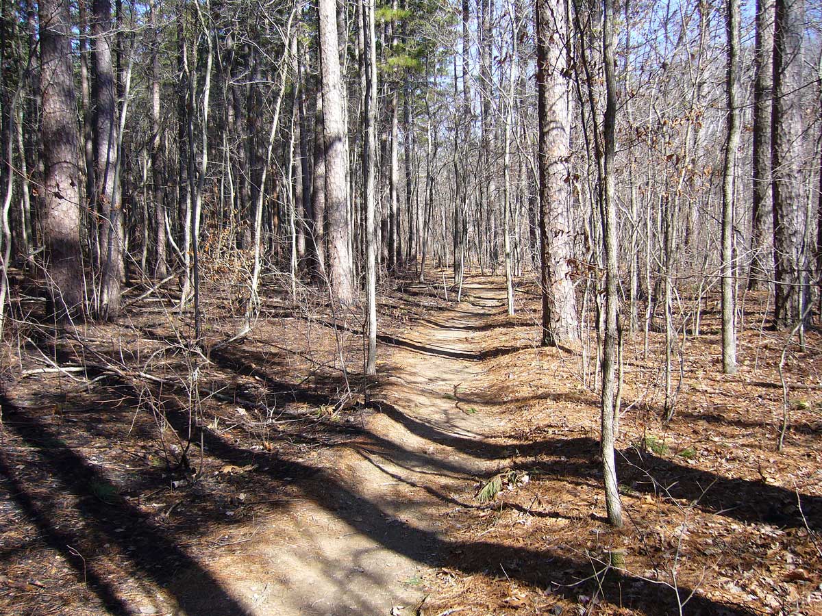
pine savanna - fire managementThe upland habitats at Hawn are of interest as well. Lamotte sandstones are the dominant bedrock, creating acid soils that support a canopy dominated by Missouri’s only native species of pine, Pinus echinata (shortleaf pine), several species of oak, and a diversity of acid-loving shrubs primarily in the family Ericaceae (including the stunningly beautiful Rhododendron prinophyllum, or wild azalea). Historically, so-called “pine savanna” was prevalent in this area, a natural community in which periodic fires maintained an open structure amongst the fire-adapted pines and allowed a diverse herbaceous layer beneath the open canopy. Much of Hawn has closed up after decades of fire suppression; trail through pine savannahowever, the Department of Natural Resources has implemented a rotational burn management regime to recreate pine savanna habitat within Hawn’s Whispering Pines Wild Area. Evidence of what appeared to be very recent burns could be seen at several places as I hiked along the Whispering Pines Trail, and while many visitors might have been alarmed at the apparent “damage” they were observing, my heart sang with the prospect of seeing mature pine savanna communities taking hold throughout my beloved Hawn. As I stood atop this ridge and looked back down from where I had come, I could almost see Henry Schoolcraft and Levi Pettibone in the distance on horseback, perhaps pausing to gaze at an elk.

REFERENCES:

Cliburn, J. and G. Klomps. 1980. A Key to Missouri Trees in Winter, 2nd edition. Missouri Department of Conservation, Jefferson City, 43 pp. (subsequently revised)

Furlow, J. J.  2004. Betulaceae in Flora of North America @ efloras.org. http://www.efloras.org/florataxon.aspx?flora_id=1&taxon_id=10101.

MacRae, T. C. 2003. Agrilus (s. str.) betulanigrae MacRae (Coleoptera: Buprestidae: Agrilini), a new species from North America, with comments on subgeneric placement and a key to the otiosus species-group in North America. Zootaxa 380:1–9.

MacRae, T. C., and G. H. Nelson. 2003. Distributional and biological notes on Buprestidae (Coleoptera) in North and Central America and the West Indies, with validation of one species. The Coleopterists Bulletin 57(1):57–70.

MacRae, T. C. and M. E. Rice. 2007. Distributional and biological observations on North American Cerambycidae (Coleoptera). The Coleopterists Bulletin 61(2):227–263.

Nelson, G. H. and T. C. MacRae. 1990. Additional notes on the biology and distribution of Buprestidae (Coleoptera) in North America, III. The Coleopterists Bulletin 44(3):349–354.

Yatskievych, G. 2006. Steyermark’s Flora of Missouri, Volume 2. The Missouri Botanical Garden Press, St. Louis, 1181 pp.

Copyright © Ted C. MacRae 2009

Add to FacebookAdd to NewsvineAdd to DiggAdd to Del.icio.usAdd to StumbleuponAdd to RedditAdd to BlinklistAdd to Ma.gnoliaAdd to TechnoratiAdd to Furl