Muir Woods National Monument

This is the best tree-lovers monument that could possibly be found in all the forests of the world. – John Muir

Coastal redwood (Sequoia sempervirens) is the tallest type of tree in the world, with maximum recorded heights approaching 380 feet. This majestic conifer grows only along the Pacific Coast in a narrow strip from Monterey to Oregon. Most of the estimated 2 million acres of original redwood forest are now gone — victims of the saw! One of the small groves that managed to escape this fate due to its relative inaccessibility grows along Redwood Creek and adjacent slopes in what is now Muir Woods National Monument. At heights approaching 260 feet, the redwoods growing here are not the tallest to be found; however, their proximity to San Francisco (just 15 miles from the Golden Gate Bridge) makes them the most heavily viewed examples of this ancient tree. Lynne and I visited Muir Woods a few times in the 90’s after moving to Sacramento — today (3/20) was our first visit since then, and the first ever for Mollie and Madison. In addition to getting to see these marvelous trees once again, we were also treated to a spectacular display of spring wildflowers.

We began our hike on the main paved trail. This is where most visitors confine themselves during a visit to this place, so the picture here documents a rare sight — no people! I apologize for its lack of focus, a consequence of the limitations of my little point-and-shoot camera in the limited amount of light that makes it through these towering trees during late afternoon.
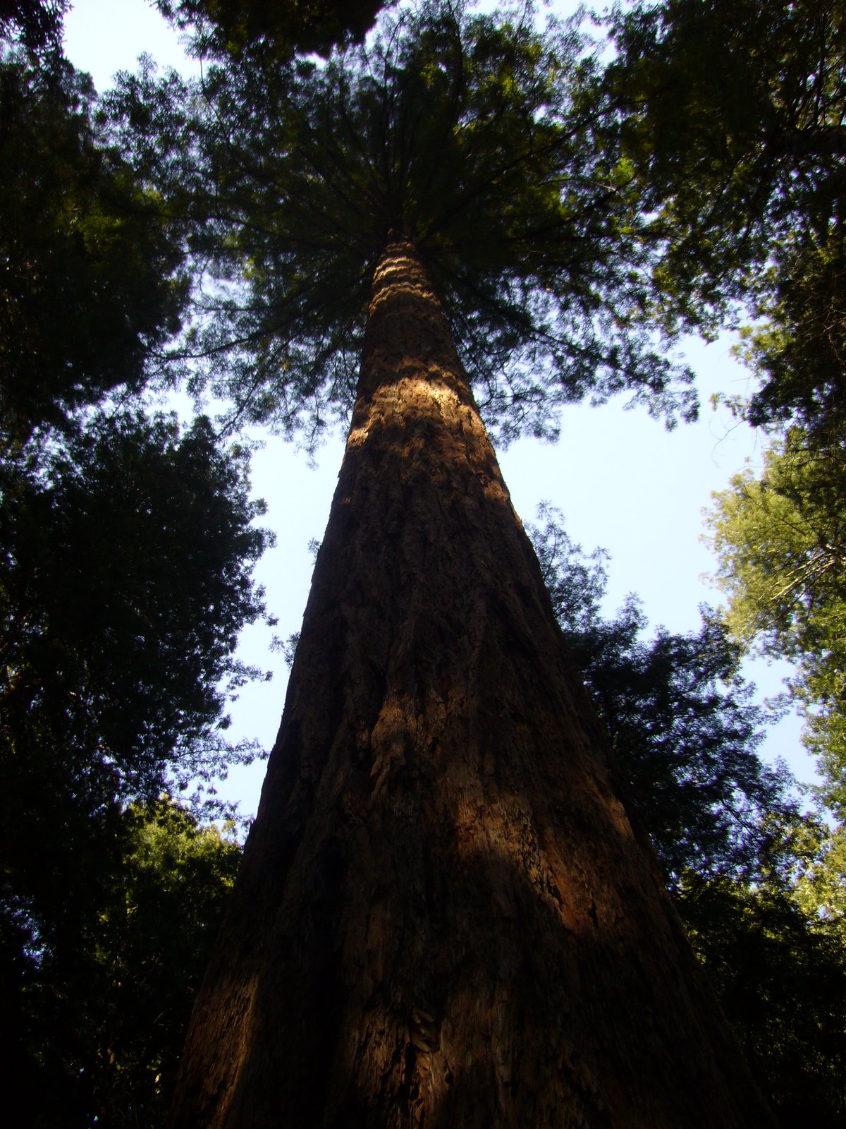
Standing beneath one of these trees and looking up is a lesson in insignificance — the feeling one gets looking straight up the trunk of one of these giants cannot be adequately captured on film (er… microchip).

We quickly tired of the crowds and decided to hike up the Ocean View Trail, which climbs quite steeply up the east side of the valley. This marvelous trail was nearly devoid of people, and we found ourselves winding through thick, dark, cool forest with numerous side ravines. The lower elevations of the trail were dominated by redwood trees and a spectacular array of spring wildflowers. Among the most common was California toothwort (Cardamine  californica [=Dentaria californica]), a member of the mustard family (Brassicaceae). I noticed that the leaves at the base of the plant were broad and oval, while those arising from the flower stalk were slender and lanceolate, often divided into 3 leaflets.

Wake robins (genus Trillium), belonging to the lily family (Liliaceae, sometimes separated into the lily-of-the-valley family, Convallariaceae), are among my favorite wildflowers. We soon noticed Western wake robin (Trillium ovatum) growing commonly in shaded areas along the trail. We were also seeing some purple-flowered wake robins — at first I thought they were a different species, but it soon became apparent that these were older Western wake robin flowers, which change color from white to purple as they age.
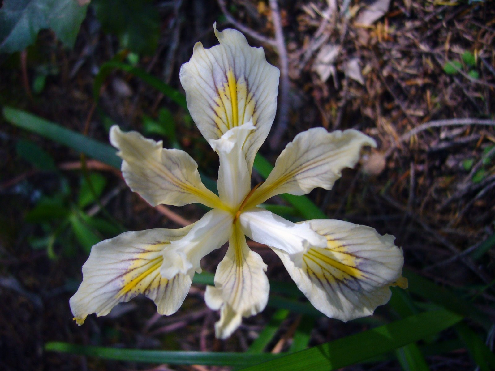
A little further up the trail we began encountering small patches of Mountain iris (Iris douglasiana, family Iridaceae). Flower color for this native species ranges from cream-white to lavender, but all of the flowers we saw were of the white variety.

We saw this fat Solomon’s seal (Maianthemum racemosum ssp. amplexicaule [=Smilacina racemosa var. amplexicaulis]) growing in one of the cool, moist, side ravines. This is another member of the Liliaceae (sometimes separated into the Convallariaceae). The large, oval leaves clasping around the distinct, unbranched stem were almost as attractive as the flowers, which apparently give rise to bright scarlet berries in the summer.

In the middle elevations the redwood forest transitioned to drier oak woodland containing a mixture of Douglas-fir (Pseudotsuga menziesii), Pacific madrone (Arbutus menziesii), bigleaf maple (Acer macrophyllum), and tan oak (Lithocarpus densiflorus). Some of the Douglas-firs were enormous.


Indian warrior (Pedicularis densiflora) is a member of the figwort family (Scrophulariaceae, sometimes separated into the Orobanchaceae). This plant, with its striking bright red flowers and finely divided, fern-like leaves, is a facultative parasite on the roots of other plants. Apparently, the genus name refers to an old superstition that sheep could become infested with lice if they ate this plant.


The juncture of the Ocean View Trail with the Lost Trail was closed, so we backtracked down the 1+ miles back to the main paved trail. By now it was fairly late in the afternoon, and the crowds had thinned considerably. Having gotten lots of good views of the giant trees, we began turning our attention downwards to the smaller understory flora. Ferns, of course, are a dominant component of this understory, especially along Redwood Creek. This large specimen may represent Western sword fern (Polystichum munitum) (family Dryopteridaceae), which can apparently be distinguished by small hilt-like projections from the base of the pinnae (leaflets), but I couldn’t get close enough to see for sure.


Abundant on the ground in the valley was redwood sorrell (Oxalis oregana), a member of the family Oxalidaceae. In places this plant covered the ground in thick carpets.


Among the more interesting plants we saw in the valley was California fetid adder’s tongue (Scoliopus bigelovii), yet another member of the Liliaceae or Convallariaceae. I wasn’t sure what this plant was at first, despite its highly distinctive, glossy, mottled foliage. We were too late to see the blooms, which apparently have a fetid odor to attract flies for pollination, but did find the maturing pods on their slender, drooping stems.


Close to the creek’s edge we saw this colony of horsetails (Equisetum sp.), primitive plants in the family Equisetaceae. Members of this group belong to one of the most ancient lineages of vascular plants, dating back to the Devonian period (416-359 million years ago). Their Paleozoic ancestors (Calamitaceae and Archaeocalamitaceae) were giants, reaching heights of 50 ft or more, and were major components of the Carboniferous swamplands. Along with lycopod trees (Lepidodendrales), they were important contributors to coal formation and, like the lycopods, became extinct by the mid-Permian (~270 million years ago). The genus Equisetum represents the only surviving descendants of this lineage. Unlike their extinct progenitors, these small, herbaceous plants rarely exceed 4 ft in height; however, they share many of the same characters such as articulate stems with microphylls arranged in whorls. Recent phylogenetic studies, using both molecular and morphological characters, suggest that horsetails, together with ferns, form a clade representing one of the three major lineages of vascular plants (Pryer et al. 2001).


Nearby we saw a patch of Giant wake robin (Trillium chloropetalum) in flower. These were taller than the California wake robins we saw on the slopes of the Ocean View Trail but similarly characterized by a whorl of 3 leaves and flowers composed of 3 erect petals. Mature flowers darken to a deep red purple, so it seems these plants had just begun flowering. Muir Woods appears to be a good place for observing a diversity of Convallariaceae!


Also along Redwood Creek we found this bigleaf maple (Acer macrophyllum) in full bloom. As its specific epithet suggests, this maple has the largest leaves of any member of the genus — in this example the newly-expanded leaves were distinctly purplish. The picture below shows the greenish-yellow flowers (petals inconspicuous) produced on long, pendulous racemes.


Interpretive signs along the paved main trail pointed out a redwood “family group,” formed by sprouts growing from the base of a larger tree. Eventually, the central “mother” tree died and decayed away, leaving a ring of offspring that mature into an enormous, characteristic circle of trees. This apparently also happens with other types of trees, though on a smaller scale, as demonstrated in this picture of an oak (Quercus sp.) family group.


As the day drew to a close we found ourselves back in the parking lot, where this California icon, a clump of Coast live oak (Quercus agrifolia), was spreading its wide, majestic crown from multiple, twisted trunks and gnarled branches.


Much too soon, it was time to leave this beautiful valley, but before heading back to Sacramento we stopped to take one last look down towards the valley and out to the Pacific Ocean from the Panoramic Highway.

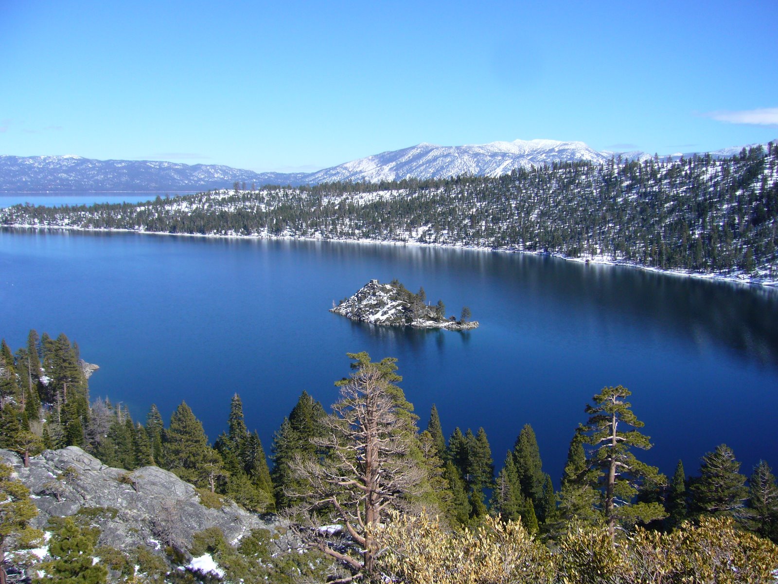
Lake Tahoe, California

…at last the Lake burst upon us — a noble sheet of blue water lifted six thousand three hundred feet above the level of the sea, and walled in by a rim of snow-clad mountain peaks that towered aloft full three thousand feet higher still! It was a vast oval, and one would have to use up eighty or a hundred good miles in traveling around it. As it lay there with the shadows of the mountains brilliantly photographed upon its still surface I thought it must surely be the fairest picture the whole earth affords. – Mark Twain, Roughing It (1872)


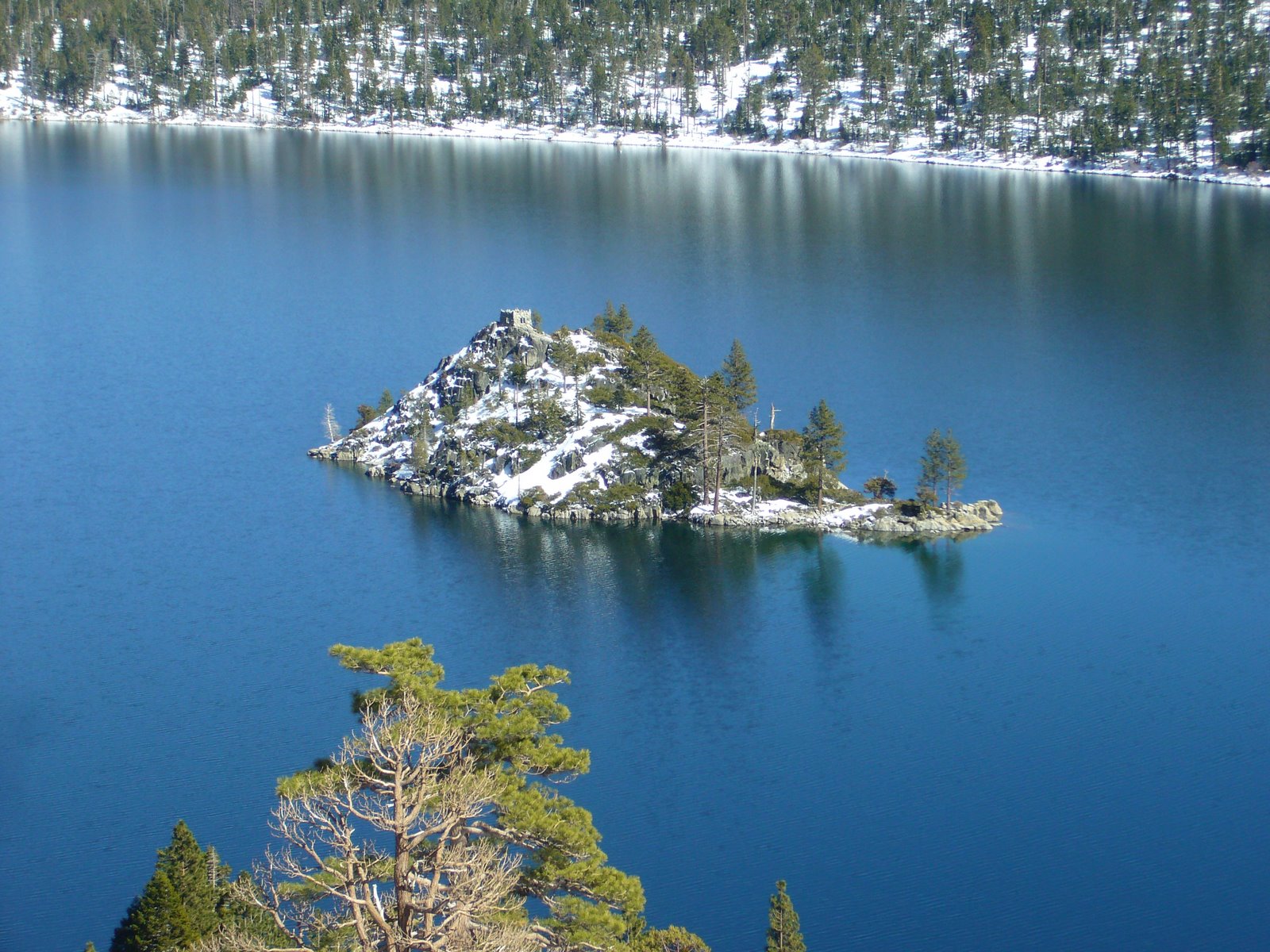
Mark Twain may not have liked the name “Lake Tahoe” – preferring its then-official, patronimic designation as “Lake Bigler.” However, he was clearly overwhelmed by its beauty, and surely no person who has ever seen this place can find fault with the words he so eloquently penned almost a century and a half ago. The view above of Emerald Bay, on the south side of the lake, may not be where Twain first viewed Lake Tahoe, but for me it is the most iconic place from which to view it. I first fell in love with Lake Tahoe almost 18 years ago, when my then fiancée and I first moved to Sacramento. We married up there, and for the 5 years we lived in California we spent many a weekend enjoying Tahoe’s 4-season charm. It has been 12 years since we moved back to St. Louis, and I hadn’t been back — until this past weekend. The reasons for the delay are many, but returning to this place reminded me why I consider it the most beautiful place in the world. I shall not let so long a time pass before my next visit.

Lake Tahoe is a relatively young lake, forming within the last several million years (in contrast, the block of granite that was to become the Sierra Nevada mountains – and in which Lake Tahoe lies – began forming during the Paleozoic Era and was then exposed by erosion beginning about 130 million years ago). The basin in which the lake lies was formed by fault-induced block slippage between two uplifted blocks, with the lake itself forming after magma upwellings dammed the northern part of the basin. Glacial action in more recent years (2 million to 20,000 years ago) caused additional damming, causing drastic fluctuations in the lake level — maximum levels reached nearly 800 feet higher than present. The most recent glaciations (~10,000 years ago) carved out Donner Lake (just east of Lake Tahoe), Emerald Bay (above), and nearby Fallen Leaf Lake (below — the frozen lake surface can just be seen above the trees in the foreground).


Emerald Bay is actually part of a glacial “staircase” featuring intermittent flat stretches containing lakes and meadows before ultimately ending at Emerald Bay. Eagle Lake lies immediately above Emerald Bay on one of these “steps,” and the 1-mile trail to it is one of the most popular hikes in the area — below is a view towards Eagle Lake from Emerald Bay:


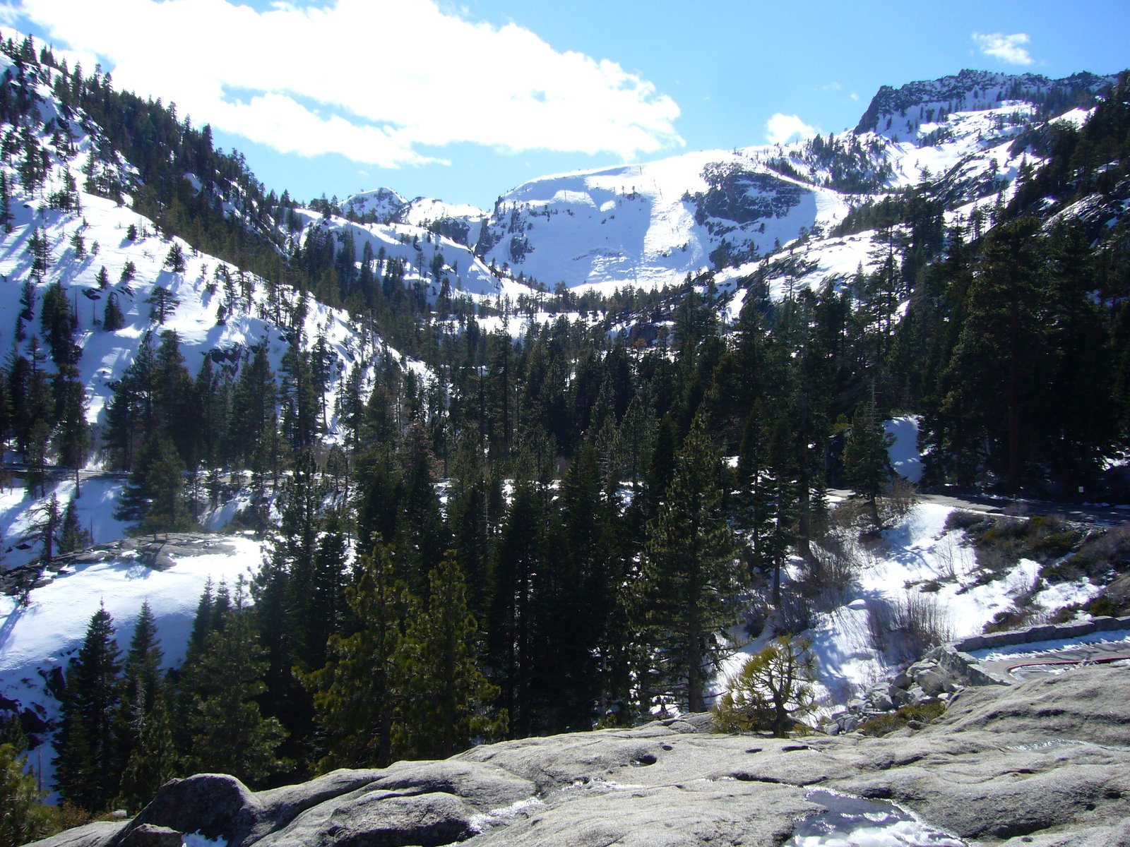
On the day we arrived (Sat 3/15), a late winter storm was dumping new snow on the surrounding mountains, as seen in this view across the south end of the lake towards the city of South Lake Tahoe. Heavenly Ski Resort was shrouded from view on this day, but the fresh powder being dumped there would provide for some delightful spring skiing over the next few days.


In the meantime, there would be plenty of activities to keep ourselves occupied. With the amount of snow on the ground, one might think there would be little opportunity for botanizing. However, I favor the woody flora, and I was excited about the chance to begin reacquainting myself with some of the western conifers for a change. Of these, one of my favorites is incense-cedar (Calocedrus decurrens) — mature trees develop thick, deeply furrowed, brick red bark that stands out in beautiful contrast from the other trees. Even dead trees maintain a rustic and majestic beauty, and this large dead snag is as stately as any I’ve seen:


On Monday we rented snowshoes and hiked the cross-country ski trails at Camp Richardson. None of us had ever snowshoed before, but the girls quickly got the hang of it (note the live incense-cedar in the background):


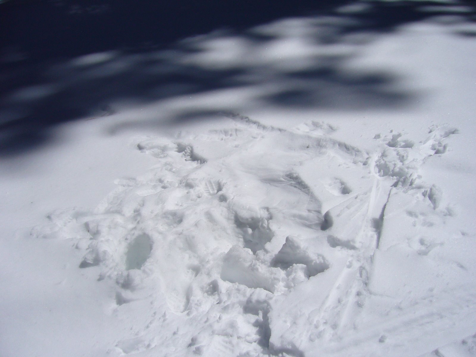
We encountered a few cross-country skiers during our hike, but for the most part we spent the day in solitude. Shortly after beginning our hike, however, we came upon this impression in the snow. At first we thought someone had attempted to make a “snow angel,” but after studying it more carefully we realized it was made by a cross-country skier who had fallen and then struggled to get back up:


At this altitude, conifers dominate the flora. I was a little rusty on my knowledge of western U.S. plants, but I think I have things figured out (please let me know if you see any needed corrections to my identifications). The aforementioned incense-cedar was a conspicuous component of this lake-level forest, and its foliage – arranged in flattened, elongated, rumpled sprays – makes this tree easily identifiable amongst the other coniferous genera with which it grows:


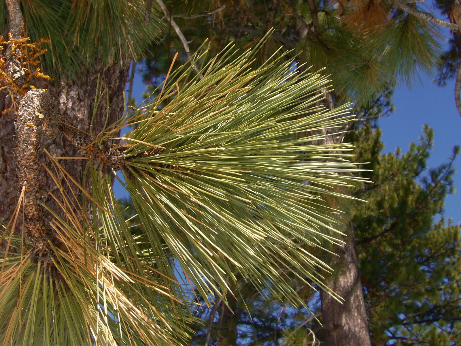
Huge pine trees also dominanted the forest in this area. At first I thought they were ponderosa pines (Pinus ponderosa) due to their large size, irregular crown, and large plate-like patterns on the trunk caused by deep cross-checked fissuring of the bark. Eventually, however, I decided they must instead be Jeffrey pine (Pinus jeffreyi), a closely related species (that was once considered a variety of ponderosa pine), since the bark was more orange than yellow.


A closeup of the needles, which are in bundles of three and measure around 6-8 inches in length:


Another dominant coniferous component of this forest, also reaching massive size, was white fir (Abies concolor). The first photo below shows a large, mature tree in the distance, while the second shows a closeup of the foliage. At first I thought this might be Douglas-fir (Pseudotsuga menziesii), as the needles appeared to be irregularly 2-ranked; however, I asked Prof. Ronald Lanner to take a look, and he confirmed it is white fir. He said Douglas-fir needles are shorter, thinner, darker green, and have a skinny stalk, while fir needles have a fat round base and are wider and flatter. The latter also have a citrusy smell when crushed, which he describes as one of the best smells in the woods! Too bad I did not try it.


This decaying stump also represents white fir based on the scaly gray bark. I suspect the outer layers of the lower portion of the trunk (core still standing) were ripped off over time by animals looking for grubs and insects as decay progressed, eventually weakening it to the point that the upper portion (laying on the ground) finally broke off and fell:


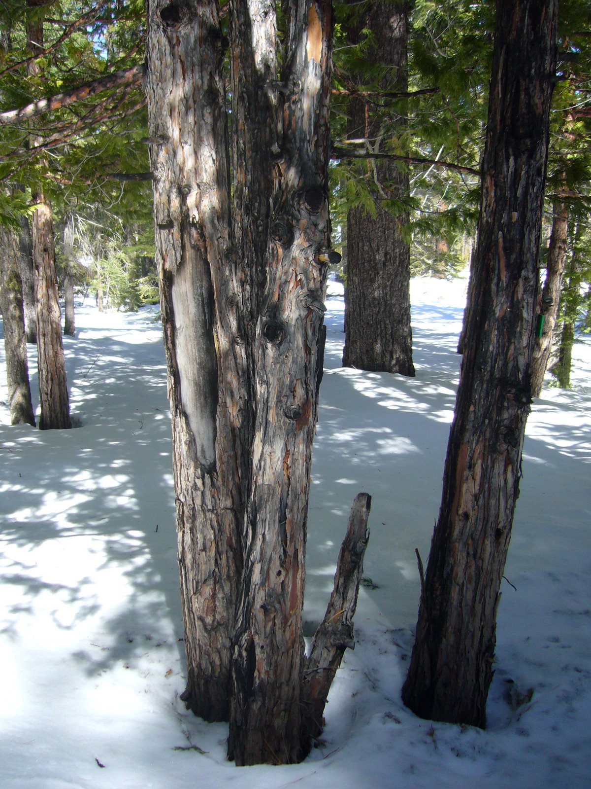
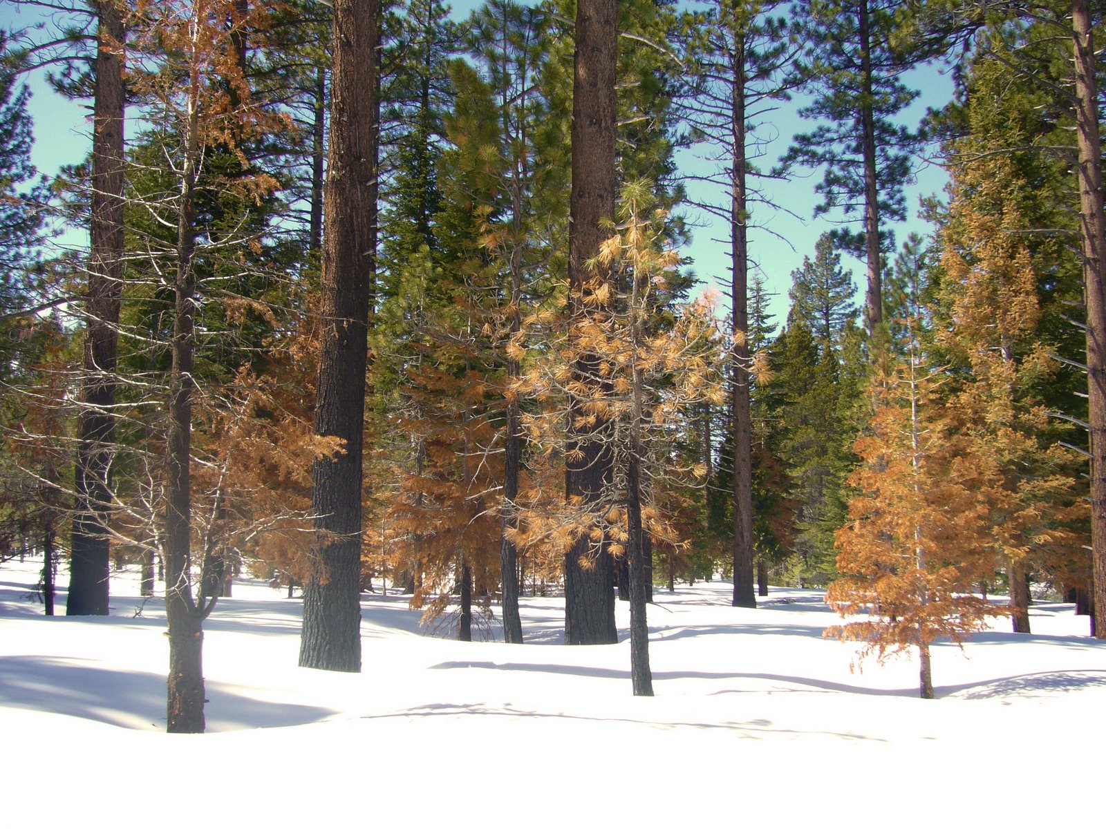
As we hiked, I realized what an important part fire plays in the ecology of these forests. During the drive up from Sacramento, we passed several areas along Hwy 50 that had suffered severe damage due to the wildfires that swept through Lake Tahoe recently. One such area was even seen in the far eastern slopes of Heavenly Ski Resort itself. The forests around Camp Richardson had largely escaped these fires, and I wondered if fire management had contributed to this. Along the trail, evidence of fire was common on the trunks of trees, but few trees – even small ones – had been killed. I presumed the charring was evidence of fires that had been intentionally set and managed by the Forest Service with the objective of preventing fuel accumulation that could lead to the larger conflagrations that caused so much damage in other parts of the basin. These small incense-cedars trunks show obvious fire charring but otherwise looked healthy:


In a few areas it appears even these “cool” fires burned a little hot, killing some of the smaller trees but still avoiding the “torched-earth” damage seen in areas affected by uncontrolled burns:


I’m not much of a birder, but I do love woodpeckers. I got a glimpse of one during our hike, but I didn’t see it well enough to identify it. We did find this woodpecker hole in the trunk of a large, dead Jeffrey pine — a feather can even be seen clinging to the upper rim of the hole. The Lake Tahoe basin is home to several species of woodpeckers — whether this hole belongs to the black-backed woodpecker (Picoides arcticus), white-headed woodpecker (P. albolarvatus), or (more likely) hairy woodpecker (P. villosus) I can’t say for sure:


At the beginning of our hike, signs warning of bears and pleading not to feed them caught the girls attention. I told them it was winter and that they would be hibernating, but I wondered if at this late stage they might actually be starting to become active. It wasn’t long before we encountered these unmistakably bear tracks, made fresh in the new-fallen snow, and the more we looked the more abundant the tracks were to be found. I secretly (and the girls outwardly!) hoped we would see a live bear, but I don’t think the girls would have handled such an encounter very calmly:


I had intended to photograph some of the conifers seen at higher elevations while skiing at Heavenly Ski Resort, but I decided not to bring my camera. Pity, as I not only saw nearly pure stands of what I presume to be red fir (Abies magnifica), but also beautifully twisted and wind-gnarled pines at the highest elevations (+10,000 ft) that probably represent whitebark pine (Pinus albicaulis), judging by their highly forked trunks and upswept limbs. These magically grotesque trees were made even more beautiful by the previous day’s storms, which had deposited thick cakes of ice on their windward sides.

We coudn’t leave Lake Tahoe without one final visit to Emerald Bay. Below is a close up photograph of Fannette Island, the only island to be found in all of Lake Tahoe, and its famed “Tea House”:


We concluded our visit to Lake Tahoe by driving up Hwy 89 to Tahoe City for dinner at the Bridgetender Cafe before heading back to Sacramento. Next up — Muir Woods!

Ozark Trail – upper Trace Creek Section

Last Saturday Rich and I finished the Trace Creek Section of the Ozark Trail by hiking the upper 12.5 miles of the section – from Hazel Creek to the Hwy DD crossing. Today was a special day for us – we would be completing our 200th mile of the Ozark Trail! Unfortunately, I came down with a cold the day before, making it somewhat difficult to fully enjoy that milestone. Nevertheless, it was a milestone that we’re quite proud of. Since we started hiking the Ozark Trail some 7 years ago, we’ve completed the Taum Sauk, Middle Fork, Blair Creek, Current River, Between The Rivers, Eleven Point, and – now – Trace Creek Sections. Of these, the Taum Sauk Section is unquestionably the finest, crossing the rugged granite outcroppings of the St. Francois Mountains, and the Eleven Point Section with its towering bluff top views is a close second. We still have much to see, however. Completed sections still awaiting us are the Karkaghne, Marble Creek, Wappapello, and Victory Sections, and the Coutois and North Fork Sections are nearing completion. By the time we complete these sections, I expect additional parts of the planned route will be constructed and ready for our enjoyment.

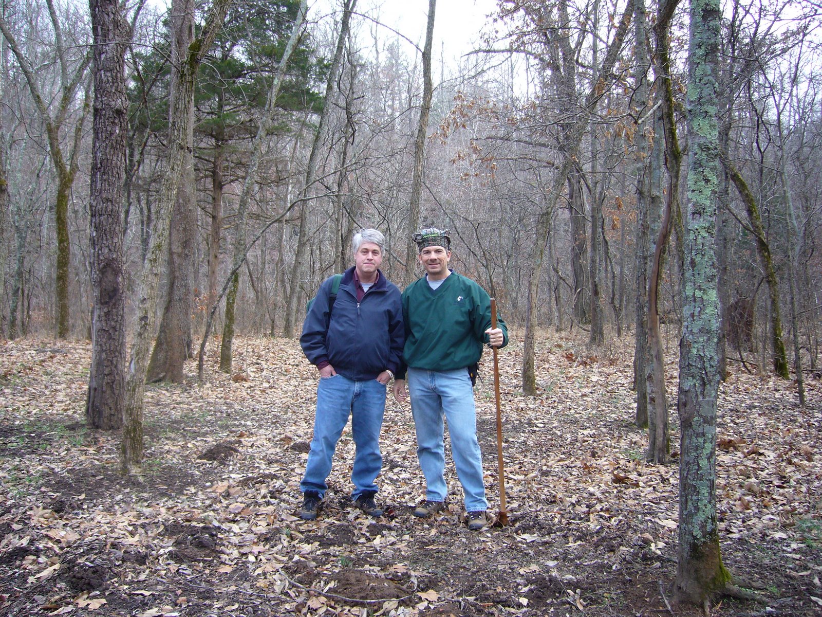
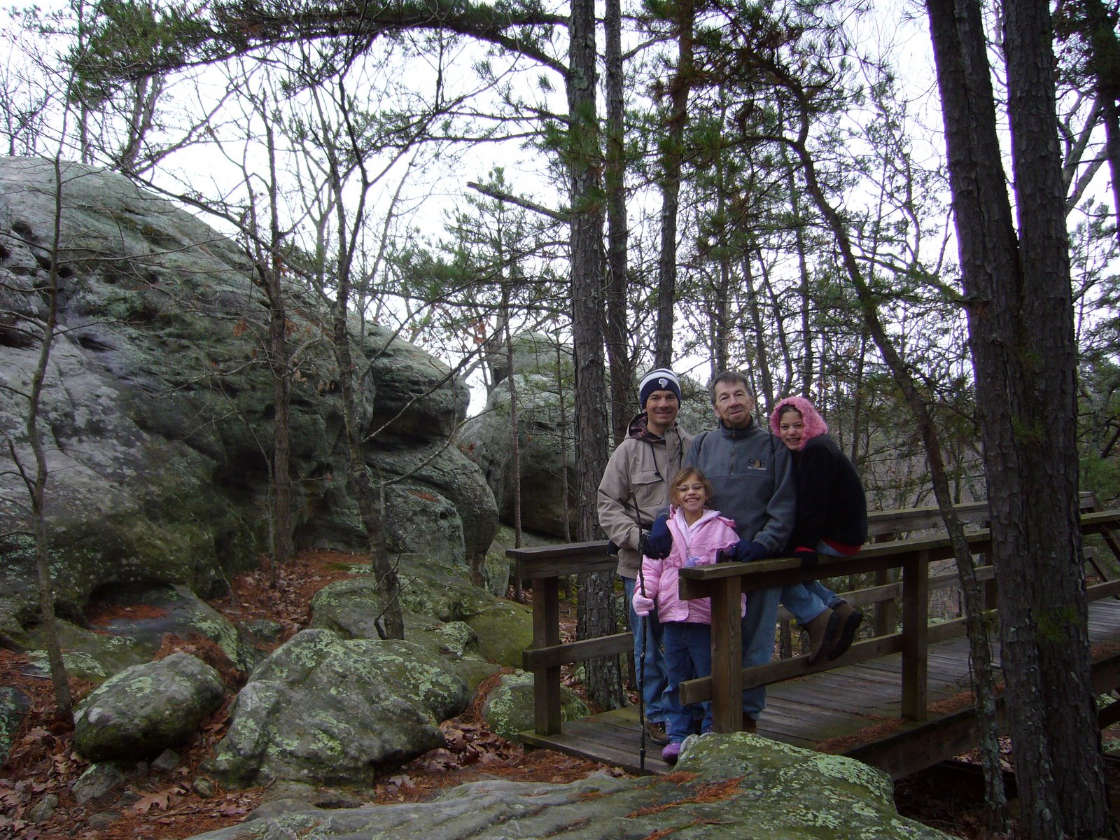
But back to Saturday’s hike. We started at Hazel Creek with mild temps and cloudy skies but no precip in the forecast. We talked briefly to a mountain biker with a 29er who took this photo of us:


These cabin remains lie in the campground at the trailhead – those are sandstone blocks which I suppose must have been transported from the Lamotte formations some 30 miles to the east near Ste. Genevieve.


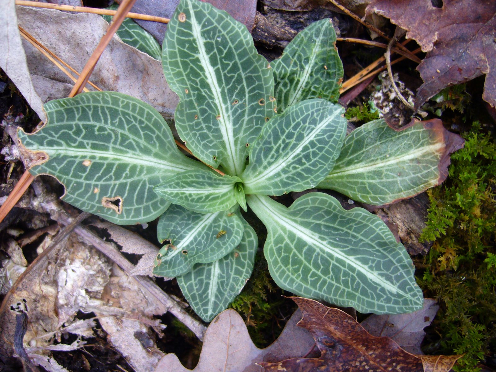
There was much to see in the vicinity of Hazel Creek. As an orchid enthusiast, I was pleased to find these Adam and Eve orchids (Aplectrum hymenale), also known as puttyroot, growing in healthy numbers on the hillside above the valley. The single leaf of this unusual plant is dusky grey-green in color, deeply creased and looking like crepe paper. They appear in late summer and persist until the plant flowers the following spring.


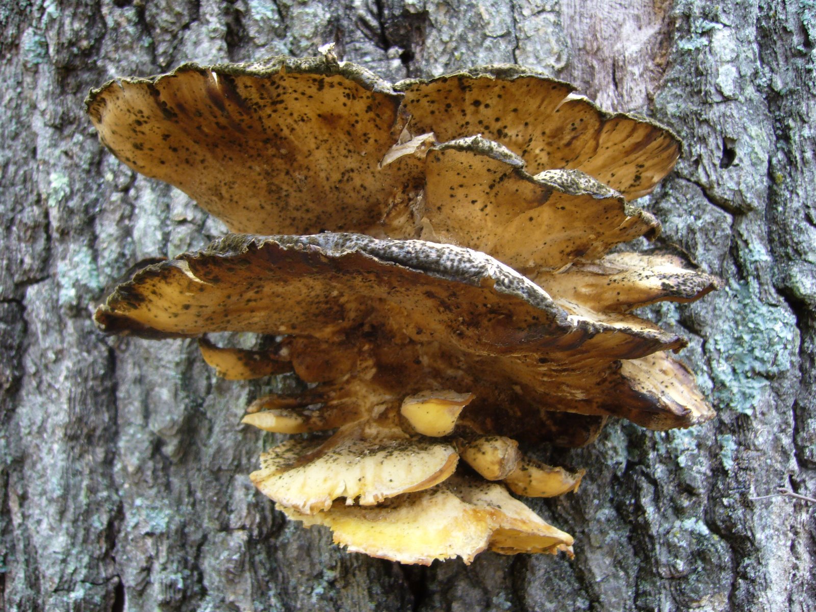
Another of the shelf fungi was found growing on the trunk of a large, dead deciduous tree.


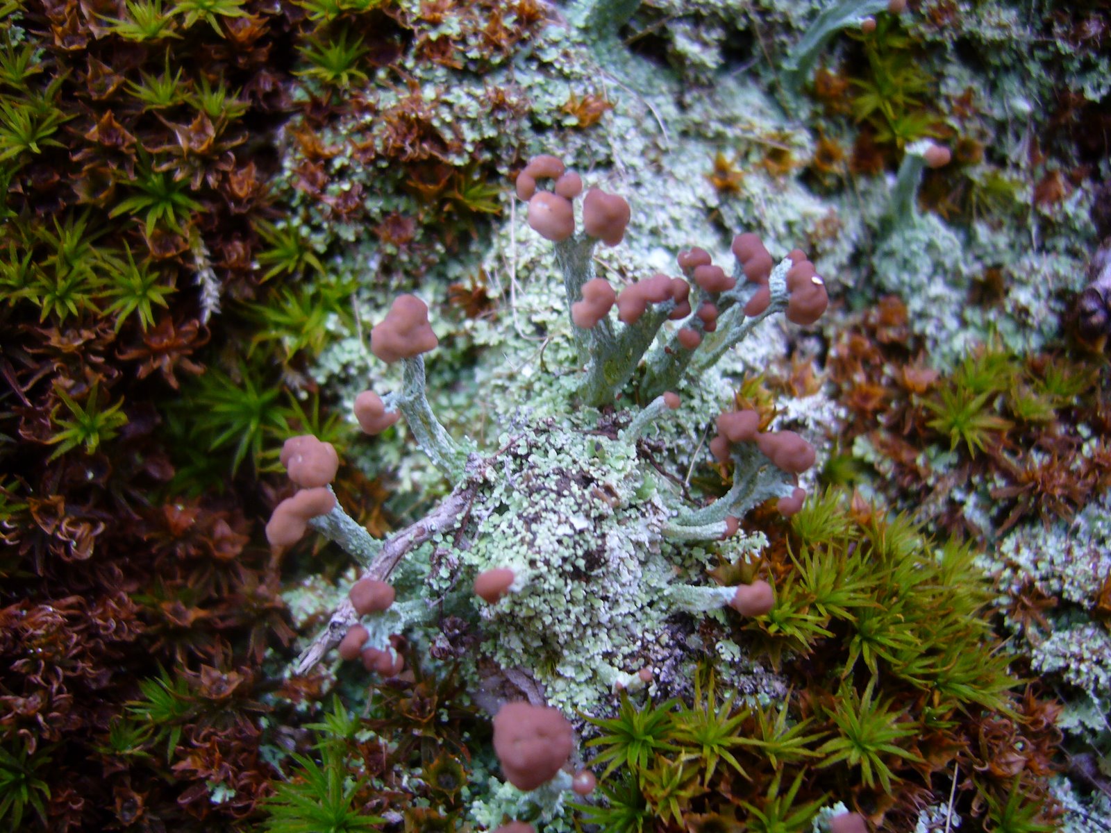
My preoccupation with lichens continues. This colony of British Soldiers (Cladonia cristatella) was found growing in trailside rocks. This lichen is named for its resemblance to the uniforms worn by English soldiers during the Revolutionary War, although the spore-producing reproductive structures are not the brilliant red color as seen during the summer. Lichens are not plants, or even a single organism, but instead a symbiotic association between an alga (in this case, Trebouxia erici) and a fungus (in this case, Cladonia cristatella). Lichen scientific names are derived from the fungus part of the relationship.


Puffball mushrooms have been a favorite of mine since I found my first colony during childhood and delighted in watching the ‘smoke’ fly as I slapped them with my hands. These days I’m satisfied to just look at them (and maybe poke one or two).


The term “puffball” actually refers to a polyphyletic assemblage of fungi distributed within several orders in the division Basidiomycota. I’m no expert (or even a novice), but I wonder if these apparently mature individuals might represent the pear-shaped Morganella pyriforme, a saprobic species that is considered a choice edible while still young. Please leave a comment if you know its identity.


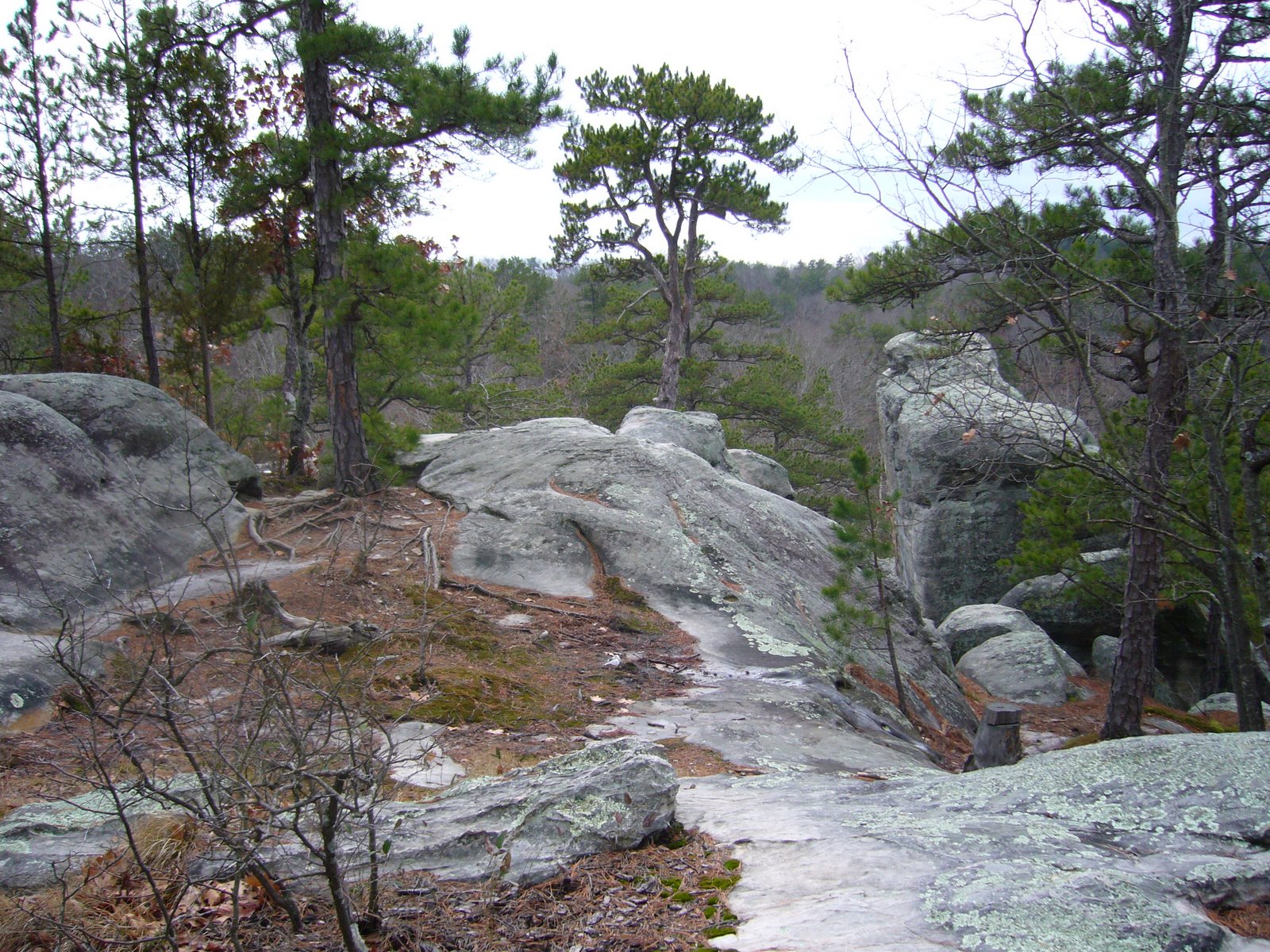
The trail was not particularly rugged but traversed across a number of ridges between the Hazel Creek and Trace Creek valleys. The bedrock was mainly chert, and along the trail we saw this quartz formation with its intricately formed interior exposed.


Approaching Trace Creek, this fireplace and chimney were all that remained of what was probably once a cozy little homestead. Obviously this house had not been constructed of sandstone blocks like the one at Hazel Creek. On each side of where the house once must have been stood two grand, old sugar maple trees (Acer saccharum) – we speculated they had been planted by the former residents and wondered what life was like in this isolated little part of the Ozarks back in the day.


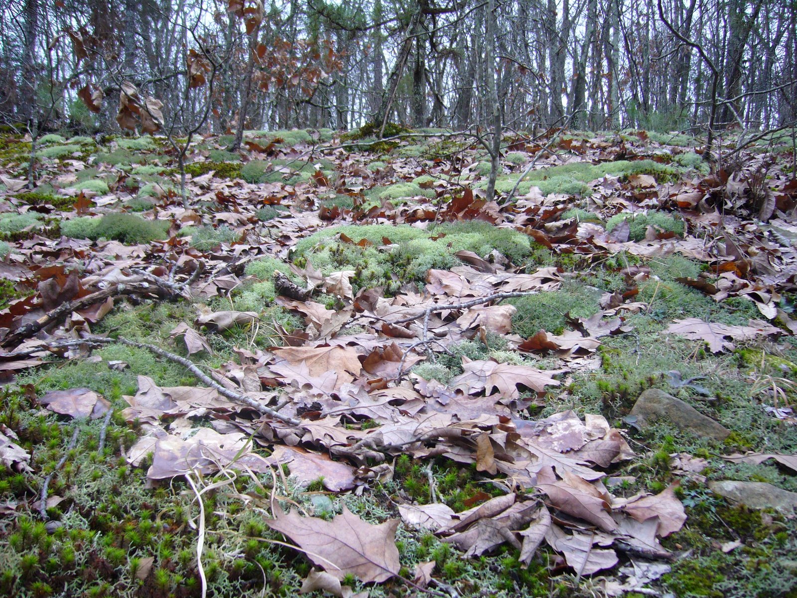
We reached the trails namesake, Trace Creek, about halfway through our hike, and by this time we were the Ozark Trail’s newest 200-mile veterans. It was a pretty little valley, and we stopped here for a bit to eat and rest. Adam and Eve orchids were plentiful here, and in looking for them I became surprised to notice how large a variety of green, herbaceous plants one can find in these deciduous forests during the winter, especially in the lower elevations (moister?).


On these hikes, it has become customary to ‘push over’ trees – dead trees, that is. The larger the better, but of course the larger they are the ‘deader’ they must be for us to be able to push them. I did not push over a single tree on my previous hike of the lower Trace Creek Section, so I made up for it this time and found three trees to push over. Here, Rich finds out what all the fun is about:

The final miles of the hike became more difficult, as my sore throat and congestion combined with the miles started taking their toll on me. We finished our hike at the Hwy DD crossing after 7 hrs of hiking, portaged back to the other car, and met up in Sullivan for our traditional post-Ozark Trail hike pizza dinner.

Pickle Springs Natural Area

Pickle Springs Natural Area lies in Ste. Genevieve County, about an hour south of St. Louis. Like Hawn State Park, the geology of this area and its effect on the flora have resulted in a unique collection of geologic features and plants found in few other places. The Lamotte sandstone outcrops that dot the landscape were formed nearly half a billion years ago when sand deposited in an extensive maze of braided river channels was cemented and buried under younger layers of limestone and dolomite formed from deposits on the floors of ancient seas that covered the interior of the continent. Later, the periods of uplift that created the St. Francois Mountains and resulting erosion of overlying strata once again exposed the sandstones at the surface. Millions of years of water, ice, rain, wind, and plants have further shaped the exposed sandstones, creating fanstastic shapes and formations and cool, deep canyons. The weathered sandstone created acid soils which support many unique plants. During the ice ages, northern plants and animals moved into the area ahead of the advancing glaciers. Mammoths roamed the landscape grazing on the northern vegetation supported by the area’s acid soils. Eventually the ice retreated, and so did the mammoths. But many of the plants remained – able to hang on in the cool, moist canyons long after the mammoths that once roamed these canyons disappeared. Because of this unique concentration of rare plants and geologic features, the area has been designated a Missouri Natural Area and a National Natural Landmark.

Yesterday I hiked the aptly-named ‘Trail Through Time’ with my family. This 2-mile trail is one of the most “feature-packed” trails in the state, with something to look at around almost every bend. Almost immediately the trail leads to the Slot, the result of a vertical fracture in the Lamotte sandstone that was loosened by leaching and then widened by erosion. The unique partridge berry (Mitchella repens) was seen on the moist, vertical walls of the rock, growing among strange holes, pockets, and ridges that formed as a result of the sand grains being variably cemented.


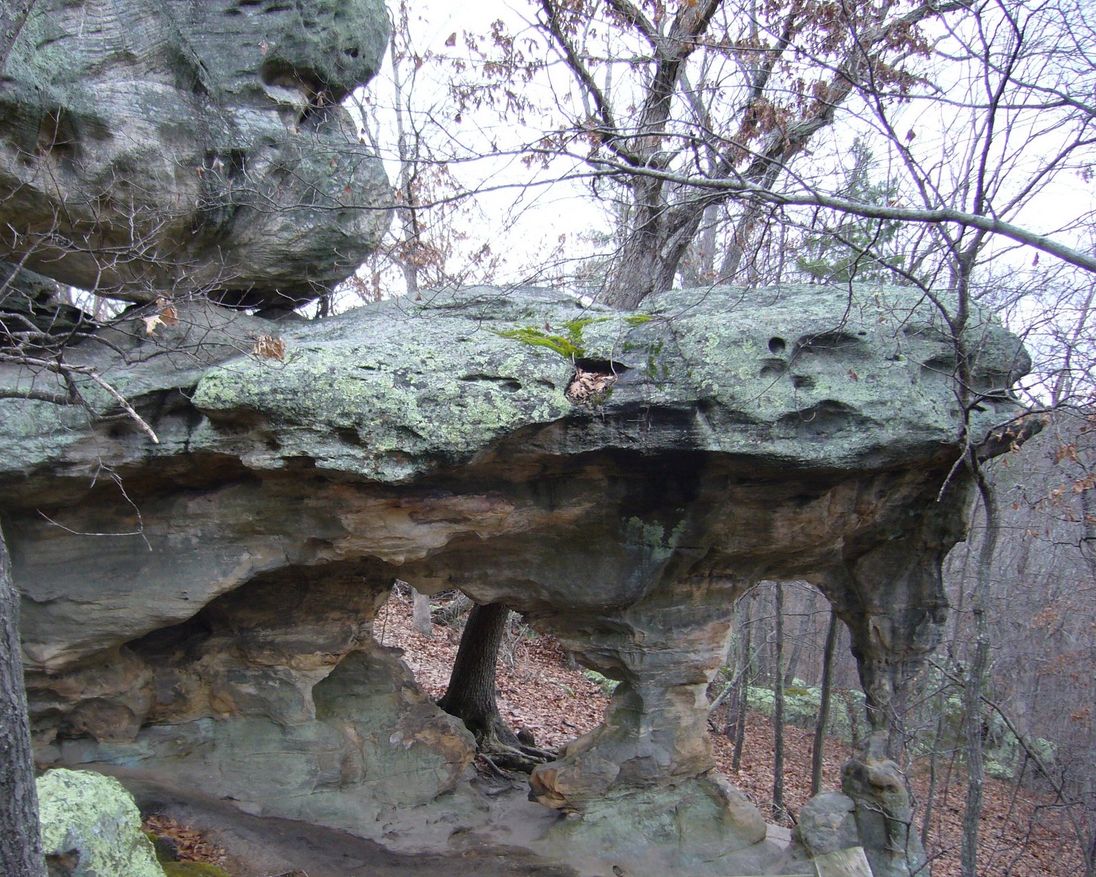
A short distance from The Slot lie Cauliflower Rocks – large moundlike formations (also called hoodoos or rock pillars) formed from jointed or fractured sandstone that undergoes deep solutional weathering followed by erosion and weather-mediated shaping. Hoodoos occur primarily in this type of rock due to its granular, variably cemented and cross-bedded matrix.


On the south side of Cauliflower Rocks lies a special type of buttress arch called Double Arch. It occurs at almost a right angle to the adjacent rock outrcrops, suggesting formation along a set of fractures running perpendicular to the main fracture trend of the area, but the precise details of its formation remain a mystery.


After leaving Cauliflower Rocks the trail descends steeply into a deep valley, at the bottom of which lies Pickle Creek just below its origin in a box canyon south of the Natural Area. Lush vegetation in this cool, moist valley contrasts with the stark rocks seen earlier.


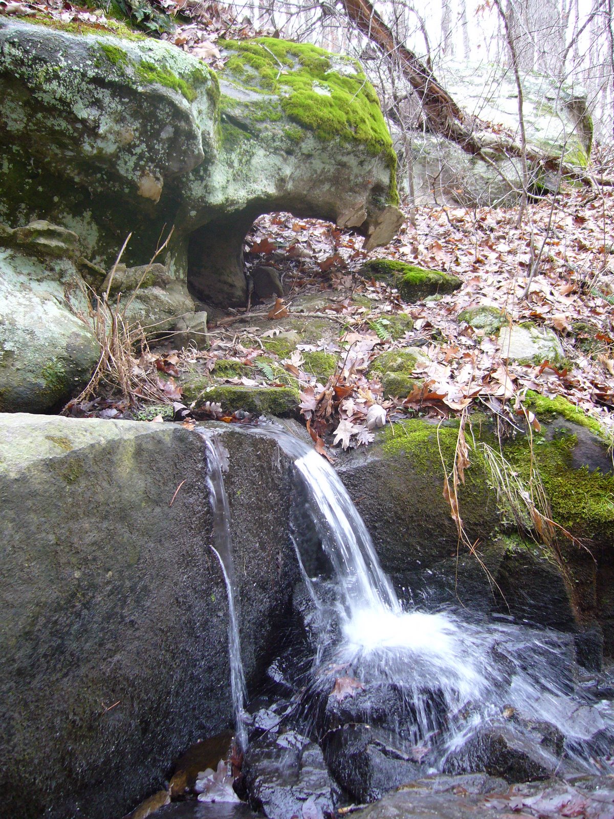
The creek is fed by a series of seeps, allowing the valley to remain moist even during the dry summer months, and along with the acid soils support a unique plant community. Lush colonies of ferns (I believe this is Polypodium virginianum L.) covered the rocks adjacent to the creek…


…while this rattlesnake plantain orchid (Goodyera pubescens) was seen in a colony growing at the base of a black oak tree (Quercus velutina) just above the creek.


Mosses and lichens were also abundant in the valley. This little hair cap moss (Polytrichum sp.) with its distinctive fruiting structures was growing in a colony at the base of another black oak tree. The members of this genus prefer acidic environments.


Further ahead, along Bone Creek, several colonies of wooly aphids (family Aphididae) were seen on the branches of a small hop hornbeam tree (Ostrya virginiana).


The highlight of the hike had to be in Spirit Canyon at Owl’s Den Bluff. The horizontal layers of sandstone, each deposited on the steep downstream slopes of sandbars, are clearly visible in the towering bluff face. At the bottom lie bluff shelters – formed where lower sandstone layers collapse due to weathering or leaching, and where native Americans almost surely camped out. The sun never reaches parts of these shelters, providing ideal conditions for a variety of mosses and liverworts – many of which are known only from this area. Fallen boulders and collapsed portions of the bluff face provided photo opps for the daring…


…and good exploring for the nimble.


By now, the trail has passed the halfway point and is looping back to the west, where it ascends to Dome Rock Overlook. Along the way, a fascinating variety of lichens, including reindeer lichen, covers the forest floor where they are supported by the acid soils.


Dome Rock Overlook is a the largest hoodoo complex in the Natural Area. The thin soils and exposed conditions create a harsh, dry, windswept environment that only the hardiest of plants can withstand. Only a few small blackjack oaks (Quercus marilandica), shortleaf pines (Pinus echinata), and farkleberry (Vaccinium arboreum) survive here. Despite their small size, some of the trees growing here are at least 150 years old.


The trail descends from Dome Rock Overlook and passes underneath, providing spectacular views of the sheer rock face below the overlook. The trail completes its descent back into Pickle Creek Valley, where Pickle Spring can be seen. This small, permanent spring – an unusual feature in sandstone where seeps are more common – was an important source of water for early settlers.


Further along the trail lies one of the areas most unusual features – Rockpile Canyon – formed some 50 years ago (a fraction of a second in geologic time) when part of a sandstone bluff collapsed in a rumble, leaving behind a sheer bluff face and a jumbled pile of large boulders. A short spur in the trail leads to the head of a small box canyon, where some of the 20+ ice age relict plant species can be seen growing in the acid soils and cool, moist canyon walls.

Near the end of the loop lies Piney Glade, an area where the exposed sandstone bedrock once again creates a dry, harsh environment. Poverty grass and little bluestem grow in small, shallow pockets of soil scattered amongst stunted shortleaf pines and blackjack oaks – creating a small prairie surrounded by a sea of forest. All three forms of lichens can be found on the rocks and soils of the glade – the aptly named crustose lichens cling tightly to rock surfaces amongst foliose (leafy) and fruticose (branched) lichens.

Rockwoods Reservation, Lime Kiln Loop Trail

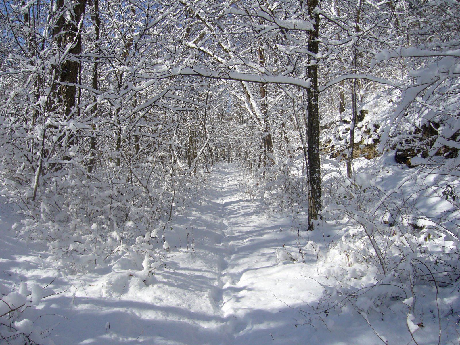
Rockwoods Reservation, in western St. Louis Co. is one of the oldest Conservation Areas in Missouri (est. 1938). It contains nearly 2,000 acres of high quality upland forest and a small prairie restoration plot. Despite its proximity to St. Louis and the numerous hiking trails it offers, I haven’t explored this area very much. We had a winter storm move through the area yesterday, dumping about 7 inches of snow over the area. Deep snows are not common in St. Louis, which typically has more open winters, so today offered the perfect opportunity to start exploring this area in a rare wintery setting. My daughters came with me to explore the 3.25-mile Lime Kiln Loop Trail.


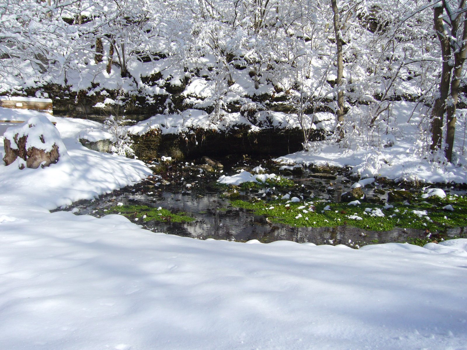
The first half mile of the trail follows alongside a spring-fed creek. As we enjoyed the serenity of the snowy landscape, a belted kingfisher flew into a nearby tree, where it paused briefly before zipping off in a chatter. The spring itself offered a beautiful contrast between the green aquatic plants that populate the spring’s exit and the surrounding white blanket.


After the spring, the trail started traversing up the hillside into a mesic upland forest dominated by oaks and hickories. The high canopy of this mature forest resulted in a sparse understory, affording spectacular views back down through the draws from which we came.


The girls were full of energy at this point, so they kept running ahead on the trail and then waiting for me to plod my way back up to them. Eventually they learned their lesson though – everytime they ran up ahead they would get hot and want to take their coats off, then they would get cold and have to put them back on.


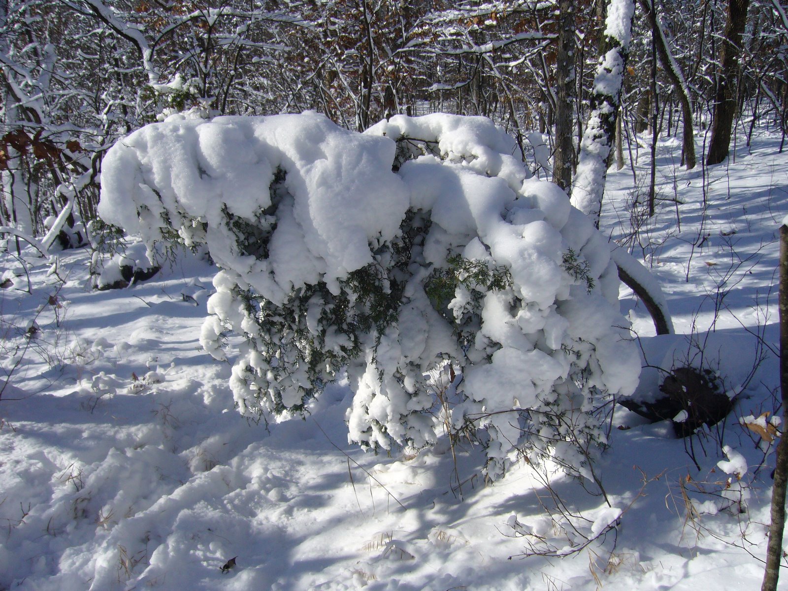
There were some drier forest types closer to the bluffs where eastern red cedar (Juniperus virginiana) became more abundant. I coaxed them to pass underneath this one, then whacked it with my hiking stick as they did so. Shocked indignation soon gave way to tenacious efforts on their part to ‘get me back’. Failing that, they redirected their efforts to ‘getting’ each other.


The games eventually gave way to quiet enjoyment of the astounding beauty of the forest. Existing tracks in the snow told us we were not the first to enjoy the trail today, but we didn’t see a single soul all day – it was easy to pretend that we were the only people in this wood. These snow-covered, hollow tree stumps reminded us of tubular sponges.


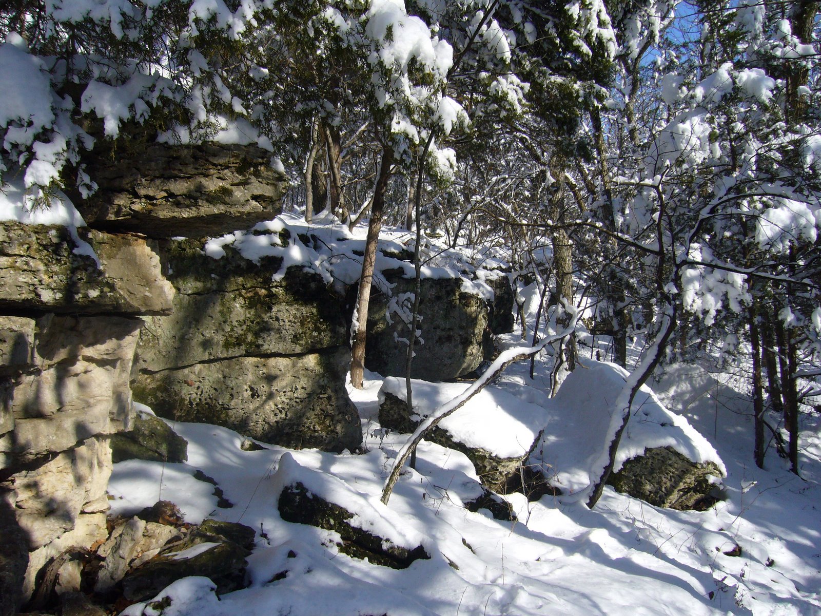
As the trail descended back down into the valley it passed through these dolomite outcrops supporting a dry upland forest dominated by eastern red cedar and blackjack oak (Quercus marilandica).


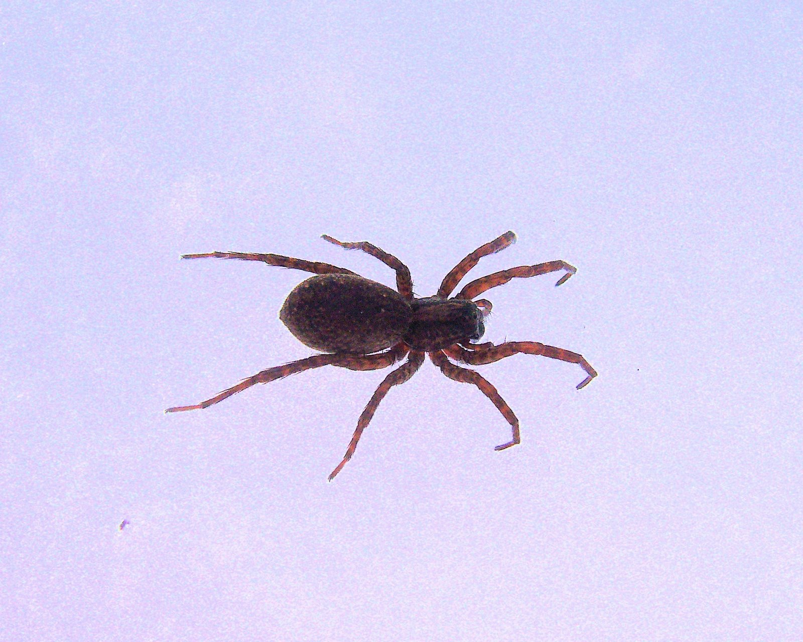
Near the end of the trail, we ran across this little spider – actively crawling on the surface of the snow with temps in the mid-20s. I half-jokingly suggested that maybe this was some kind of ‘snow spider’. My 8-yr old daughter thought that seemed likely, then suggested that when we got home we could get online and go to http://www.spider.com/ and type ‘snow spider’ to see what it said. I told her I thought that was a great idea! Alas, that website (and http://www.spiders.com/) lead to a couple of IT company websites, so that was no help. Fortunately, I was able to find something that looked similar – a wolf spider in the genus Gladicosa – on BugGuide. I told Madison her suggestion worked 😉


The lime kiln for which this trail is named was built in the mid-1800’s by a wealthy businessman, who used it to produce lime for mortar construction of homes in nearby St. Louis. The kiln, 12-ft wide at the base and 40-ft high, was built next to the hillside to allow limestone (quarried nearby) to be dumped in at the top. Locally cut firewood was loaded into the arches at the bottom on each side, which heated the kiln to 800°F, converting the stone to lime which was removed from the opening at the bottom in front. Vertical expansion joints on each side in the center allowed for expansion of the stone during heating.


This was the second hike in the past few weeks that I’ve taken with the girls, and like last time they had an absolute ball! Of course, naturalist that I am, it pleases me that they enjoy the outdoors so much, and I’m quite impressed that they hiked such a distance with no complaint. The area offers several additional hiking trails ranging from 1.5 to 2.2 miles in length. At only a 15-minute drive from our house, I look forward to exploring the rest of Rockwoods trails with them.